Walks in the British Landscape
Walks in Greater Manchester
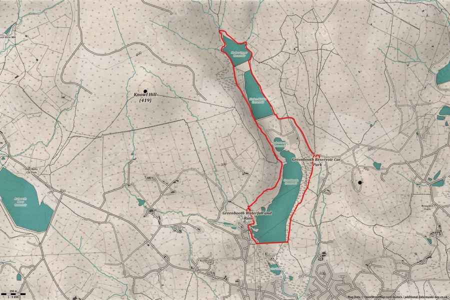
Around Naden Valley and Reservoirs
A fairly easy walk on mostly good paths around the Naden Valley and its reservoirs - marked moderate as some may find parts steep.
Length: 7Km (approx.)
Difficulty: Moderate
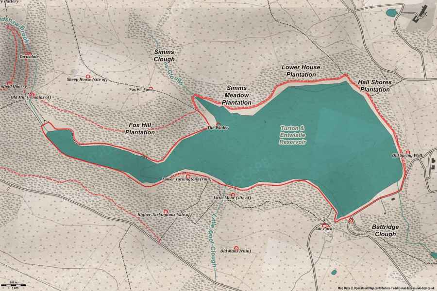
Around Turton and Entwistle
A short and easy walk round the shoreline of Turton and Entwistle Reservoir, taking in views across the water.
Length: 4Km (approx.)
Difficulty: Easy
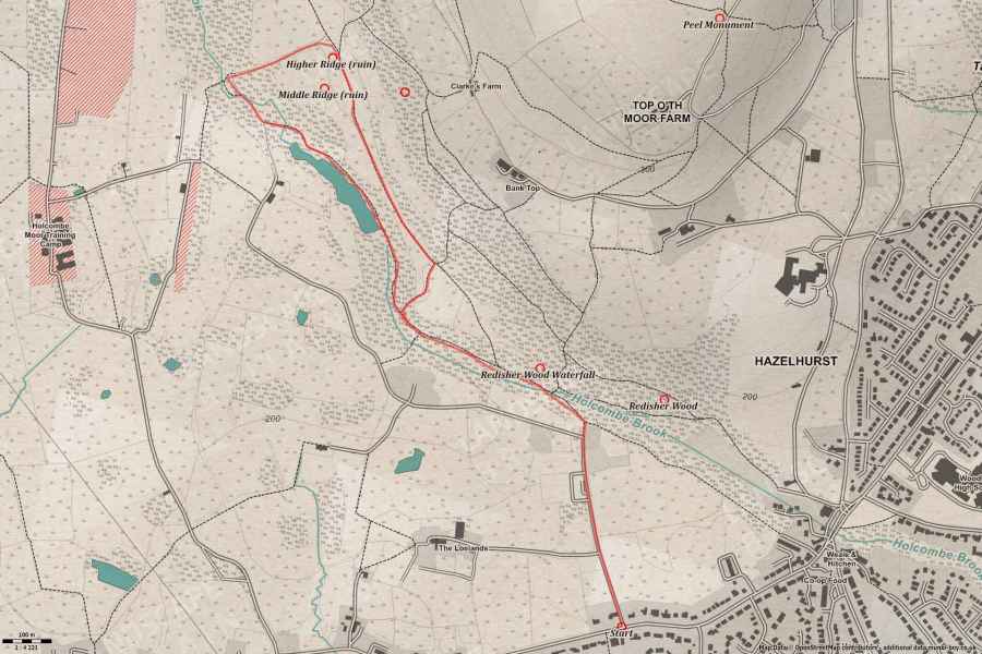
Redisher Wood and Waterfall
A short walk through Redisher Wood to see the waterfall, then up out of the woods and back along Redisher Ridge, with good views and an interesting ruined farmstead along the way.
Length: 4Km (approx.)
Difficulty: Easy
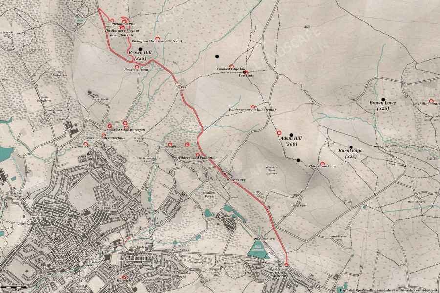
Rivington Pike by Georges Lane (and back)
A relatively easy walk to Rivington Pike and back, although some may find it steep in places the views are often spectacular.
Length: 7.49Km (approx.)
Difficulty: Easy
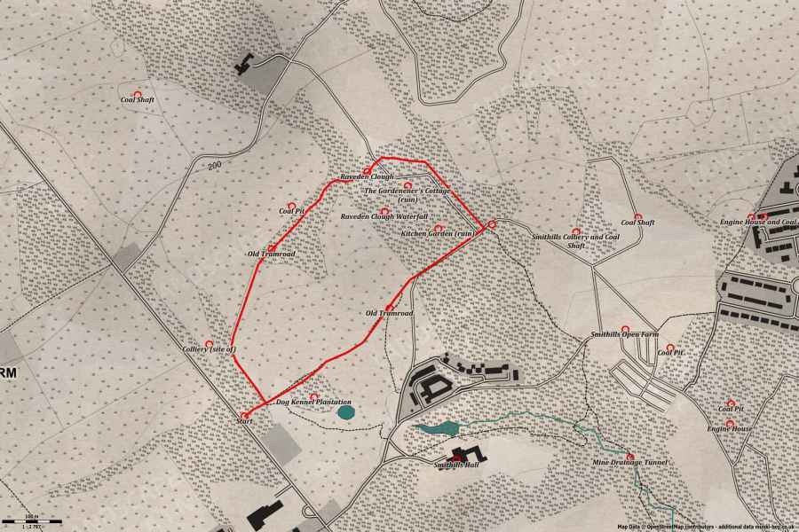
Smithills Hall Kitchen Garden Ruins and Coal Mining Tramroads Explore
A short walk around a section of Smithills Hall Park, following the route of the old mining tramroads and taking in the ‘lost’ Kitchen Garden and the ruins of the Gardener’s Cottage.
Length: 2Km (approx.)
Difficulty: Moderate (easy optional)
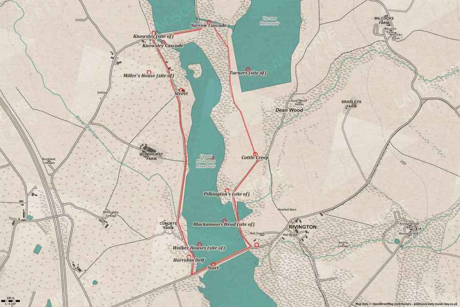
Around Upper Rivington Reservoir
A short and easy stroll around the Upper Rivington Reservoir with views of Winter Hill and the Pike, a possible Roman road and a couple of ornamental waterfalls after rain.
Length: 4Km (approx.)
Difficulty: Easy
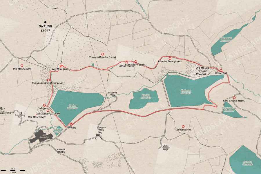
Piethorne Valley Walk
A short walk around the interesting and scenic Piethorne Valley with a selection of historic ruins, reservoirs and bluebells if you’re lucky
Length: 5Km (approx.)
Difficulty: Moderate
Walks in Derbyshire
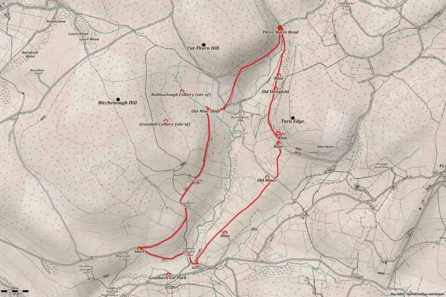
Three Shires Head (Panniers Pool Waterfall) Walk
A nice circular up the River Dane to the historic Panniers Pool at Three Shires Head (or Three Shire Heads as it once was known); talking in good views of the surrounding hills and the small waterfalls below Pannierspool Bridge.
Length: 6Km (approx.)
Difficulty: Moderate
Walks in Staffordshire
Three Shires Head (Panniers Pool Waterfall) Walk
A nice circular up the River Dane to the historic Panniers Pool at Three Shires Head (or Three Shire Heads as it once was known); talking in good views of the surrounding hills and the small waterfalls below Pannierspool Bridge.
Length: 6Km (approx.)
Difficulty: Moderate
Walks in Cheshire
Three Shires Head (Panniers Pool Waterfall) Walk
A nice circular up the River Dane to the historic Panniers Pool at Three Shires Head (or Three Shire Heads as it once was known); talking in good views of the surrounding hills and the small waterfalls below Pannierspool Bridge.
Length: 6Km (approx.)
Difficulty: Moderate
Walks in Lancashire
Rivington Pike by Georges Lane (and back)
A relatively easy walk to Rivington Pike and back, although some may find it steep in places the views are often spectacular.
Length: 7.49Km (approx.)
Difficulty: Easy
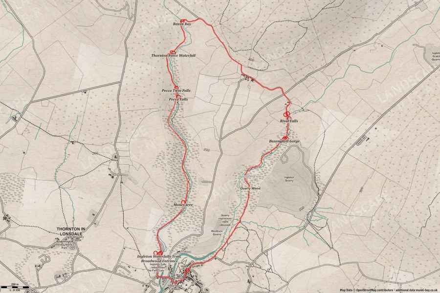
Ingleton Waterfalls Trail
Probably the best waterfall walk on a managed trail - payment required but it’s worth it for the well-kept viewing platforms and stairs up the rocky cliffs.
Length: 7Km (approx.)
Difficulty: Moderate
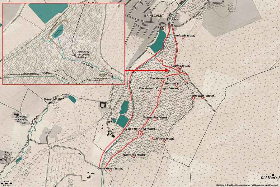
Brinscall Woods (Hatch Brook Waterfall Walk)
A short easy loop around Brinscall Woods and ruins with views down the Hatch Brook waterfall and optional stream scramble to view from the foot of the falls.
Length: 4.5Km (approx.)
Difficulty: Easy (difficult optional)
Around Upper Rivington Reservoir
A short and easy stroll around the Upper Rivington Reservoir with views of Winter Hill and the Pike, a possible Roman road and a couple of ornamental waterfalls after rain.
Length: 4Km (approx.)
Difficulty: Easy
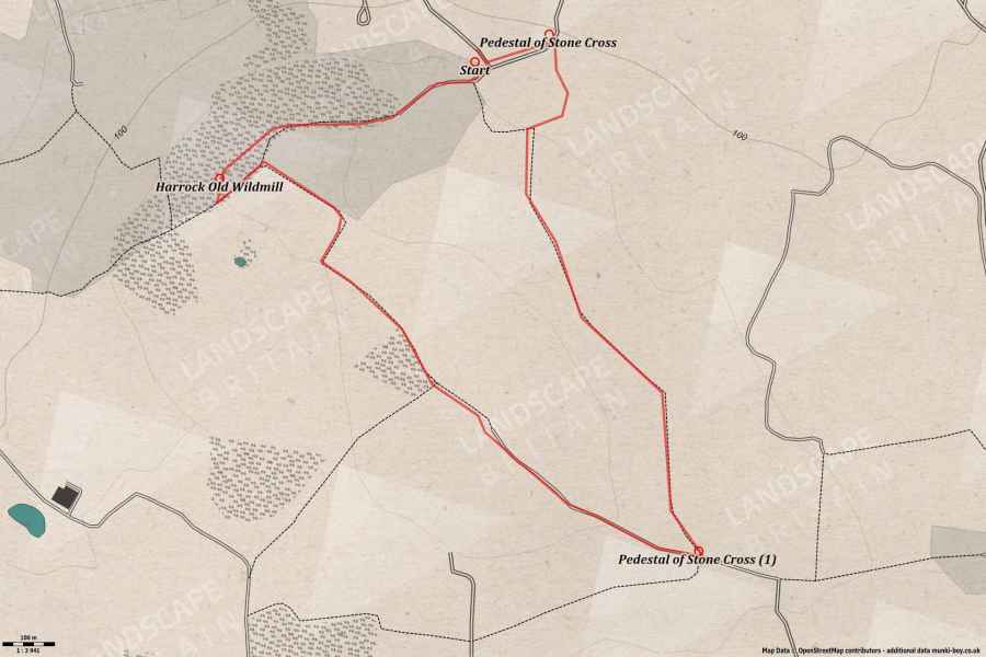
Harrock Old Windmill
A short walk up to the ruins of historic Harrock Old Windmill on Harrock Hill with a short loop to the summit for views.
Length: 4Km (approx.)
Difficulty: Easy
Musbury Heights Quarry Explore
A little walk up to the old quarry ruins on Musbury Heights, with optional exploring.
Length: 5Km (approx.)
Difficulty: Moderate
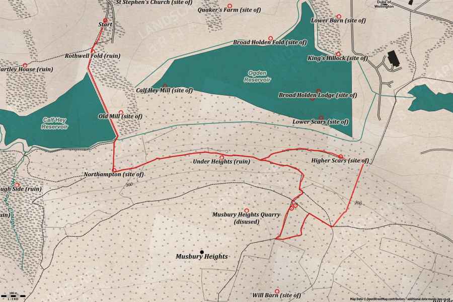
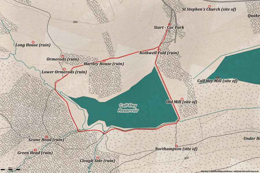
Calf Hey Reservoir Walk
A pleasant and easy stroll around Calf Hey Reservoir taking in good views and ruined farmsteads.
Length: 2.5Km (approx.)
Difficulty: Easy
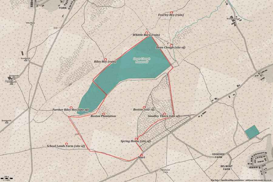
Dean Clough Reservoir Walk
A short and easy stroll round the Dean Clough Reservoir and back up through the small pine woods.
Length: 3.36Km (approx.)
Difficulty: Easy
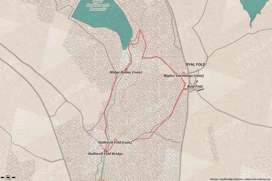
Roddlesworth Woods Walk
A short walk that’s good with dogs, around the Roddlesworth Woods and down the river below Halliwell Fold Scar.
Length: 3Km (approx.)
Difficulty: Moderate
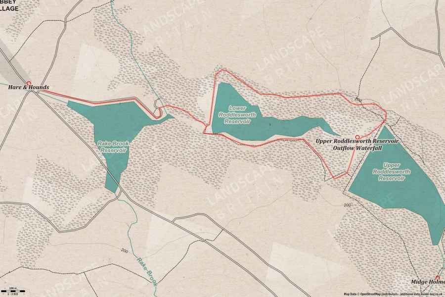
Roddlesworth Reservoirs
A short walk with a bit of woodland, beside the reservoirs at Roddlesworth with optional bridge over waterfall cascade - weather and water-levels permitting.
Length: 3Km (approx.)
Difficulty: Easy
Walks in North Yorkshire
Ingleton Waterfalls Trail
Probably the best waterfall walk on a managed trail - payment required but it’s worth it for the well-kept viewing platforms and stairs up the rocky cliffs.
Length: 7Km (approx.)
Difficulty: Moderate
Walks in Cumbria
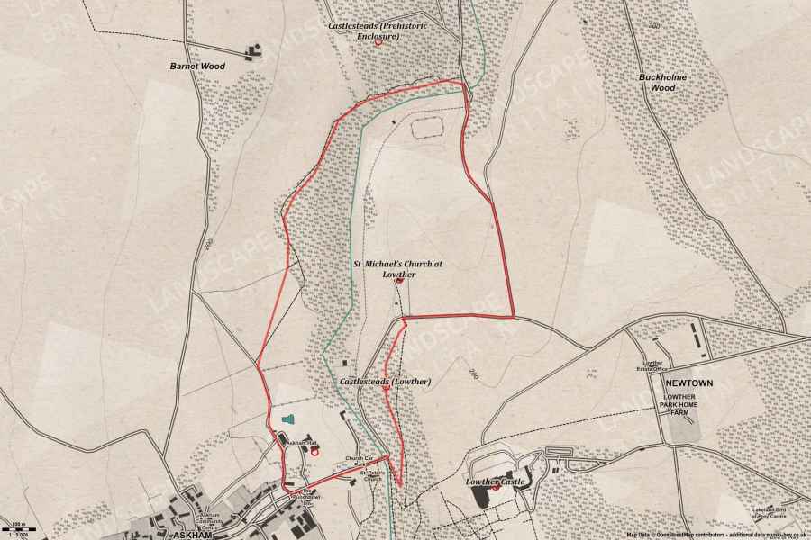
A Stroll Around Askham
A short walk around an area with a long history from prehistoric to present, visible on the ground.
Length: 4.5Km (approx.)
Difficulty: Easy
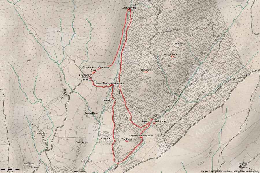
Appletree Worth and River Lickle
A scenic walk with an interesting lost village, returning along a section of the River Lickle.
Length: 7Km (approx.)
Difficulty: Easy
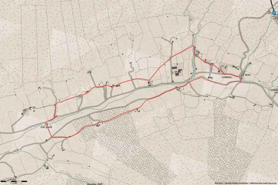
Ibbeth Peril Walk
A short walk along the River Dee taking in views of the Arten Gill viaduct, some fossils and a visit to Ibbeth Peril, or nearly if the water’s too high.
Length: 4.56Km (approx.)
Difficulty: Easy
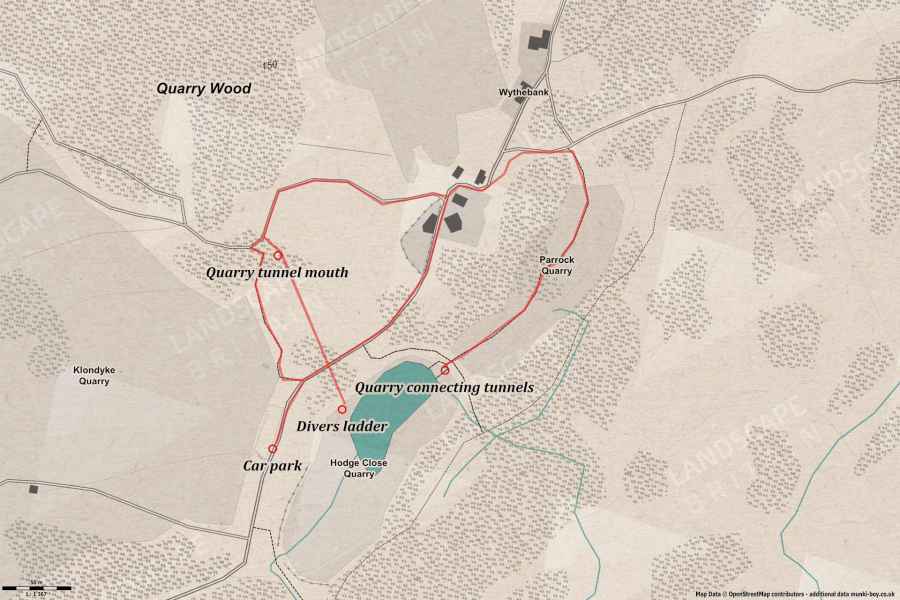
Hodge Close Explore
A short but deadly explore around Hodge Close and Parrock Quarry with flooded quarry tunnel and dangerous cliffs.
Length: 1.45Km (approx.)
Difficulty: Dangerous
Mist, Mines and Ruins
Own label and private label building products
We produce, brand and supply for some of the biggest names in the industry. Read more...