Ingleton Waterfalls Trail
A Walk in North Yorkshire
Walk spec.
Difficulty: Moderate
Basic length: 7Km (approx.)
Terrain:
- Steep steps
- Tarmac
- Tracks
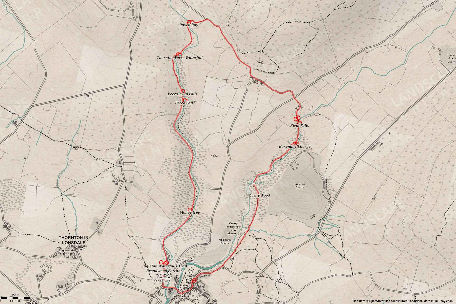
Probably the best waterfall walk on a managed trail - payment required but it’s worth it for the well-kept viewing platforms and stairs up the rocky cliffs. The circular route goes upstream along the River Twiss up rocky rocky gorges with decent waterfalls and up to the Ravenray bridge; before descending along the River Doe and past more waterfalls.
Marked as moderate due to the stair climbs which some may find difficult.
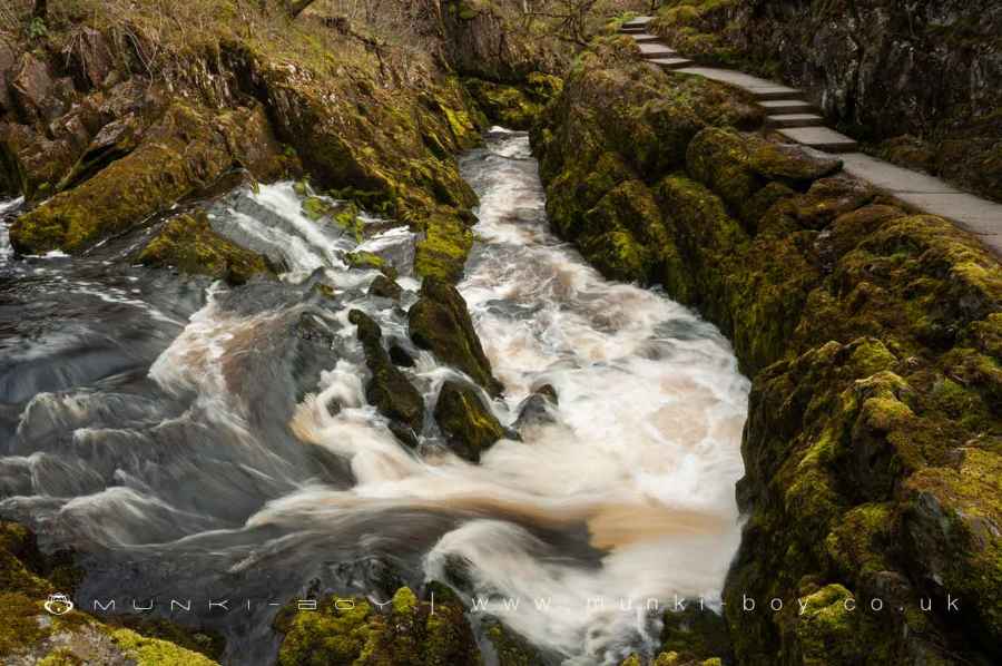
Footpath Below Rival Falls
1. Ingleton
The Waterfall Trail starts at the large car park past the ticket booth; which is just after passing beneath the viaduct on the west side of the River Twiss in Ingleton Village.
Leaving the car park and heading upstream the track follows the west bank of the Twiss which at this point is relatively wide and shallow, although it can be ferocious after heavy rain. Soon the river passes through a narrow, rock gorge with the footpath briefly ascending to the left, then leading down into Swilla Glen.
Rocky Gorge Leading into Swilla Glen
2. Swilla Glen
Swilla Glen is a usually peaceful spot where the Twiss flows through a valley, sheltered by steep rocky cliffs on either side. The footpath continues beside the river beneath a generous canopy of trees before passing a fallen tree that is completely covered with bent and hammered coins - a fairly common tradition, but this is perhaps the most extreme.
Further on a viewing platform (obscured by foliage in recent years) for the large drop of Pecca Falls and a footbridge taking the trail to the opposite side of the river. There is a small cave in the cliff on the left, possibly an old mine trial.
The path leads on, almost to the foot of the mighty Pecca Falls where the valley narrows to a steep ravine. A footbridge takes us back across the river where a series of steps and platforms allows us to climb up the cliff side. Here we get a view of the top of the large waterfall before two smaller waterfalls known as Pecca Twin - a favourite for budding long-exposure photographers.
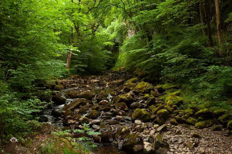
Swilla Glen
The Money Tree in Swilla Glen
3. Hollybush Spout
Contiuing up the ravine the trail reaches a viewing platform for Hollybush Spout, an impressive little waterfall into a pool, surrounded by rocky cliffs.
Further steps lead up out of the ravine - where a snack hut is available in-season - and across a plateau on to the west of the river. A little further downstream a small, note the rocky outcrop in the river which has the interesting name Cuckoo Island, before reaching a sharp bend to the right.
Here there are views to the spectacular Thornton Force, a waterfall with huge drop over a shelf in the rock. Thornton Force is incredibly powerful after rain, and a gentle curtain of silver water in dry periods. The river is wide and shallow below the falls, whose cliffs seem to form a small amphitheatre - a nice place to stop.
Hollybush Spout
4. Thornton Force
Thornton Force is amazing due to its size and the lovely sheltered cove surrounding.
A lot of folks tend to stop here before turning back, as the next part of the walk goes over the tops and the steps and stairs to get there are numerous and steep. Thornton Force is the most impressive waterfall on the trail, so if you only make it this far, it’s not too bad.
There is plenty more to see on the rest of the trail so keep going if you don’t mind more uphill. Take the stairs up the cliff on the west side the waterfall to find the river as it plunges over the edge (keep to the paths).
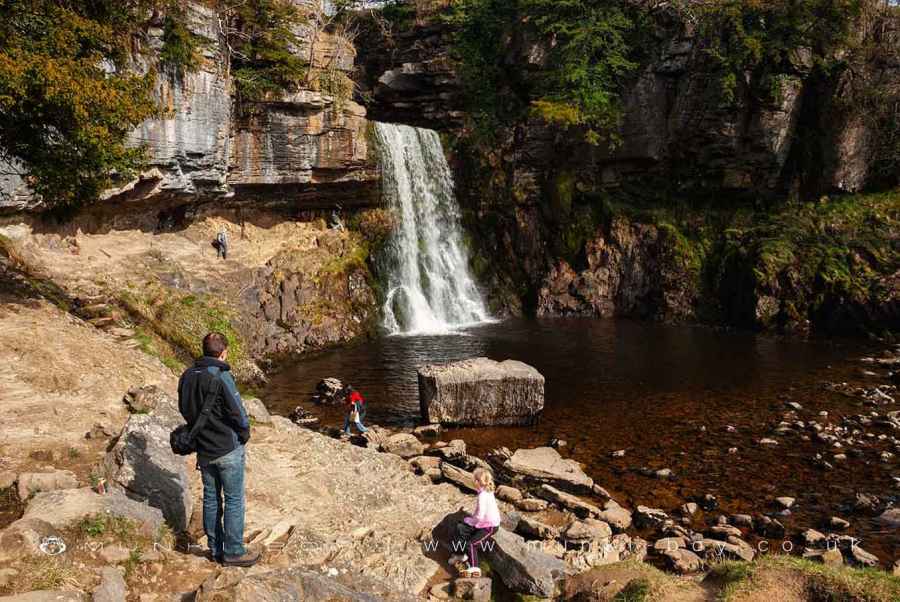
Thornton Force
5. Raven Ray
Leaving the top of Thornton Force the footpath bears left to the area known as Raven Ray, here the river Twiss flows down from Kingsdale; but our path goes to the right, across Ravenray bridge and steeply up the valley-side of Twistleton Scar.
At the top of the slope turn right on the small lane where a wonderful ice cream van is often present on sunny days.
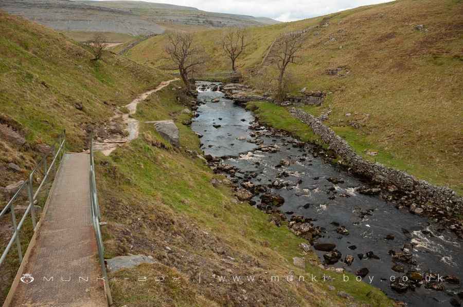
Ravenray Bridge
6. Twistleton Lane
The small, farm track we are currently on is Twistleton Lane and is said to follow the route of an old Roman road. As the track heads down beside the buildings of Scar End and Twistleton Hall, there are good views across to mighty Ingleborough with its ancient hillfort. Note the buildings marked ‘Caves’ at White Scar on the opposite valley side.
Passing on and directly across Oddie’s Lane towards Beezleys, where there is now a seasonal cafe.
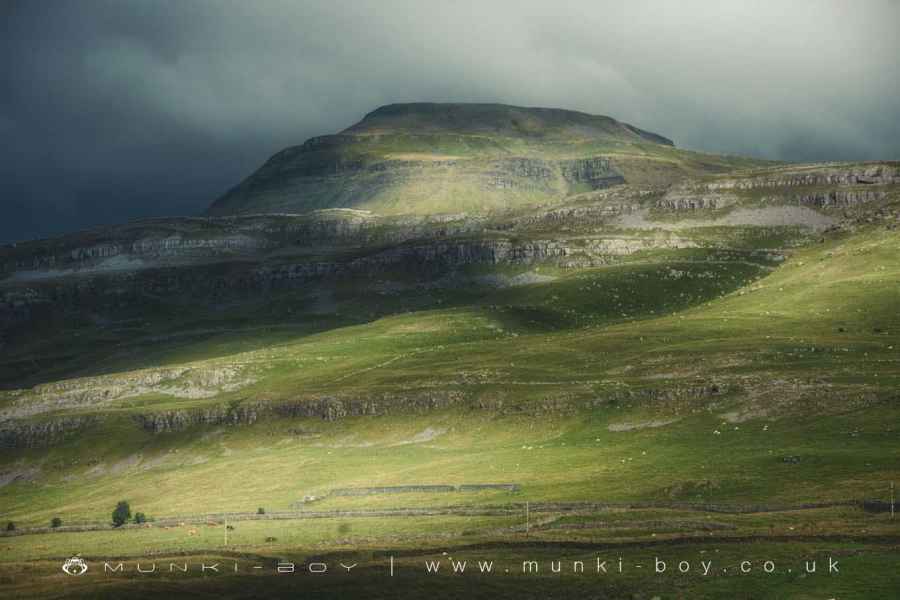
Ingleborough
7. Beezley Falls and Triple Spout
As the path drops down into the trees, Beezley Falls comes into view at the back of a long pool. Perhaps more delightful is the Triple Spout just below the pool - depending on the water levels.
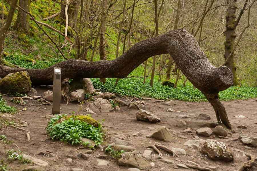
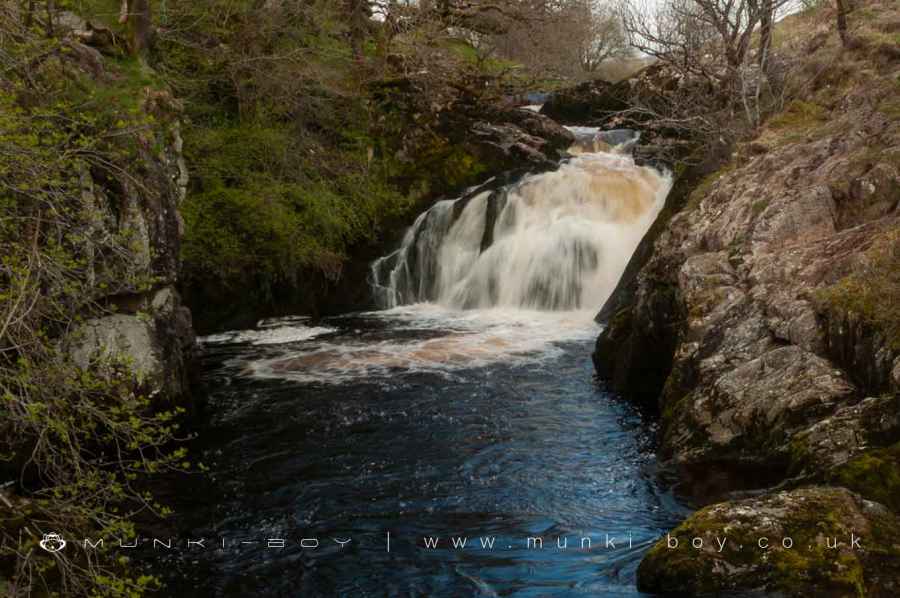
Folowing on the path leads down to Rival Falls, which pass by unseen until a sharp bend in the river with a section of rapids with a concrete section of footpath leading round the side of a rocky slope - just above the churning white water after wet weather.
A backward glance from here reveals the Rival Falls as two small cascades that look quite similar, above the zig-zag section of rapids. This is perhaps the best spot on the Doe valley section of the trail, very otherworldly with moss-covered rocks green in spring and summer, golden the remainder.
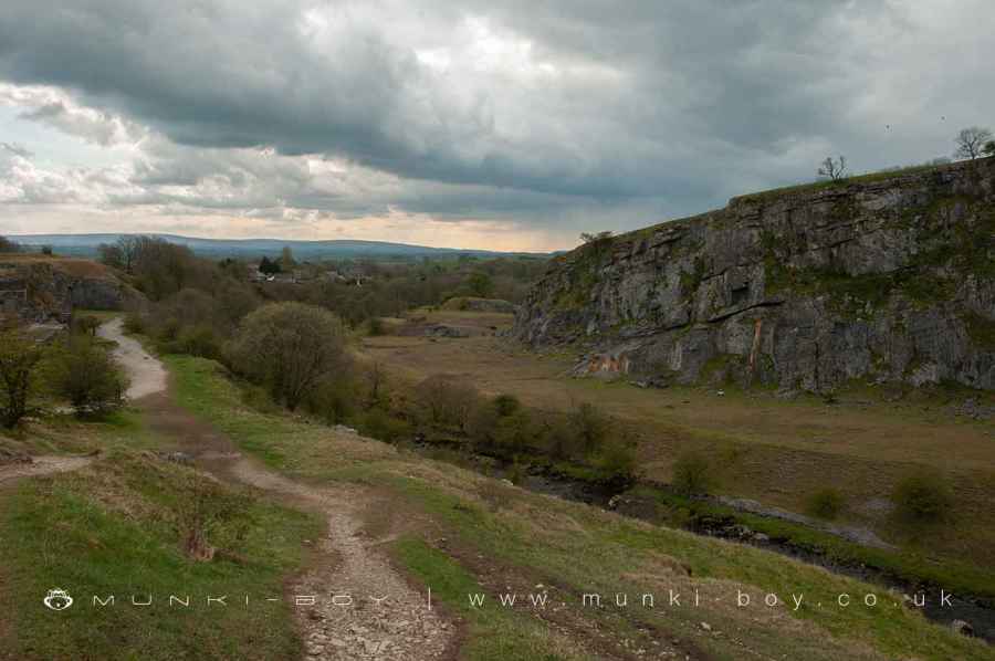
After this point some areas of slate quarrying occur along the trail and in the river bed - revealed when the water is low enough.
Beezley Falls
Footpath Below Rival Falls
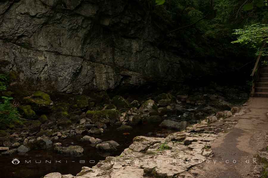
8. Baxenghyll Gorge
Further downstream the trail passes by Baxenghyll Gorge, a deep and narrow slit through which the river passes, over small waterfalls.
There is fantastic little gantry over the gorge from which one can look down to the water below.
The area immediately downstream is Yew Tree Gorge.
After Baxenghyll Gorge a small ‘bay’ in the river with slate quarrying above is encountered. Here a large quantity of slate, a metamorphic rock is seen below the footpath where quarrying has taken place in the past.
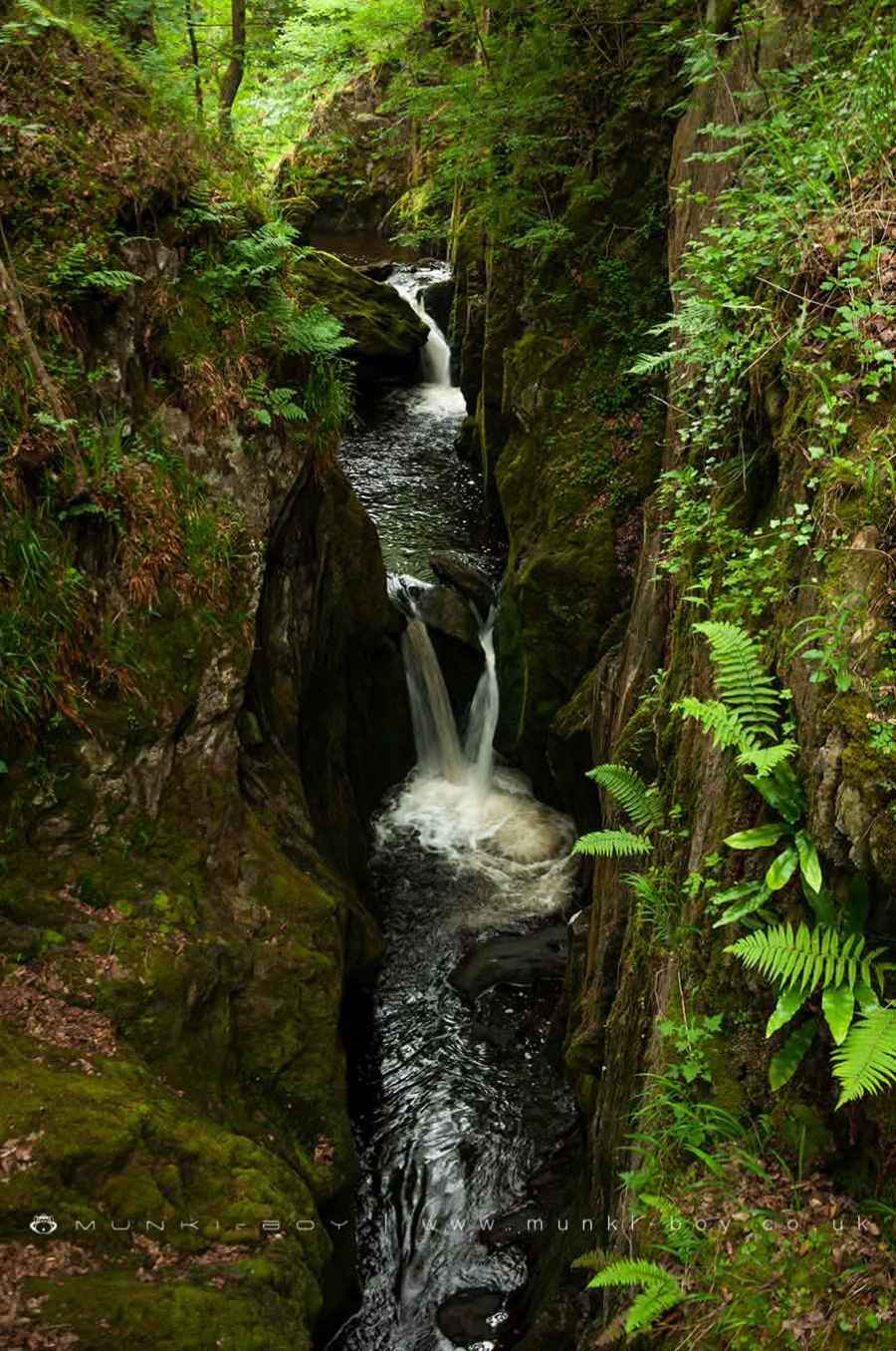
Baxenghyll Gorge
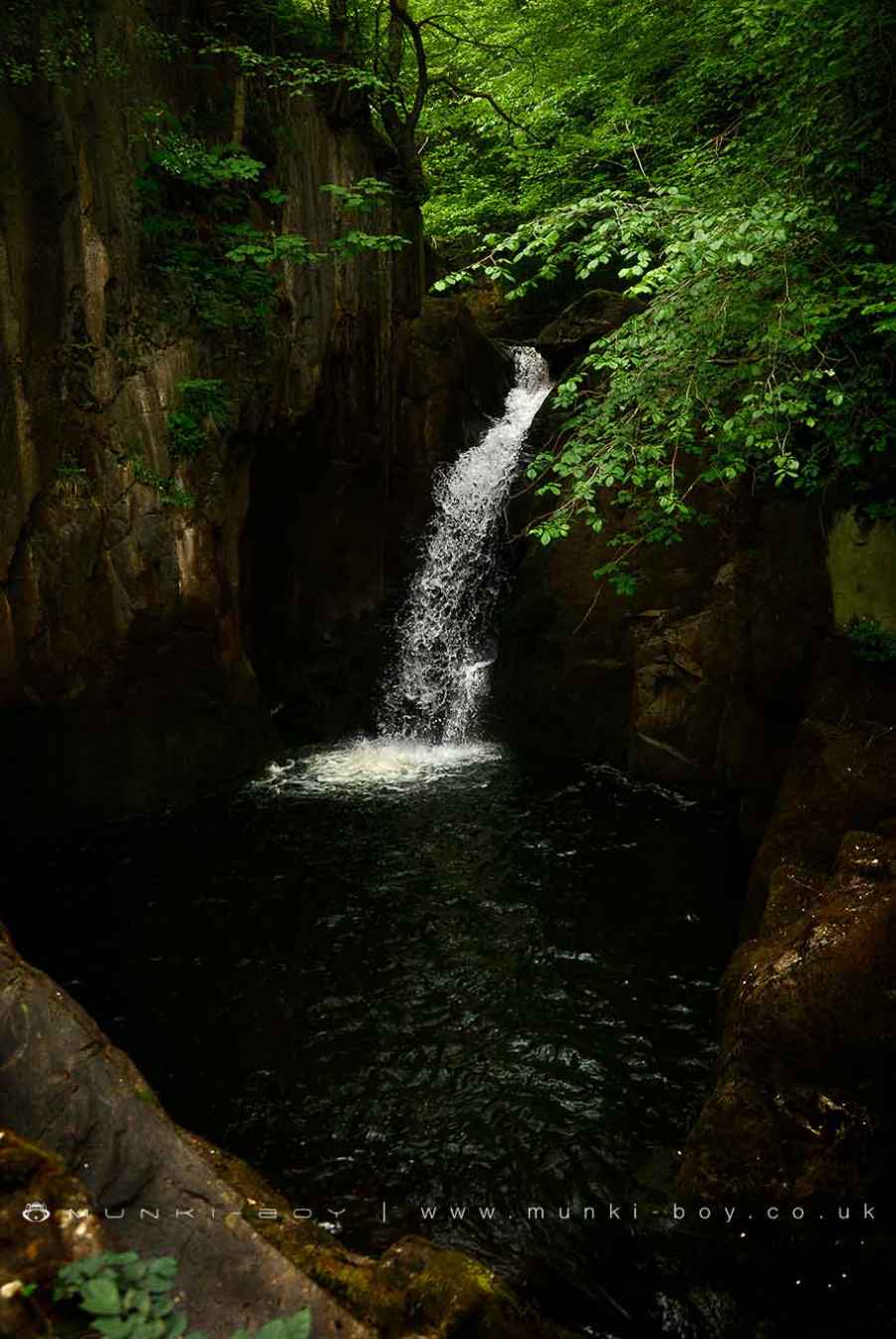
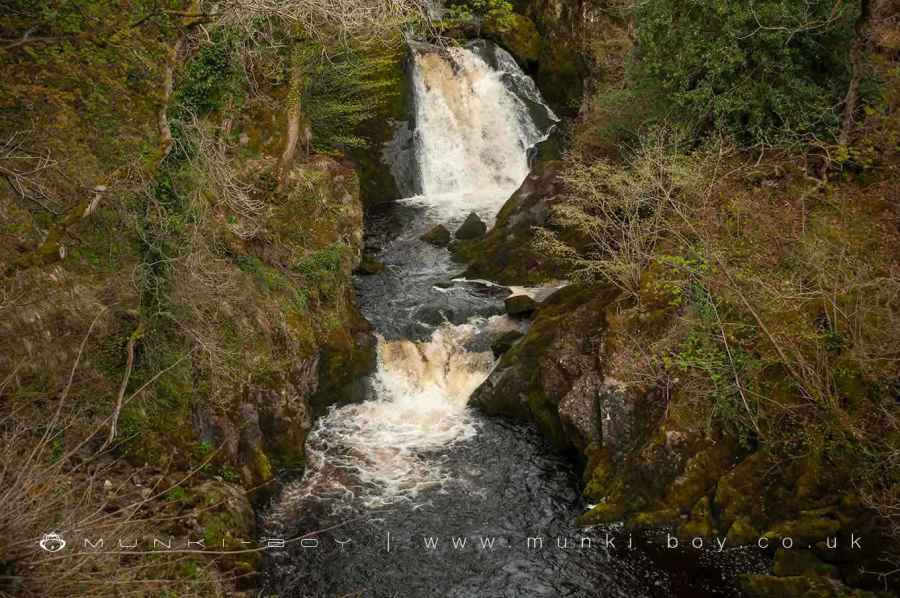
9. Snow Falls and Twistleton Glen
Snow Falls, the last of the notable waterfalls on the trail is difficult to view. The falls are sometimes mostly occluded in the summer months but can be glimpsed after the leaves die back, even then the falls require you look-back from the footpath after passing.
After Snow Falls the woods gradually thin-out and the path narrow before leading out onto a grass-covered, rocky plateau that marks the site of the former quarries. The old powder magazine buildng can still be seen on the opposite valley-side.
Snow Falls
10. Back to Ingleton
There are a few industrial ruins down the trail as it head back into Ingleton that belonged to the old quarries. There are also a few tunnels around, possible drainage for the quarries.
Just as the trail ends and Ingleton begins there is a fantastic chippy called Inglenook. Once stuffed simply head downhill and turn right crossing the Doe and Twiss by the road bridge before heading back into Ingleton Waterfalls Trail car park.
Old Quarries at Twistleton
Footpath Below Rival Falls
These walks are described for educational purposes only and we make no recommendation that you follow them, do so at your own risk. We accept no liability for your safety or for the reliability of the walk, map, description or anything else.
Mist, Mines and Ruins


Own label and private label building products
We produce, brand and supply for some of the biggest names in the industry. Read more...