

Ingleton Waterfalls Trail by munki-boy
Ingleton Waterfalls Trail
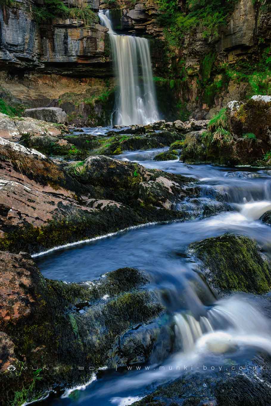
Ingleton Waterfalls Trail is in The Yorkshire Dales National Park in England.
Spectacular waterfalls on a nice hiking trail with decent paths for the most part although steep in places over rock.
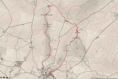
The walk is a circular starting and ending in Ingleton near the railway viaduct, the full route is around five miles. A managed hiking trail kept tidy with admission fee including car parking. Food and drinks stall and cafe on route when open. There’s often a artisan ice cream van on the top above Thornton and the reward of Inglenook chippy at the end.
Created: 12 June 2021 Edited: 29 November 2023
Ingleton Waterfalls Trail Information
Ingleton Waterfalls Trail Address
Broadwood Entrance, Ingleton, Carnforth LA6 3ET, UK
LA6 3ET
Website: http://www.ingletonwaterfallstrail.co.uk/
Get directionsTwiss Details
Twiss
Twiss is a river in Lancashire
Twiss takes in water from an area around 21.324 km2 in size and is part of the Greta and Rawthey catchment area.
Twiss is 13.28 km long and is not designated artificial or heavily modified.
Doe
Doe is a river in Lancashire
Doe takes in water from an area around 38.49 km2 in size and is part of the Greta and Rawthey catchment area.
Doe is 6.808 km long and is not designated artificial or heavily modified.


Ingleton Waterfalls Trail LiDAR Map

Contains public sector information licensed under the Open Government Licence v3.0
Walks in Ingleton Waterfalls Trail
Local History around Ingleton Waterfalls Trail
There are some historic monuments around including:
Yarlsber campApron Full of Stones cairnCastle Hill prehistoric defended enclosureCastle Hill motte and bailey castleSettlement 440yds (400m) SW of Twistleton HallMeal Bank Quarry Hoffmann kiln, quarry and lime works.


