Calf Hey Reservoir Walk
A Walk in Lancashire
Walk spec.
Difficulty: Easy
Basic length: 2.5Km (approx.)
Terrain:
- Gravel tracks
- Tarmac
This walk is very easy apart from a bit of a slope to climb back up from the reservoir, the area is managed and has car parking and good tracks.
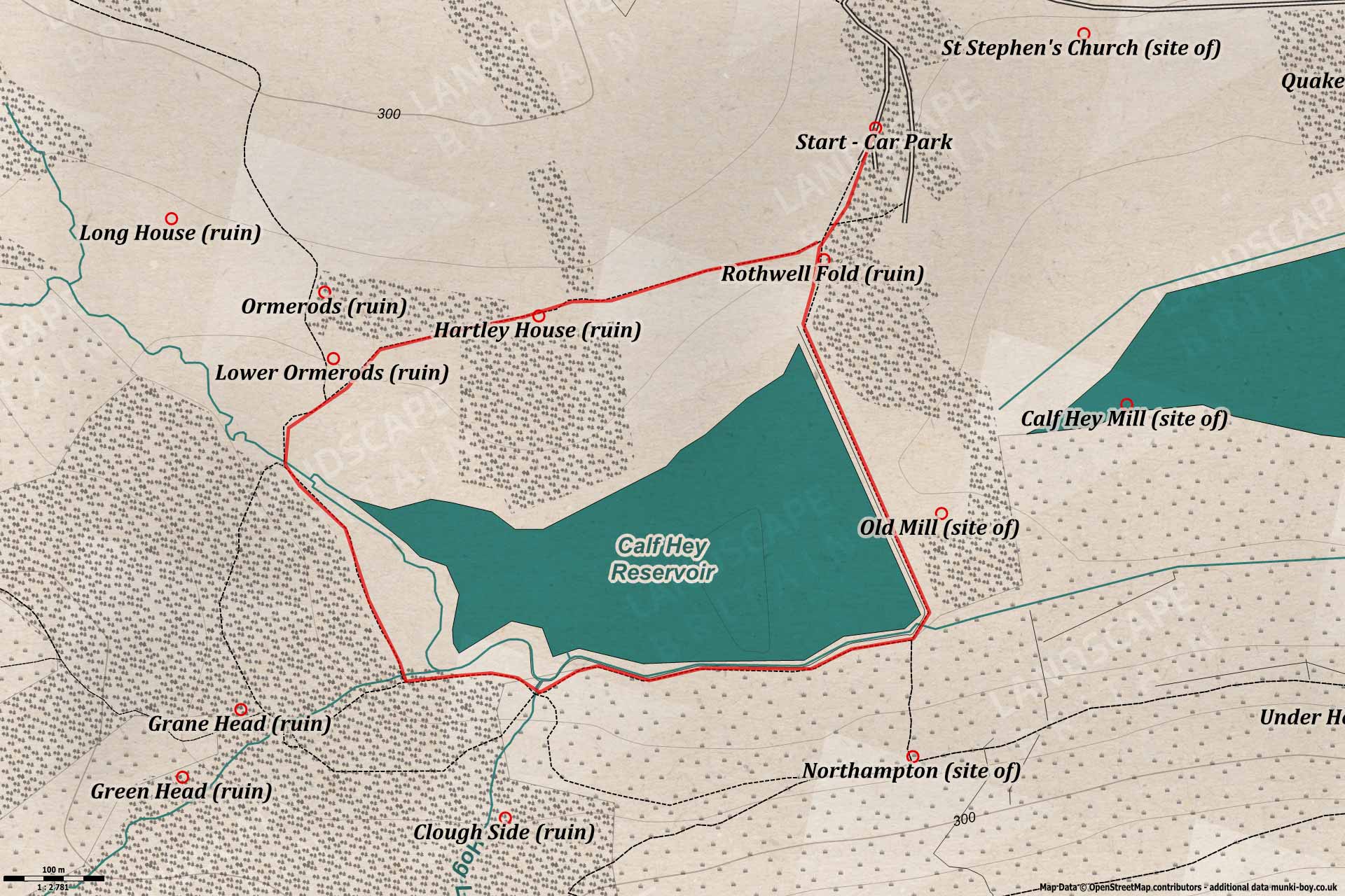
Calf Hey Reservoir
1. Down to Calf Hey
Down the track from the bottom of the car park towards the reservoir the ruins of Rothwell Fold can be seen in the wooded area to the right. This farm went derelict around the 1950s, outlasting many of the other lost farms nearby. Worth a little look if you like exploring, a few low walls remain with interesting alcoves in places.
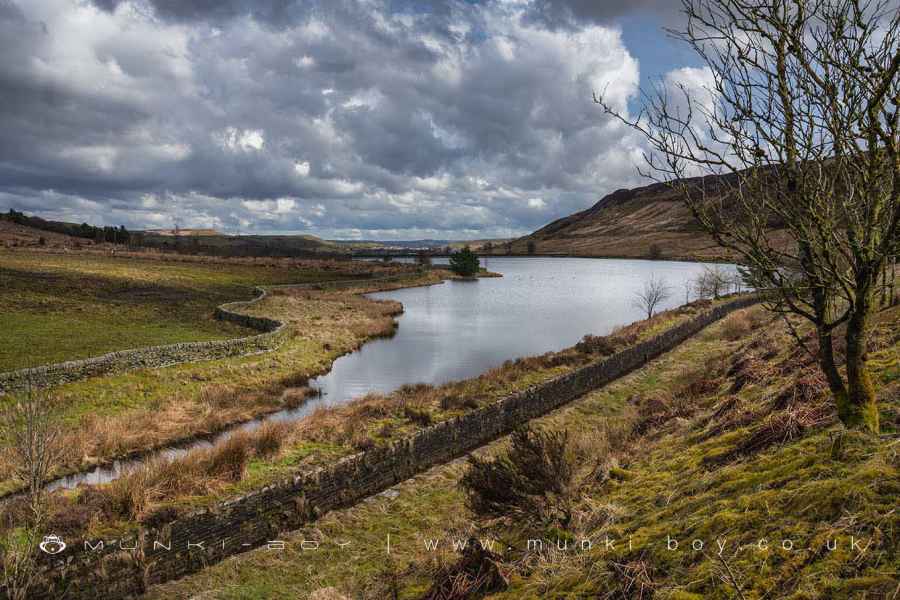
Reaching the corner of the reservoir, we bear-left passing an old water valve (from 1856 as the plaque declares) and the views open out across the water of Calf Hey and down the valley over Ogden Reservoir toward Haslingden. Pausing about half-way along the reservoir embankment you might be able to imagine the valley here before the reservoirs, the Ogden Brook meandering down and looking over the present embankment the Calf Hey Mill with its small millpond, just where the tip of Ogden Reservoir starts today. Under the embankment and a little to the right a smaller mill, already marked as old on the 1845 map. There would have been a good few farms scattered around the valley sides too.
Reaching the end of the reservoir embankment a small bridge crosses the overflow channel which goes all-the-way down the side of Ogden Reservoir and on into Holden Wood Reservoir lower down the valley. Looking upstream the channel continues providing a means for water from Ogen Brook to bypass Calf Hey. We’re turning right here and continuing with Calf Hey Reservoir to our right, but if you look where the public footpath continues up the hillside you might be able to make out the stone rubble where an old house named Northampton stood, after wet weather tiny stream coming down forms small waterfalls behind.
20" Gate Valve - This valve was originally installed in Calf Hey Dam in 1856
2. Hogg Lowe Clough
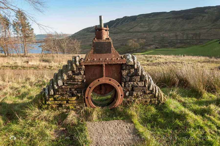
A little further on we find the foot of Hogg Lowe Clough on our left where the brook enters water channel and reservoirs over a series of small stone weirs. Another stream joins soon after with slightly more impressive weirs, you can find a good amount of water coming down here after wet weather. There are some interesting ruins up the clough here if you have time and inclination - our walk continues by bearing-right to reach the western tip of Calf Hey Reservoir where various water channels and sluices can alter the course of the stream coming into the reservoir or to send it on down the valley.
Hogg Lowe Clough
3. Ormerods
Turning right and heading uphill the preserved ruin of Ormerods is just to the left of the track. An old farm ruin with evidence of various stages of building from the 17th to 20th Centuries. There is an informative signboard detailing the various parts of the remaining structure and the history of Ormerods and its decline after the.building of the reservoirs.
Bearing right again we soon come upon the even larger ruins of Hartley House, an old farmstead that grew into several farms and cottages before ending with the same fate as Ormerods.
There are good views across the valley here before we find ourselves back at the corner below the car park.
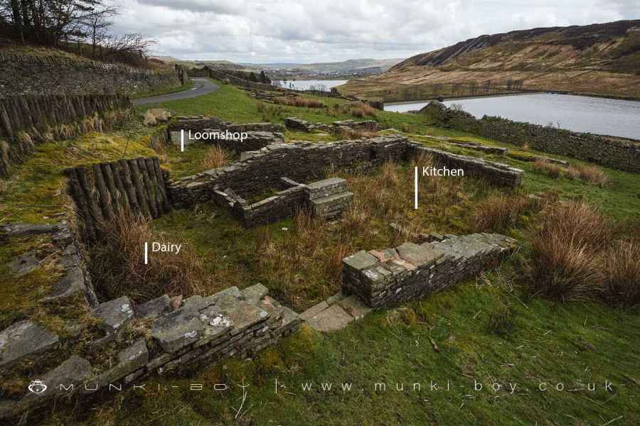
Hartley House Farm 2 Ruins
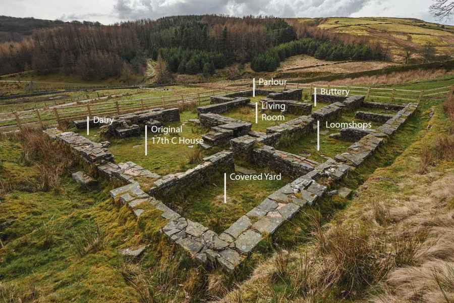
Ruined Rooms at Ormerods
Calf Hey Reservoir
These walks are described for educational purposes only and we make no recommendation that you follow them, do so at your own risk. We accept no liability for your safety or for the reliability of the walk, map, description or anything else.
Mist, Mines and Ruins


Own label and private label building products
We produce, brand and supply for some of the biggest names in the industry. Read more...