Smithills Hall Kitchen Garden Ruins and Coal Mining Tramroads Explore
A Walk in Greater Manchester
Smithills Hall Kitchen Garden and Coal Mine Tramroads
Walk spec.
Difficulty: Moderate (easy optional)
Basic length: 2Km (approx.)
Terrain:
- Gravel tracks
- Mud
- Mud tracks
- Steep slopes
- Wet stream bed
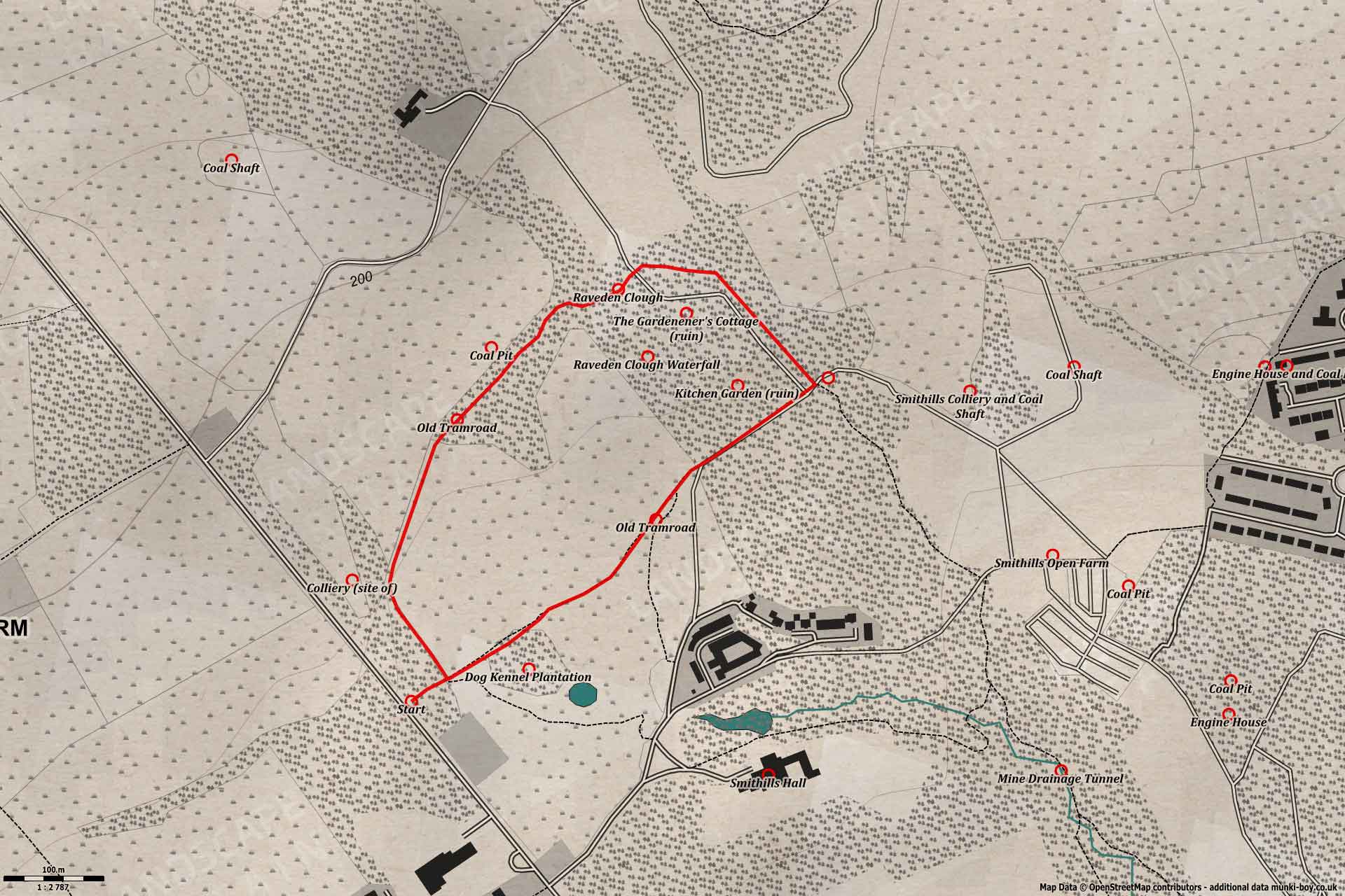
Smithills Hall Kitchen Garden Ruins and Coal Mining Tramroads Explore Walk Map
Get Directions (Opens Google Maps)
This short walk around the former coal mining area and lost Kitchen Garden of Smithills Hall can turn into a lengthy explore, there’s plenty of historic remains and often wildlife around. Otherwise it’s an easy dog walking area enjoyed by locals, away from the popularity of the Hall and surrounding gardens.
Marked as moderate difficulty as this route requires descending the small Raveden Clough and fording the Raveden Brook with variable water levels from dry to infrequently raging. There is an option of a shorter loop or slightly longer walk round to cut out crossing the brook.
Raveden Clough
1. The Old Tramroads
This walk starts from a small gate beside Smithills Dean Road, just above the driveway entrance to Smithills Hall. There is car parking down the driveway - make your way back round the drive.
Starting at the gateway into the small woods on the East side of Smithills Dean Road beside the house named Little Dean. Old fencing beside the road here is found to be made from cut sections of the iron tracks from the tramroads.
Make your way directly through the woods towards the next gateway. This is the route of an old tramroad used to transport coal from the local pits down to an area near the sharp bend on Smithills Croft Raod (below Barrow Bridge Chimney) close to the Halliwell Bleachworks. There were once many stone sleepers here from the tramroads but only one or two remain near the path. These small cobbles were used in pairs to support the iron tracks, unlike train sleepers in one, long piece.
Reaching the second gate turn left, heading slightly uphill with the woods on our left and the open former parkland of Smithills Hall to our right. As the track bends to the right, look left past the fence to find a remaining stone embankment from the tramroads, now overgrown with grass and ferns. The embankment crosses a small brook - a tributary of Raveden Brook that passes over the waterfall at Smithills Hall - which descends into an old-looking, stone-lined culvert to issue some distance downhill at the Dog Kennel Plantation. Across the small brook in the field beside the woods there is much stone rubble, probably indicating the site of an old colliery building associated with the tramroad.
Smithills Hall Parkland
Coal Tramroad Embankment at Smithills Hall Park
Old Coal Tram Tracks at Smithills
2. Raveden Clough
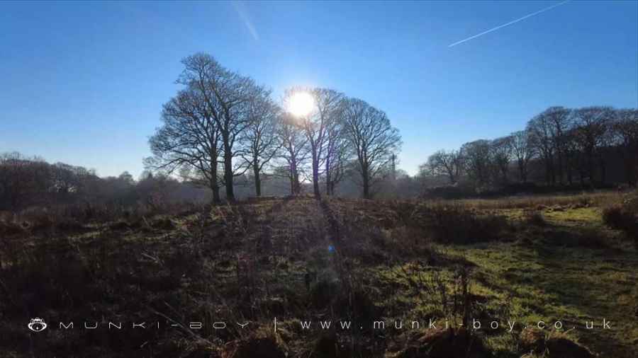
Following the track of the old tramroad as it bends to the right - with views up towards Winter Hill beyond the mysterious Priests Crown. Looking up past a couple of field boundaries there is the site of an old coal pit shaft, in a small hollow beside the woods surrounding the Shoulder of Mutton Clough. Today capped with a ‘modern’ concrete NCB cap for safety. All the other known shafts in the local area were infilled many years ago and hidden under the fields.
As the track enters a small woodland there are ponds to the right dotted around some peculiarly lumpy ground that is probably evidence of water management in times-gone-by. There are a number of small streams and springs coming down from the fields above and much of the spring water was collected for use and kept away from the other ground water to keep it pure.
The old tramroad is now to our left where a stone wall or causeway is found beside a straight, flat area of ground. Eventually this and our path lead down to the Raveden Clough. Note if you don’t want to cross the river here you can turn directly right before the clough, heading down the side of the open grassland with the woods of the clough to your left. There is a bridge at the bottom and the option to come back up the other side of the brook to meet us on the other side.
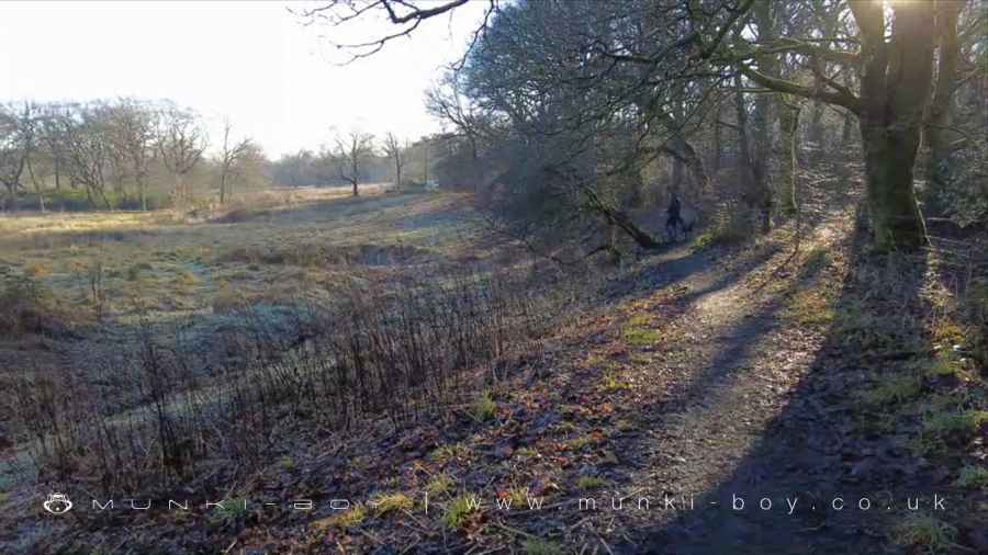
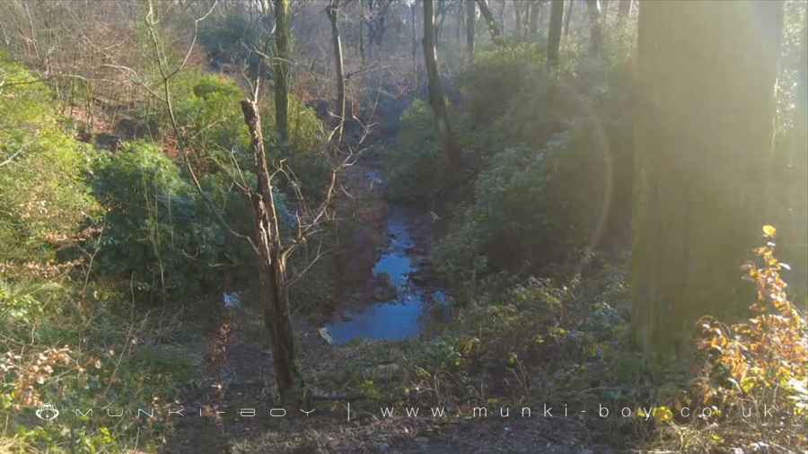
This are of Raveden Clough is often nice in any season with many types of fungi, wildflowers and much wildlife including deer. Verdant in spring and summertime, ablaze in autumn colour which remains throughout much of the winter due to the persistent Beech leaves.
The bank on either side is slightly steep and can be slippery with mud and fallen leaves. The river rocks are slippery when wet but the stream can be completely dry in hot weather. Infrequently, after heavy rain the stream is impassible so don’t bother.
Raveden Clough
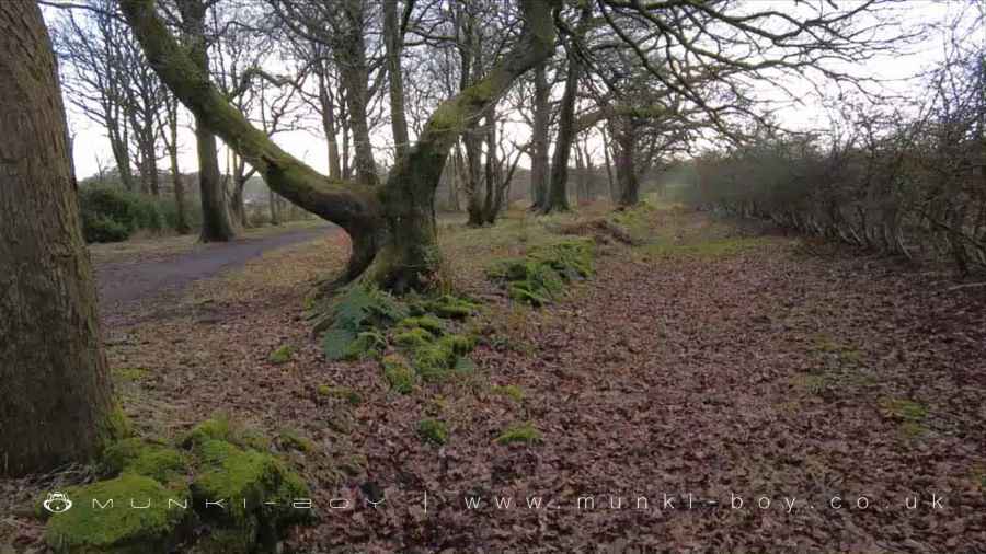
Coal Tramroad near Raveden Clough
3. The Gardener's Cottage and Kitchen Garden
Once across the brook and up the opposite bank, the route ahead is to the right, but we can take a small detour left and towards a field gate. Bearing right before the gate there is a tall fence - broken in places - which surrounds some old stone tanks which stored spring water for use in the garden. The spring water was brought across the nearby clough in an iron pipe (now broken but still visible) to keep it separated from ground water.
Returning to the path above the river crossing and taking the left-hand fork which after a short distance through the trees passes by a crumbling wall and gate; this was the Gardener’s Cottage for the kitchen garden. It’s possible to have a poke around in the courtyard beside the demolished cottage. The back wall has a small, metal door which might have been the coal chute.
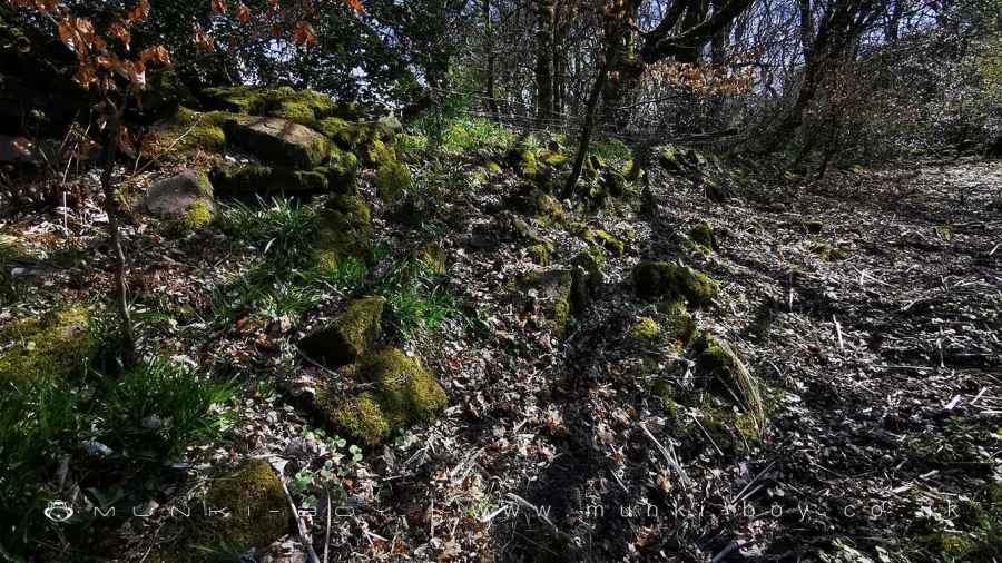
Returning through the gateway and a few metres further along the path we reach the corner of the walled, Kitchen Garden. There is a large, flat area at the top here which was the site of a number of glasshouses and outbuildings. The near-side to our path has a long bank of rubble which is perhaps the remains of the outbuildings. In the back wall of the garden, a protruding iron pipe can be found of the same diameter as that previously described which carried spring water from the tanks a little way up the hill.
The Kitchen Garden appears on old maps made around 1894 but there is only open country shown on the 1850s map. The garden must have been created sometime between and would have grown vegetables and produce for Smithills Hall. In the latter half of the 20th Century a garden centre or plant nursery operated from here and after closing the garden area was used by the local council for plants and as a storage area.
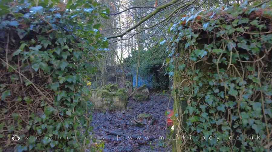
Ruins of the Gardener's Cottage and Smithills Kitchen Garden
4. Further Tramroads
At the end of the high garden wall, another old tramroad cuts across a tall embankment to the left over a number tributaries of Raveden Brook. This tramroad ran between the old Smithills Colliery and the bleachworks at Smithills Croft with connecting tracks to the tramroad we saw earlier.
After looking left we can head-right and through the bottom area of the Kitchen Garden which is open at this end - or use the archway provided. It’s up to you whether you want to explore the garden itself. The central pathway is easy enough but the flat, plinth areas to either side are quite overgrown. I’m not sure which parts date to which period of occupation but there are stone structures and low brick walls in the undergrowth which probably held raised beds for plants.
The flat, open area at the bottom of the garden is deceptive, there is no high-wall but there is much stone rubble pushed out at the bottom of the flat area. I suspect the wall continued right around the garden but was demolished here.
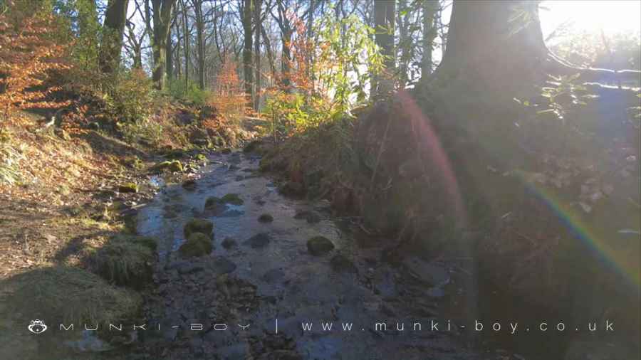
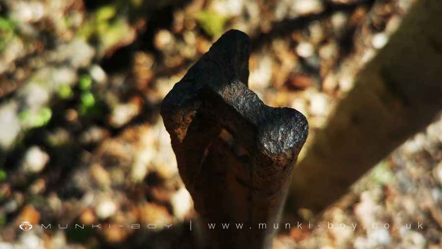
After admiring the garden, we will leave by the open gateway opposite the stone arch and heading across another causeway over the Raveden Brook once more. Here we meet up with those who didn’t cross the brook earlier. Looking up the Raveden Clough here we might glimpse a small waterfall at the top. The more adventurous might carefully head down to the brook and walk up the stony bed. The less adventurous might head up the path beside the garden wall and try to look down from above the water. The disinterested are free to move forward to the path between two, curiously carved, stone gateposts. The rightmost being best-preserved and looking like a stone cactus. Note the flats on two sides, by which I imagine they are not in their original setting.
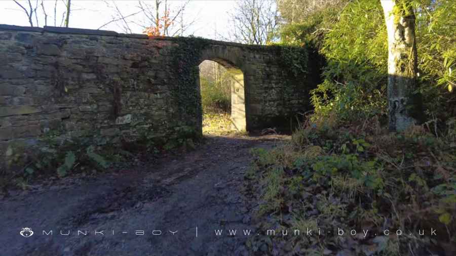
Archway at Smithills Kitchen Garden
Raveden Brook
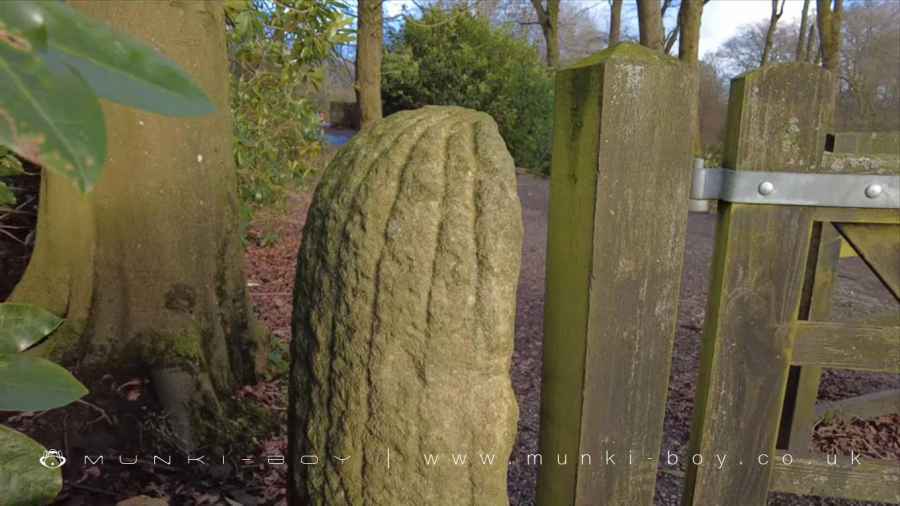
Cactus Looking Gatepost at Smithills
5. Mistery Mounds and Dog Houses
Once through the gate the linear heading of the old tramroad is apparent, although the modern path is quite curvy. To the right there is an enigmatic-looking, conical mound topped with trees, that could be fancied as an ancient burial mound, of a size to rival local record-holder, Round Loaf.
However, this seems to be another series of tanks; these holding water for Smithills Hall. There is also a round, stone-walled depression on top which could be a filled-in well, together with a rectangular stone vessel.
Downslope from here, Smithills Hall can be glimpsed behind the trees and the buildings on the left which were once the old Coaching House, now residential properties.
Following on with the track heading straight back to the start of our walk, passing the small Dog Kennel Plantation on the left. Just below here was the site of the kennels for the hunting dogs of Smithills Hall. The stone culvert mentioned earlier comes out here, from a tunnel beneath the little stream that flows today. There was until recently (2021) a little path here, but the ground has fallen away so a little fording is sometimes required.
A Mound Containing Wells and Water Tanks at Smithills Hall
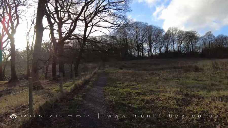
Coal Tramroad to Halliwell Bleachworks
Raveden Clough
These walks are described for educational purposes only and we make no recommendation that you follow them, do so at your own risk. We accept no liability for your safety or for the reliability of the walk, map, description or anything else.
Mist, Mines and Ruins


Own label and private label building products
We produce, brand and supply for some of the biggest names in the industry. Read more...