Appletree Worth and River Lickle
A Walk in Cumbria
Walk spec.
Difficulty: Easy
Basic length: 7Km (approx.)
Terrain:
- Gravel tracks
- Mud tracks
- Road without footpath
- Steep slopes
- Tarmac
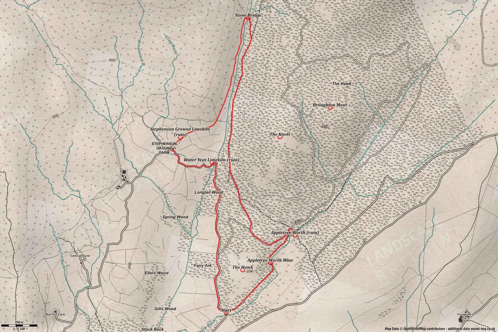
A scenic walk with an interesting lost village, returning along a section of the River Lickle past old sheepfolds and ruined limekilns. The terrain is not bad with small sections of mud track, gravel and a small section of narrow country-road at the end.
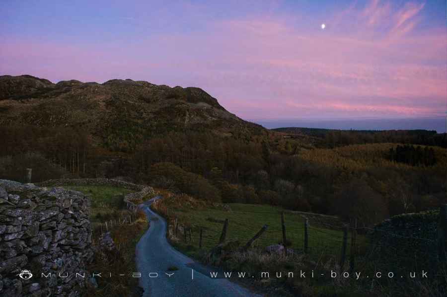
Old Road to Appletree Worth
1. The Hawk
Starting from the small car park at The Hawk Bridge and heading along the small path in a northeasterly direction with the steep slope of the The Hawk on our left. This track is the old road to Appletree Worth which is our first destination.
There is an old prehistoric settlement on top of The Hawk which gives the hill its name. There isn’t much to see on the ground and there is no proper track to continue the walk so we aren’t going ascend but take a look if you like. The Hawk is a scheduled monument and of historic importance so treat the site with due respect.
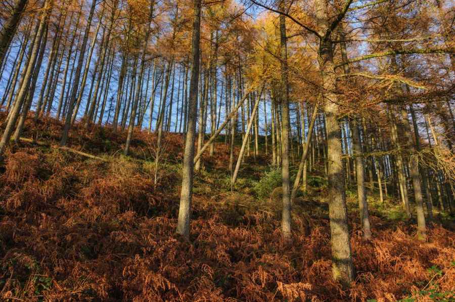
The Hawk
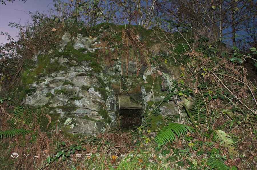
2. Appletree Worth Beck and the Old Mine
After a short distance at a sharp bend of the Appletree Worth Beck a large rock outcrop is found to the left of the track below which an adit for the old Appletree Worth mine can be seen. I don’t know much about this little mine, the adit looks pokey and damp inside after the entrance so I wouldn’t go in unless you know what you’re doing. Even without flooding there can be sudden drops and false floors in these old mines. There is a second, partially collapsed adit nearby, hard to find in the undergrowth.
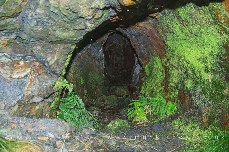
Appletree Worth Mine
3. The Lost Village of Appletree Worth
Following the track and the beck round the zig-zag bend a small bridge beside some old stepping stones marks the entrance to the ruins of Appletree Worth. This would have been a small village, probably grown out of an enlarged, earlier farmstead. Aside from farming the community would have had access to the nearby mine and there is also an old limekiln - hard to discern in its ruinous state up the opposite river bank to the village. The small bridge is modern but ford was added here some time after the stepping stones.
Take care if you explore the ruins as they are quite overgrown and there could be a danger of collapsing walls and falling rock.
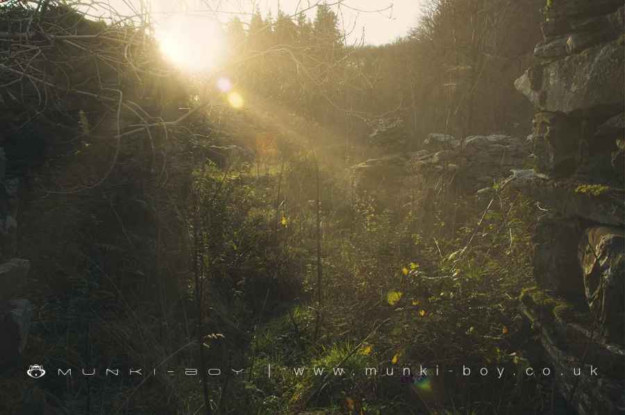
Ruins of Cottages at Appletree Worth
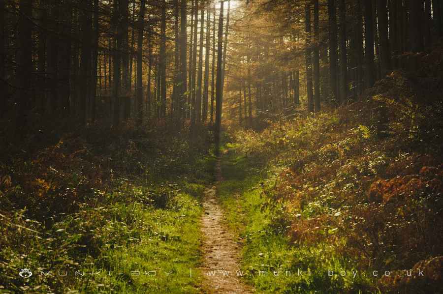
4. Broughton Moor
Returning over the bridge from the ruins and turning back the way we came, we now take the right fork of the path that leads uphill and over Broughton Moor to the valley of the River Lickle. The woodland here is a modern conifer plantation managed by the forestry commission, presumably beforehand this was open moorland. The path leads up and over The Hawk before bearing right up the valley of the River Lickle.
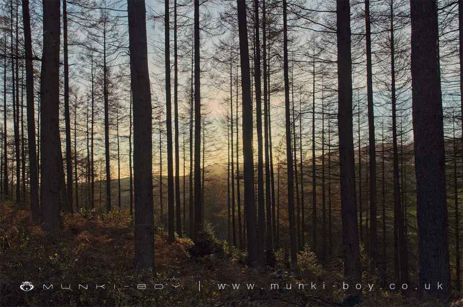
Broughton Moor Woods
5. River Lickle
The main path now leads just east of a northerly direction as the river runs the opposite way from it’s source of many tributaries near the foot of White Pike, the pointy looking mountain that (weather permitting) should come into view higher up the valley. After some distance where the path runs below Jordan Crag, look out for a path heading off to the left and diagonally down the valley side to the river. Here is found an ancient-looking stone “clapper” bridge which allows us to cross the river and head up the opposite bank to an old cart track.
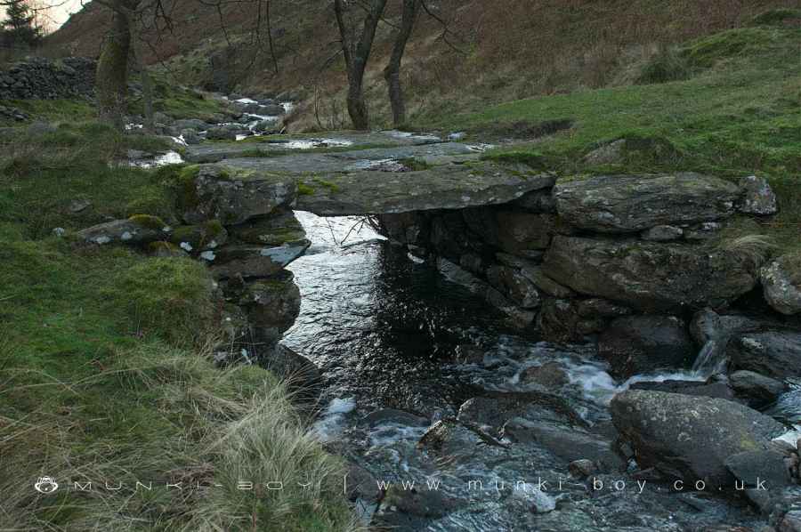
Stone "clapper" bridge over the River Lickle
6. The Old Cart Track
The next section follows the opposite bank of the River Lickle downstream and back down the valley along an old cart track. Look out along the way for exposed bedrock bearing the ruts of horse-drawn carts of the two centuries that have worn grooves into the stone. There are a few interesting structures along the way with the remains of an old stone hut or shelter on the right side of the track. As the track nears Stephenson Ground and the road, the ruins of an old limekiln are found not far to the right of the track. There are good views back up the valley to White Pike and across to the rocky crags up on The Knott.
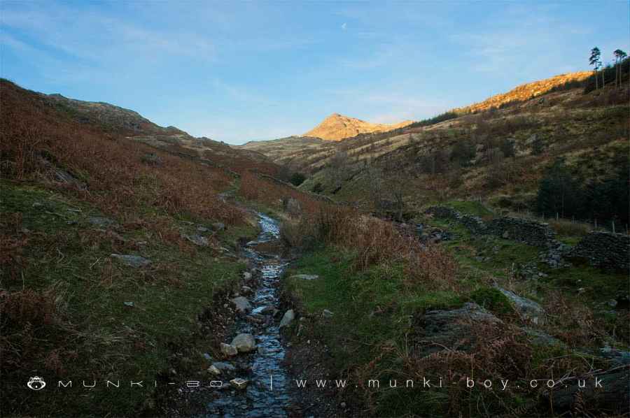
The Old Cart Track beside the River Lickle, with White Pike beyond
7. Water Yeat and the Road Back
Once the small tarmac road is reached beside Stephenson Ground we turn left to head downhill and back towards the starting point. Careful on the road here, there isn’t far to walk and we saw no traffic but there is little or no pavement. The road zig-zags down toward the river - look out for another old limekiln on the left - until Water Yeat Bridge is reached. Yeat or alternate spellings such as yate are often local dialect in the north, meaning gate.
After crossing back over the River Lickle the roads heads steadily uphill. First passing by Longtail Wood on the left then the strangely named Fairy Ark, for which the wooded area is named on maps today but actually denotes a small outcrop in the River Lickle below. Before long we find ourselves back at the bridge and car parking area.
The Road Down to Water Yeat
Water Yeat Limekiln
Old Road to Appletree Worth
These walks are described for educational purposes only and we make no recommendation that you follow them, do so at your own risk. We accept no liability for your safety or for the reliability of the walk, map, description or anything else.
Mist, Mines and Ruins


Own label and private label building products
We produce, brand and supply for some of the biggest names in the industry. Read more...