Piethorne Valley Walk
A Walk in Greater Manchester
Walk spec.
Difficulty: Moderate
Basic length: 5Km (approx.)
Terrain:
- Mud tracks
- Road without footpath
- Sheep
- Steep slopes
- Tracks
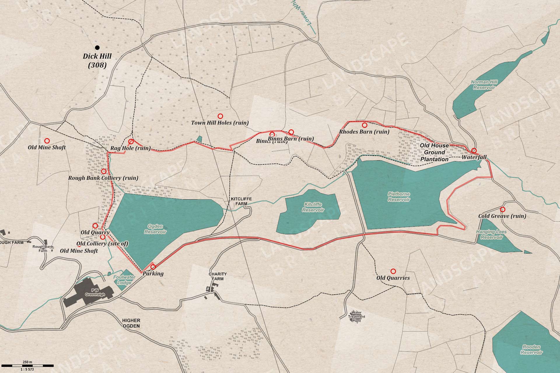
This walk is easy if you’re into hiking and has good tracks but some unsurfaced and a few steep-ish slopes. It’s good for dog walking although there are sheep around some of the tracks and unfenced fields if you’re dog doesn’t like sheep, or likes sheep too much.
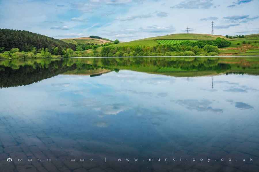
Ogden Reservoir
1. Ogden Reservoir
The Piethorne Valley Walk starts from the small public car park at the Southwest corner of Ogden Reservoir and making our way up to the edge of the water from where there are good views out across the reservoir towards Rag Hole Clough beyond. Continuing along the West embankment (to the left with the Ogden Reservoir water on our right) we can see a much smaller reservoir to the West. This is Foulwater Lodge, which was constructed at the time of the larger reservoirs, I would imagine to compensate the mills downstream with water due to the new reservoirs blocking the valley. The buildings just beyond are on the site of an old fulling mill that had two small and irregular shaped lodges on site. Fulling is a process of making woollen cloth but I would imagine in this area it was applied to cotton.
A little further along the embankment there is an interesting gated pier with animal shapes on the gate framework and also tells us Ogden Reservoir was made in 1868. Just ahead of us beyond the large spillway leading from the reservoir a small spoil heap of a shaly looking rock can be seen. This was the site of an old coal mine or colliery that had a couple of trials driven into the valley side from just below here where the bottom of the embankment now stands. There were also several mine shafts, mostly now covered over by the water works but just above the trees above the slope there is a concrete capped shaft.
From here we climb up a brief slope and follow the path around the reservoir to the right (Northeast) with the Rough Bank Wood to the left of the path. There are more good views here across the lakes.
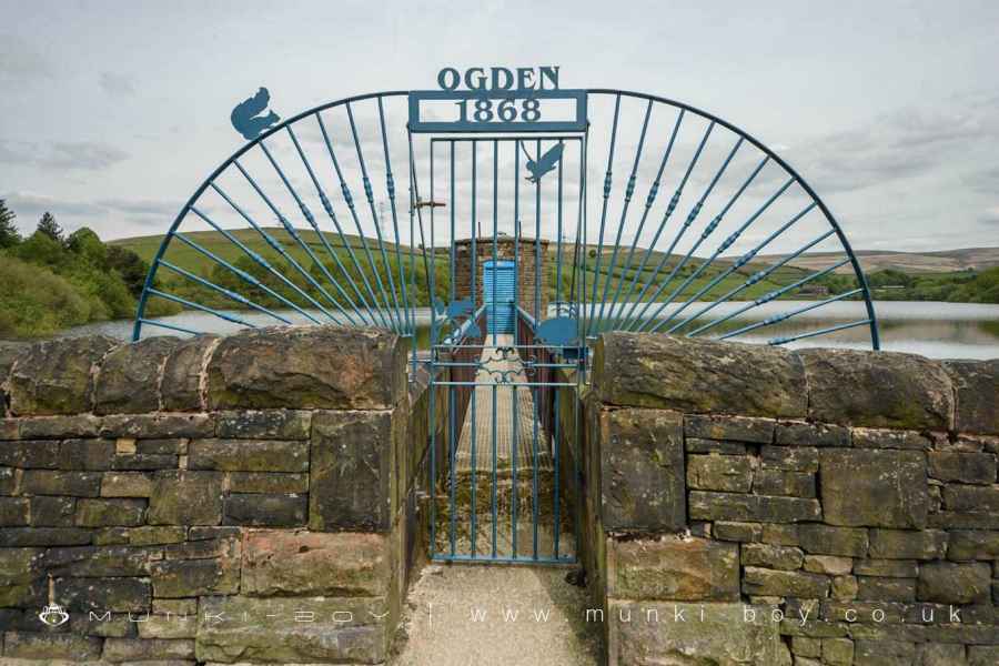
Ogden Reservoir Gate
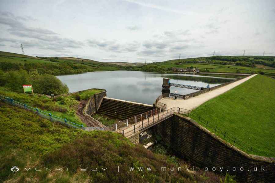
Ogden Reservoir Spillway
Site of Old Colliery at Ogden Reservoir
2. Rag Hole
As the path continues into Rag Hole Clough there can be seen in the woods to the left, scarce remains of stone walls or the corner of a small stone cabin that where once part of Rough Bank Colliery, where coal was worked from the early 19th Century for many years. Rag Hole Colliery had at least two mine shafts, colliery buildings and a small haulage or tramway on site. The woods here are quite overgrown, maybe more can be seen in the Winter months. There is a large looking old shaft on top of the hill above but I have not seen it except via Google Earth.
Moving on up Rag Hole Clough the footpath crosses a small stream at a bend to the right (East) and up a steep slope. Erosion control, temporary footpath here on last visit. As the first part of the slope breaks we can see the low walls that remain of Rag Hole, an old farm and outbuildings that once stood here. Now preserved in a safety concious and sanitised format. Searching slightly to the North along a sketchy looking dry stone wall and we find a stone water trough collecting from a spring that would have been the farm’s water supply.
It’s funny to think this stone trough collected water to make things a bit easier for the people who lived here a couple of hundred years ago, then someone made most of the valley into a giant water trough to make things easier for the nearby towns. Same principle but on a much larger scale, only a relatively short time later.
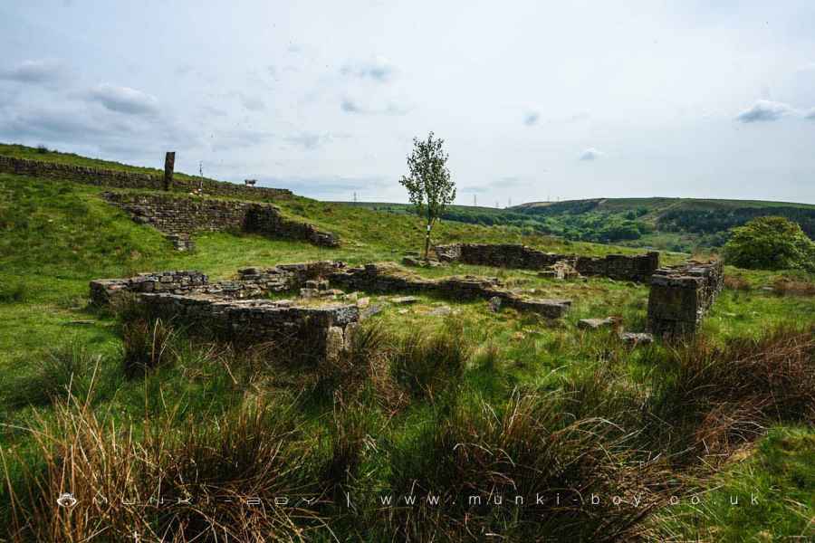
Rag Hole ruins
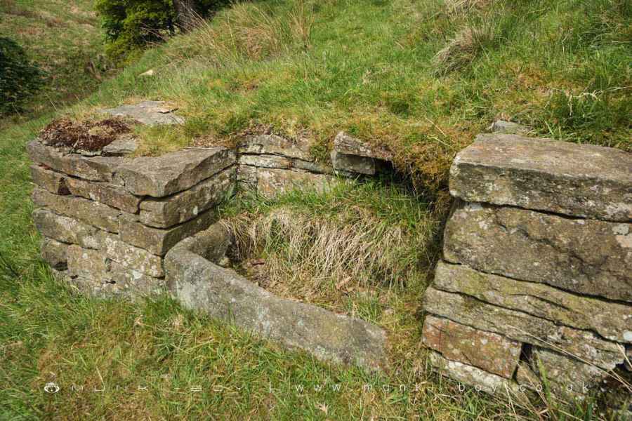
Rag Hole Spring
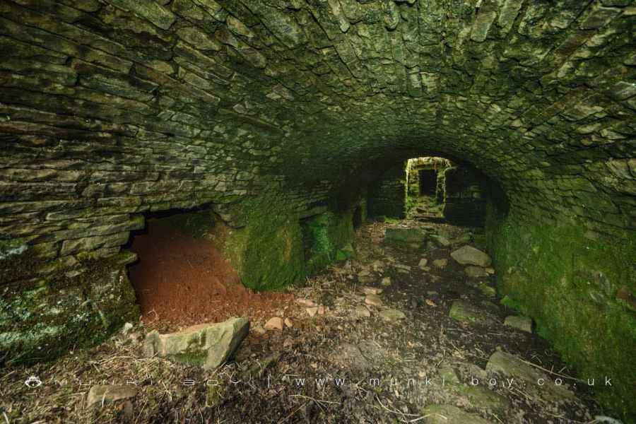
3. Cellar Door
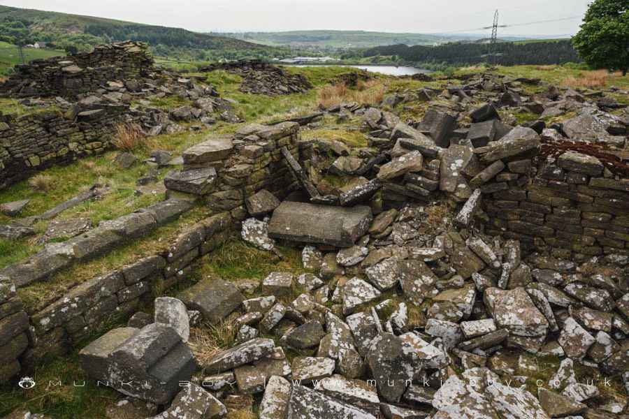
Moving on from the ruins of Rag Hole in a generally Easterly direction with Ogden Reservoir below us on the right for some distance we find Kitcliffe Reservoir comes into view with its water treatment works on the opposite shore. At a meeting of tracks we bear left heading up slope rather than down towards the water. Soon the track bends round and the large and very interesting ruins of Binns come into view. Search around here and the wide opening of an old barrel vaulted cellar can be easily found. The cellar at Binns looks very much like a traditional “root cellar” as popular with the American settlers.
I’m not sure how safe it is to go inside but there’s a good bit of architecture remaining in with what looks to be a hole for an old stair leading down after some distance. Very well preserved considering it was possibly built as far back as the 18th Century and has been derelict for more than a hundred years.
There are also large areas of demolished farm and outbuildings nearby with some ornate stonework amongst the rubble. Part of this ruin was used as a sheep pen after the farm became derelict. A little further down the track a flat area of land with some stonework remaining marks the site of Binns Barn, which was probably just that.
The ruins of Binns at Piethorne
The vaulted "cellar" at Binns ruin
4. Old House Ground
After a bend in the track the site of Rhodes Barn can be seen to the right of the track. It’s a bit messy and there’s not much left here although the old stone trough and spring that served the farm is easily found beside the track. But we’re approaching the Old House Ground Plantation and if you’re here with us at the right time of year you are in for a bluebell treat that can be easily seen from the path which sticks resolutely to the top edge of the wood. The wood itself having no paths. It’s a lovely place for masses of bluebells but the steep slope of the ground on which the wood grows is a bit off for photography.
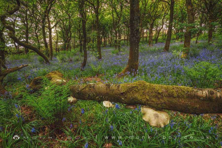
Bluebells at Old House Ground Plantation
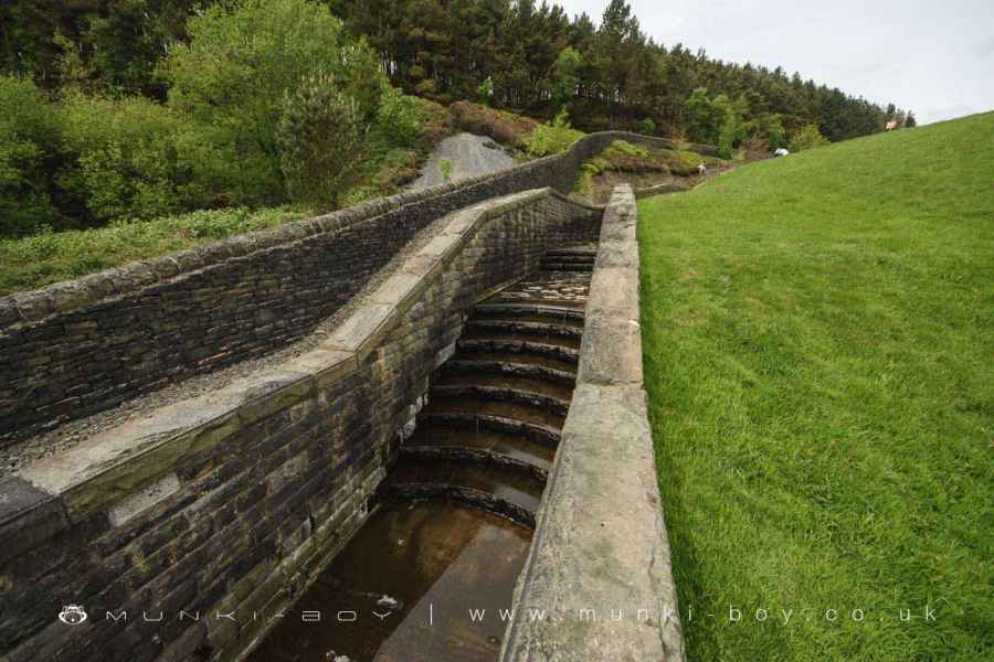
5. Normal Hill Waterfall and The Way Back
After the end of the woodland is reached our route turns right (South) following the the Easterly tip of Piethorne Reservoir, but check straight ahead a short distance first as the spillway down from Norman Hill Reservoir features an artificial waterfall that is good after wet weather and interesting otherwise.
Following the track around the edge of Piethorne Reservoir is simple enough and another old spring trough can be seen here to the left of the track before swinging round to the right (West) and finally meeting a tarmac track which leads back to the car park along the Southern edge of Piethorne, Kitcliffe and Ogden Reservoirs. I don’t think it’s particularly busy but it is some sort of road so careful.
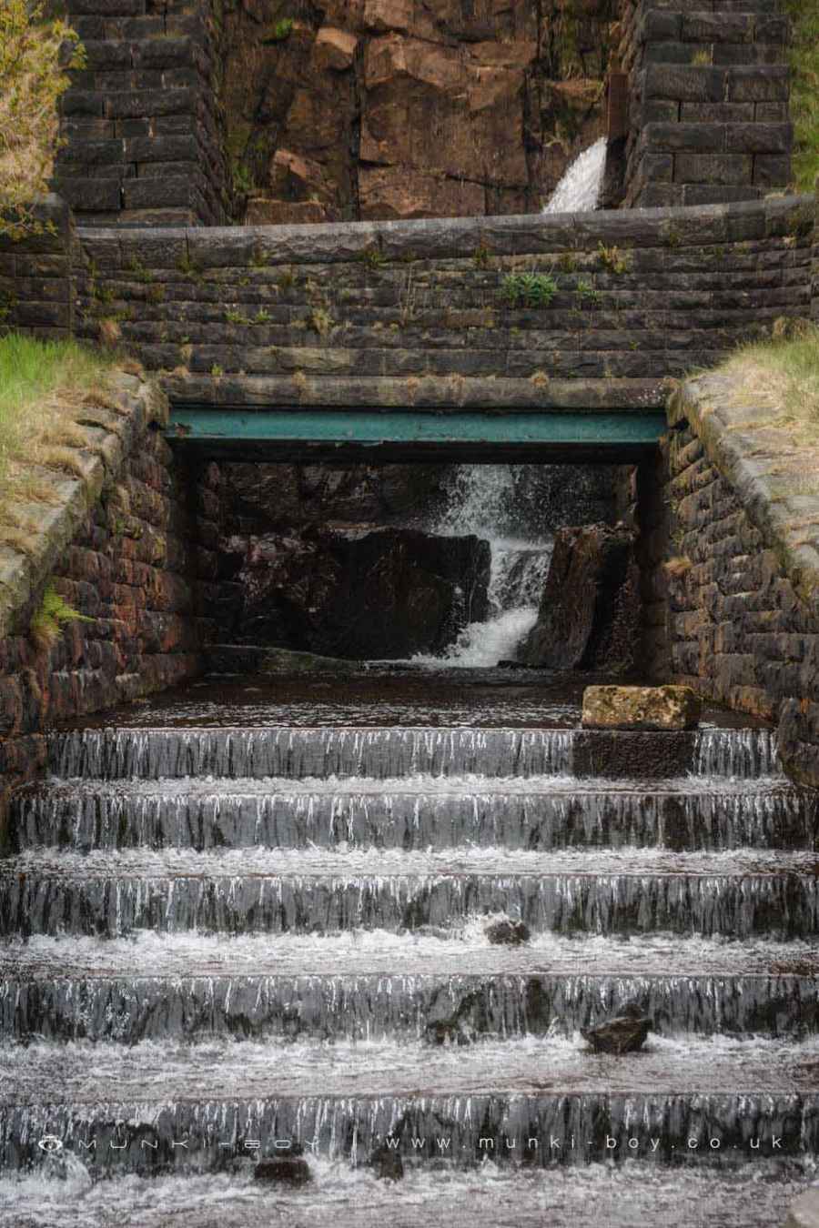
Waterfall from Norman Hill Reservoir
Ogden Reservoir
These walks are described for educational purposes only and we make no recommendation that you follow them, do so at your own risk. We accept no liability for your safety or for the reliability of the walk, map, description or anything else.
Mist, Mines and Ruins


Own label and private label building products
We produce, brand and supply for some of the biggest names in the industry. Read more...