Dean Clough Reservoir Walk
A Walk in Lancashire
Walk spec.
Difficulty: Easy
Basic length: 3.36Km (approx.)
Terrain:
- Mud tracks
- Steep slopes
- Tracks
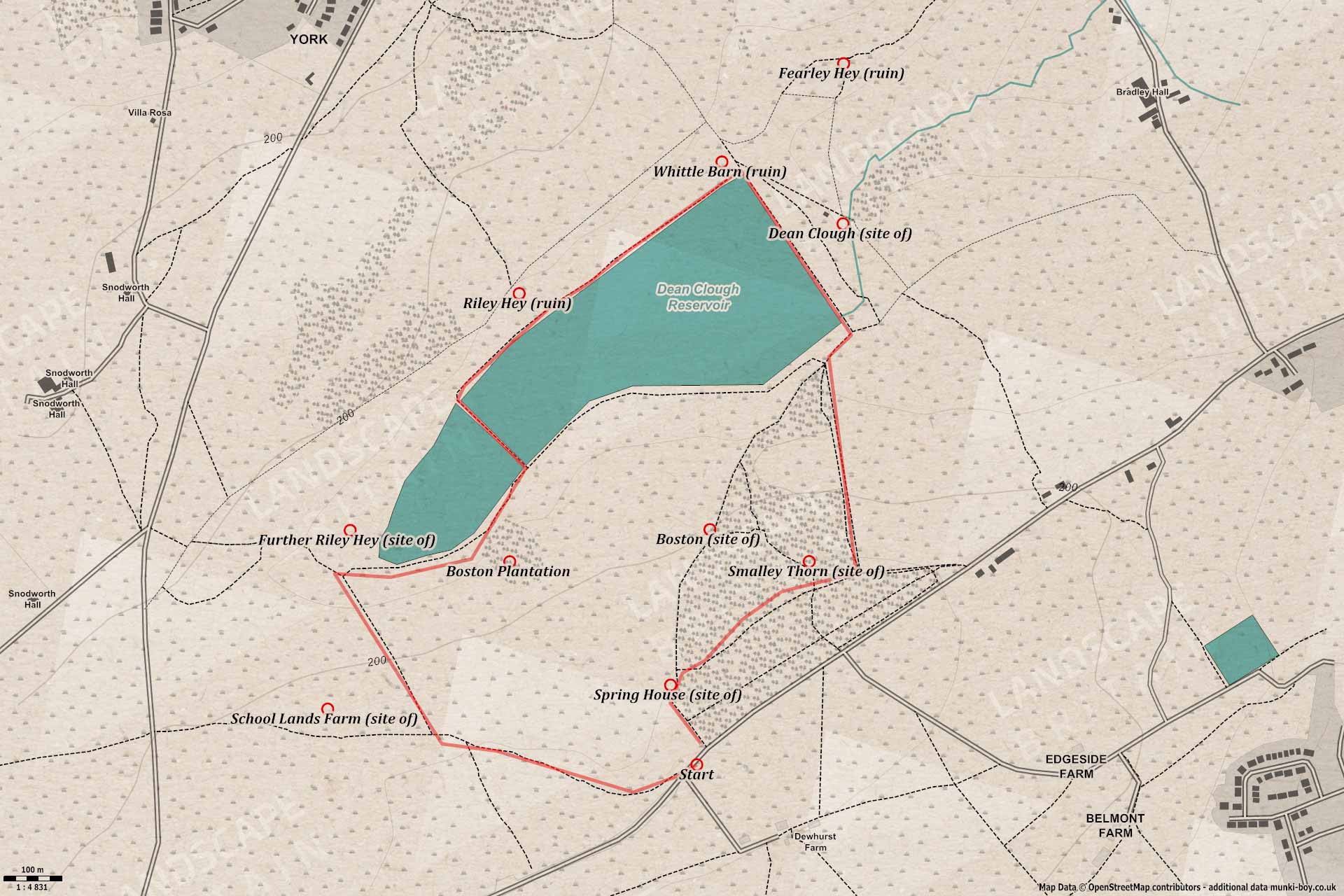
This walk is very easy going except for maybe a bit of mud and a slight hill at the end, maybe steep if you don’t like hills at all. The walk begins at the small layby of which there are a couple on the Harwood Road near the pine woods above the reservoir.
Dean Clough Reservoir
1. Down Dean Clough
An old farm track leads down and slightly away from the Western end of the Dean Clough Reservoir which should be on your right at this point. This was the site of a farm named Cow Hey that went derelict sometime in the latter half of the 20th Century but not much remains today.
Following the track down past some old stone gateposts a small bend in the track marks the place where we turn right onto a smaller path - aiming for the tip of the reservoir. Just past where we turn was the site of another old farm known as School Lands which suffered a similar fate to Cow Hey. It seems a good few farms stood around here a couple of hundred years ago but most are now gone.
View towards Pendle Hill from above Dean Clough Reservoir valve house
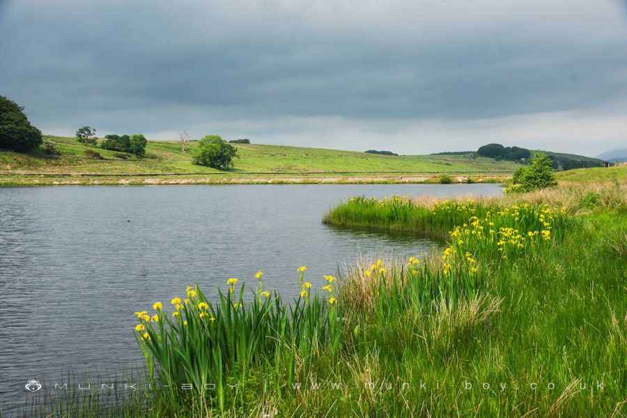
2. Yellow Flag
Heading down toward the water the views to the Northeast can be good, over the water and down the small valley towards Pendle Hill. After heading along the straight section of track we reach the gate to the reservoir with a small sign about “Keeping Lancashire on Tap” tells a little about the area.
Head along the Southern edge of the reservoir with the water on your left - in Summer there are tons of Yellow Flag flowers here as well as meadow wildflowers. Watch out for deer around the edge of the Boston Plantation the small wood to our right, and dragonflies and birdlife around the shoreline. A little further along the shore the remains of an old wooden pier can be seen - Something to do with fishing at Dean Clough Reservoir, not sure.
Dean Clough Reservoir
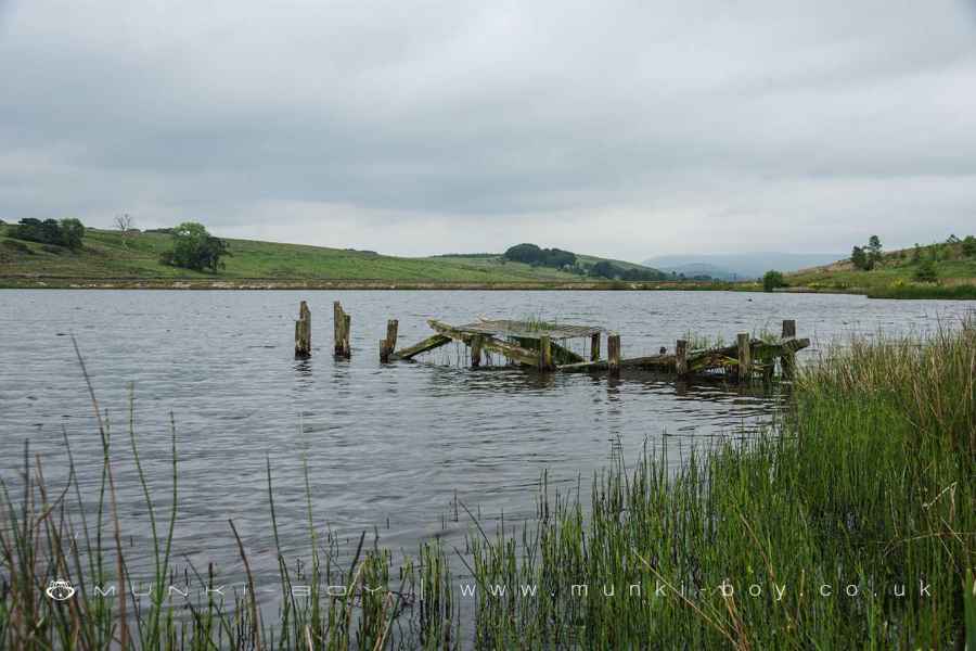
An Old Wooden Pier at Dean Clough Reservoir
3. A Causeway
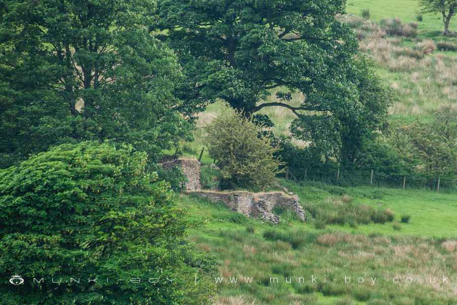
Once the dividing embankment is reached turn left and head across to the other side of water to continue along the opposite shore. Just past here on the left the few ruined remains of yet another farm. This place was originally known as Upper Riley Hey, Riley Hey being a farm just further West. Sometime around the turn of the 20th Century Riley Hey became Further Riley Hey and Upper Riley Hey became the new Riley Hey - who knows what was going on back then. Both farms derelict around the same time as the others in the area with Further Riley Hey going first.
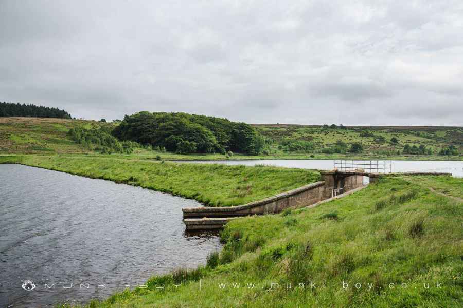
Dean Clough Reservoir separating embankment
4. Distant Castle
Continuing straight along the edge of the water to reach the large embankment at the end of the reservoir the (weather dependent) view should get even better - it’s possible to see the grand house of Clerk Hill with the old Deer Park and “castle” with the higher ground above where the ancient monument of Jeppe Knave Grave is situated and the Nick o’ Pendle rising higher beyond.
The "castle" on Wiswell Moor
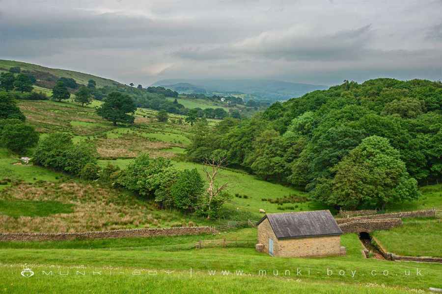
5. Back Up The Hill
The small building just below the embankment is the valve house for the reservoir and it is at this last corner of the reservoir that we turn left and after a few metres turn right heading up beside the pine woods where the path joins another heading into the woods. Just here was the site of Smalley Thorn but I don’t think much remains on the ground.
Follow the path through the woods to the other side, just at the corner of the track yet another old house once stood; known as Spring House. Here a small section of path leads back up to the main road.
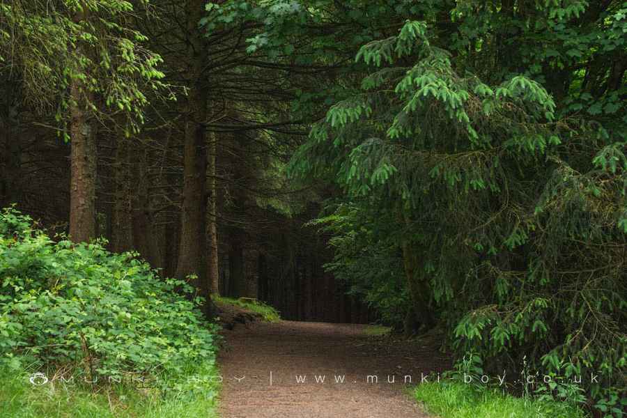
Pine Woods above Dean Clough Reservoir
Dean Clough Reservoir
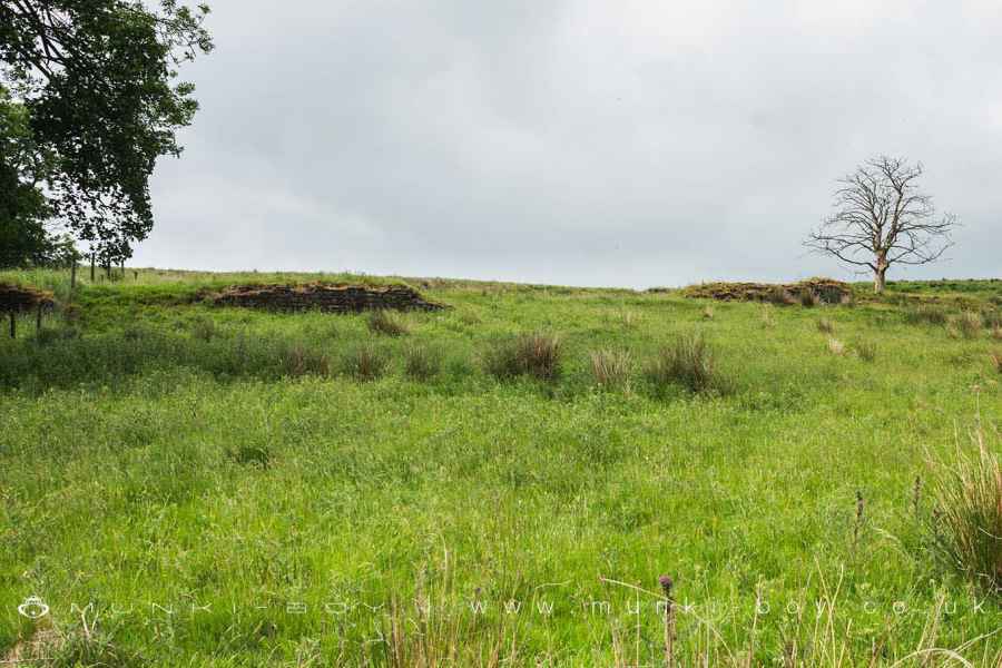
Upper Riley Hey (ruin)
Fearley Hey (ruin)
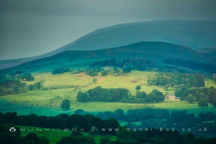
Clerk Hill and Deer Park Wood with Wiswell Moor and Nick o' Pendle beyond
These walks are described for educational purposes only and we make no recommendation that you follow them, do so at your own risk. We accept no liability for your safety or for the reliability of the walk, map, description or anything else.
Mist, Mines and Ruins


Own label and private label building products
We produce, brand and supply for some of the biggest names in the industry. Read more...