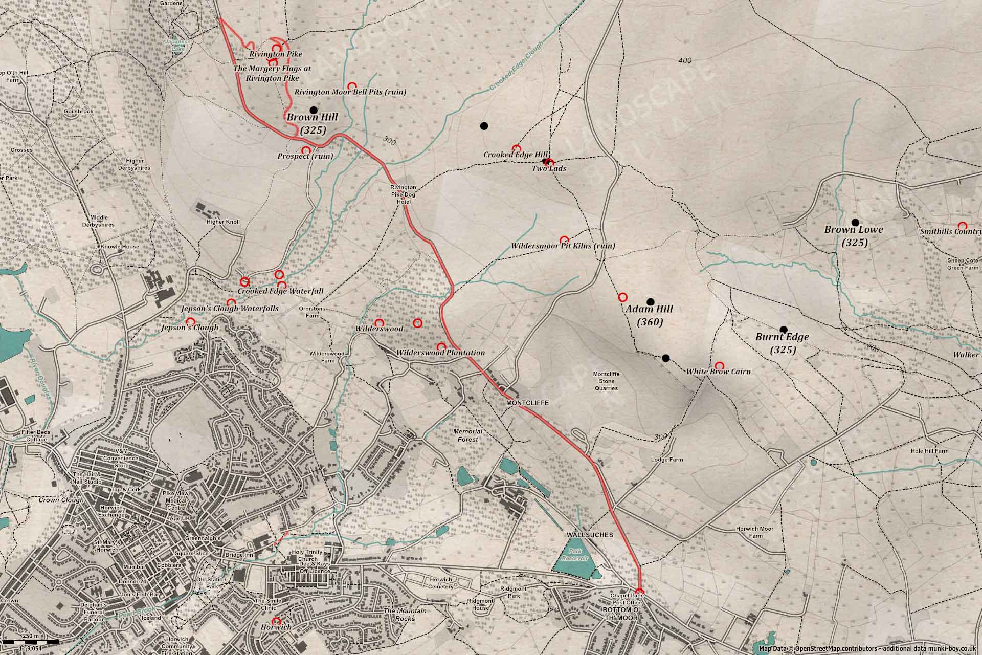
Rivington Pike by Georges Lane (and back)
A Walk in Greater Manchester
Rivington Pike
Walk spec.
Difficulty: Easy
Basic length: 7.49Km (approx.)
Terrain:
- Gravel tracks
- Mud tracks
- Road without footpath
- Steep slopes
- Tarmac
A lovely walk up to the Pike, taking in several historic mining areas and possibly prehistoric sites as the route rises to reveal more and more spectacular views.
Marked as easy this route is often used by families - although some may find it steep in places. Most of the tracks are formerly cobbled and now rough gravel, sometimes with large puddles in places. There are are a couple of small sections of narrow tarmac road but they are often used by walkers and traffic is minimal except on holidays. There is the option of a small car park situated beside Wilderswood Plantation roughly half-way to the Pike.
Rivington Pike from the old Pike Road
1. Georges Lane
This walk starts at the bottom of Georges Lane, above the town Horwich and opposite the Ye Jolly Crofters pub on Chorley Old Road.
As you may already know, such old fashioned names containing ‘Ye’ are spelled using the character ‘Thorn’, which we don’t use anymore, but had a ‘th’ sound. I’m not sure how long a pub has stood here, the current building certainly doesn’t seem particularly old, but does stand on an ancient route. The character Thorn is said to have been removed from the alphabet in 1300. Anyway, let’s get on…
Heading up Georges Lane leaving behind the hamlets of Bottom o’th Moor and Tup Row and passing by a small, wooded area known as Tup Row Wood. The site of an old, disused quarry or delf, and later a water pumping station lifting water from an incredibly deep borehole to help ease the demand for water caused by the industrial revolution in the area. The pumping station was demolished many years ago but many large stone blocks remain friom the old building. Just at the top of the wood, where the road bends left there is a reconstructed stone trough in place of the original one which must have been used to supply spring water to the local houses.
As the road ascends, little glimpses out above the treeline tease the views to follow which soon begin to open-out into a panorama by the time the junction with Matchmoor Lane is passed. It’s possible to see the Welsh mountains on clear days.
After a short distance a signboard is incoveniently blocking the whole footpath, but it’s nice to know we just entered the West Pennine Moors!
The road continues before bending slightly left at the entrance to the large Montcliffe Stone Quarries, which grew from a much smaller quarry known as Dairy Hole; beyond which was the tiny, Stanley Reservoir whcih was drained in the early 1990s I believe.
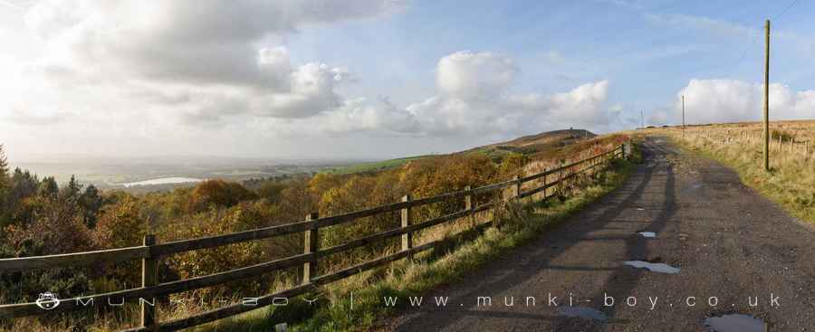
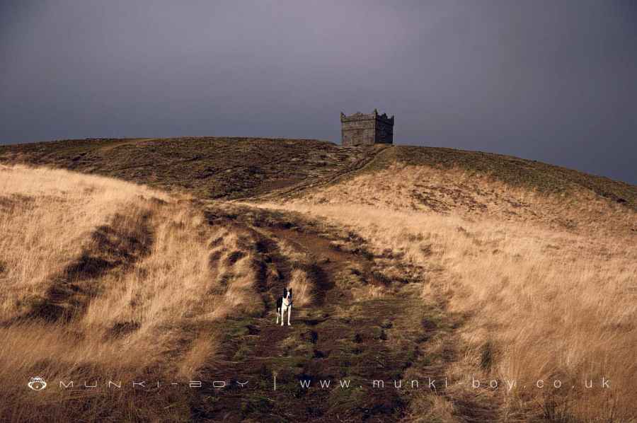
The Pike Road above Georges Lane
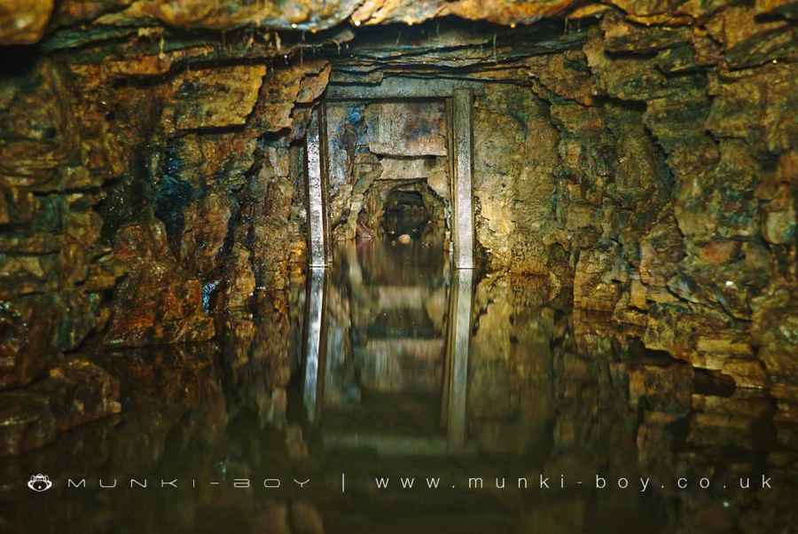
2. Winter Hill Mines
We are now in the Winter Hill coal mining area and much of the surrounding hillside has expansive ‘galleries’ below ground. Mining has been going on here since before records began, but the large Winter Hill Mine which had buildings behind the houses surrounding the mast road (or Belmont Road as it was known) which leaves our road to the right closed as late as the 1950s. Large areas further up the hill were later, open-cast mined to remove the pillars of coal and rock that supported the ceilings of the original mines.
As the lane heads downhill towards the Wilderswood car park, note the small building half-buried in the fields to the right. This is a water management system taking water from the old mines for consumption and is situated close to a former drift entrance to the mines. A drift being a tunnel heading into the hillside, rather than a vertical mine shaft.
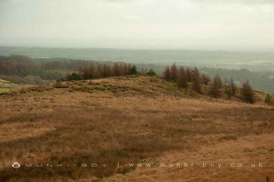
Wilderswood, on our left is a series of plantations with some areas of natural woodland. Another former mining area there are many remains to find hidden in the woods, together with the site of Rockhaven Castle but that is walk in itself.
After a sharp bend to the right, just before another sharp bend to the left, we can see the Wildersmoor gate, leading up onto the moors. Just here a tall metal pipe which looks like part of an old gas lamp is actually a vent to prevent gas building up in the mine tunnels deep below ground.
Winter Hill Mines
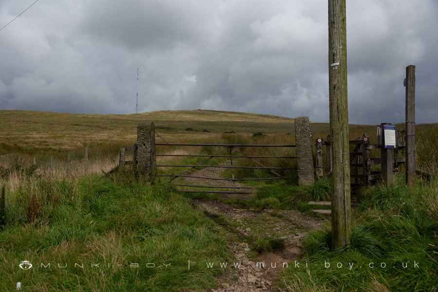
The Wildersmoor Gate
3. A View to a Hill
Leaving the final remnants of tarmac as the road heads slightly uphill the Pike comes into view as we pass an area of disturbed and hollowed ground beside the track on the left. This is the site of yet more drift mine entrances. A little further on a raised, linear bank running down the fields towards Ormston’s Farm marks the site of a mine tramway which took fireclay down to a pipeworks known locally as Klondyke. A little further on a cafe on the right is now occupying the Sportsman’s Cottage, which was a pub in the 19th Century and until recently Rivington Pike Dog Hotel.
From here the old road snakes off the left side of the current track and can be seen as a hollow feature, snaking off towards the Prospect ruins. The road we’re on was built by Leverhulme and eventually links to Belmont Road (Sheephouse Lane) passing by the Pigeon Tower on the way.
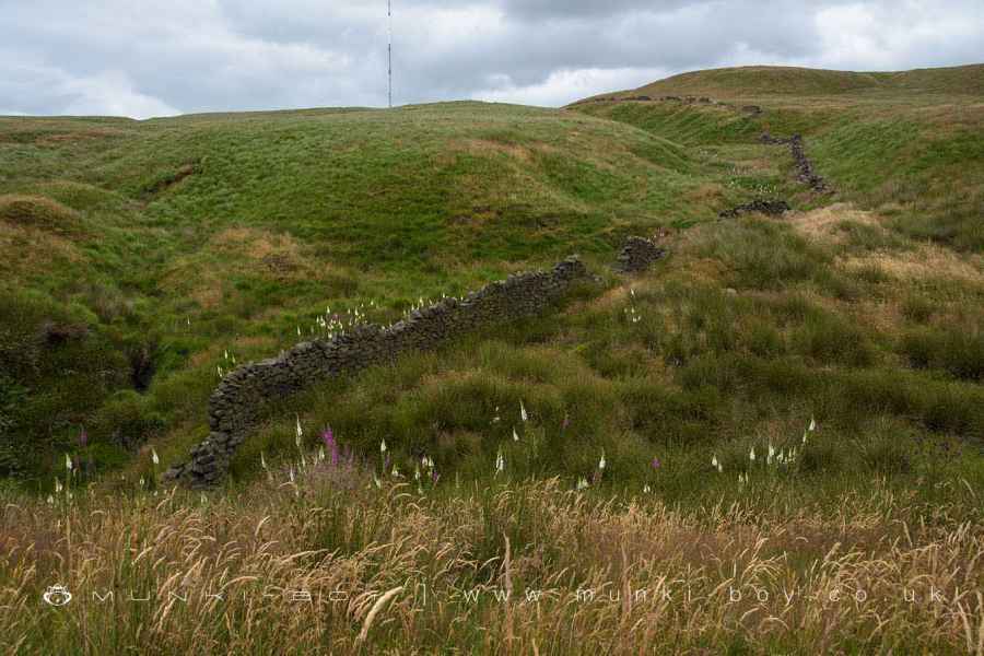
As the road passes over a Crooked Edge Brook there is a boundary stone on the right and somewhere around here was an ancient standing stone that was still used as a waymarker in medieval times. In the 1950s, local archeaologist J. Winstanley claimed to have found the stone recumbent some distance upstream. However, modern archeaologists have been unable to find the site. The Two Lads cairn on the hill above has possibly ancient origins.
Further on, just before the track bends to the left, the River Douglas passes under the track, a tiny moorland stream beginning its journey from Douglas Springs on the moors above. The hill bearing down on us here is Brown Hill, it’s not uncommon to witness people attempt a shortcut here, thinking this is the Pike. In fact it’s a struggle to cross from Brown Hill to the Pike.
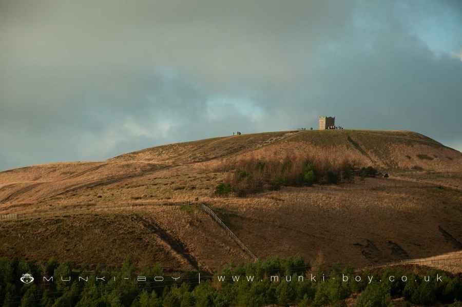
People on Rivington Pike
Crooked Edge Clough where an Ancient Standing Stone Stood
The Old Coal Tramway down to the Klondyke
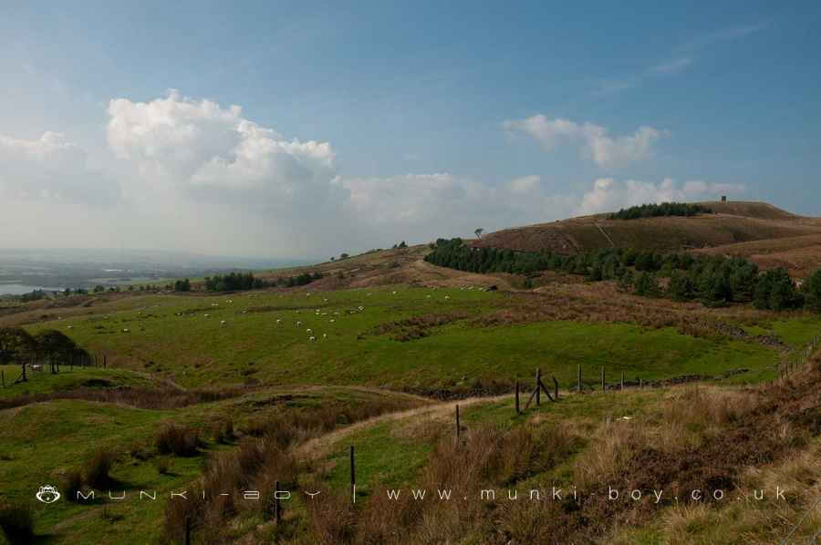
4. Rivington Pike
Rounding the corner to the right the we pass by the ruins of Prospect on our left, one of many local farm ruins. There is also a large scar in the ground that was yet another drift mine entrance.
We soon reach an area of very disturbed ground on the right. Once the site of some public toilets, the remains of which were finally removed just a few years ago. The ground here has been churned up by off-road vehicles.
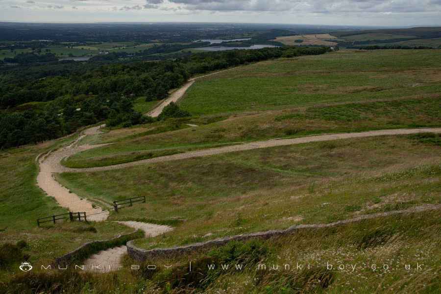
There are several routes up and down the Pike, two are official and the third is a rough track that has been in use for many years, but this causes erosion so it’s best to take the less-steep route here or the steps round the other side. Here we will pass through the gate and follow the gravel path that takes its time curving round the side of the hill but allows for views across the moorland to Winter Hill.
Once round the chicane bends and Brown Hill is passed on the left, it’s possible to make out several round depressions in the ground, mid-way to Crooked Edge Hill with its cairn on top. These depressions are the remains of Bell Pits, an early method of mining. These pits are probably not that ancient, but some examples date back to prehistoric times.
Following the path as it takes a sharp turn left to head up the steepest part of the hill, we are treated to views across Rivington Moor to the TV and radio masts, this is a good but often soggy path for another time.
Take the last few steps onto the flat-ish top of the Pike and touch the Pike tower - as tradition dictates. Noting along the way the rock outcrop at the top of the rough path. These are the Margary Flags, sandstone flags that are a recognisable part of the carboniferous rock strata known as the West Pennine Coal Measures.
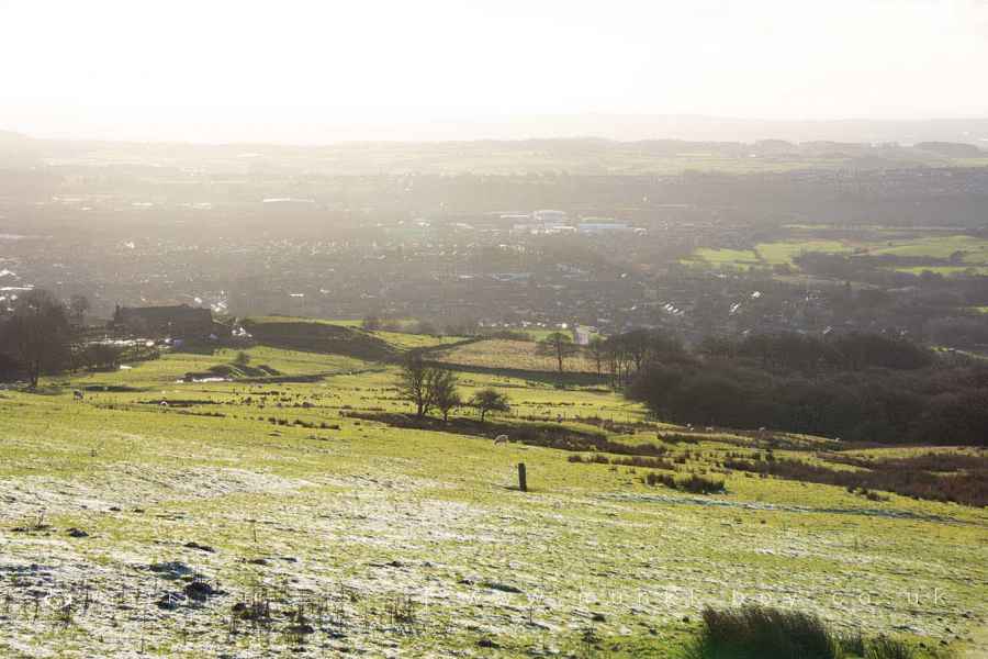
The views from the Pike are often spectacular, taking in a wide plane that heads all the way to the sea, from the docks at Liverpool, the Orme and Anglessey on the left. The eye moves right, past Southport and Blackpool Tower to Heysham with its cube-like power station and the Lakeland fells beyond. The reservoirs in the foreground are those of Yarrow and Anglezarke. Views to the north and east are blocked by Winter Hill from where Pendle Hill, Fountains Fell and Ingleborough can be seen.
The Rough Track Up Rivington Pike
Brown Hill
Rivington Moor Bell Pits (ruin)
5. Step on Down
Once you have had your fill of fresh air and views you can make your way to the stone steps on the west side of the hill - if you don’t fancy the steps you can go back down the slope and turning left at the bottom arrive at the foot of the steps. The path down leads to another old toilet block at the top of Leverhulme’s terraced gardens.
Our route turns left along the road back to the gate we used to ascend the Pike and back the way we came.
The Steps at Rivington Pike
Rivington Pike from the old Pike Road
These walks are described for educational purposes only and we make no recommendation that you follow them, do so at your own risk. We accept no liability for your safety or for the reliability of the walk, map, description or anything else.
Mist, Mines and Ruins


Own label and private label building products
We produce, brand and supply for some of the biggest names in the industry. Read more...