The Margery Flags at Rivington Pike by munki-boy
The Margery Flags at Rivington Pike
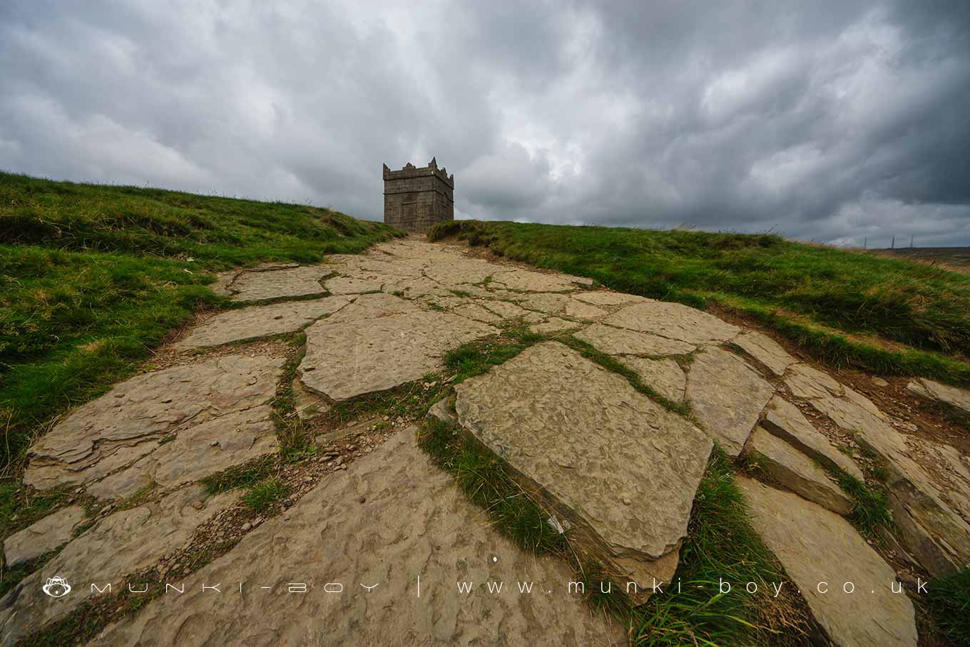
An outcrop of rippled, fine-grained sandstone forming ‘flags’ close to the top of Rivington Pike and other places in the surrounding area.
This layer of sandstone on the southern side of the top of the pike is part of a stratigraphic formation in the Lower Coal Measures that was often used historically when large, flat sections of rock were required such as stone paving flags and flat roofs for small buildings. This rock is ripple-bedded so we can see the ripples the water made on the sand before it was compressed into rock.
The Margery Flags strata probably formed in the first stage of the Westphalian period. The Westphalian is a stage in the regional stratigraphy of northwest Europe with an age between roughly 313 and 304 million years ago. It is a subdivision of the Carboniferous system or period and the regional Silesian series. This is a period of time when this area was part of a large river-delta system and in particular these fine-grained sediments are associated with lens-shaped bars of sand (bar-finger sands) forming at the mouth of river deltas.
Until the 1990’s erosion control which replaced soil on the eroding Pike there was a large outcrop of rock where the top few stone-steps are today, this had to be climbed after the steep slope which was causing more erosion. Of course the rocks are still there, but the Pike was covered with a special mesh and recovered with soil, the stone-steps and tidier paths were created at the same time.
Created: 28 April 2021 Edited: 29 November 2023
The Margery Flags at Rivington Pike
Walks in The Margery Flags at Rivington Pike
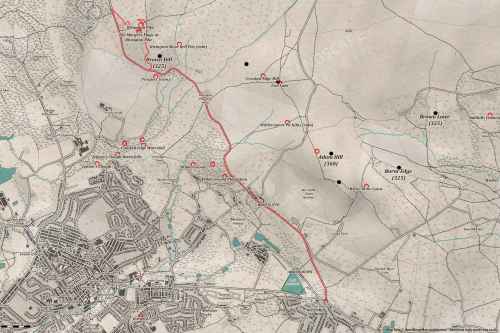
Local History around The Margery Flags at Rivington Pike
There are some historic monuments around including:
Headless Cross, GrimefordThe Moat House moated site 600m WNW of St David's ChurchPike Stones chambered long cairnRound cairn on Winter HillGidlow Hall moated site, Aspull, 560m NNE of Pennington HallRound Loaf bowl barrow on Anglezarke MoorRound cairn 280m west of Old Harpers FarmBretters Farm moated site and two fishpondsRound cairn on Noon Hill.


