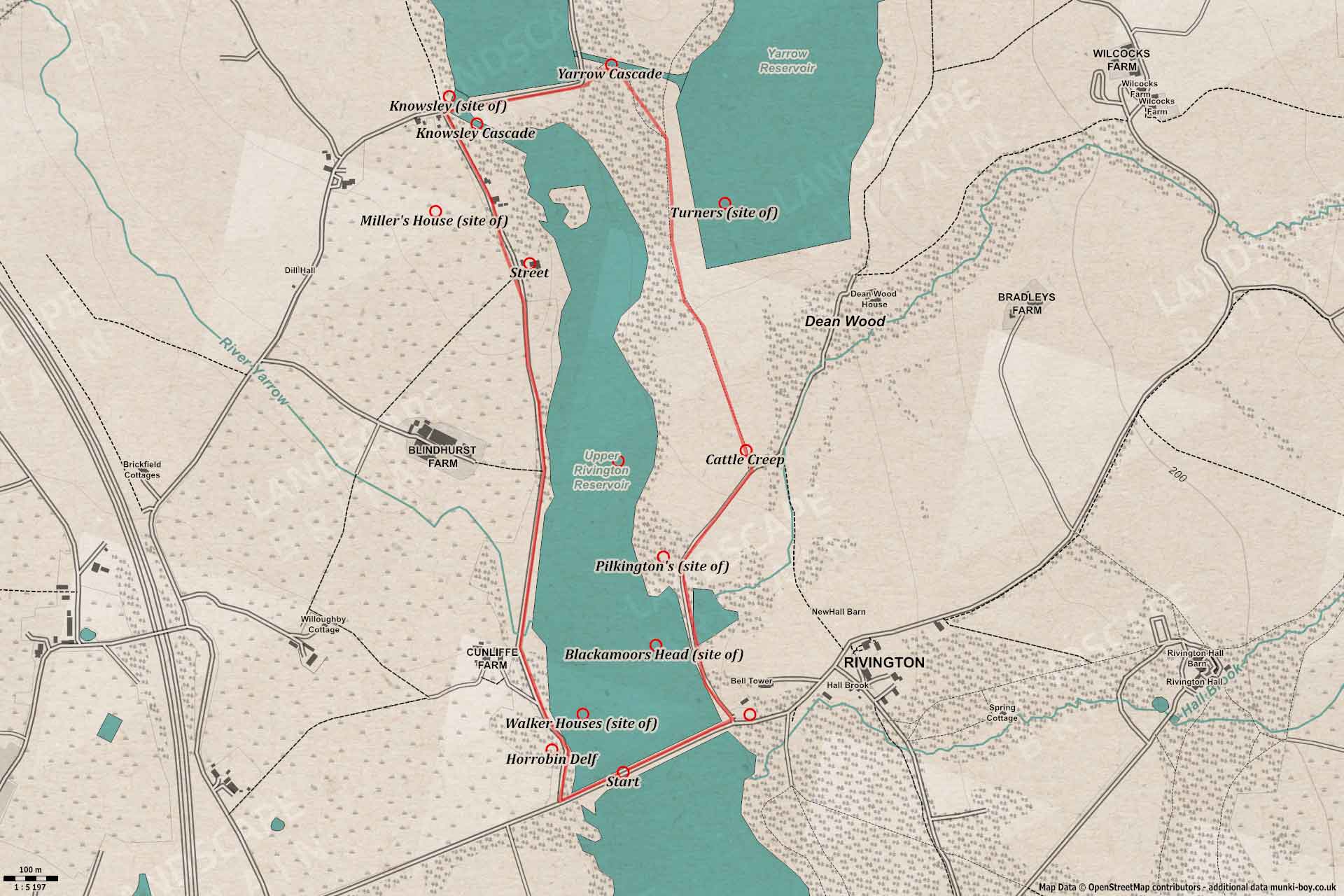
Around Upper Rivington Reservoir
A Walk in Greater Manchester
Rivington Reservoirs Video
Walk spec.
Difficulty: Easy
Basic length: 4Km (approx.)
Terrain:
- Gravel tracks
- Mud tracks
- Tarmac
A short and easy stroll around the Upper Rivington Reservoir with views of Winter Hill and the Pike, a possible Roman road and a couple of ornamental waterfalls after rain. The terrain is not usually at all bad, with tarmac for about half the walk, a small section of mud track on a slight incline and the rest gravel or eroded tarmac.
Upper Rivington Reservoir
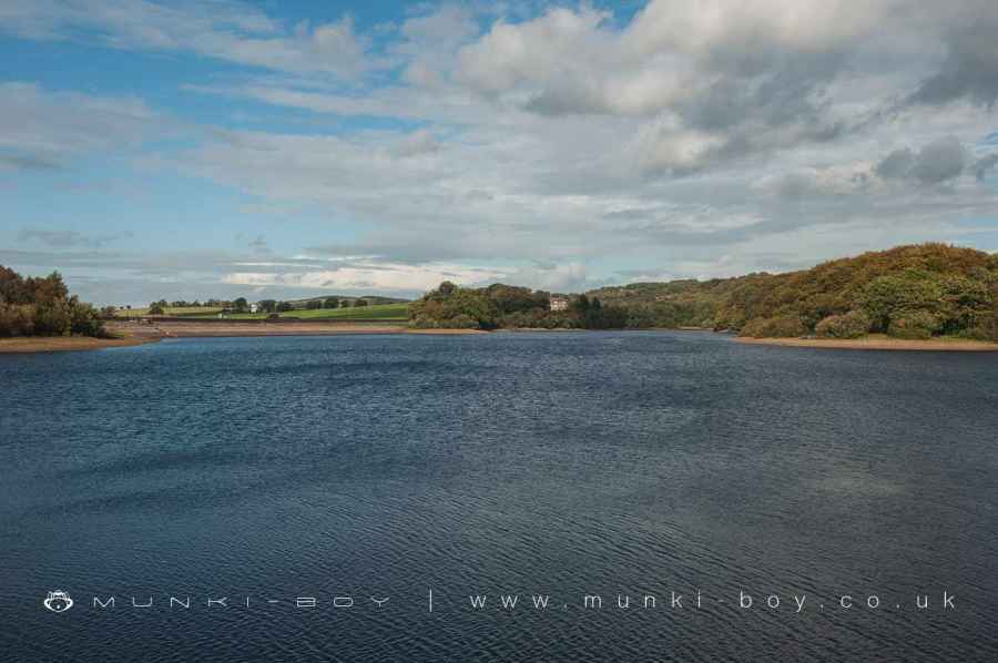
1. Horrobin Lane
There is roadside parking along one side of Horrobin Lane which is a good place to start and end the our walk.
Horrobin Lane leads into Rivington Village across the embankment between the Upper and Lower Rivington Reservoirs, with some of the best-known views across the waters and up over the wooded lower slopes of Winter Hill, with the Pigeon Tower and Pike just above the treeline.
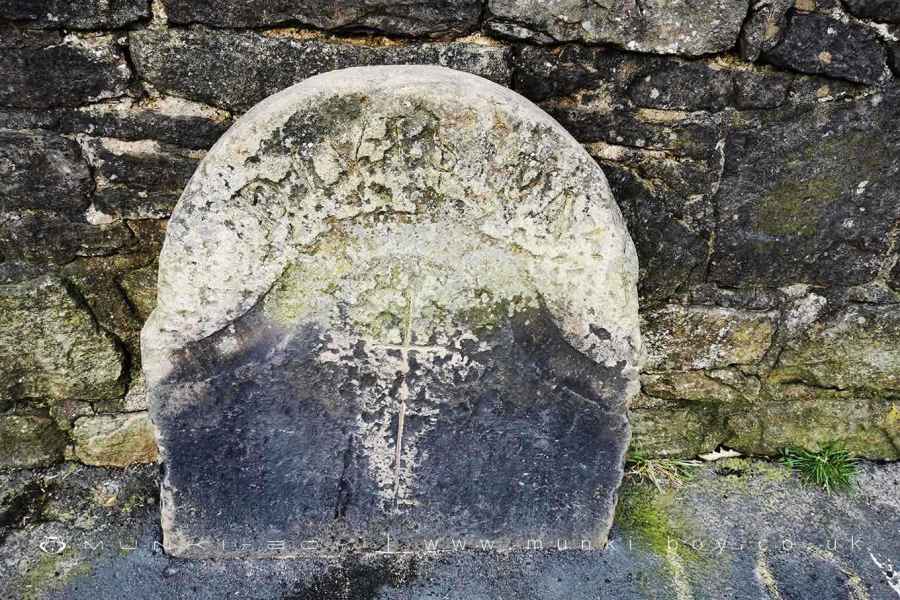
Around the central point of the embankment on the northern wall, that is looking towards the Upper Rivington Reservoir an old boundary stone can be found. It is said to have been defaced as part of the effort to confound enemy troops should they have invaded during the Second World War - as are several other examples found locally.
Setting off in a just south-of-easterly direction - that is away from Rivington - a right-turn is found at the end of the embankment at the site of Horrobin Lodge, a gothic-looking stone cottage built at the time of the reservoirs. The “Liver Bird” motif can be seen carved in stone which represents the Liverpool Corporation Waterworks.
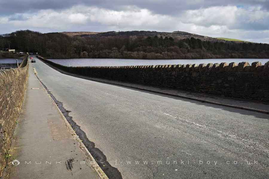
Horrobin Lane, Rivington
Horrobin Cottage
2. Along the Embankment
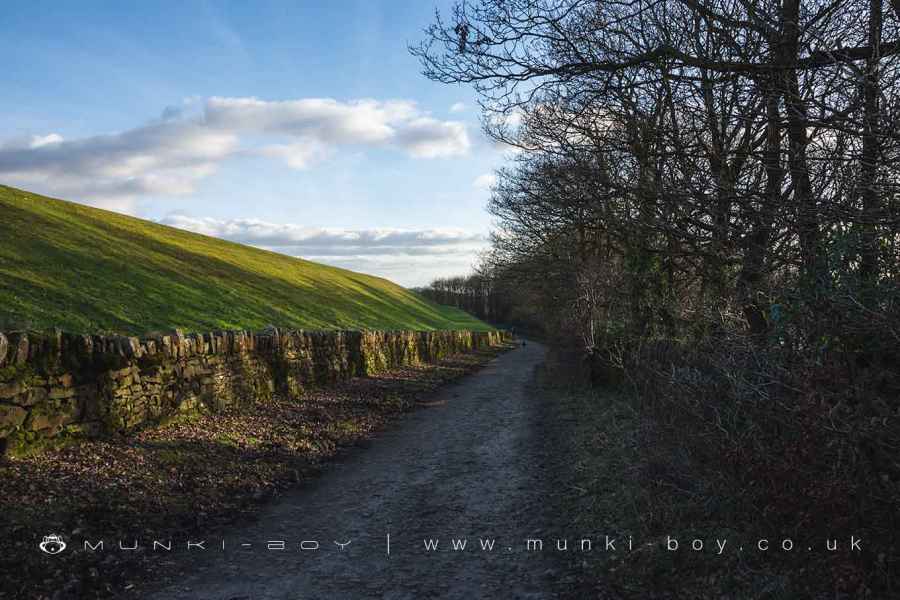
On turning right we must beware as the tarmac track we are on serves various farms and residential properties and although pedestrian traffic is usually most frequent, motor vehicles may be encountered, so take care at least until the straight section beside the water.
This road is known as the Street Drive after the large property we will encounter shortly, but it was constructed at the time of the reservoirs - as was the house iteslf - to replace the old driveway to the street and to allow access to the reservoir embankment on this side.
Passing the driveway to Cunliffe farm on the left and approaching the corner a chunk of exposed bedrock is found in the grip of the large roots of a tree. This is a reminder of what was blasted out to make way for the reservoirs.
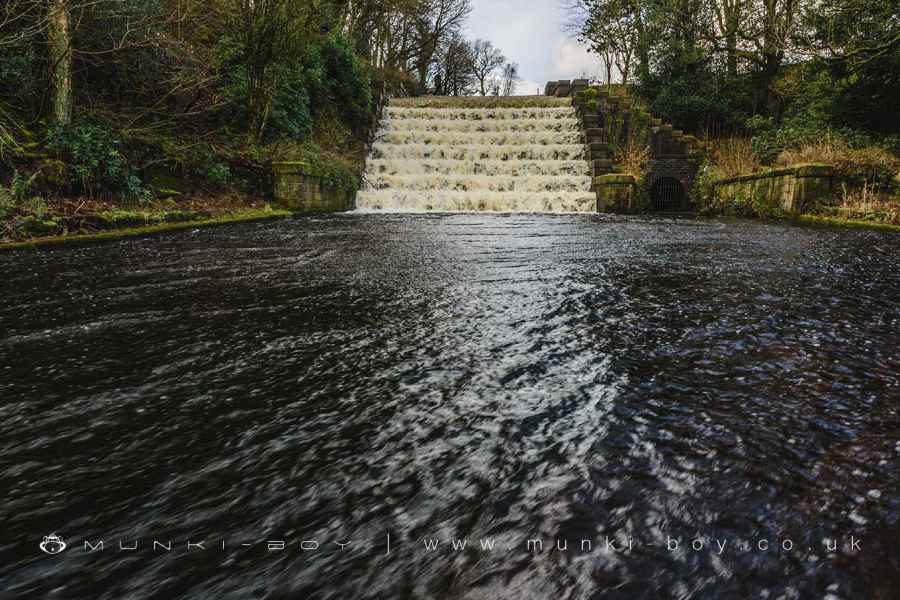
Looking right over the impressive metal spikes that surround the reservoir “overflow” to stop large debris, we see the even more impressive heights of Winter Hill, the Pigeon Tower and pike on one side and the angular summit of Noon Hill to the north. While looking over the other side of the track the massive outflow leads down the River Yarrow. Sometimes bone-dry, when the water level in the reservoir is high enough the cascade can get fierce looking.
A little further on and under an arch of trees the track bends slightly-left at a point where the old driveway to The Street used to run. It’s difficult to make out but it crossed the grassy field close to where a large, dead tree stands today and continued to the old house and beyond, roughly half-way between the modern tarmac road and the where the shore of the reservoir is today.
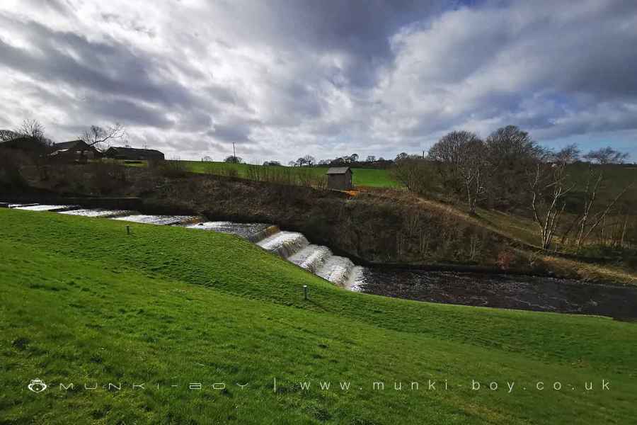
Cascade from Upper Rivington Reservoir into the River Yarrow
A Greylag Goose in the debris trap at Upper Rivington Reservoir
3. Down The Street
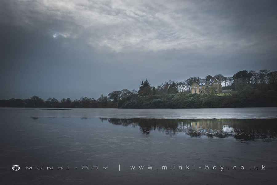
Before long we approach the moden entrance to The Street, the current building was built on the site of an earlier house at the time of the construction of the reservoirs. Judging by the old maps the prior had several quite large structures, one of which the modern building stands roughly on the footprint of.
The name “Street” or “The Street” is rumoured locally to come from a Roman road that ran along here, but actual evidence other than the name and a “Causeway” name a little further north is sparse. The name however, does fit as in the more famous example “Watling Street”, which runs not far away. According to M.D. Smith the house was occupied in 1534 by an Alexander Street. The grand house was re-developed in the 1990s into “luxury apartments”. Another possibly interesting feature is an earthwork down below the house which could be a “rampart” or archery butts, but could alternatively be modern.
On passing the driveway entrance, looking into the vegetation on the left side of the track reveals pets grave with inscribed stone dated 1900. There are a couple of other smaller monuments nearby.
Passing another couple of properties that were added around the mid-19th Century are seen on the right along with an interesting old iron lampost. Firstly the Coachman’s Cottage followed by the Gardener’s. The former grounds are quite extensive along the bank of the reservoir but there are the remains of garden elements both along the foot of the embankment and around the further shore for a distance. In fact the small island at this end of the reservoir has a small, stone landing stage which was followed around the turn of the 20th Century with an ornamental bridge over to the island.
The Street overlooking Upper Rivington Reservoir
Old Landing Stage on the island at Upper Rivington Reservoir
4. Knowsley Embankment
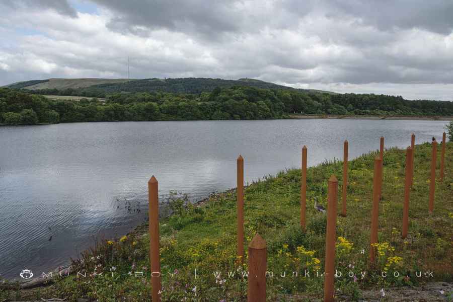
Upon reaching the end of the lane, on the left note a similar cottage to the one we passed at the other end, also with the “Liver Bird” motif. Leaving the lane an turning right once more on the one side views open across the Anglezarke Reservoir with Healey Nab beyond. While on the left we find the overflow into Upper Rivington Reservoir which is on private ground but when water is flowing over the cascade is quite impressive.
Walking along the footpath about half-way across the embankment and looking towards the Upper Rivington Reservoir a heronry can be seen at the right time of year, although lately it is being taken over by cormorants, as is another tree on the opposite bank of the Anglezarke Reservoir.
Anglezarke Reservoir Overflow Cascade
5. Yarrow Overflow
At the end of the embankment the road bends sharply to the left, although our route is straight-on through following the footpath there is a good view of the Yarrow overflow cascasde from the roadside just past the corner, if you’re tall enough to peep over the wall. If not the mud track we should be following veers first to the left right next to the overflow - careful not to fall in, before turning right and uphill toward the Yarrow Reservoir.
The top of this track brings-us-out on the track surrounding the Yarrow Reservoir, and we should turn right and head downhill, but, turning briefly left there is a view down the overflow cascade on one side and a view over the Yarrow Reservoir on the other. Close to here “the face on the wall” was once situated, a crude stone carving on one of the upright stones of the drystone wall said to represent a foreman at the time of the reservoir construction but I’m not sure if this was just a conjecture by Rawlinson who wrote of it in his book. It is gone from here after being broken years ago, it was for some time in the Gallery beside the Great House Barn at Rivington and hopefully it is there still.

Yarrow Reservoir Overflow
6. Cattle Creep
Returning to the walk, heading downhill with the Turner’s Embankment of Yarrow Reservoir on our left, the track we are on looks pretty ancient but again it was built at the time of the reservoirs - the original footpath ran roughly parallel in the field on the left and leading to Turner’s a farmstead now beneath the waters on the other side of the embankment.
Soon views open out over the Upper Rivington Reservoir to the right, with Rivington on the left with the hills rising beyond. If you’re lucky you might see Goldcrest along here as we have at times. At the end of this track is a junction with the driveway leading to Dean Wood House, but just before there is a little tunnel hidden under the road, just by the fenced-off cattle gate. This is known as a Cattle Creep and is just tall enough for cows and sheep to pass under. I wonder if this was created in order for livestock to graze both fields while there was heavy traffic while Yarrow Reservoir was created. The tunnel is blocked at one end by an old farm gate and is very damp and muddy inside.
At the gate at the end of the track we turn right and head back down towards the shore of Upper Rivington Reservoir, at the corner were today there is an area for anglers. This was the site of Pilkington’s although little remains today other than a small pile of rocks.
The track beside the Yarrow Reservoir Embankment
The Cattle Creep near Upper Rivington Reservoir
7. The Breeding Pond
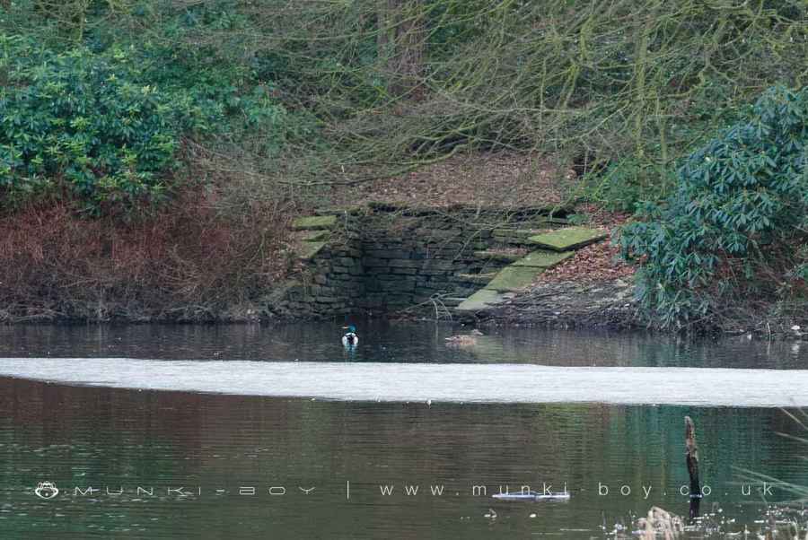
A few steps further on the left side of the lane there is a small pond known locally as The Breeding Pond a term relating to fish stocking. I think an old sluice used to link the pond to the reservoir and there is a metal walkway close to the wall with iron steps leading down but I suppose the gate is left open as the water level seems to vary with the level in the reservoir. The water level here varies greatly for the walkway is often completely submerged and at other times the whole pond seems almost dry. We have seen Kingfisher here rarely but Heron are often seen along with the ubiquitous Mallard.
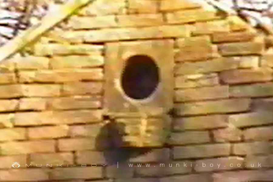
It is just toward the end of the pond that the old lane led down to the Blackamoors Head, an old inn which was demolished and submerged by the reservoir. The pub was re-built as a hotel where The Rivington is now situated at the end of the lane, but this too was demolished in the early 20th Century. The sign of the Blackamoors Head was so old as to have been carved from stone rather than wood - as was the custom many years ago, and was used together with a stone “owl hole”, at the top of the gable of the barn which still stands at the site of the New Hall at Rivington Village. Sadly, the barn was in disrepair for many years and the gable partly collapsed along with the owl hole and Blackamoors Head which to my knowledge where never found when the barn was rebuilt.
The Breeding Pond at Upper Rivington Reservoir
The Blackamoors Head (2004)
8. Back to the Start
There is now just a little stretch of lane before we turn right and find ourselves back at the Rivington embankment but there are views out across the waters of Upper and Lower Rivington Reservoirs to enjoy and perhaps look out for the old boundary stone if you didn’t see it at the start. It marks the place where the old River Yarrow flowed before the reservoirs.
The Old Boundary Stone at Upper Rivington Reservoir
Upper Rivington Reservoir
These walks are described for educational purposes only and we make no recommendation that you follow them, do so at your own risk. We accept no liability for your safety or for the reliability of the walk, map, description or anything else.
Mist, Mines and Ruins


Own label and private label building products
We produce, brand and supply for some of the biggest names in the industry. Read more...