Ibbeth Peril Walk
A Walk in Cumbria
Walk spec.
Difficulty: Easy
Basic length: 4.56Km (approx.)
Terrain:
- Chickens
- Mud
- Mud tracks
- Roads
- Sheep
- Stiles
- Tracks
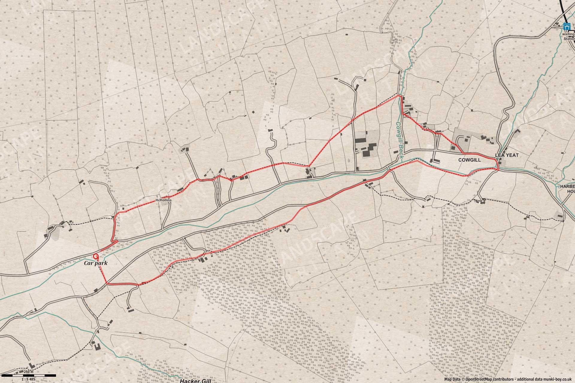
This walk is probably useful if you’re planning on using the train to the Dent station above the valley but the walk shown here is based from the car park at the other end.
Lot’s of farm animals if you’re crossing the fields or there’s road walking if not, so dogs on leads a lot of the time.
If you want to visit Ibbeth Peril and you aren’t potholing there this short walk is a good excuse for the drive over. The car park is adjacent to Ibbeth Peril which is on the River Dee just around the bend from the small bridge south of the car park and this is where the walk begins.
Dangerous Rapids
The River Dee is deceptively dangerous around here with rocky rapids and waterfalls, sometimes the water is roaring through the rocky gorge and obviously dangerous but the flow of the river is pretty strong when it isn’t full-on. Don’t fall in. I am told there are times when the river dwindles to a pleasant stream on the surface but I haven’t seen it. Ibbeth Peril is a dangerous pothole, don’t go in if you don’t know what you’re doing.
Dentdale
1. Ibbeth Peril
Heading South from the car park along the foot path we find a small footbridge over the river Dee, here it’s possible to gauge the water level and ferocity. Don’t bother if the water is high because it’s very slippy and you could be swept away, but the Ibbeth Peril pool is just round the bend in the river and around this area can be seen what look like bi-valve shell fossils, white against the grey limestone country rock. They stand out best down at stream level where the rocks are wet. If you’re going to get wet maybe save it until returning to the car park at the end of the walk.
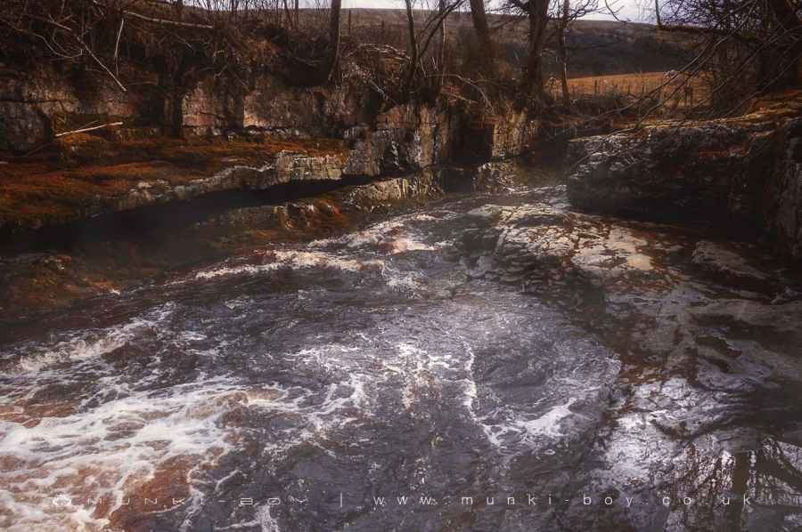
Ibbeth Peril
2. Dee and Cowgill
Finished exploring? Head along the path beyond the footbridge in a Southerly (slightly Southeast) direction until a farm road is reached. If it’s a particularly muddy day you can turn left and follow this road in a Northeasterly direction or you can head directly across the road where a curving track leads to the East and just on a very sharp bend a footpath leads off to the left (NE). The footpath is part of the Dales Way and crosses several fields and passes to the left (North) of a couple of farms before joining back up with the farm road we crossed earlier. There were some friendly lamas here last visit.
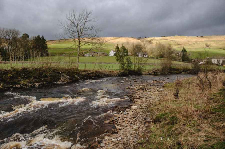
River Dee at Cowgill
3. Lea Yeat
Continuing in a roughly Easterly direction the farm road eventually comes to a stone bridge at Cowgill on the left, but the Dales Way continues as a footpath on the right-hand side (South) of the river and bending to the right then left across some fields to another bridge at Lea Yeat which we should cross.
The next part of the walk involves fields with livestock and gates/stiles so it’s possible to follow the road to the left (West) all the way back to the car park.
Otherwise we will be following the road round to the left (West) for a short distance to the third turning on the right (North) - a driveway to a property that is also a signed footpath.
Incidentally Coal Road, the second right turn after the bridge, after a short distance the road becomes Lea Yeat Brow and is the road down from the train station.
Heading up the driveway until it bends to the right and the footpath diverges to the left and diagonally across a couple of fields to a second and third farm, and up a small section of farm road that leads North before the footpath heads off again to the left (West) over fields.
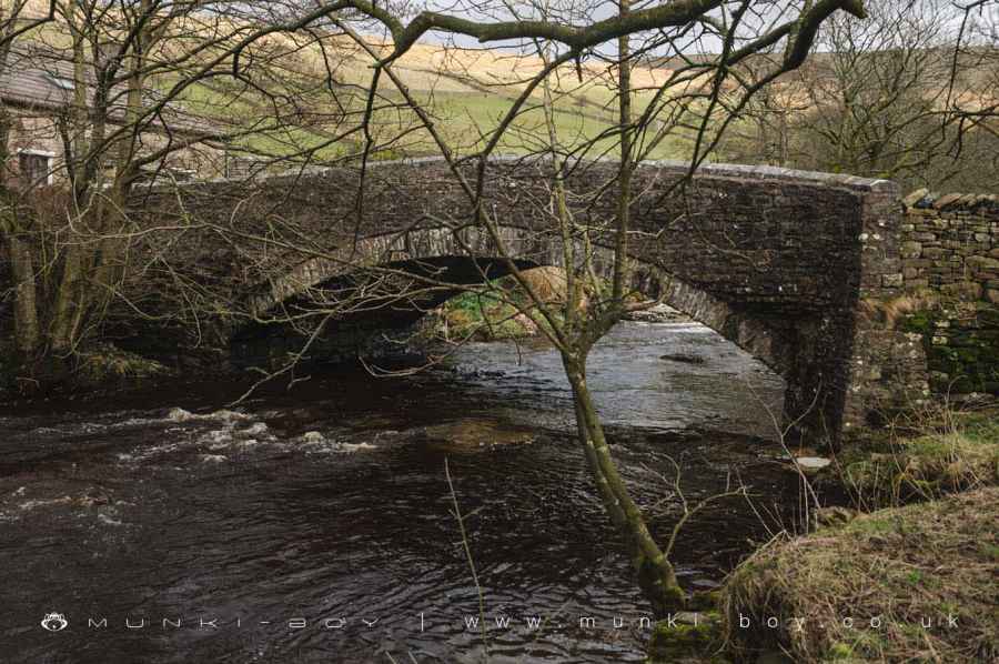
Bridge at Lea Yeat
Muddy footpaths near Cowgill
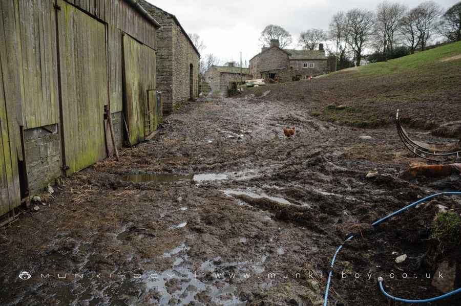
4. Chicken Chase
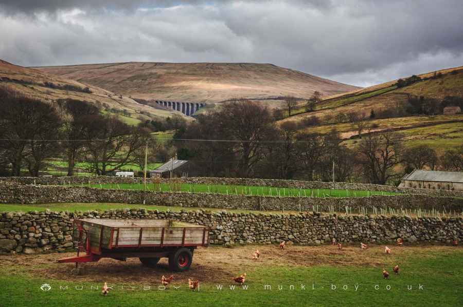
From around here looking back in the direction we have just come it’s possible to see a half-decent view of the Arten Gill viaduct above the valley. There were sheep and free-range chickens in the fields here.
The rest of the walk involves a general Westward movement across fields and by farms until the Dent Brewery is reached. This section can be appallingly muddy so it’s possible to “give up” at any of the previous farm roads/tracks leading left (South) that are encountered as you cross the fields towards Dent Brewery. Footpaths cross the fields and markers can be difficult to spot where the next boundary can be crossed.
A couple of fields after the Dent Brewery there is a small farm track and turning left (South) we head back to the road, almost opposite the car park.
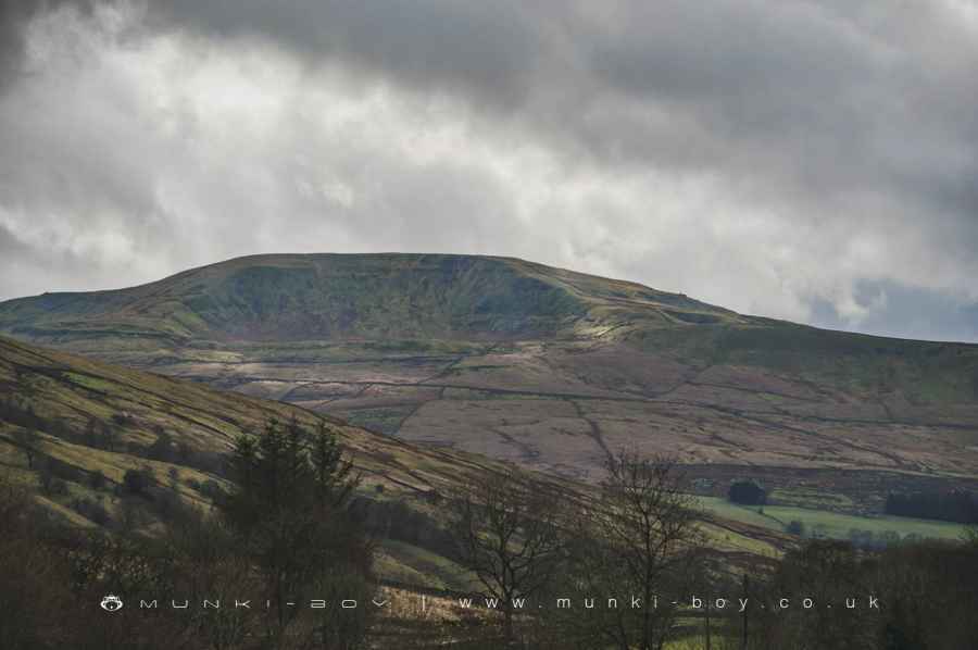
Great Coum
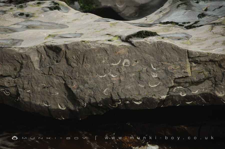
Fossil shells in limestone at Ibbeth Peril
Dentdale
These walks are described for educational purposes only and we make no recommendation that you follow them, do so at your own risk. We accept no liability for your safety or for the reliability of the walk, map, description or anything else.
Mist, Mines and Ruins


Own label and private label building products
We produce, brand and supply for some of the biggest names in the industry. Read more...