Three Shires Head (Panniers Pool Waterfall) Walk
A Walk in Derbyshire
Walk spec.
Difficulty: Moderate
Basic length: 6Km (approx.)
Terrain:
- Mud tracks
- Optional Wet stream bed
- Road without footpath
- Sheep
- Steep slopes
- Tarmac
- Tracks
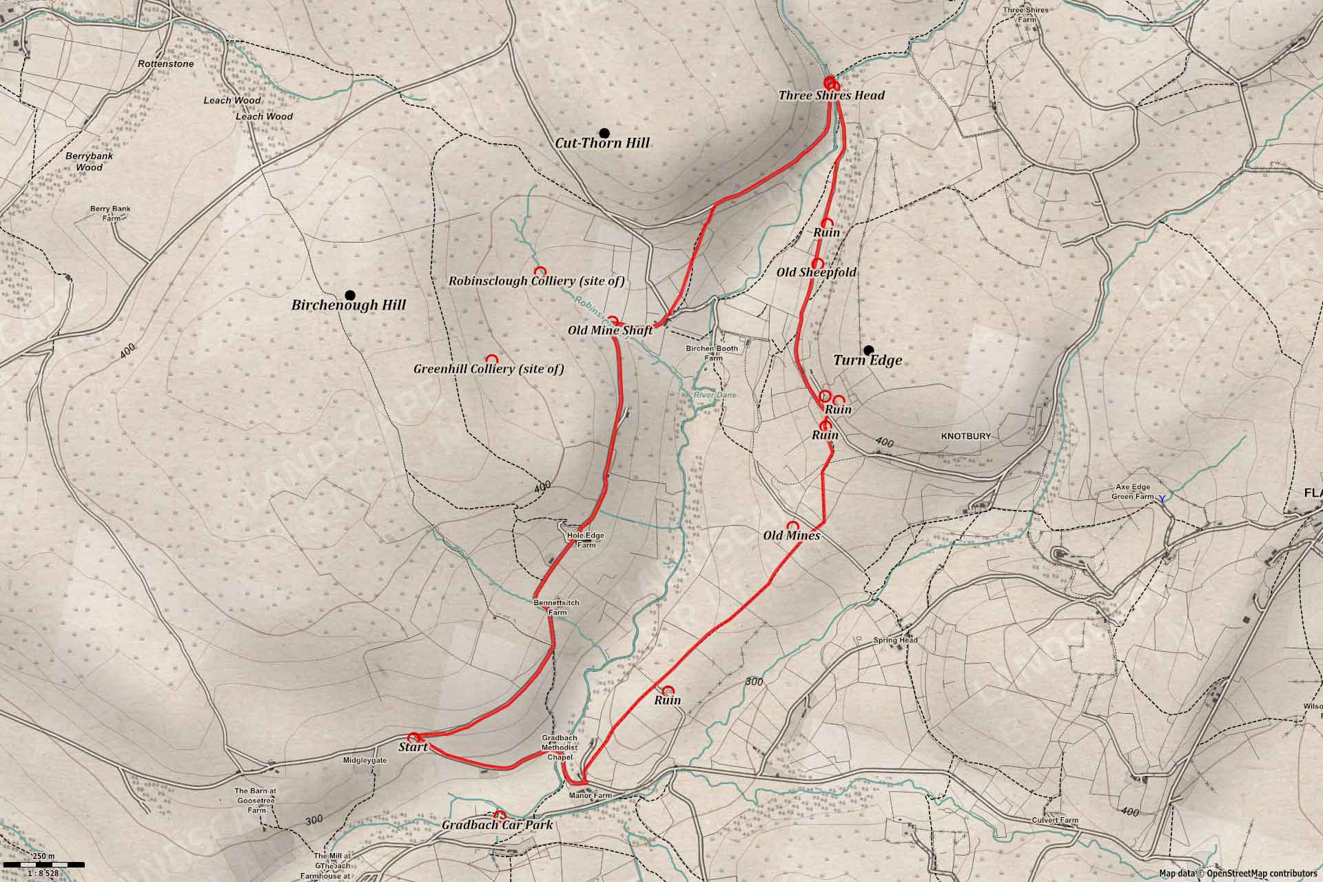
A nice circular up the River Dane to the historic Panniers Pool at Three Shires Head (or Three Shire Heads as it once was known); talking in good views of the surrounding hills and the small waterfalls below Pannierspool Bridge.
The main car park is Gradback Car Park at: https://goo.gl/maps/pn5jXz96p7SfWbCu7 but it’s often full.
Most of this walk is along stoney tracks and old farm roads with a section of public footpath along fields that can be muddy. There is also a small section of tarmac road to return to the starting point.
Panniers Pool Waterfall
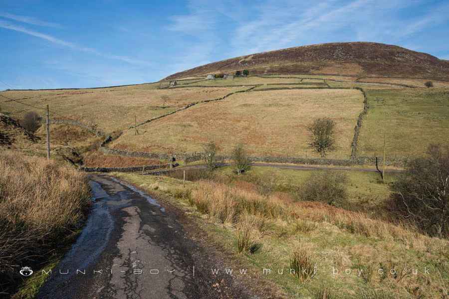
1. Old Farm Roads
The walk starts from the junction of Love Lane with an old farm road (near Midgleygate Farm) that leads to Bennettshitch Farm.
Heading at first in an easterly direction the old track bends northwards unrtil Bennettshitch Farm comes into view, followed by Hole Edge Farm as the views begin to open out across the valley and southwards where The Roaches can be seen with its rocky aspect against the skyline.
A little further on a long, barn building can be seen below the track on our right, which was the site of Far Hole Edge which was once a farmstead but is now Hole Edge Barn - one would assume now used by Hole Edge, the first farm we passed. Interestingly, there is the site of Greenhill Colliery in the fields above to our left; which worked a coal seam in the 19th Century. A ‘U’ shaped earthwork is still visible on the ground.
Depending on the season, looking northwards we may get a glimpse of the waterfall below Pannierspool Bridge in the distance.
The Old Farm Road near Bennettshitch
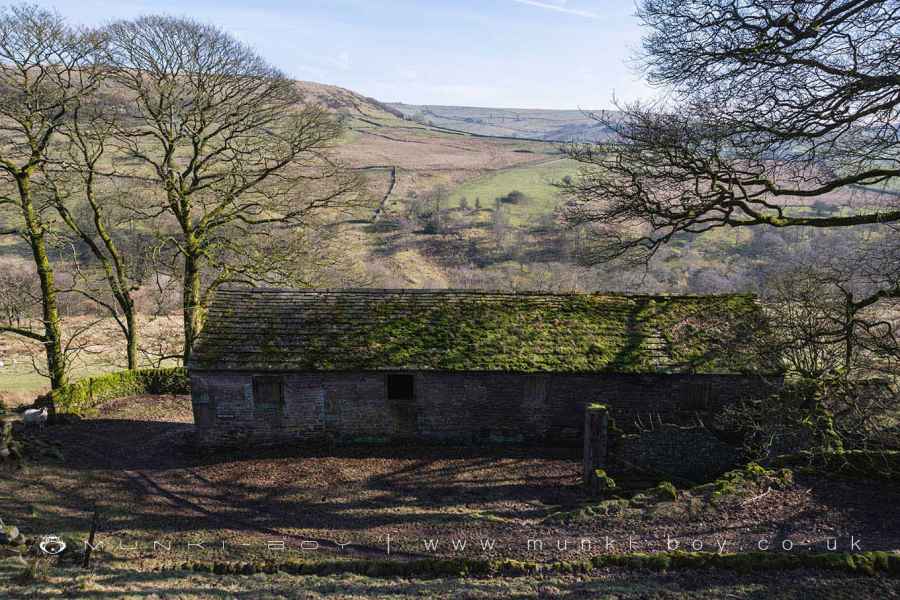
Far Hole Edge
2. Robins Clough
The track, next bends left into Robins Clough, a small valley where a tributary makes its way down to the River Dane.
At the apex of the track rounding the clough, notice the old coal shaft that has been fenced off by The Coal Authority. This shaft probably relates to the old Robinsclough Colliery which was located further up the little brook; where some disturbed ground marks the site of the 19th Century colliery itself, and an old air shaft a small distance to the northwest.
As we wend our way out of the clough we reach the farm shown as Knar on the old maps, and a public footpath leaving the old road.
Robins Clough
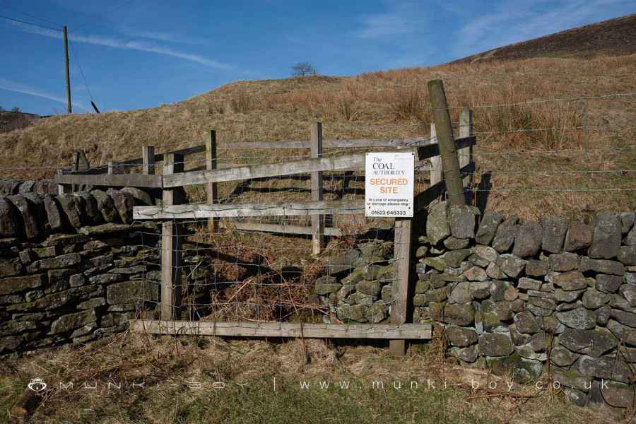
Old Coal Shaft of Robinsclough Colliery
3. Panniers Pool
Leaving Knar and the old farm track behind, the public footpath heads diagonally across until fields give way to an area of boulder-strewn moorland, before a rough-track that skirts the slope of Cut-thorn Hill.
Turning to our right (northeast) as the footpath meets the track and continuing as the track bends northwards and descends the ravine to the Pannierspool Bridge.
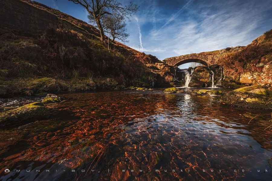
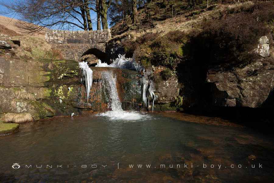
Panniers Pool was an important stop on a historic packhorse route where the horses where able to drink from the shallow pool. Today the pool is in a small, picturesque gorge and fed by two small waterfalls.
This is the also the site where the boundaries of the three shires, Debyshire, Staffordshire and Cheshire meet. Today most people call the site Three Shires Head but on the old maps the name is Three Shire Heads.
Pannierspool Bridge - which our route passes over - is a Grade II listed building and probably dates to the late 18th Century and is said to be 4 feet wide and of the packhorse type.
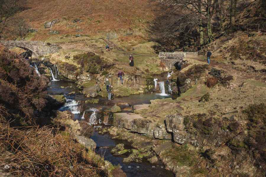
Waterfalls and Panniers Pool at Three Shires Head
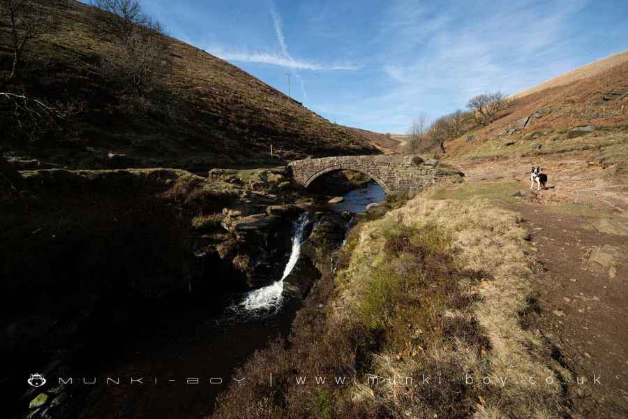
Pannierspool Bridge
4. Turn Edge
Leaving the Panniers Pool area after crossing the bridge, turn right (heading South) and uphill along a rocky track that ascends the side of the valley, below Turn Edge to find a nameless ruin on our left. This seems to have been in use at the end of the 19th Century. There are some walled areas in the field just further on which might have been an old sheepfold.
The track gradually follows the curve or Turn Edge to our left (eastwards) and passing a cottage on our left, immediately before more ruins on the slope. As we reach a ruin on our right, we must head onto the public footpath that runs across the front of the ruin and downslope.
Where the path reaches a junction with other paths - near some circular mounds that were probably old lead mines onto mineral veins associated with the nearby geological fault - we must take the route down through the fields in an southwesterly direction.
Soon the footpath follows straight along the field boundary - this section was quite muddy in places. Passing another ruined barn to our right and continuing straight-on until the footpath leaves the fields at a cottage beside Manor Farm and we turn right, following the curve of the tarmac Love Lane over a small bridge across the River Dane.
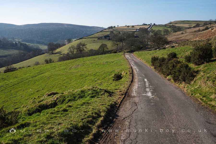
If you’re returning to the start of the route: All that remains is to follow the lane, passing a private residence to our left that is shown as a pub called ‘Plough’ on the the OS map sheet surveyed in 1871 and upwards back to our starting point.
Or if you managed to get a space at the Gradbach Car Park: You can go left past Manor Farm and take the next sharp-right to take you back to the car park.
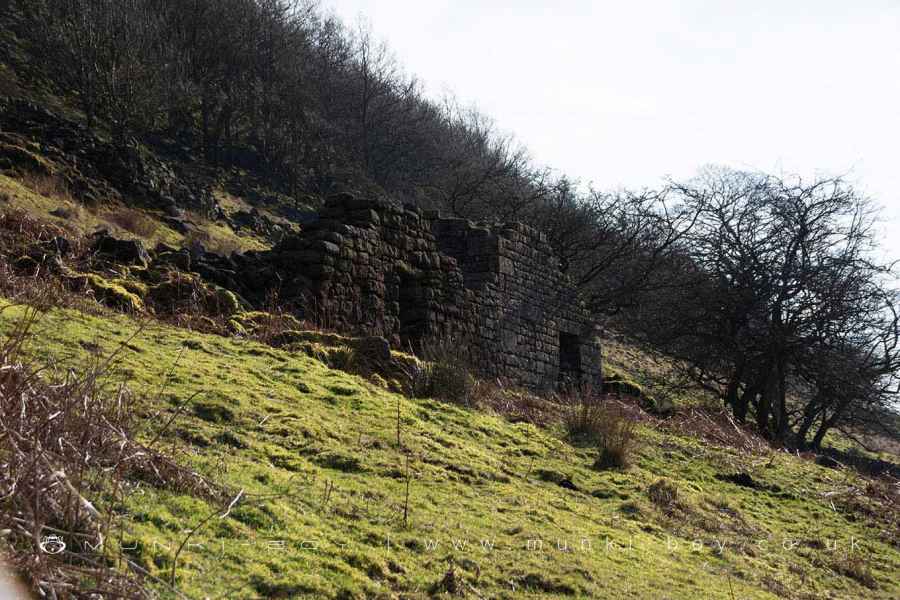
Ruin above Panniers Pool
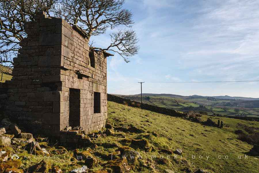
Ruin below Turn Edge
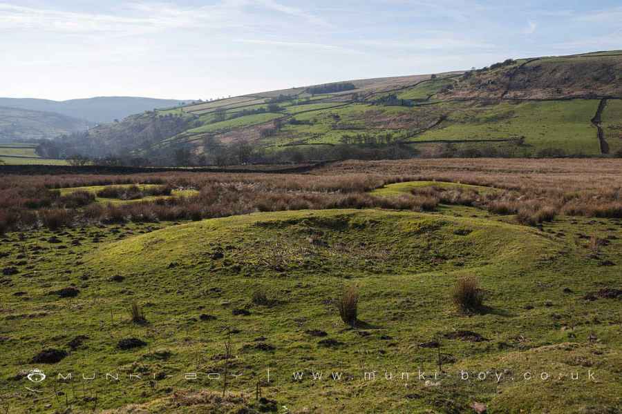
Old Mines below Turn Edge
Panniers Pool Waterfall
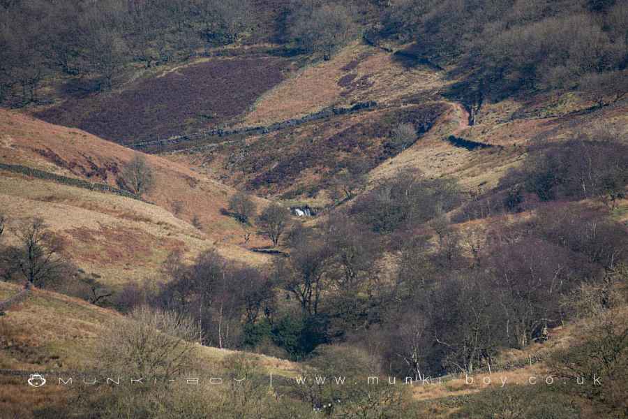
Panniers Pool Waterfall from near Robins Clough
The Small Waterfall at Panniers Pool
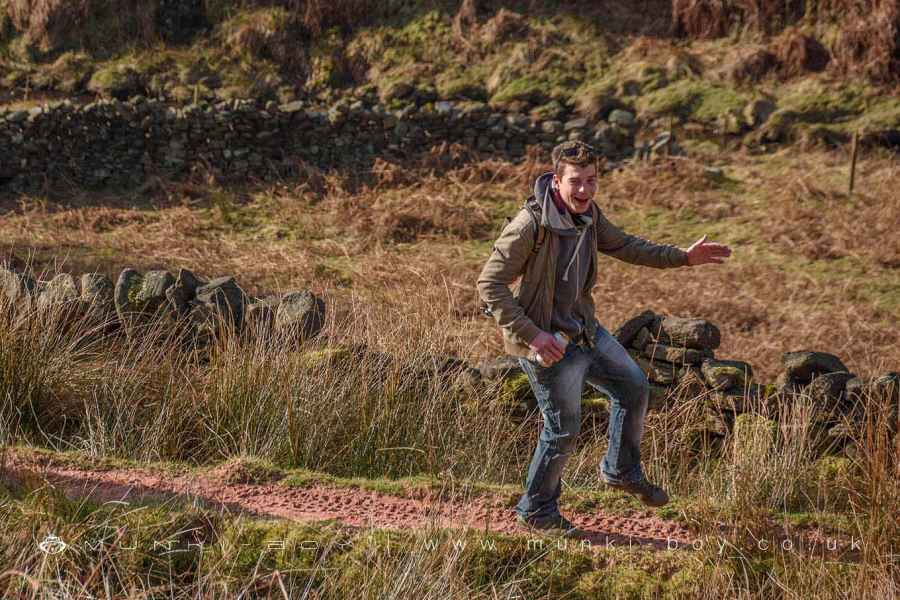
Friendly Locals
These walks are described for educational purposes only and we make no recommendation that you follow them, do so at your own risk. We accept no liability for your safety or for the reliability of the walk, map, description or anything else.
Mist, Mines and Ruins


Own label and private label building products
We produce, brand and supply for some of the biggest names in the industry. Read more...