Harrock Old Windmill
A Walk in Lancashire
Walk spec.
Difficulty: Easy
Basic length: 4Km (approx.)
Terrain:
- Gravel tracks
- Mud
- Mud tracks
- Tarmac
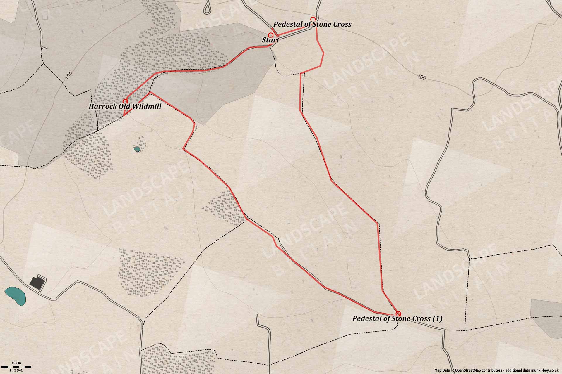
A short walk to visit the old windmill on Harrock Hill, with an extra loop tacked on to the higher part of Harrock Hill which gives good views across to the West Pennine Moors. Although the walk is very easy the section from near the windmill to the summit trig point and covered reservoir can be very muddy indeed - over ankle depth - so beware.
Harrock Old Windmill
1. Old Mill Lane
The walk starts from the tiny parking area at the southern end of Sanderson Lane where there is also a bench with views toward Chorley and Healey Nab.
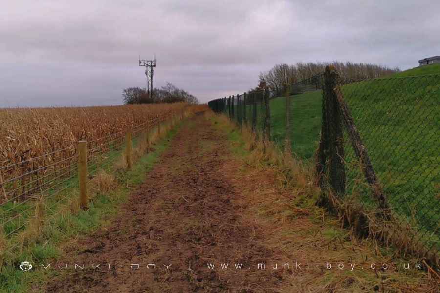
Heading stratight to the T-junction, turning right and uphill, ignoring signs for a diverted footpath continue straight up the the old lane toward Halliwell’s o’th’ Hill and on through the old farmyard with the house on the right and barns to the left, immediately after which a five-barred gate with “wheelchair friendly” access to the left leads onto the footpath along an old hollow road of Old Mill Lane. On our right is some private woodland belonging to the Harrock Hall Estate, while to the left are occasional glimpses across to Winter Hill and the West Pennine Moors. The nearby bit of hill that can be spotted is an unamed and higher summit of Harrock Hill, at least that’s how it appears on the maps, with the title Harrock Hill on the smaller summit that we are climbing and the other without any name. Interestingly both summits had OS trig points for the original surveys, today only the one on the higher summit remains behind the fence of an underground reservoir. A little further on the ponds in the field on the left are the remains of an old quarry - perhaps where the stone was got for the windmill itself.
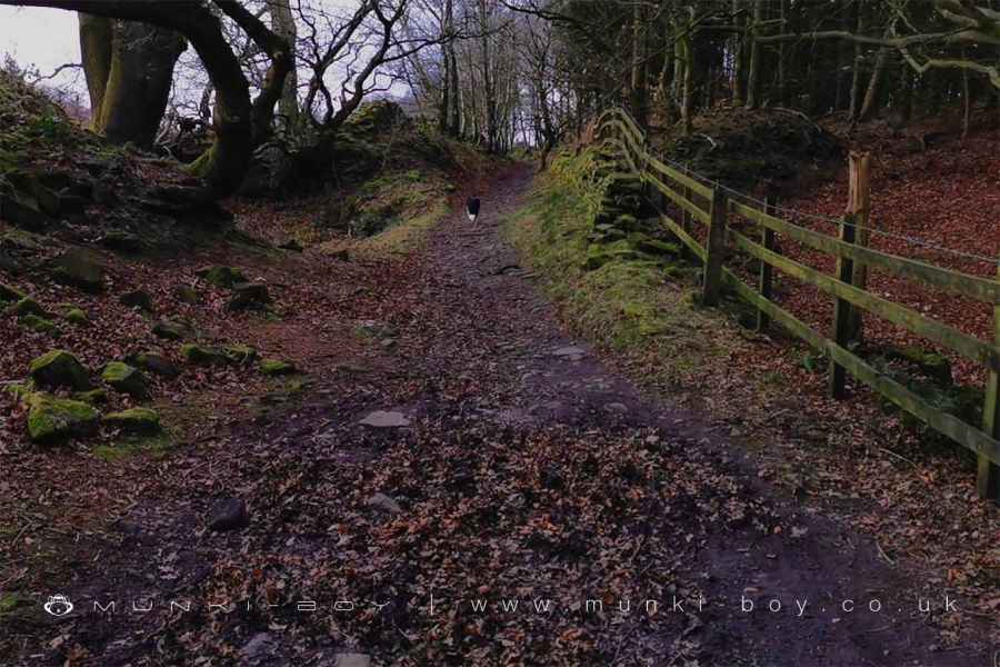
Old Mill Lane at Harrock Hill
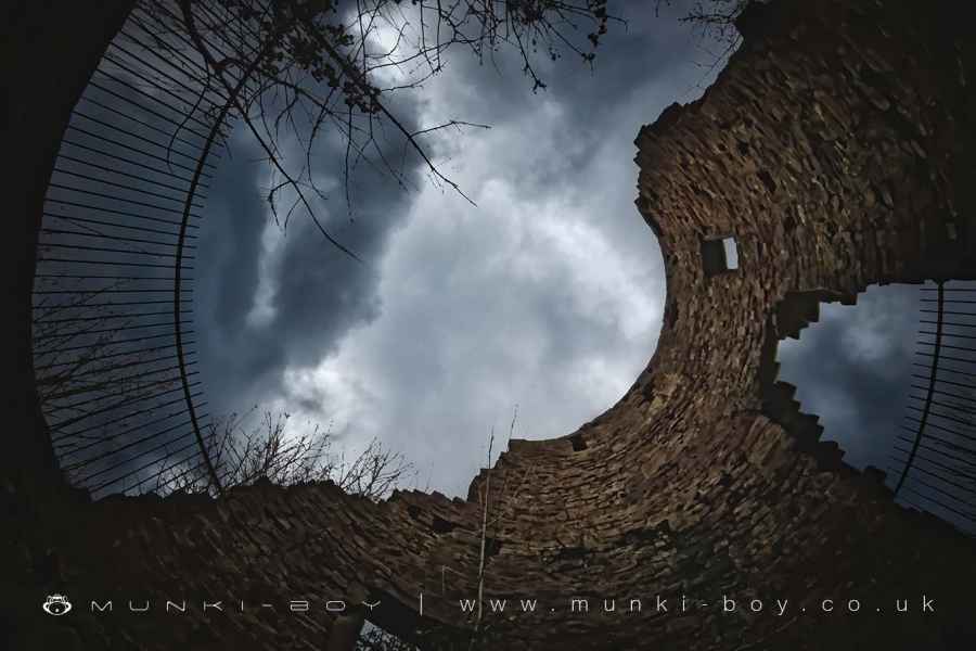
2. Ruined Windmill
Once the woodland on the right gives way you a few small tracks lead off to the right and onto the slightly higher ground which you can take your pick from, heading diagonally for a small distance but keeping roughly parallel to the main track, depending on the time of year you will either make out the form of the standing portion of the old windmill tower or come upon it through the trees. The gaps in the tower walls are fenced so you can take a look down into the lower floor of the windmill that is carved out of an outcrop of the Rough Rock on which we’re stood. It’s possible to head downslope to either of the old windmill entrances - I always think it looks like an example of an early drive-thru windmill - and take a look inside - warning - there’s perhaps a risk of falling masonry so don’t go inside through the large and inviting gaps in the fences.
As I have mentioned elsewhere I find the construction of the windmill very interesting, I’m not at all sure why it’s made this way. Presumably there would have been something like a wooden, garden shed on top of the tower with the axel for the sails coming out of one side. You can see the rectangular holes around the inside of the tower at various levels which would have held the wooden floor joists for the different floors on the way up. Harrock Old Windmill is shown on the maps surveyed around 1830 as a ruin or derelict building but it is mentioned in documents from 1660 so the windmill itself could be even older.
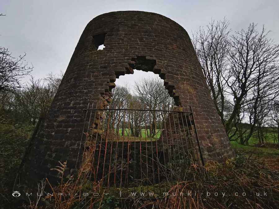
Harrock Old Windmill Tower - above ground portion
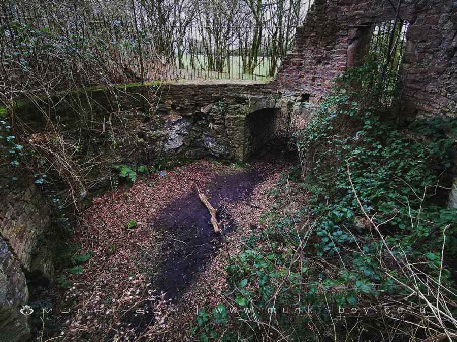
Harrock Old Windmill Interior
3. Up and Over
Once you’ve had your fill of the old windmill, we can head back onto the Old Milll Lane and at a point a few metres back towards the ponds we passed earlier there is a five-barred gate leading southeast into a field and on towards the higher part of the hill. This was the continuation of Old Mill Lane that lead to Harrock Hall. The path can be very muddy here so take care. Once a corner is reached with another Harrock Hall Estate sign we find the strange, rectangluar mound on the top of the hill together with a phone mast. The mound is an underground or covered reservoir I believe and the old trig point which marks the summit of the hill is inside its fence.
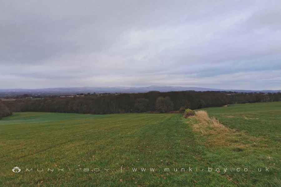
Moving on with views opening to the West Pennines to the East we follow the track downhill almost reaching the buildings at Hill House Fold but stopping at track leading off in a hairpin left turn where an ancient stone cross once stood. Heading back on ourselved up the track that was Hill House Lane with the summit we just visited to the left and hopefully grand views to the right until the nearby woods of Wrights Coverts, a remainder from the days when hunting was popular around the turn of the 20th Century and the track gradually turns to northwards.
Mast and Covered Reservoir on Harrock Hill
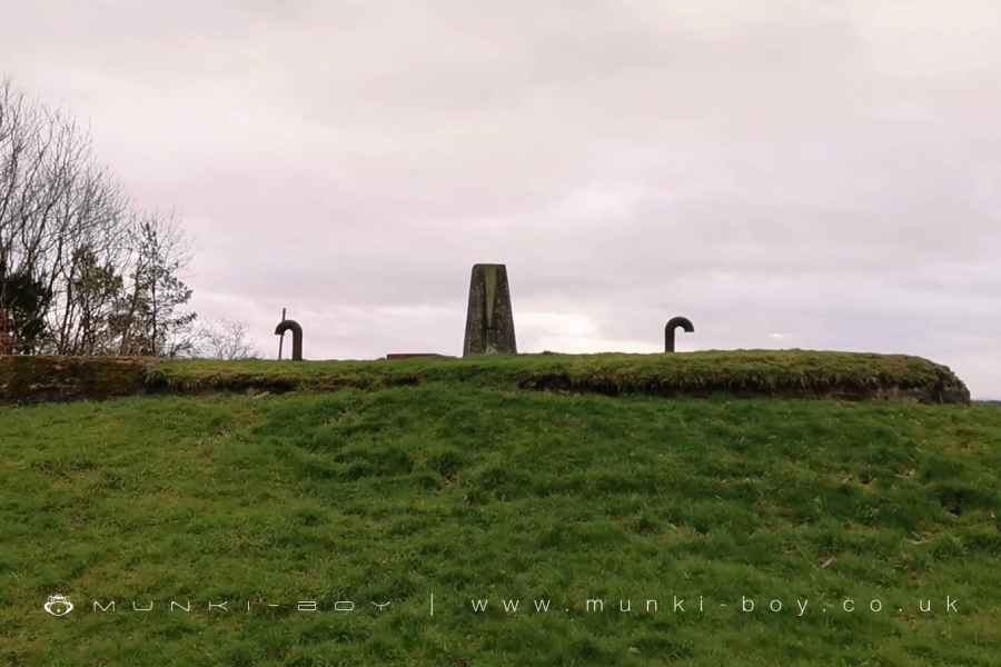
Trig Point on Harrock Hill
4. Wrights Coverts On The Way Back
At the end of the fields the track splits with the left fork leading more directly back to the start of the walk but venturing right leads to an alternative route past a derelict looking but fairly modern wooden bridge and onto a small tarmac road which meets the southern end of Coopers Lane where the stone pedestal of another ancient cross can be found, after which there is just a small stretch of tarmac track leading up to the place we started from.
Wrights Coverts with Winter Hill beyond
Harrock Old Windmill
These walks are described for educational purposes only and we make no recommendation that you follow them, do so at your own risk. We accept no liability for your safety or for the reliability of the walk, map, description or anything else.
Mist, Mines and Ruins


Own label and private label building products
We produce, brand and supply for some of the biggest names in the industry. Read more...