Roddlesworth Reservoirs
A Walk in Lancashire
Walk spec.
Difficulty: Easy
Basic length: 3Km (approx.)
Terrain:
- Mud tracks
- Roads
- Tracks
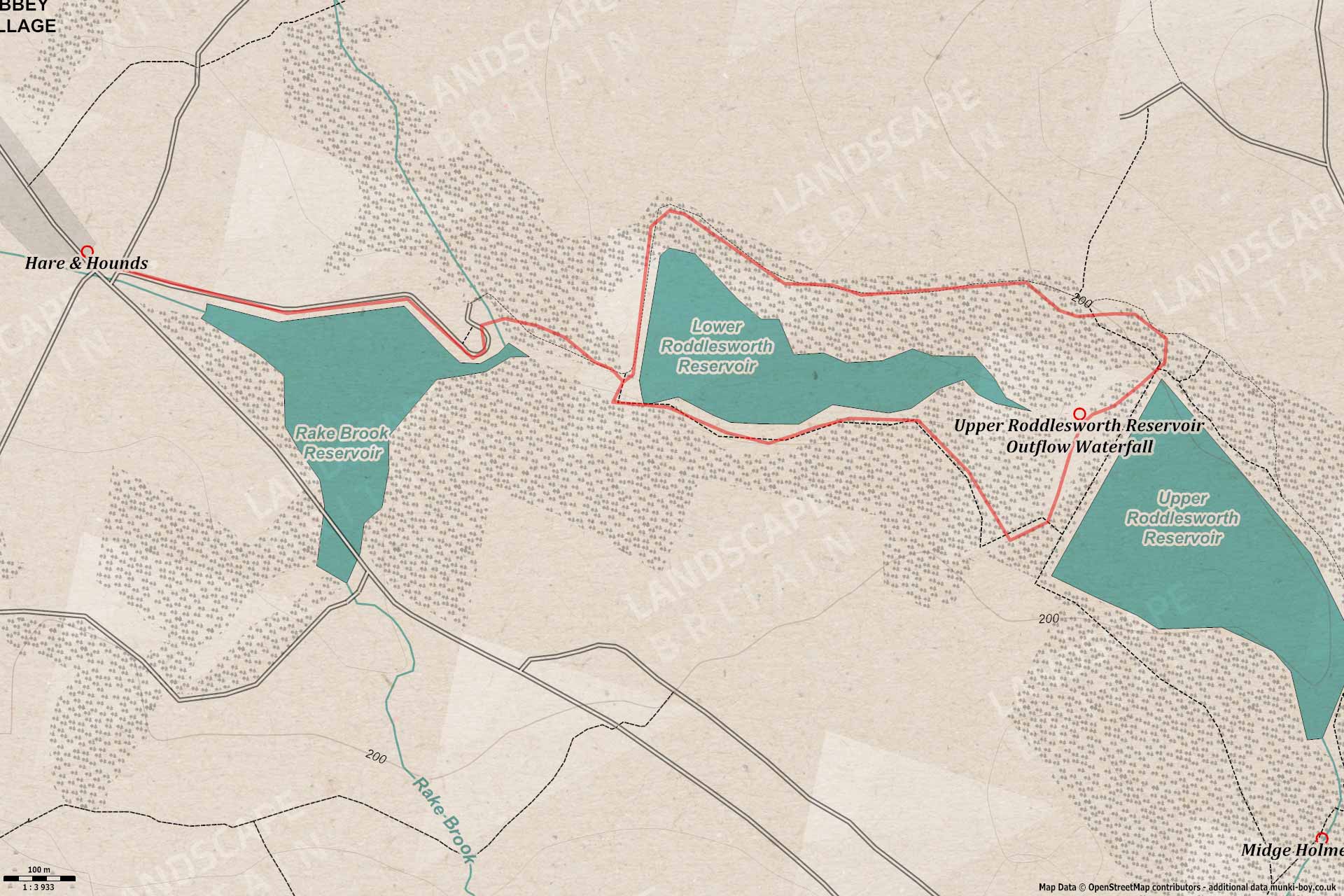
This walk takes in the Rake Brook and Lower Roddlesworth Reservoirs and barely the eastern tip of the Upper Roddlesworth Reservoir and the interesting old outflow cascade “waterfall”. The terrain is pretty easy with hardly any steep bits and decent tracks for the most part. However, the southern shore of the Lower Roddlesworth Reservoir can be muddy at times, those times being after rain and also the ideal times for checking out the outflow cascade if you want to see water cascading down.
This walk is a popular dog walking area and is good for socialising dogs but there’s also families and kids around on weekends and the tracks further into the woods are used as bridleways.
There is limited roadside parking in the lane opposite the Hare & Hounds at the southeastern end of Abbey Village.
Darwen Tower from the track leading to Rake Brook Reservoir
1. Abbey Village and Rake Brook Reservoir
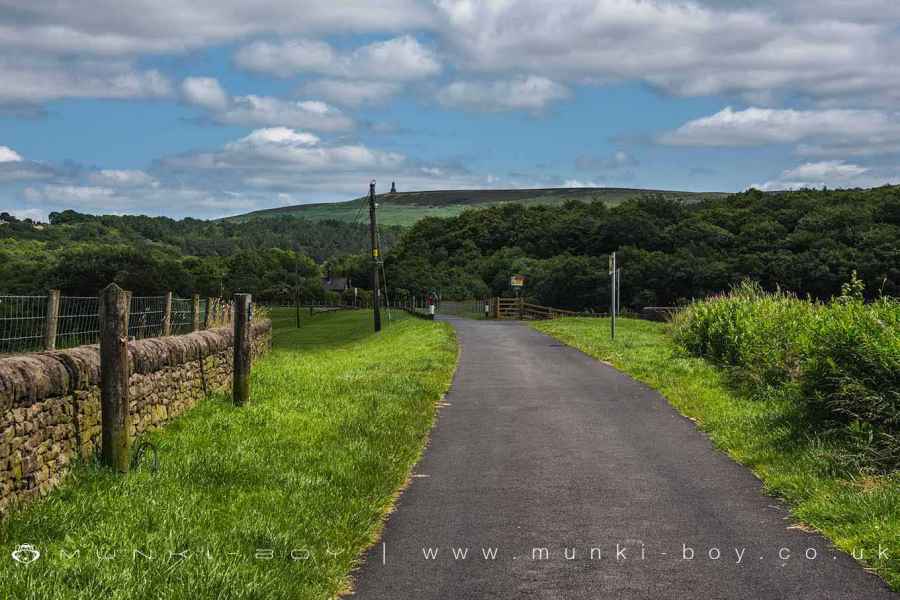
Start the walk from the entrance to Roddlesworth Reservoirs beside the Hare & Hounds pub, heading along a good tarmac road that leads along the left side of The Goit, an artificial river that was constructed along with the reservoirs to carry water round to the Anglezarke Reservoir near Chorley. Soon after the embankment of Rake Brook Reservoir is reached with views up to Darwen Tower straight ahead and a little further along the long-ridge of Longridge Fell can often be seen to the North (left). Rake Brook Reservoir takes its name from the little stream flowing in from the South, where the other reservoirs take their names from the River Roddlesworth flowing in from the East.
At the end of the embankment an old water company cottage (now a private residence) is reached beside a ford and footbridge across the outflow spillway of Rake Brook Reservoir leading down to the River Roddlesworth in the old Benson Wood. The spillway is often dry and sometimes a bit overgrown in summertime but it’s a pretty impressive size and can take a fair bit of water if the reservoir is overflowing.
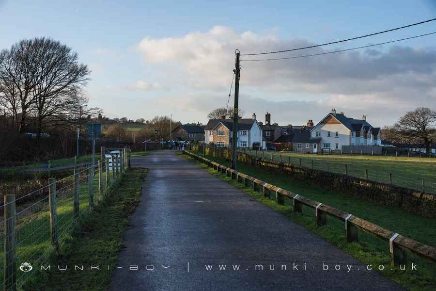
Looking back at Abbey Village from the road near Rake Brook Reservoir
Rake Brook Reservoir
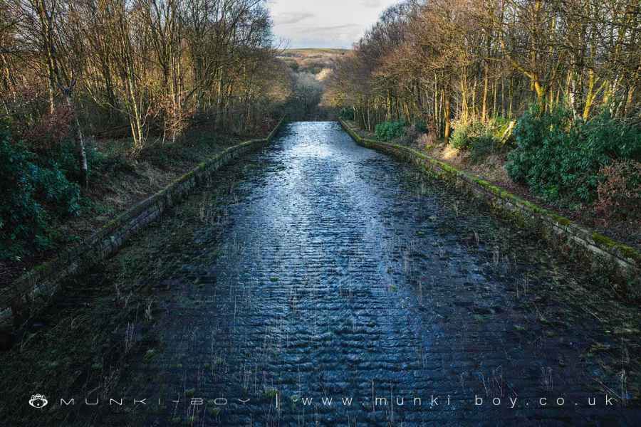
2. Lower Roddlesworth Reservoir
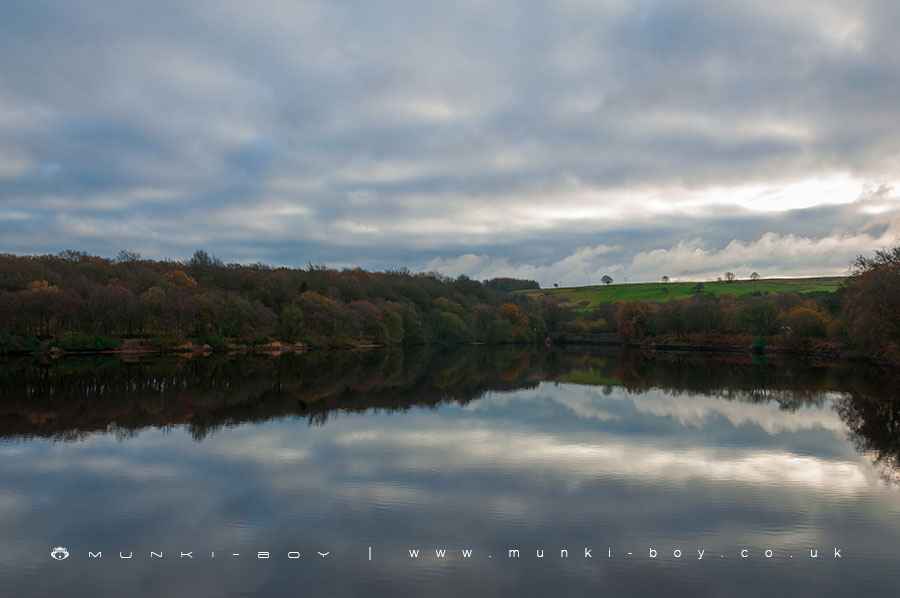
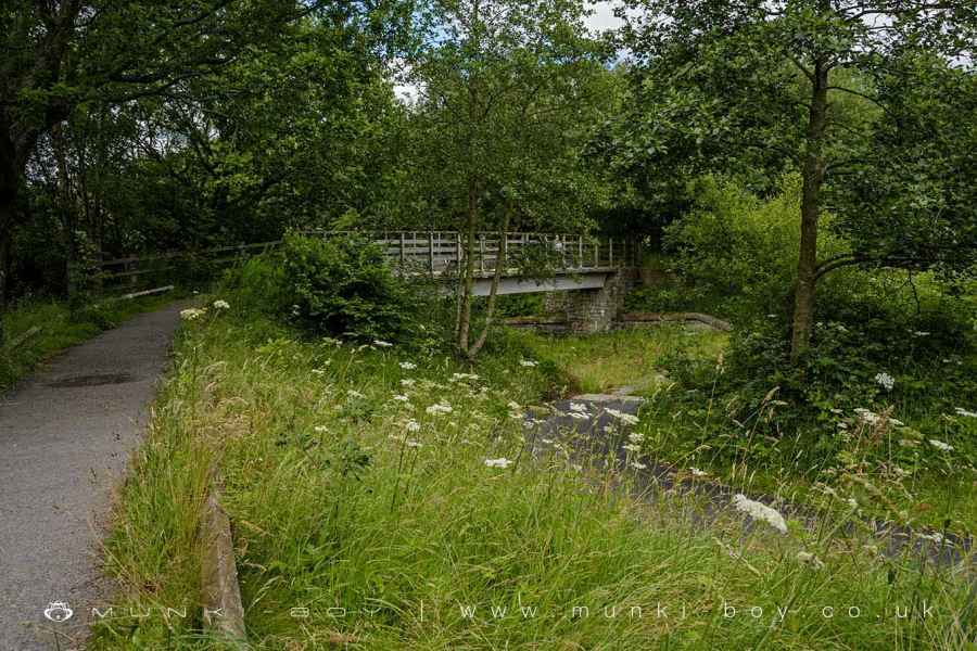
After taking the footbridge (you took the footbridge right?) there’s another small section of artificial river linking up to the Lower Roddlesworth Reservoir. (There’s a wooden bridge here, but don’t cross as we’ll be coming back that way.) Soon the Lower Roddlesworth Reservoir comes into view and we turn left along its western embankment with views again of Darwen Tower across the water and maybe a few ducks, geese or swans. The woodland that surrounds the reservoir and leads on up the valley is today known as Roddlesworth Woods but it is a relatively modern woodland for the most part but, interestingly the small wooded area at the bottom of the embankment to the left was the old Roddleworth Wood.
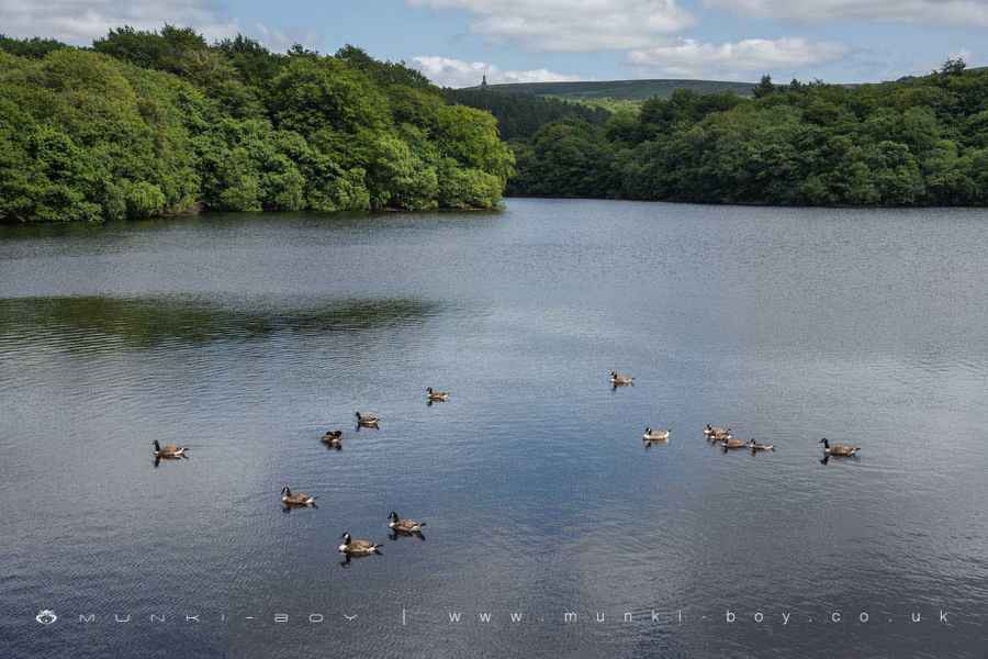
Lower Roddlesworth Reservoir
3. Roddlesworth Woods
Once the end of the embankment is reached the tarmac is replaced by a dirt track that’s used by water company vehicles to get to the upper reservoir and around parts of the woodland. The ground rises and the woodland part of the walk begins, as the track leads up a slightly steep corner and continues East following the bank of the Lower Roddlesworth Reservoir but some distance from the shore. It sometimes possible to see deer in the woods if it’s a quiet day, but there’s almost always a few squirrels about. There are also plenty of weird and wonderful fungi here, best around autumn-time.
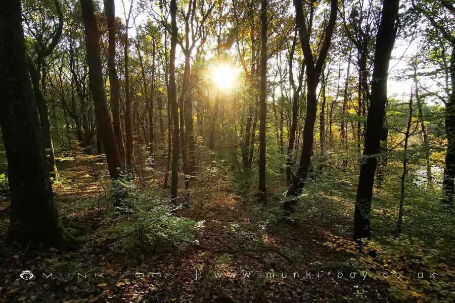
Sun Shining in Roddlesworth Woods
4. Upper Roddlesworth Reservoir and the Cascade
Keep heading along the main track towards the embankment of the Upper Roddlesworth Reservoir - there’s a small track branching off to the right towards an old bridge but we’ll catch it from the other side later. At the top of the wooded slope there are views across the Upper Roddlesworth Reservoir which is probably the best-looking of the three and has the easiest waterside access. The track we’ve been following continues on and it is possible to loop round the reservoir but I’d like to show you the cascade. If you do want to go round the reservoir shore it’s quite straightforward, just keep turning right until you meet up with us at the other end of this embankment we’re on.
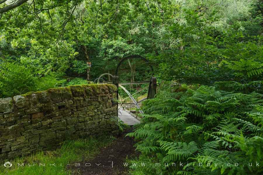
Still with us? Then make your way across the small bridge over the reservoir outflow and onto the small path that leads down the side of the embankment. Soon a small gap in the trees on the right leads to an old iron bridge that spans the overflow cascade and has good views if there’s water flowing below. Glancing down to the bottom of the cascade, a ruinous and rocky pool can be seen and this is a slightly tricky, optional visit if you’d like to see the cascade from the bottom. I’ll show you shortly.
After having a look at the bridge if you like that sort of thing, continue the path down and along the lower part of the embankment where some plant can be seen for the waterworks. It’s gated but you can peep into the embankment tunnel or just pass by. If you’d like to see the bottom of the cascade you can make your way round to the right and over some old broken stonework and muddy ground to the river. It’s fine but take care if you aren’t used to scrambling. It’s best to make your way back up after taking in the view.
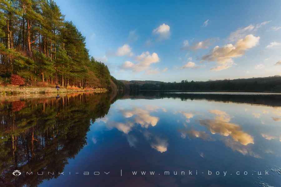
Upper Roddlesworth Reservoir
Old Bridge over Upper Roddlesworth Reservoir Waterfall
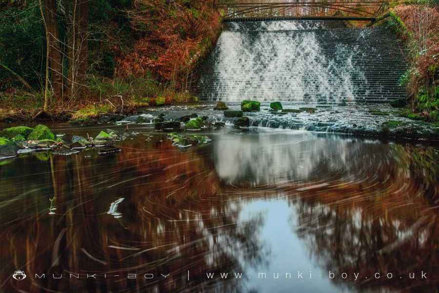
Waterfall at Upper Roddlesworth Reservoir
5. Back to Lower Roddlesworth Reservoir
The tracks here are often a bit muddled and can be altered for erosion control at times but we’re generally making our way along the southern bank of the short connecting river between the reservoirs that we were on the other side of earlier. This section can be a bit muddy but there’s a good chance to see wildlife and look out for more fungi. It’s not far to the wooden bridge we passed earlier and crossing we will be back at the edge of the Lower Roddlesworth Reservoir, from which we retrace the first part of the walk back to Abbey Village.
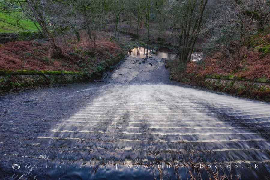
Looking down the waterfall at Roddlesworth Reservoir
Darwen Tower from the track leading to Rake Brook Reservoir
Longridge Fell from Rake Brook Reservoir
Bridge and Ford across Rake Brook Reservoir Spillway
Rake Brook Reservoir Outflow Spillway
These walks are described for educational purposes only and we make no recommendation that you follow them, do so at your own risk. We accept no liability for your safety or for the reliability of the walk, map, description or anything else.
Mist, Mines and Ruins


Own label and private label building products
We produce, brand and supply for some of the biggest names in the industry. Read more...