Redisher Wood and Waterfall
A Walk in Greater Manchester
Walk spec.
Difficulty: Easy
Basic length: 4Km (approx.)
Terrain:
- Gravel tracks
- Mud tracks
- Road without footpath
- Tracks
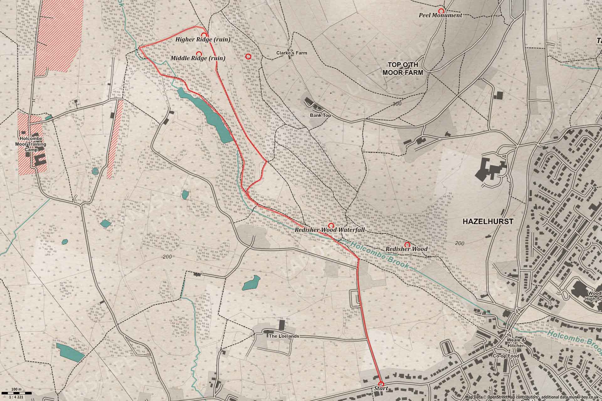
Redisher Wood is located along a post industrial river which is especially popular with dog walkers. The walk takes in pleasant woodland, a river and associated mill lodges, the Redisher Woods Nature Reserve, a waterfall (after rain) and great views across ruined farmsteads in the landscape they once farmed. This walk avoids the nearby MOD shooting range and its restricted access and paths.
Redisher Wood
1. A Bit of Road
This walk starts from the main road (A676) - limited parking nearby - junction with Redisher Lane, which is a small tarmac road without footpath, but it’s fairly quiet but watch out for cars.
The lane is bounded by tall hedges and abundant with wildflowers including Jack-by-the-Hedge in season. It’s possible to get a glimpse of Peel Monument on the hill ahead as the road passes by a few properties and farms until a sharp-left bend, but we continue straight-on to the gated entrance to the wood.
Now reduced to a footpath, this route was once much more important as it once lead down to Ridge Cotton Mill across the river and on to further farmsteads.
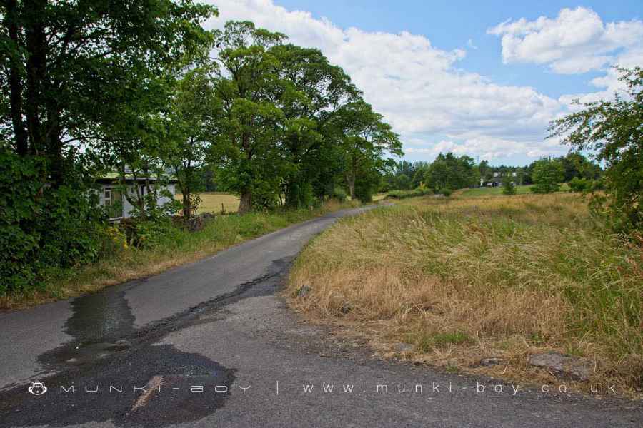
Redisher Lane
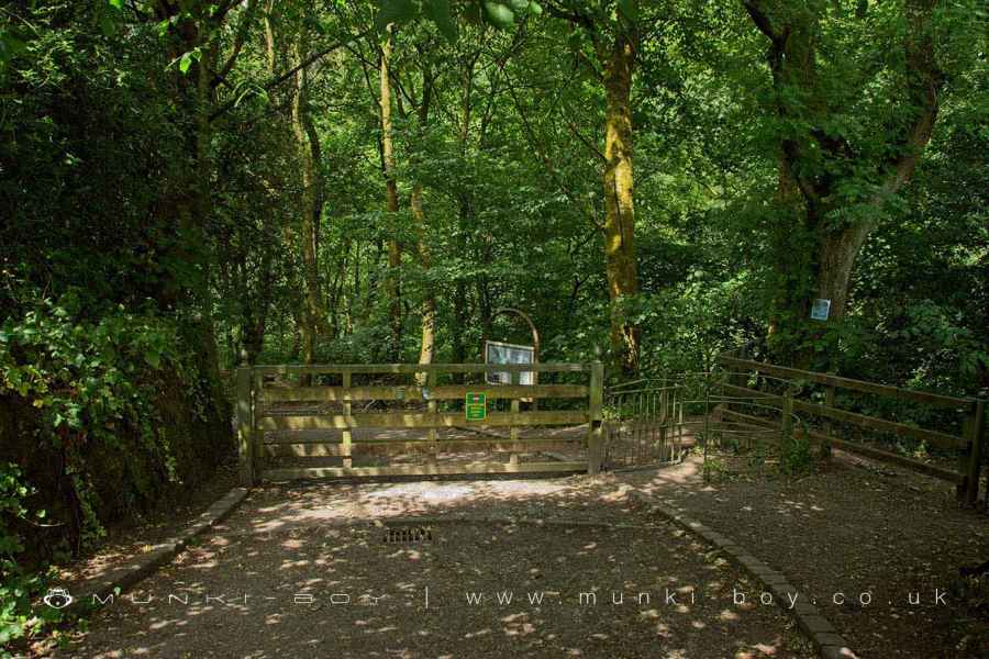
Entrance to Redisher Wood
2. Into the Wood
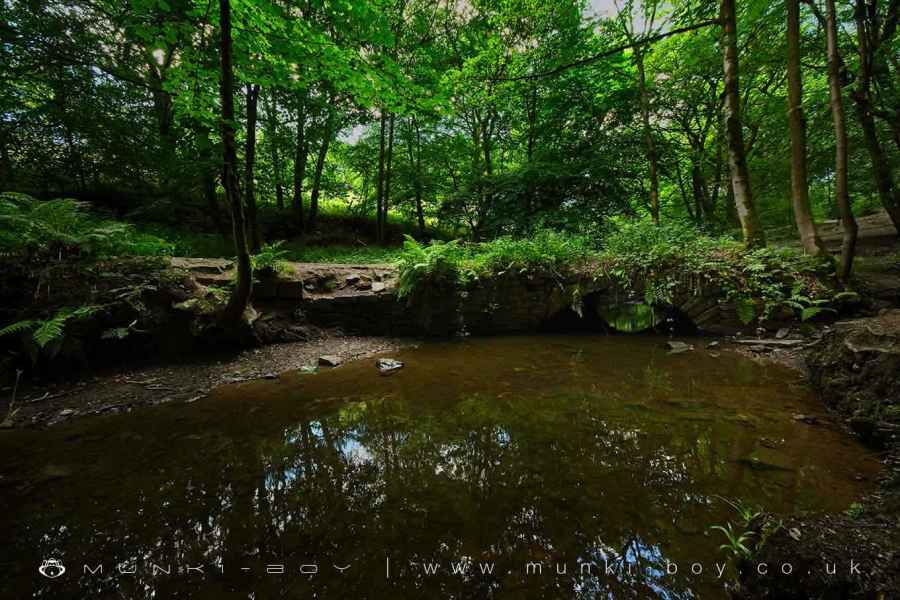
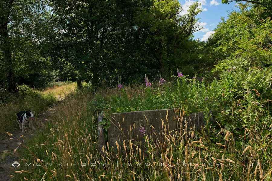
Passing through the gate and heading down into Redisher Wood until a wooden bridge is reached with tracks along either side of the Holcombe Brook. Go left (upstream) a short distance to ‘The Old Bridge’, built of stone which has been recently renewed with the addition of wooden rails.
Here on the uphill side of the brook, a smaller tributary which rised below Saplin Wood, flows over a stone ledge - probably a geological fault, possibly quarried further - after sufficient rain forming the popular Redisher Wood Waterfall.
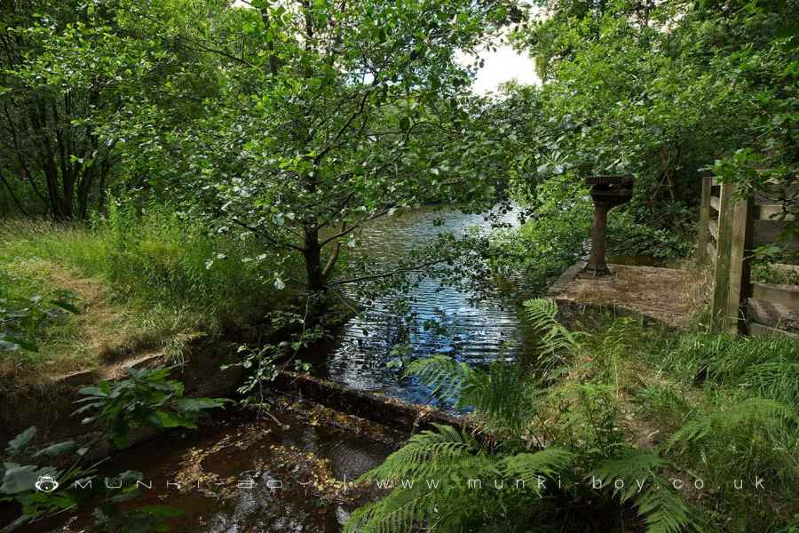
Continuing on upstream, with the brook on our left, we pass by the site of the cotton mill which was in use from the early 19th Century, and Bottom Simons Lodge which is now mostly dry with the brook meandering through.
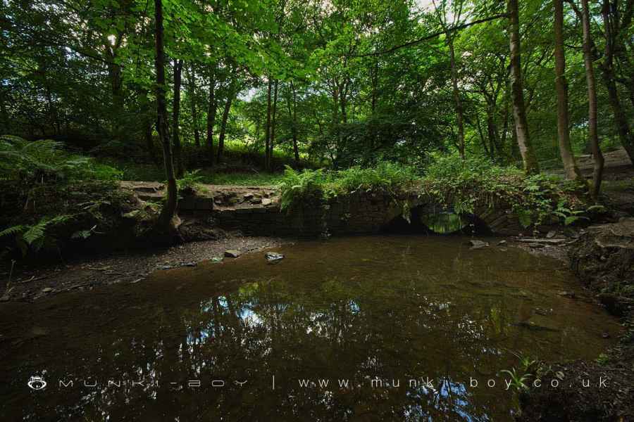
The Old Bridge across Holcombe Brook in Redisher Wood
3. Simons Lodge
Heading further up the brook which meanders below a steep slope with interesting exposed mud or shale in places with a number of exposed nodules, rich in iron. This is possibly the Rossendale Formation which overlies the famous Holcombe Brook Grit and was formed around 320 million years ago in the Carboniferous Period.
Simons Lodge is reached above a stone-lined section of the brook where the remains of iron sluices can be seen. The footpath follows closely the side of the lodge which is long and narrow, being simply a dammed section of the brook. In places it’s possible to get down to the water’s edge. The lodges and water management along this section of Holcombe Brook regulated water to the former cotton mill and bleachworks downstream.
After Simons Lodge continue along the track, following the brook upstream some distance to a junction near a ford with concrete ‘stepping stones’ over the brook, but go right where a wooden fingerpost marks out the footpaths and bridleway and short path to a tree-lined, sunken way marks an old farm road which leads up to a gate and out of the woods onto moorland grass.
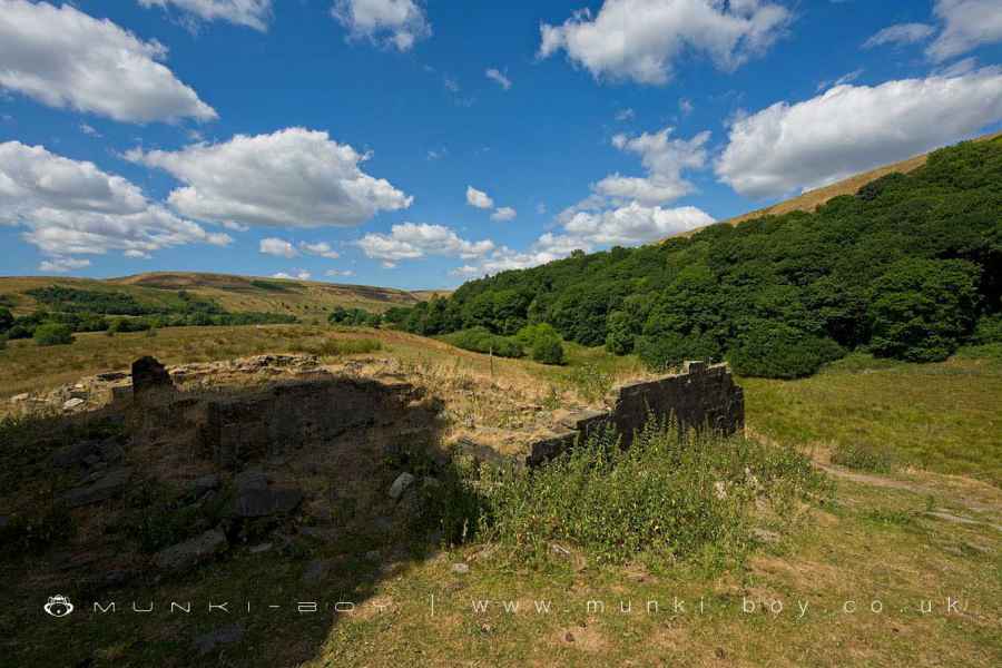
Heading straight uphill the ruins of Higher Ridge soon come into view. Glance right by a single stone gatepost and below the trees the low remains of Middle Ridge can be made out.
Old Sluice at Simons Lodge
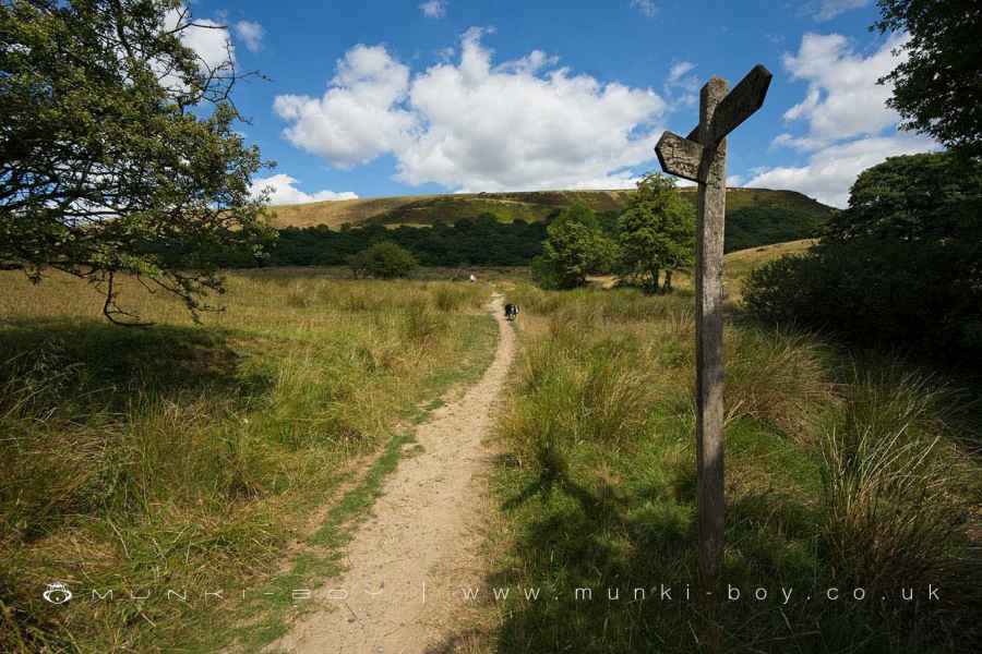
Fingerpost below the Higher Ridge ruins
4. Redisher Ridge
Higher Ridge is one of the more impressive ruined farmsteads around Redisher Woods and would have still been occupied as late as the 1940s. Although no walls remain upstanding to any height, a number of low walls remain that give an indication of the room layout.
Looking to the Northwest the treeline gives out with the valley heading up towards Holcombe Head where the small hamlet and mill of Cinder Hill once stood, with evidence of industrial activity going back to at least the medieval period.
Yet we must turn away and head Southeast along the moorland grass of Redisher Ridge, with Redisher Wood on our right and Saplin Wood to our left, across the little valley known as The Bottoms.
Redisher Ridge runs round the lower slopes on the Southwest of Holcombe Hill between the small brook that flows over the waterfall in Redisher Wood and the Holcombe Brook and is a pleasant counterpoint to the woods below. With a moorland aspect and much wildlife including butterfies and dragonflies in season. It’s possible to see deer on quiet days.
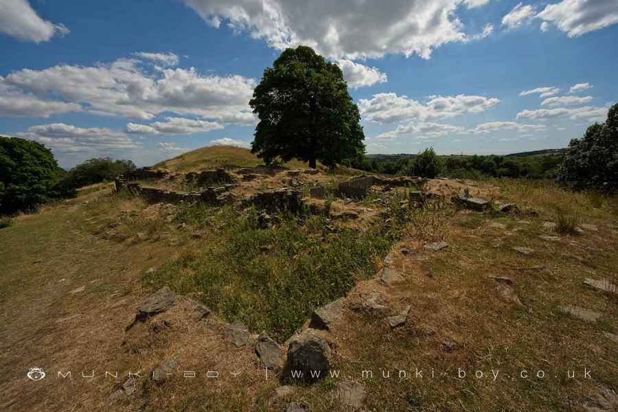
Higher Ridge (ruin)
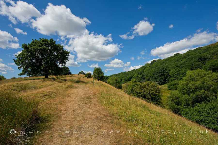
Redisher Ridge
5. Lower Ridge
Follwing along the ridge path until a wooden gate is reached. At a fingerpost beside an old stone gatepost, turn right to head back down towards the woods.
About half-way down the slope and above a flight of stone steps, a section of old Flagstone Wall is found at the site of Lower Ridge - another lost farmstead. The site is overgrown and little remains of the building above ground but the flagstone walling is interesting and is of a type found locally around Holcombe Moor.
The steps lead back down into Redisher Wood above the Holcombe Brook at the former Bottom Simons Lodge we passed earlier. Turn right to follow the path back to the Old Bridge and back along Redisher Lane to the start of the walk.
The old Flagstone Wall at the site of Lower Ridge
Redisher Wood
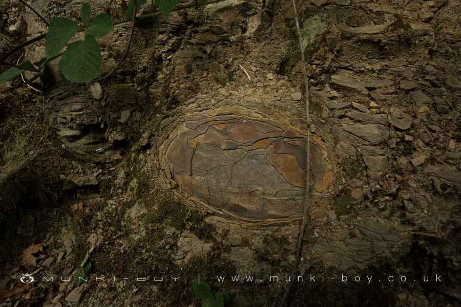
Ironstone Nodule in Redisher Wood
View towards Cinder Hill from Redisher Ridge
These walks are described for educational purposes only and we make no recommendation that you follow them, do so at your own risk. We accept no liability for your safety or for the reliability of the walk, map, description or anything else.
Mist, Mines and Ruins


Own label and private label building products
We produce, brand and supply for some of the biggest names in the industry. Read more...