Roddlesworth Woods Walk
A Walk in Lancashire
Walk spec.
Difficulty: Moderate
Basic length: 3Km (approx.)
Terrain:
- Mud tracks
- Muddy
- Steep slopes
- Steep steps
- Tracks
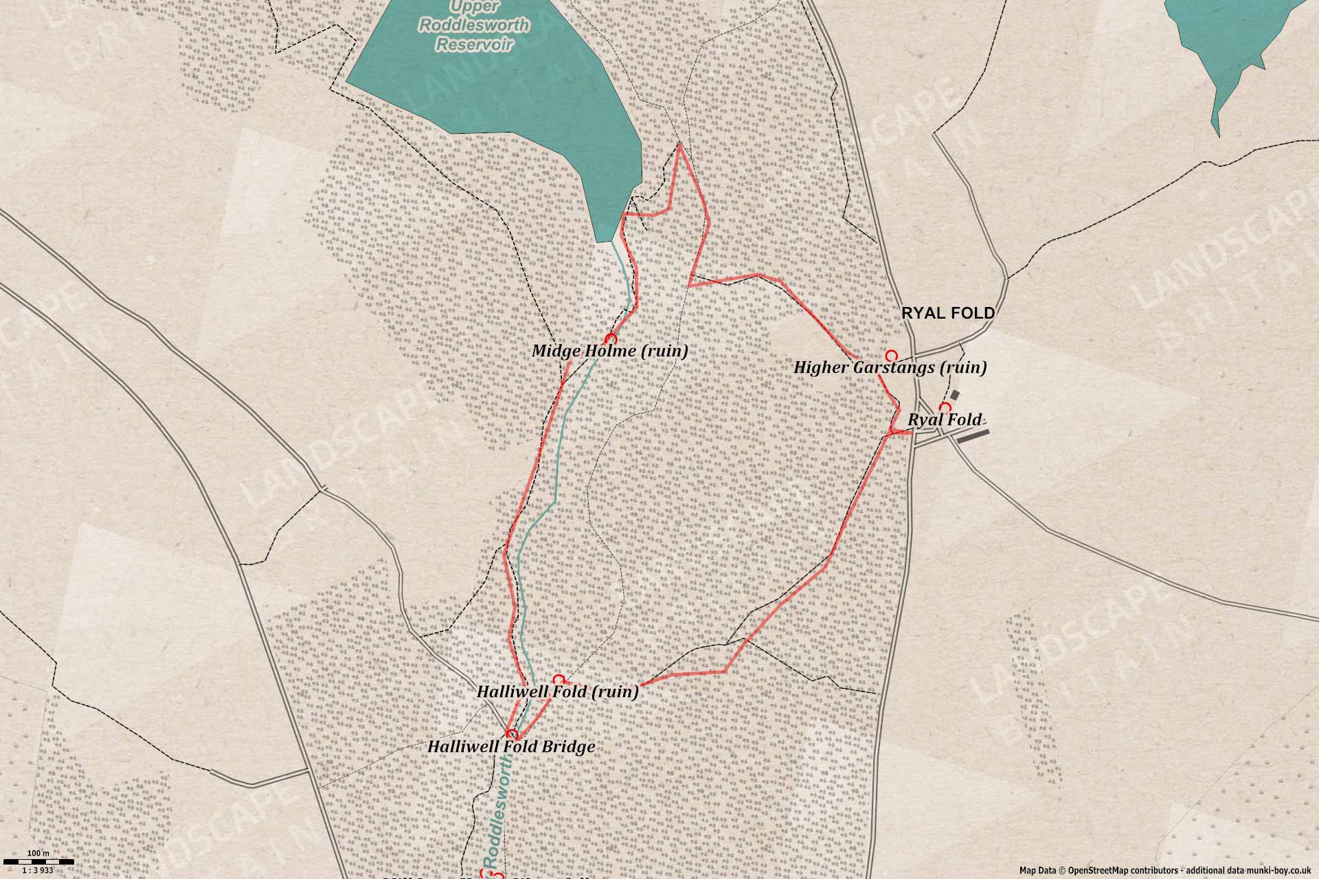
This walk is only short around mostly decent paths but there can be muddy areas and there’s a fairly steep hill at the end. It’s a bit of a slog if you’re into walking but could be difficult for some.
Roddlesworth Woods are very popular for dog walks and there’s usually plenty of dogs around. There’s a couple of streams and a shallow slope into the Upper Roddlesworth Reservoir to play in.
Roddlesworth Woods
1. Roddlesworth Woods
The walk starts at the small car parking area at Ryal Fold where there is also a country cafe and information centre. The parking is limited but there’s often a few spaces free.
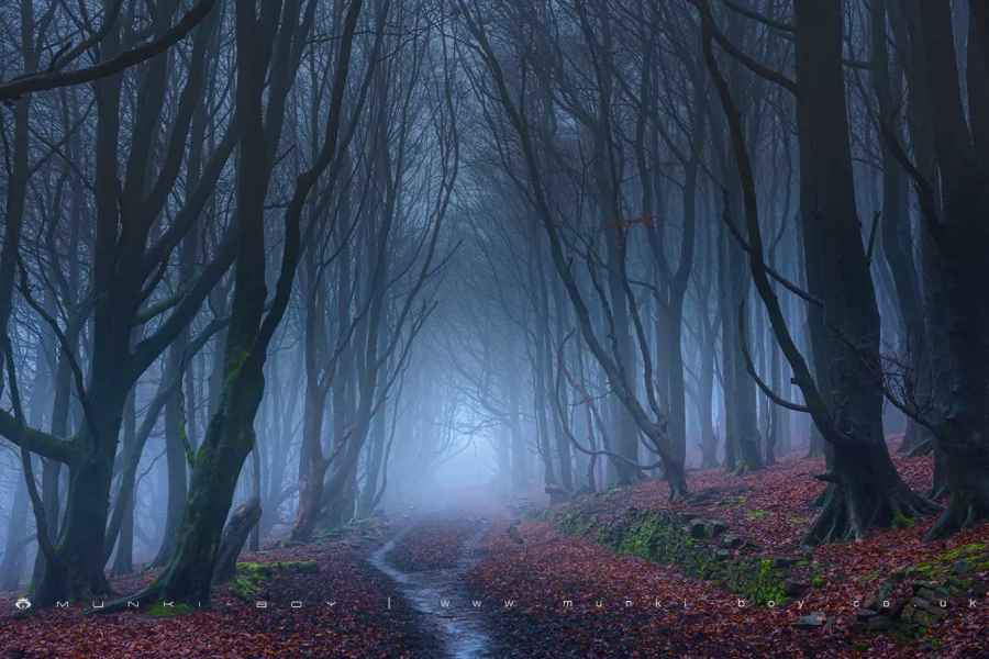
Starting from the gate marked Roddlesworth Reservoirs which is opposite the parking area at Ryal Fold, after a few metres at a fork in the path, turn left through the stone gateposts that lead to a (often mud covered), track with over-arching trees that look spectacular on the right day. Despite the ancient appearance the trees have only been here since they were planted around 1900 as part of the Tockholes Plantation that accounts for much of the woodland we see today. The path itself is an old farm track leading down to Halliwell fold, altough it does look like a unkempt tree-lined avenue it seems to have nothing to do with the ruined Hollinshead Hall nearby.
After a bend to the right, the path passes through a little hollow section where puffballs can be found in late Summer. The trees give out to a clearing where the track descends back into the woodland where a stony path seems to make a lot of fuss crossing a small stream, it’s a strange setup but is interesting. Upon reaching a crossing of ways note the gateposts and rubble-walls of Halliwell Fold, an old farmstead that went derelict, again around 1900. Behind one of the old buildings here is the top of the Halliwell Fold waterfall that descends an almost vertical shale cliff, it’s unfenced and dangerous here but we’ll be passing below shortly. Note the old stone-cobbled area which would probably have been the farmyard.
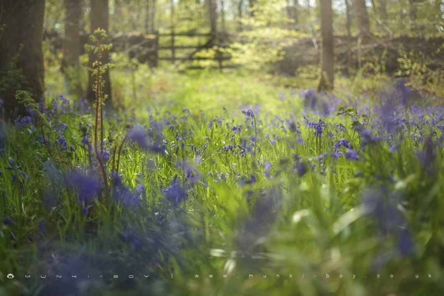
Bluebells in Roddlesworth Woods
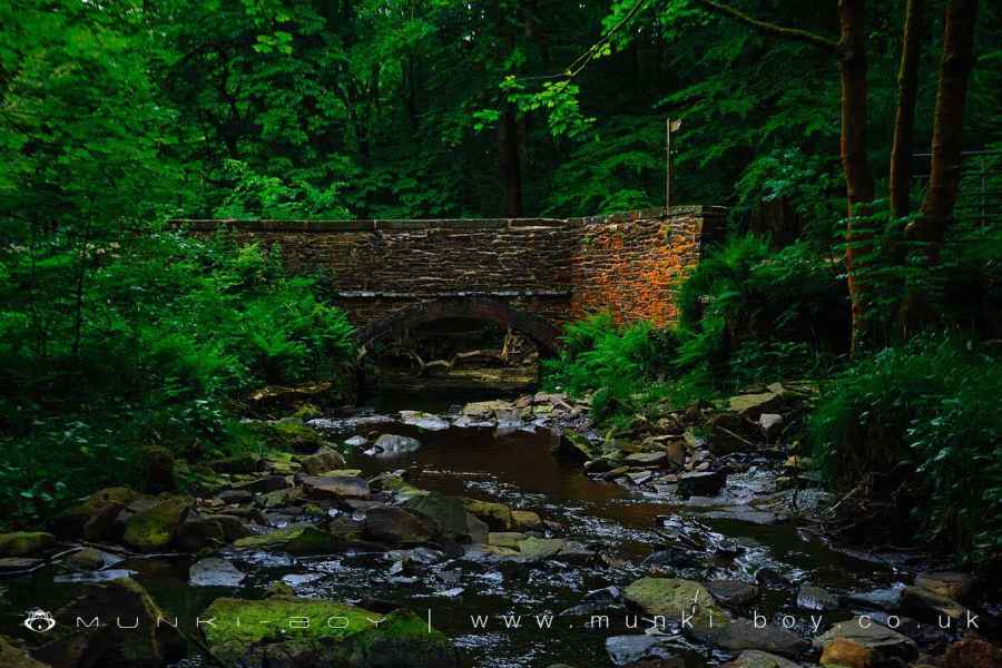
Halliwell Fold Bridge
2. Halliwell Fold Scar
Taking the path to the left by the old stone gateposts we soon reach the old Halliwell Fold Bridge, our route crosses the bridge and immediately turns right through an iron gate - but you might want to pause and admire the upstream view from the bridge where a lovely little pool is formed in an old quarried out area. An excellent spot for a paddle or for dogs to cool off.
Back to our route, and taking the iron gate on the downstream side of the river, have a look to the right as the view up the River Roddlesworth to the bridge is often nice, especially in Autumn. The path roughly follows the stream as the opposite bank becomes a steep shale cliff and a sharp bend reveals the Halliwell Fold waterfall - if you’re lucky - if not then a dismal trickle may be all you’ll find. The stream bed follows the foot of the cliff for a short distance and the exposed bedrock is interesting and it’s quite common to see photographers practicing the long-exposure technique here. There’s often wagtails to be seen in the stream around here too.
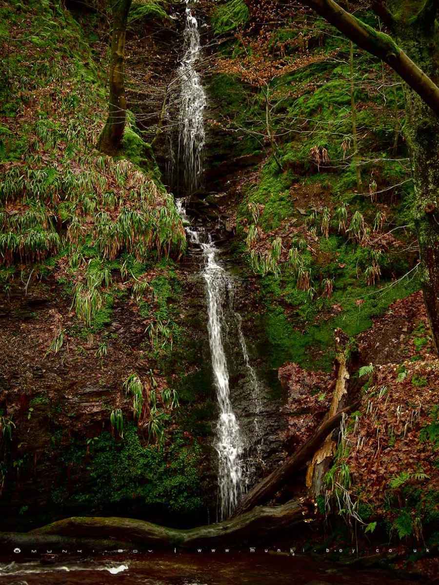
Halliwell Fold Waterfall
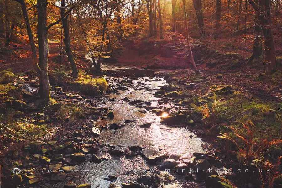
3. River Roddlesworth
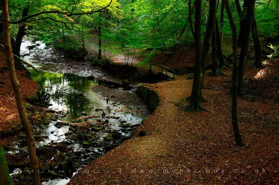
A little way further on and another pool opens out at a bend in the stream before some wooden steps leading up, another good place to stop with dogs or for a paddle, it’s shallow to deep in places depending on recent rainfall. As the steps take the path up the bank, the stream bends away to the right and we are in a strange looking area that was once delightful and covered with fallen leaves and mushrooms towards winter-time. However, around 2016 “conservation” was performed and a large stone track for vehicles driven through. It’s difficult to understand.
Moving on down the steps and keeping the river to our right we soon reach a small concrete bridge. Looking just upstream from here the water-worn rocks in the stream bed are quite smoothly curved in places. As the path follows downstream the site of Midge Holme doesn’t come into view as there’s little left that isn’t covered in brambles, but this was once the site of a house and a curious pair of gateposts on either side of the river that opens out to the shore of the Upper Roddlesworth Reservoir where the track climbs up a few metres into a stand of Scots Pine with views over the water.
Dogs in the River Roddlesworth
4. Upper Roddlesworth Reservoir
The Upper Roddlesworth Reservoir just here has a shallow shore and is a popular place for giving dogs a swim. Our route continues on a bit away from the shore where a rather broken wooden bridge crosses the little creek. Ascending up through the trees on the other side a wider track is reached. Turning right here the track curves left and right until a wooden fence is reached with a track leading off to the left and up towards a steepening slope, some of the best bluebells are found here in springtime.
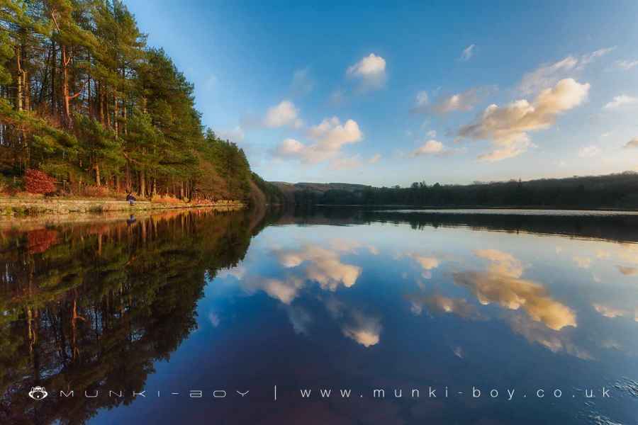
Upper Roddlesworth Reservoir
5. Onwards and Upwards
Heading up hill the track bends to the right and towards the top the extensive ruin of Higher Garstangs can be seen to the left. There’s not much of great interest other than low walls filled with stone rubble but the layout of various buildings can be seen on the ground. Moving on the track bends further to the right and through a small section that can be a bit overgrown in summer; before reaching the track just near the gate from the start of the walk.
River Roddlesworth in Autumn
Roddlesworth Woods
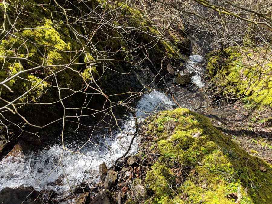
Halliwell Fold Waterfall from the top
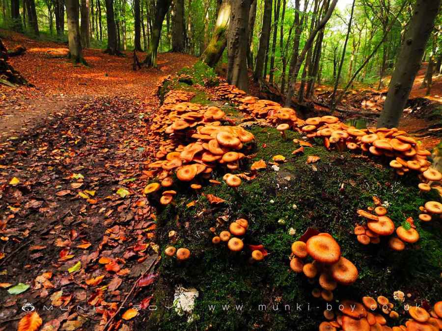
Mushrooms in Roddlesworth Woods - this area has been lost to "conservation"
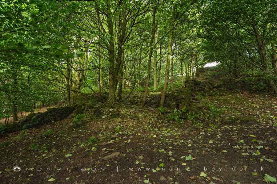
Higher Garstangs (ruin)
These walks are described for educational purposes only and we make no recommendation that you follow them, do so at your own risk. We accept no liability for your safety or for the reliability of the walk, map, description or anything else.
Mist, Mines and Ruins


Own label and private label building products
We produce, brand and supply for some of the biggest names in the industry. Read more...