Around Naden Valley and Reservoirs
A Walk in Greater Manchester
Walk spec.
Difficulty: Moderate
Basic length: 7Km (approx.)
Terrain:
- Gravel tracks
- Mud tracks
- Tarmac
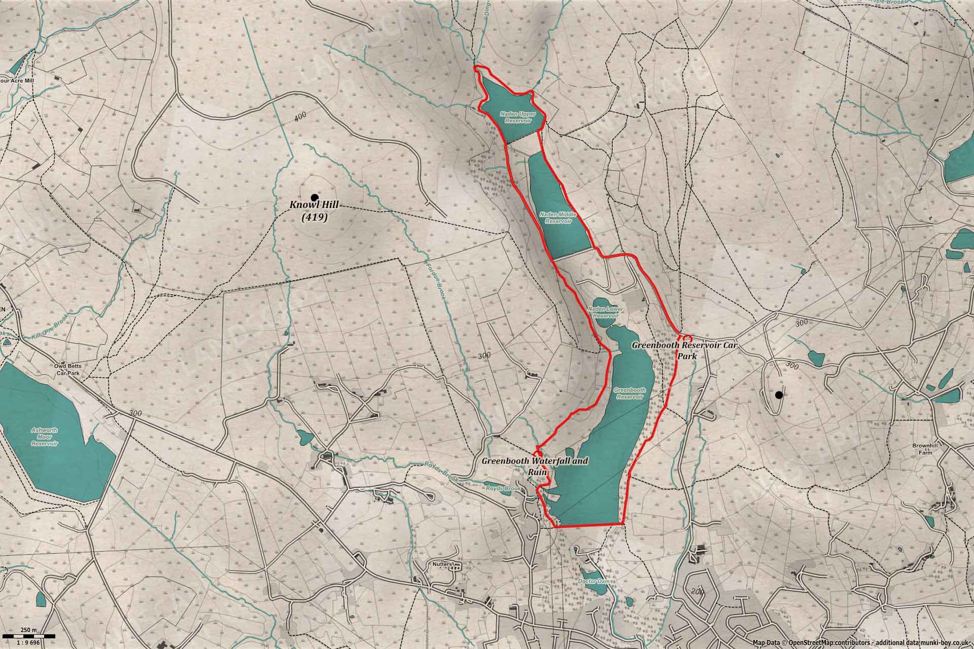
A fairly easy walk on mostly good paths around the Naden Valley and its reservoirs - marked moderate as some may find parts steep.
The walk starts from the Greenbooth Reservoir Car Park, off Forsyth Lane.
Naden Valley Hiking
1. Forsyth Forsooth
From the car park, head down Forsyth Lane past the edge of the conifer plantation and the Naden Valley comes into view on the left.
Passing several quarried out rock faces on the right, note the large sandstone nodules in the strata which is probably around 320 million years old.
The path gradually bends to the left approaching Naden Middle reservoir and here we had a choice of routes because the path along the eastern shoreline looked too inviting to miss. However, I don’t think this is a designated route although the path was clearly well-used, it seemed to just end along with the water and we continued by climbing the steep embankment of Naden Higher Reservoir.
It seems the correct route is to keep following the main footpath up the left side - which means repeating the same bit of track on the way back.
2. Going the Wrong Way
Nevertheless, off we go along the shorline path on the east bank of Naden Middle Reservoir, a nice enough dirt track with access to the water’s edge in places.
It is at the end of this track where we got a bit confused as it didn’t seem to head up to the higher reservoir as confidently as it had made its way along the shore. There is a small track up the right-hand side of the embankment and this is how we ascended - but it didn’t feel right.
Hopefully you good citizens are keeping up with us from the main track across the valley?
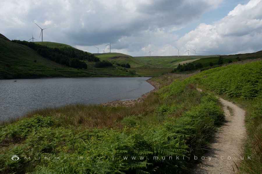
Shoreline Path at Naden Middle Reservoir
Naden Higher Reservoir Embankment
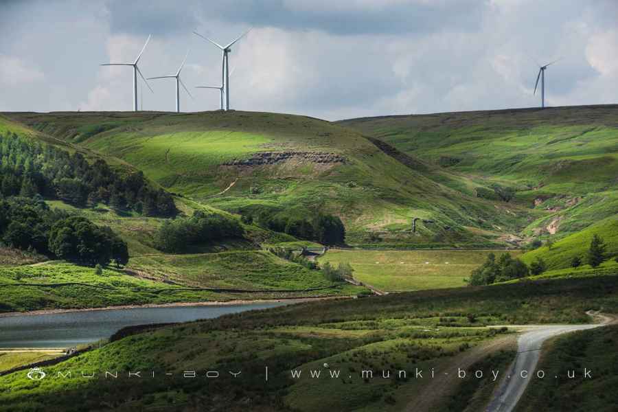
3. Naden Higher Reservoir
The path takes a circular route around the perimeter of Naden Higher Reservoir and this is the route we took - widdershins.
It’s a nice, little lake with several brooks feeding in and an interesting look as it is foreshadowed by several, large, wind-turbines. I still call these ‘windmills’ - although, strangely, in my lifetime seeing an actual windmill is quite an exotic experience, but I’ve seen thousands of wind-turbines.
Once around the top lake we will return back down the main path - not the embankment.
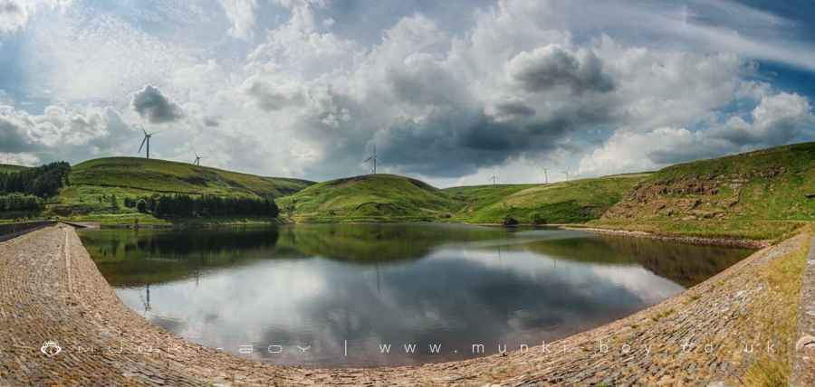
Naden Higher Reservoir
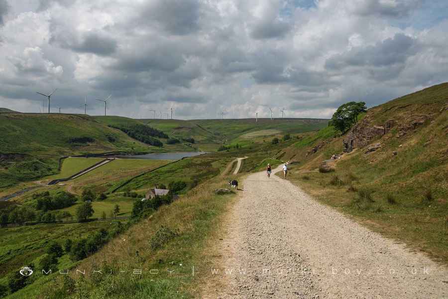
4. Naden Middle and Lower
The track now follows down beside the overflow spillway towards Naden Middle and Lower Reservoirs on our left.
Passing a few trees on the left there looks to be some ruin or at lease a stone gatepost, before the views open out.
Follow the track for some distance as it curves to the right and ascends behind some old quarried or mined-out area before descending a small clough with a bridge and up the other side.
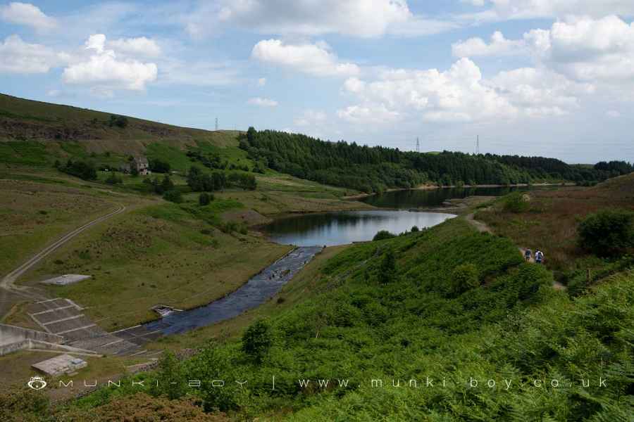
Naden Middle and Lower Reservoirs
5. Rainshore Clough and Waterfall
The path next crosses Rainshore Clough, the site of an old fulling mill until the turn of the 20th Century. A few upstanding walls remain from Rainshore Clough Lower Mill together with the remains of a water management system that includes disused filter tanks on the old map.
Behind the ruins is a temperamental waterfall, sometimes almost dry.
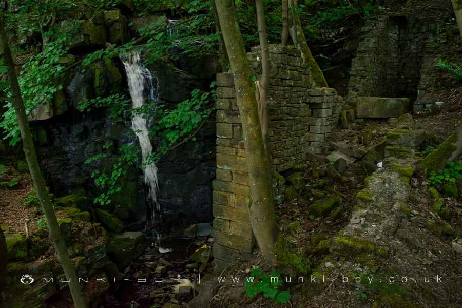
Greenbooth Waterfall
6. Round the Pit
After Rainshore Clough the path descends to the embankment of Greenbooth Reservoir, beside a rather impressive overflow pit.
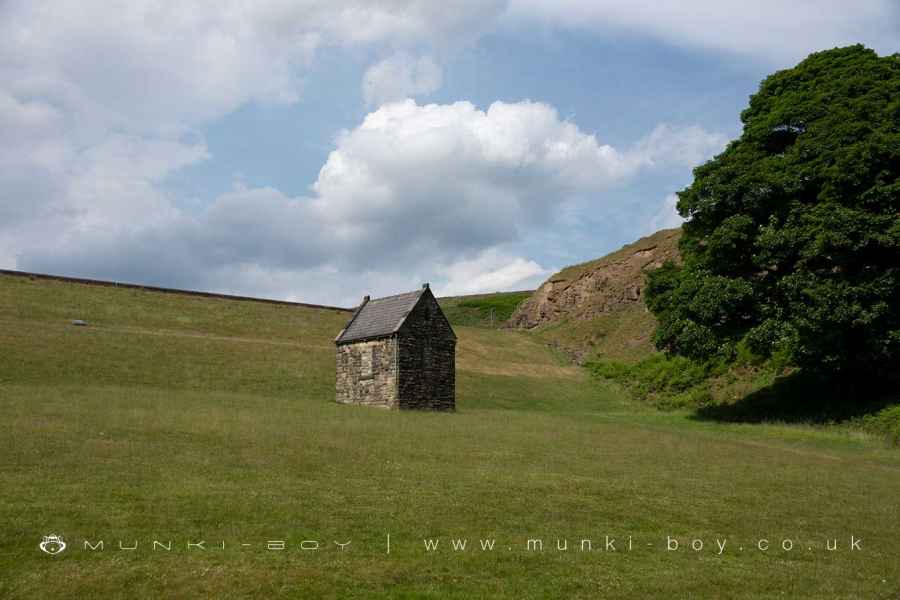
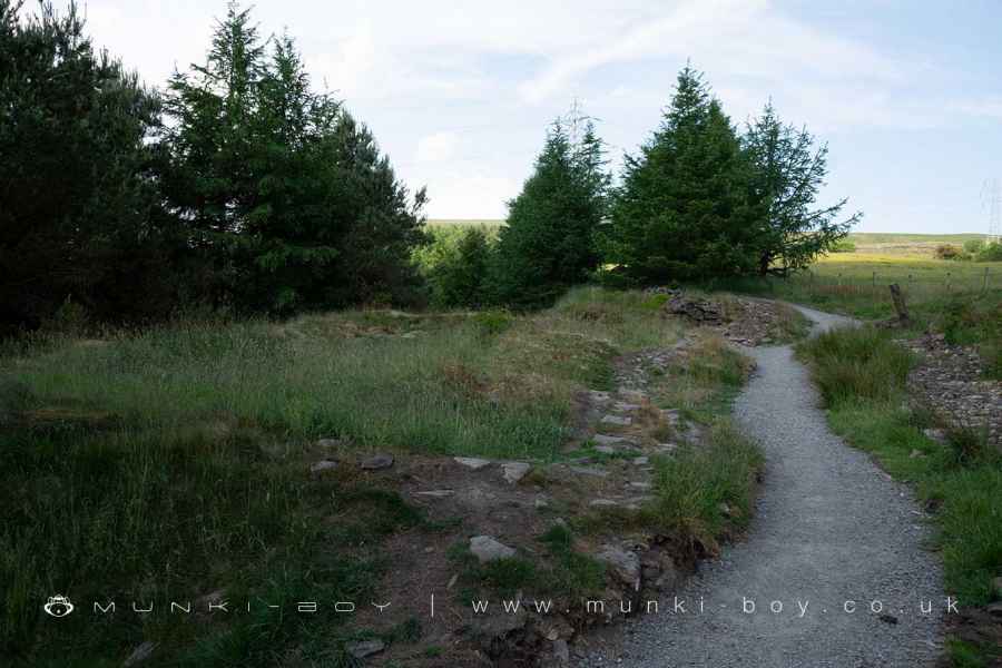
Follow across the embankment, turning left at the end as the path ascends towards conifers and small quarries on the left. After some distance the footpath passes between some stone rubble that remains from the ruin of Green Booth, another old farmstead.
After a short distance we arrive back at the car park.
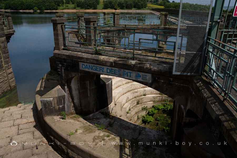
Greenbooth Reservoir Overflow Pit
Green Booth (ruin)
Naden Valley Hiking
These walks are described for educational purposes only and we make no recommendation that you follow them, do so at your own risk. We accept no liability for your safety or for the reliability of the walk, map, description or anything else.
Mist, Mines and Ruins


Own label and private label building products
We produce, brand and supply for some of the biggest names in the industry. Read more...