Brinscall Woods (Hatch Brook Waterfall Walk)
A Walk in Lancashire
Walk spec.
Difficulty: Easy (difficult optional)
Basic length: 4.5Km (approx.)
Terrain:
- Gravel tracks
- Mud tracks
- Muddy
- Optional Steep slopes
- Optional Wet stream bed
- Tarmac
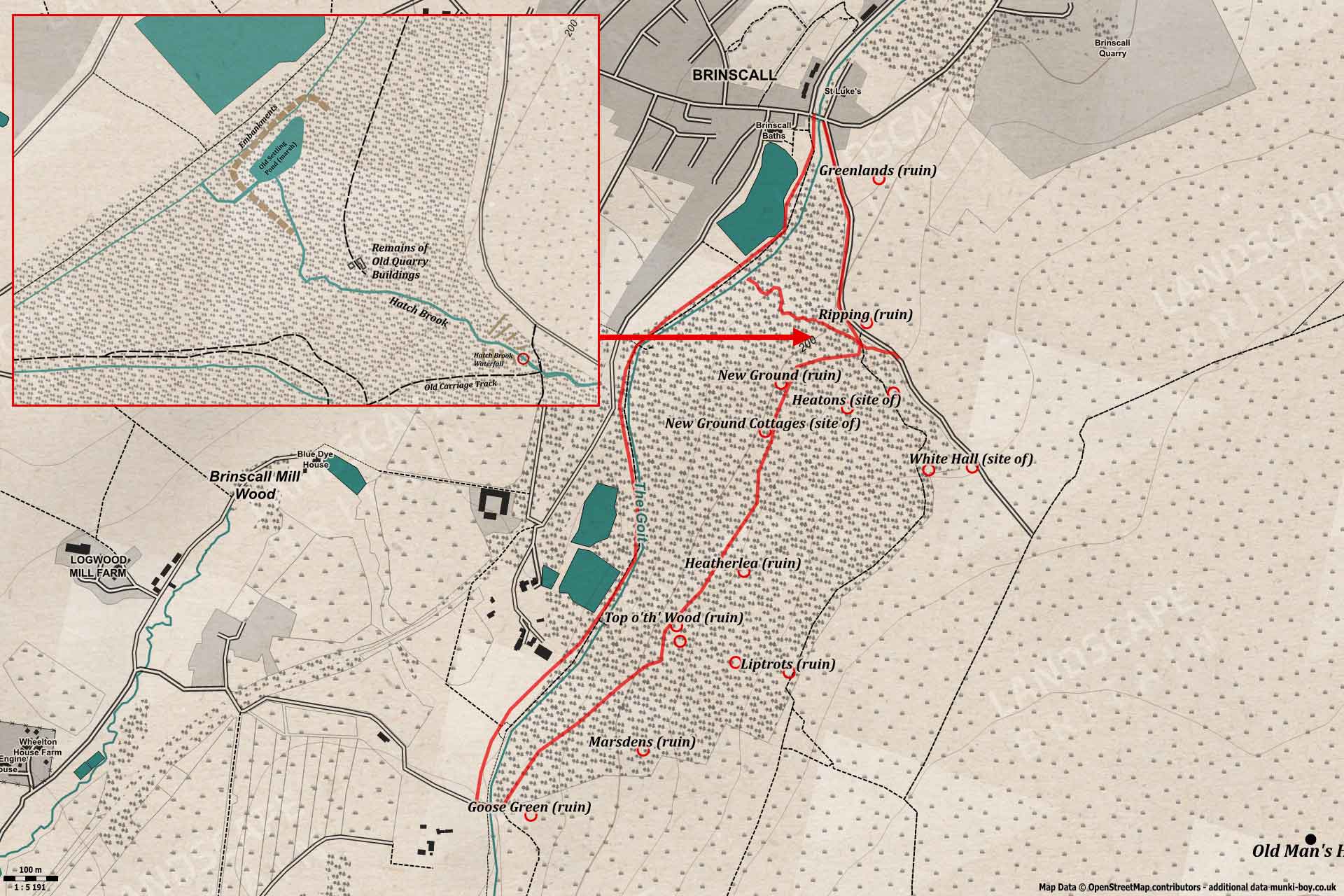
The woods at Brinscall (Wheelton Plantation) scenic and (sometimes) peaceful, are teeming with interesting ruins of old farmsteads with several that can be easily explored, others are hidden away. The Goit, an artificial stream runs along the foot of the woods while Hatch Brook goes over a waterfall on its way down through the woods. The lower path beside the Goit is prone to a bit of flooding at times, the path is partly helped by a boarded walkway.
The walk starts from the village of Brinscall where there is limited roadside parking.
Wheelton Plantation Ruins
1. Brinscall
Leaving Brinscall by the ornate iron gate leading into the picnic area beside the old reservoir and heading towards the woodland, passing the children’s play area on our left. A path enters the trees heading southwest and continuing beside the reservoir on our right. Here the Goit runs in a culvert from the reservoirs at Abbey Village to emerege a little further on at the first stone bridge.
When the further corner of the reservoir is reached, look across to the left and upslope into the trees. Here, just over the embankments of an old pond (now often marshy), the Hatch Brook comes down and spreads into the small marsh before entering the Goit.
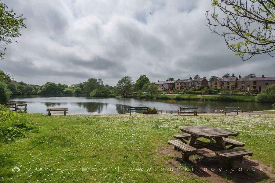
Brinscall Reservoir
2. Hatch Brook Waterfall Bottom (Optional)
This little scramble to the foot of Hatch Brook Waterfall is optional as it is not suitable for everyone who would be comfortable on the main footpath. After viewing the waterfall you’ll need to descend back down the brook to continue the walk from here. The main walk route will pass the top of the waterfall later, but it’s not “the view”. There are a couple of ways to do this but my preferred route is…
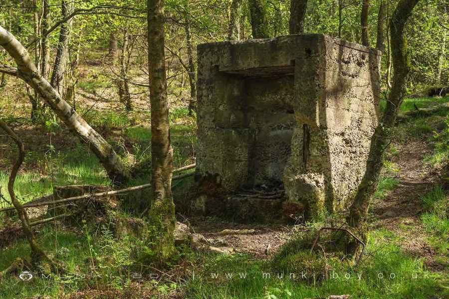
Starting from the main path and looking uphill, the lumpy ground ahead are the old embankments of a small pond, together with some water channels that had sluices. Make your way past here as best as you can - avoiding swampy ground and areas where the brook has spread out across the ground. Soon the brook can be seen in its proper bed as it goes round a couple of bends. Nearby there is a large, concrete structure of unknown purpose (unknown to me at least). On the old maps there are some old quarry buildings shown around here so it may be some part of them. Upstream from here the brook is goes through a short, narrow section before the falls come into view beyond a jumble of loose, quarried rocks.
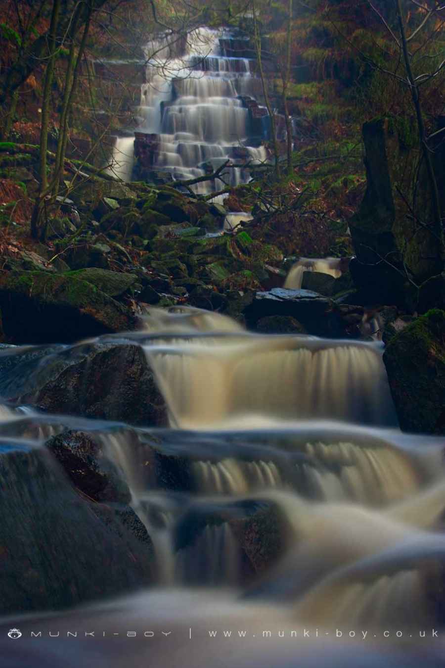
Hatch Brook and Waterfall
3. Along The Goit
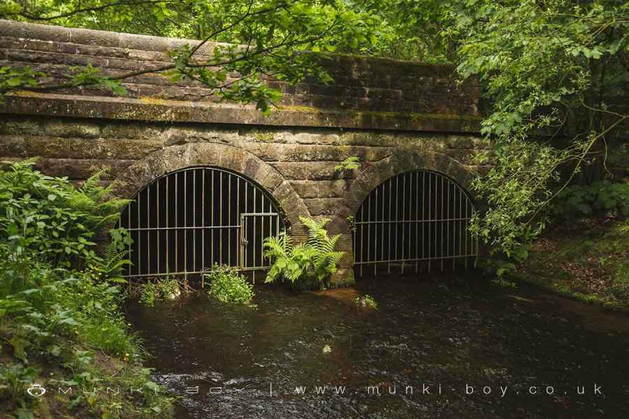
Back on the main track, and after some distance a bridge is reached, and once passed to continue straight on. The Goit will be found to have emereged from its culvert on the other side of the bridge. There are locked gates barring access to the tunnel but it goes for an impressive distance, following the foot of the hills, all the way round to Withnell at Norcross Brow. I’m not sure if they fly through but we’ve often seen Dippers going in and out.
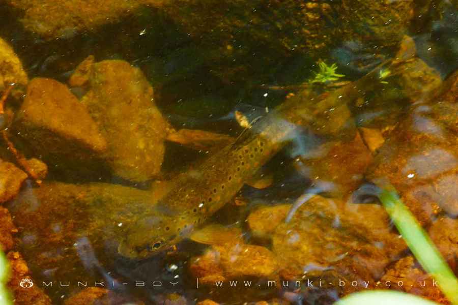
For a while the Goit looks artificial as it flows in a trough shaped ditch, but the water is shallow here and it’s often possible to see fish darting about, or somehow staying perfectly still against the flow. Further on as the path follows a bend in the river a square reservoir can be seen to the right of the track, this was once much larger and stored water for the Brinscall Hall Printworks.
Near here on the opposite side of the Goit, there is a crystal clear spring which I think might be part of the rare “limestone flush” that is just past the boundary of the woods. On the hillside above the spring the was once an old well, and there seems to be evidence of springs and water storage around the old ruins higher up still. I also have my eye on some suspect looking rocks a little further back, beside some entirely less suspect looking stonework.
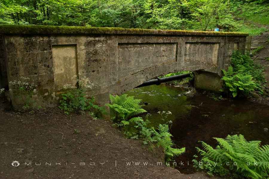
A little further along the Goit is spanned by a rather ornate concrete footbridge, although not on our route this leads to paths on the other side of the river. From here on the Goit starts to look more natural in places with greenery growing over in springtime. There is also an interesting-looking old sluice gate system the track passes over before finally reaching another stone bridge at the southern end of the woods.
The track here leads on to White Coppice but we must turn right and crossing the bridge, perhaps pausing a moment atop the stile to look up the moorland beside the woods where Goose Green farm once stood. You can pop over to take a look if you’re interested and the grass isn’t too long. The site of the farmhouse is now a small plateau-like area with the stones of the demolished buildings scattered around. Another farm Fir, stood higher up the moor and was reached via steep, hollow way that can still be made out ascending the hillside beyond.
The Goit Emerges in Wheelton Plantation
Concrete Footbridge over The Goit
A Trout Fish in The Goit
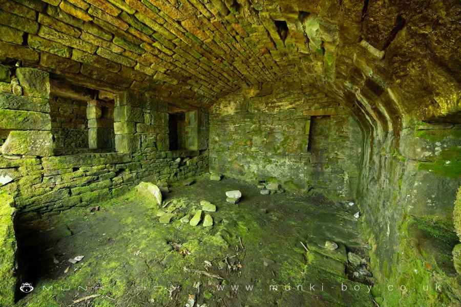
4. Ruins at Top 'o 'th Wood
Turning left once past the stone bridge and onto a path heading upwards through lovely mixed woodland and onwards heading further uphill until a sprawling area of ruins is reach, first on the right side of the track, then the left.
The ruins here represent the old farmstead “Top o’ th’ Wood” (mostly to the left) and a later mansion “Blackhurst” built on the site later (19th C.) on the right (again mostly). I think Blackhurst enveloped the remaining buildings of the former farmstead. From here we will follow the main track between the ruins heading roughly northeast, but take a look around the ruins first.
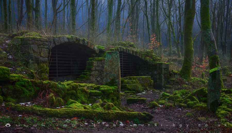
The Blackhurst ruins are the outlines and collapsed rubbleo of some former buildings with what could be a spring water source within a small arched alcove, paths around the lost gardens easily discernable, and the remains of a rock grotto with part of the entrance tunnel still intact. The “cattle byre” at Top o’ th’ Wood is perhaps the most impressive and viewable below the main path. The underground portion here is barred-off as it is home to a colony of bats.
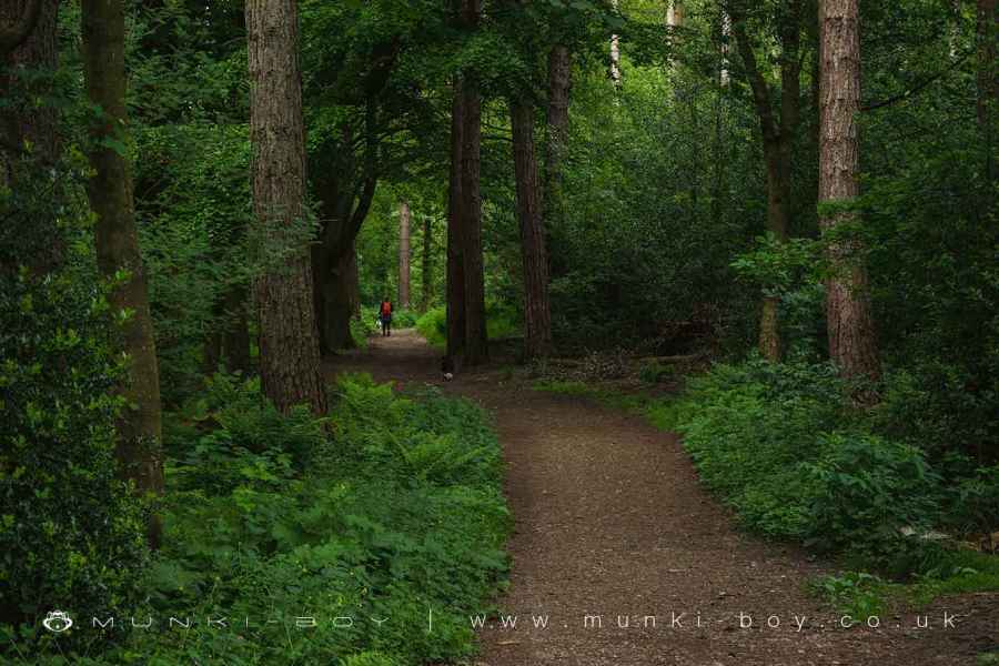
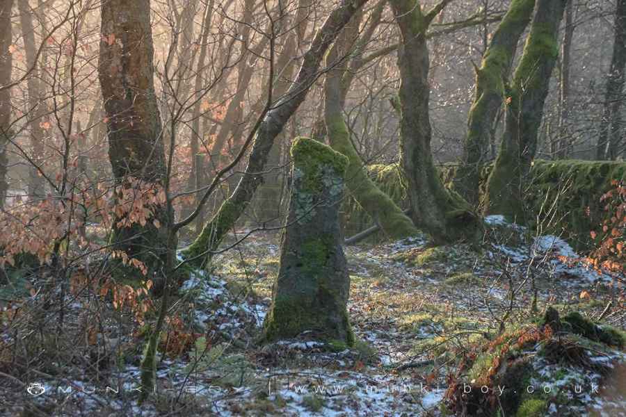
Woodland Path at Brinscall
Ruins in Brinscall Woods
5. Heatherlea
Carrying on along the main track which Clayton describes as an “old carriage track”, after some distance look out for an old overgrown track branching off to the right, just after an old drystone wall. Here, set back from the track are the ruins of Heatherlea, another large house or mansion. A small area, possibly a front garden surrounds the collapsed remains of a large, stone house. Large, stone lintels - probably from the windows - can be seen on the ground, but the most interesting features are a little further up.
Just beyond the main house ruins among some more collapsed stonework is a small tunnel, perhaps an old “covered spring”, supplying water to the house. Further up still a large, round hole is found. Marked as an old shaft on maps, this is actually an old water storage container for the property.
Take a look around if you like, then we’ll resume the walk back on the carriage track.
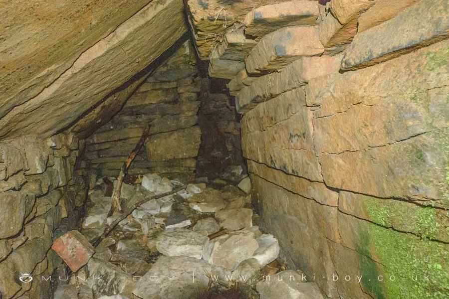
Tunnels Behind Heatherlea
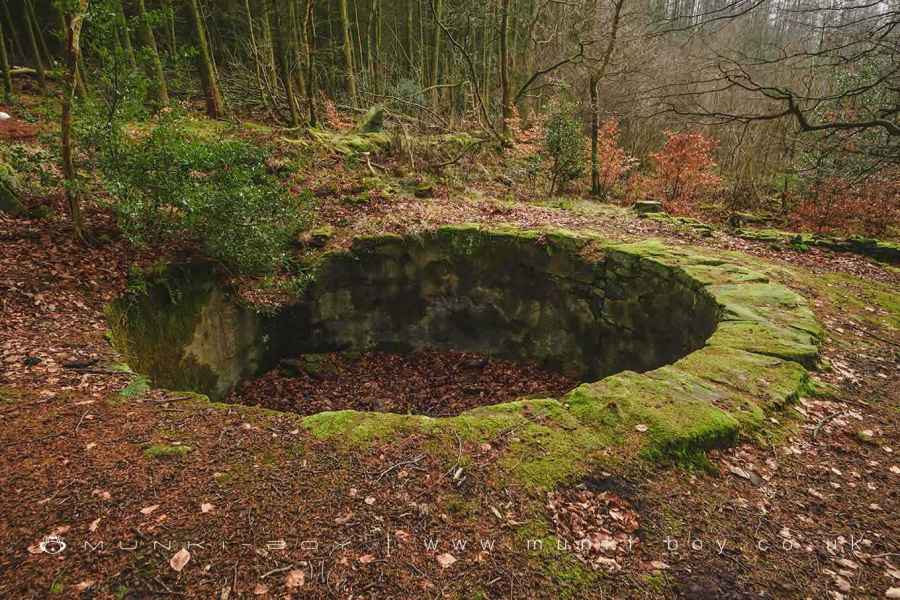
Interesting remains of an old water tank at Heatherlea
6. The Way Back
The walk back simply follows the old carriage track to the road but along the way there are several ruins beside the track (not easily explorable on the left). Including the extensive New Ground and its row of cottages which can be seen in their ever-overgrown state and Heaton’s, similarly. The hillside has been built-up on the other side and I don’t know if you can get a glimpse but there is a tall supporting wall over the downward slope.
At one point the track bends sharply right, then left as it passes over the Hatch Brook, just above the waterfall. It’s not the best view but it’s there if you didn’t fancy trekking up the brook earlier. It’s tempting to hop over but the ground is often fairly loose soil covered with dead leaves, hard to stop once you set off.
As the carriage track finally meets the tarmac of Edge Gate Lane, you can see the rubble and groundplan of Ripping, another 19th C. farm. It gets very muddy on the ground but there is a public footpath passing through if you want to take a closer look. Then it’s back down Edge Gate Lane into Brinscall village and the end of our journey.
Old Gatepost in Brinscall Woods
Old Quarry Buildings at Brinscall Woods
Wheelton Plantation Ruins
These walks are described for educational purposes only and we make no recommendation that you follow them, do so at your own risk. We accept no liability for your safety or for the reliability of the walk, map, description or anything else.
Mist, Mines and Ruins


Own label and private label building products
We produce, brand and supply for some of the biggest names in the industry. Read more...