Retail in Silsden
There are great places to visit near Silsden including some great cities, villages, woodlands, parks, historic buildings, museums, gardens, country parks, hiking areas, towns, lakes, historic monuments, hills, ancient sites, nature reserves, shopping centres, airports, bluebell woods, ruins, rivers and streams, castles, waterfalls and boroughs.
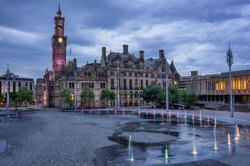
There are a number of cities near Silsden including Bradford, Leeds, and Wakefield.
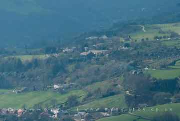
Silsden has some unmissable villages nearby like Wyke, Haworth, Oxenhope, Thornton, Manningham, Saltaire, and Ripponden.
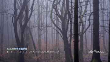
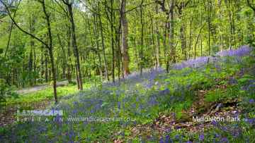
The area around Silsden features a number of interesting woodlands including Judy Woods, Chevin Forest Park, Middleton Park, and Hardcastle Crags.
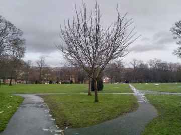
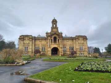
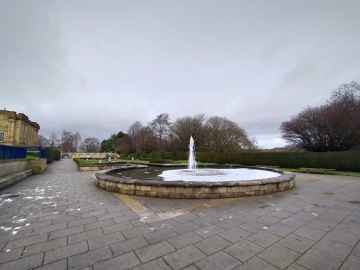
Silsden has some unmissable parks nearby like Lister Park, Cartwright Hall Gardens, Peel Park, Shibden Park, Roundhay Park, Middleton Park, and Park Square.
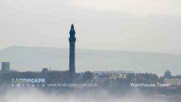
There are a number of historic buildings near Silsden including Cartwright Hall, Hewenden Viaduct, Halifax Town Hall, North Bridge - Halifax, Halifax Minister, Wainhouse Tower, and Shibden Park.
The area around Silsden features a number of interesting museums including Cartwright Hall, and Yorkshire Sculpture Park.
Cartwright Hall Gardens is a great place to visit close to Silsden if you like gardens.
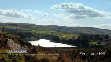
There are a several good country parks in the Silsden area like Penistone Hill Country Park, Ogden Water Country Park, Shibden Country Park, Chevin Forest Park, Golden Acre Park, Bretton Country Park, and Yorkshire Sculpture Park.
Silsden's best nearby hiking areas can be found at Penistone Hill Country Park, Colden, The Chevin, Hardcastle Crags, and Withens Clough.
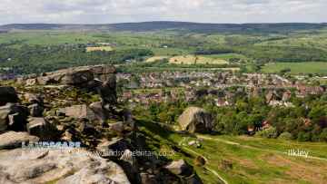
There are a number of towns near Silsden including Ilkley, Sowerby Bridge, Halifax, Todmorden, Huddersfield, Bradley, and Otley.
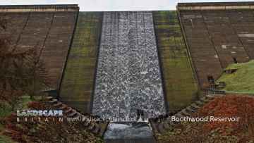
Silsden has some unmissable lakes nearby like Boothwood Reservoir, Ogden Water Country Park, Ogden Water, Shibden Park, Light Hazzles Reservoir, Warland Reservoir, and Gaddings Dam.
Wainhouse Tower, and Centre Hill Beacon Site are some of Silsden best historic monuments to visit near Silsden.
The area around Silsden features a number of interesting hills including Centre Hill, Stoodley Pike, and The Chevin.
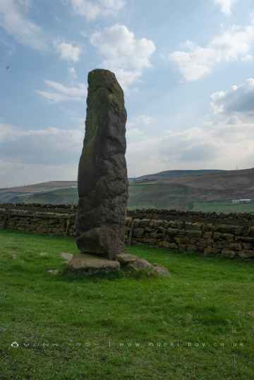
Ancient Sites to visit near Silsden include Stones Lane Standing Stones, and Centre Hill Beacon Site.
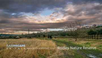
Silsden has some unmissable nature reserves nearby like Rodley Nature Reserve, RSPB St Aidan's, and Yorkshire Sculpture Park.
Trinity Leeds, White Rose Shopping Centre, The Merrion Centre, County Arcade, and Leeds Kirkgate Market are great places to visit near Silsden if you like shopping centres.
Silsden is near some unmissable airports like Leeds Bradford Airport,
Don't miss Middleton Park's bluebell woods if visiting the area around Silsden.
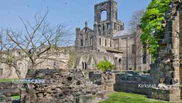
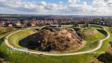
Silsden has some unmissable ruins nearby like Kirkstall Abbey, and Sandal Castle.
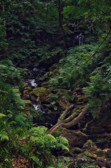
River Dearne at Bretton, Hebden Water, and Hebden Beck are some of Silsden best rivers and streams to visit near Silsden.
The area around Silsden's best castles can be found at Sandal Castle.
Waterfalls to visit near Silsden include Greenwood Lee Clough Waterfall.
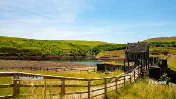
There are a number of boroughs near to Silsden including Kirklees.
Silsden History
There are some historic monuments around Silsden:
- Cup marked rock 14m from the wall on the unforested plateau at Rivock
- Round Hill, round barrow 1/2 mile (800m) NNE of Upper Austby Farm
- Recumbent gatepost with cup and ring carving 57m west of the Swastika Stone
- Cup and ring marked rock 150m west of Low Edge Farm, Bradley Moor
- Black Hill round cairn
- Cup and ring marked rock next to wall NNW of Black Pots
- Cup marked rock between Doubler Stones and Gawk Stones
- Late prehistoric enclosed settlement known as Castle Stead Ring
- Five carved rocks in Cottingley Woods, 600m NNE of Lee Farm
- Cup and ring marked rock on moor east of Gawk Stones
- Cup and ring marked rock known as the Sepulchre Stone, Addingham Moorside
- Flat carved rock 150m south west of Silver Well Cottage
- Late prehistoric enclosed settlement with an outlying bank and ditch on Counter Hill, 220m north east of Moorcock Hall
- Carved rock on bank of How Beck, east of path from West Morton to Riddlesden and 440m south west of Barn House Farm
- Cup and ring marked rock 350m SSW of Panorama Reservoir
- Barden Tower medieval fortified house and medieval garden earthworks
- Rock in Panorama Woods with single cup and ring carving
- Cup, ring and groove marked rock south of derelict wall on Bradley Moor, 70m south west of Low Edge Farm
- Ore hearth smeltmill and wood drying kiln in Lumb Clough Wood, 350m south east of Bank Foot
- Cup marked rock 39m south east of entrance to Silver Well Cottage
- Two cup and ring marked rocks in conifer plantation on Rivock
- Two carved rocks in field 130m north east of Cawder Hall Farm, Horse Close Hill
- Carved rock on bank at side of track opposite Garth House, 60m south west of Snaygill Farm
- Split and hewn cup-marked rock north of a wall junction on Rivock
- Kildwick Bridge
- Cup marked rock near wall below Rivock Edge
- Cup marked rock 47m south east of Rivock Edge triangulation pillar
- Large carved rock at hill top, north east of line of stone grouse butts on Rivock
- Rock with three cup marks 150m south west of Black Beck Hole
- Cup and ring marked rock below Brunthwaite Crag
- Five carved rocks near the edge of Rivock outcrop
- Cup and ring marked rock 370m SSW of Panorama Reservoir
- Cup marked rock east of entrance to Silver Well Cottage
- Large carved rock in the wall between grouse moor and forestry plantation on Rivock
- Cup marked rock adjacent to wall near road from East Morton to West Morton
- Cup marked rock on north side of barn, 100m north west of the Grey Stones Farm
- Cup marked rock in enclosed pasture NNE of Black Pots
- Group of four carved rocks in Panorama Woods
- Carved rock known as the Anvil Rock
- Long barrow and superimposed round cairn on Black Hill
- Subcircular enclosed settlement on Horse Close Hill 250m north of Horse Close Farm
- Cairn 290m north of Woodhead on Harden Moor
- Two prominent cup marked rock outcrops known as Doubler Stones
- Bolton Priory
- Carved rock near wall in pasture below Addingham Crag 290m south of Cragg House
- Prominent cup and ring marked rock on Coarse Stone Edge
- Rock with one cup in field south east of Great Wood Plantation, 450m north east of Cawder Hall Farm, Horse Close Hill
- Rock with one cup at the base of a wall, 250m NNE of Cawder Hall Farm, Horse Close Hill
- Cup marked rock just within afforested area north east of wall on Rivock
- Large cup and ring marked rock in forestry furrows on Rivock
- Carved rock south east of entrance to Silver Well Cottage
- Rock with at least 15 cups 240m south of Great Wood Laithe, Horse Close Hill
- Cup marked rock 1m from wall on unforested plateau at Rivock
- Cup and ring marked rock between Spicey Gill and the Ilkley-Keighley road
- Rock with one cup in east end of Great Wood Plantation, 375m NNE of Cawder Hall Farm, Horse Close Hill
- Anglo-Saxon cemetery and medieval manorial centre including fishponds and part of the open field system adjacent to St Peter's Church
- Churchyard cross at the Church of St Peter
- Cup and ring marked rock below Addingham Crag
- Rock with at least one cup mark 310m east of Cawder Hall Farm
- Cairn 330m north of Woodhead on Harden Moor
- Carved rock incorporated in and extending beyond outbuilding at Hardwick House Farm
- Low rock with one cup on unforested plateau at Rivock
- Low Moor round barrow
- Late prehistoric enclosed settlement 150m north of Shaygate Farm, Wilsden
- Late prehistoric enclosed settlement known as Catstones Ring on Catstones Hill
- Cup and ring marked rock known as Piper Crag Stone
- Cup and ring marked rock between Keighley Gate and Silver Well Cottage
- Park Hill earthwork
- Rock with single cup mark in forestry SSE of Black Pots
- Cup and ring marked rock 12.5m from drainage cut NNE of Black Pots
- Cup and ring-marked rock north east of a wall junction on the southern flank of Rivock
- Carved rock known as the Swastika Stone
- Cup and groove-marked rock on Rivock, west of a deep channel
- Cup and ring marked rock 42m east of Rivock Edge triangulation pillar
- Cup marked rock in forestry furrow on Rivock
- Cup and ring marked rock in wall at High Snaygill 80m east of High Laithe
- Cup marked rock 19m above forestry track in Rivock conifer plantation
- Rock with at least six cups 170m north west of Grey Stones Farm
- Round barrow 500ft (150m) NNW of Marchup Plantation in Parson's Lane
- Two carved rocks near Neb Stone
- Late prehistoric enclosed settlement known as Round Dykes Camp on Addingham Low Moor
- Six carved rocks in field west of Riddlesden Golf Course
- Cup and groove marked rock between East Morton and West Morton
- Ring cairn 310m north of Woodhead on Harden Moor
- Cup and ring marked rock overlooking bend in Ilkley-Keighley road, 185m south east of Neb Stone
- Cup, ring and groove marked rock at the base of a wall between East Morton and West Morton