Manningham by kelvinjay
Manningham
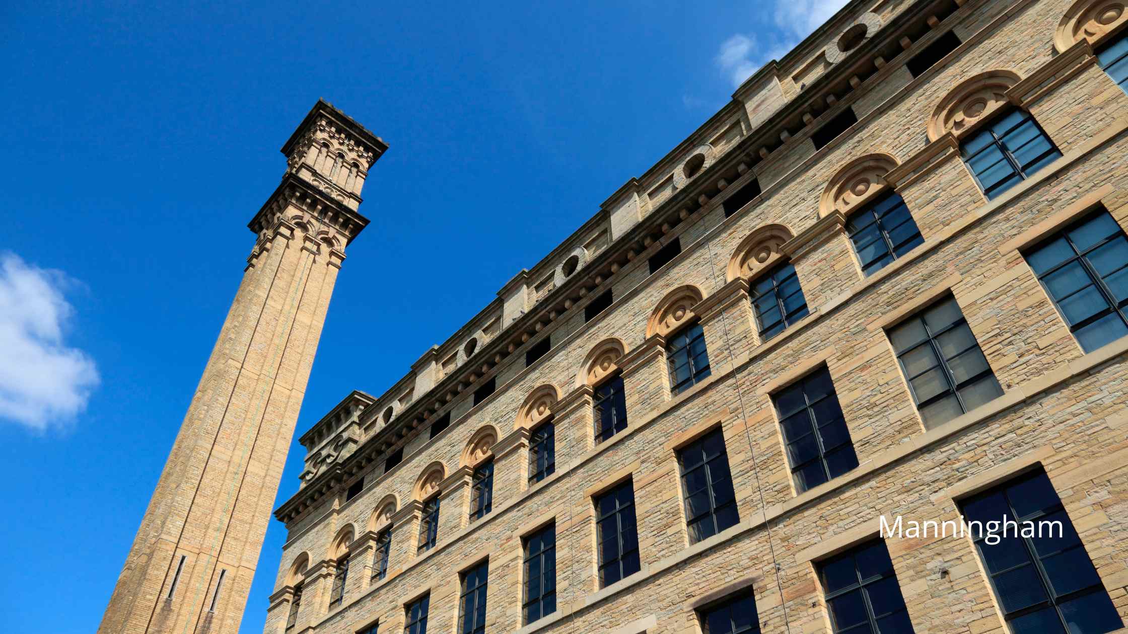
Manningham, located in Bradford, West Yorkshire, is an area rich in industrial heritage and cultural diversity. Historically a key player in the Industrial Revolution, Manningham’s landscape was once dominated by large mills and factories, reflective of Bradford’s prominence as a global center for wool and textile manufacturing. Among its most notable landmarks is Lister Mills, a stunning example of Victorian architectural grandeur. Once one of the largest silk factories in the world, this grand mill symbolized the economic prosperity of the era and the innovation within the textile industry.
Today, Manningham stands as a testament to both its industrial past and its evolving future. While the chimneys and machinery have largely fallen silent, the impressive structures like Lister Mills have found new life, repurposed into vibrant residential and commercial spaces, blending historical charm with modern living. The area around Manningham retains a bustling, urban feel, with a diverse community adding to the rich tapestry of cultures, cuisines, and traditions.
The streets of Manningham are lively, reflecting the myriad of communities that have made the area their home, each contributing to the unique urban tapestry with a variety of shops, eateries, and cultural venues. This diversity is celebrated in numerous community events and festivals, contributing to Bradford’s reputation as a city of rich cultural diversity. Despite the urban development, Manningham also offers pockets of greenery and parks, providing a tranquil escape from the city hustle and a nod to Yorkshire’s wider reputation for scenic landscapes. In this way, Manningham captures the essence of a post-industrial Northern English community — one foot in its majestic industrial past and another stepping forward into a dynamic and inclusive future.
Created: 27 October 2023 Edited: 29 November 2023
Manningham
Shopping in Manningham
Manningham Lane Retail Park Manningham, Bradford
Manningham Lane Retail Park retail park
Tesco Valley Road, Manningham
Tesco supermarket
Freshco 43, Oak Lane
Freshco supermarket
Local History around Manningham
There are some historic monuments around including:
Round cairn on east flank of Baildon HillRock with large number of cup marks south of Dobrudden caravan parkLate prehistoric enclosed settlement in Crosley Wood, Bingley, 185m north of Scourer BridgeCup and ring marked rock at Faweather Farm, High EldwickRock with single cup mark between road and Pennythorn HillEnclosed settlement known as `Soldier's Trench' including a cup-marked rockFive carved rocks in Cottingley Woods, 600m NNE of Lee FarmCarved rock near north east corner of Glovershaw quarryCarved rock above Bracken Hall Crag, north of the bottom of the track to Mitton SpringRound barrow and L-shaped earthwork on Baildon Golf CourseCup and ring marked rock in Dawson Wood, 370m north east of Heaton ShayCup marked rock 180m north of the covered reservoir at BaildonPrehistoric enclosure, carved rocks and orthostat wall, Buck Wood, 195m west of football groundBoulder with prehistoric rock art at Glovershaw FarmCup-marked rock west of confluence of Lodepit Beck and Glovershaw BeckCup and ring marked rock north of Pennythorn HillCup marked rock 60m south west of the War Memorial at Crowgill ParkCarved bedrock close to road north east of the public toilets on Bracken Hall GreenRoadblock, Bracken Hall Green, Baildon MoorRound cairn and curving bank on Pennythorn HillCup-marked rock close to road south east of a small car park south east of Bracken Hall Farm.Carved rock in spoil of shaft mound south east of Dobrudden caravan parkCup and ring marked rock at Hoyle Court Drive, CharlestownCup and groove marked rock north of Birch Close Farm house, High EldwickCairnfield including ring cairn and carved rocks on Low Plain, Baildon MoorRock with single cup mark south of Dobrudden caravan parkCup marked rock 71m south east of Dobrudden caravan parkCup-marked bedrock near Old Glen HouseNorthernmost of two cairns east of Glovershaw quarry, including adjacent cup-marked rockCup and ring marked rock east of Eaves Crag, Baildon MoorCarved rock in field behind Bracken Hall FarmCarved rock in Hawksworth SpringSmall cup-marked rock 30m east of Glovershaw quarryCup and groove-marked rock on east edge of Glovershaw quarryLate prehistoric enclosed settlement 150m north of Shaygate Farm, WilsdenCup marked rock and round cairn south east of Dobrudden caravan parkCup-marked rock between road and public toilets at Bracken Hall GreenSmall carved rock in path east of Glovershaw quarryCup-marked rock on slight bank north east of Glovershaw quarryRock with one cup mark north east of the Cricketers' Arms, Baildon GreenCup and groove marked rock in garden of Oakwood Barn, High EldwickSouthernmost of two cairns east of Glovershaw quarryCup and ring marked rock 42m south of Dobrudden caravan park.


