Retail in Apperley Bridge
There are great places to visit near Apperley Bridge including some great cities, villages, woodlands, parks, historic buildings, museums, gardens, country parks, hiking areas, towns, lakes, historic monuments, hills, ancient sites, nature reserves, shopping centres, airports, bluebell woods, ruins, rivers and streams, castles, waterfalls and boroughs.
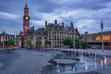
Bradford, Leeds, and Wakefield are great places to visit near Apperley Bridge if you like cities.
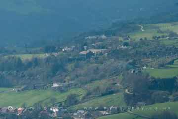
The area around Apperley Bridge features a number of interesting villages including Wyke, Haworth, Oxenhope, Thornton, Manningham, Saltaire, and Ripponden.
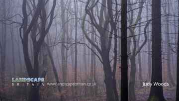
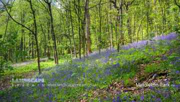
Judy Woods, Chevin Forest Park, Middleton Park, and Hardcastle Crags are some of Apperley Bridge best woodlands to visit near Apperley Bridge.
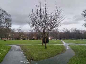
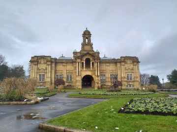
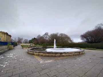
There are a number of parks near Apperley Bridge including Lister Park, Cartwright Hall Gardens, Peel Park, Shibden Park, Roundhay Park, Middleton Park, and Park Square.
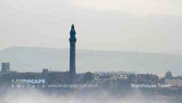
Apperley Bridge's best nearby historic buildings can be found at Cartwright Hall, Hewenden Viaduct, Halifax Town Hall, North Bridge - Halifax, Halifax Minister, Wainhouse Tower, and Shibden Park.
There are a number of museums near Apperley Bridge including Cartwright Hall, and Yorkshire Sculpture Park.
There are a number of gardens near to Apperley Bridge including Cartwright Hall Gardens.
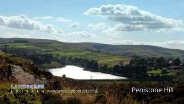
The area around Apperley Bridge features a number of interesting country parks including Penistone Hill Country Park, Ogden Water Country Park, Shibden Country Park, Chevin Forest Park, Golden Acre Park, Bretton Country Park, and Yorkshire Sculpture Park.
There are a number of hiking areas near Apperley Bridge including Penistone Hill Country Park, Colden, The Chevin, Hardcastle Crags, and Withens Clough.
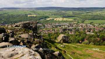
Apperley Bridge's best nearby towns can be found at Ilkley, Sowerby Bridge, Halifax, Todmorden, Huddersfield, Bradley, and Otley.
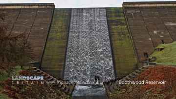
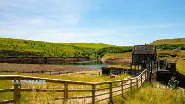
Apperley Bridge has some unmissable lakes nearby like Boothwood Reservoir, Ogden Water Country Park, Ogden Water, Shibden Park, Light Hazzles Reservoir, Warland Reservoir, and Gaddings Dam.
The area around Apperley Bridge boasts some of the best historic monuments including Wainhouse Tower, and Centre Hill Beacon Site.
Apperley Bridge's best nearby hills can be found at Centre Hill, Stoodley Pike, and The Chevin.
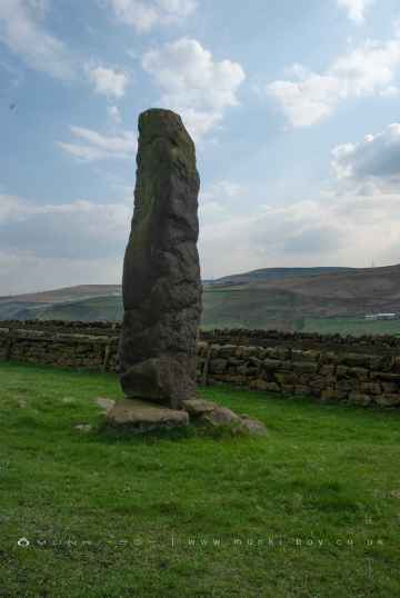
Apperley Bridge has some unmissable ancient sites nearby like Stones Lane Standing Stones, and Centre Hill Beacon Site.
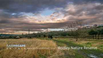
There are a several good nature reserves in the Apperley Bridge area like Rodley Nature Reserve, RSPB St Aidan's, and Yorkshire Sculpture Park.
There are a number of shopping centres near Apperley Bridge including Trinity Leeds, White Rose Shopping Centre, The Merrion Centre, County Arcade, and Leeds Kirkgate Market.
Apperley Bridge is near some unmissable airports like Leeds Bradford Airport,
The area around Apperley Bridge's best bluebell woods can be found at Middleton Park.
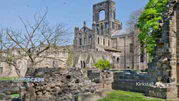
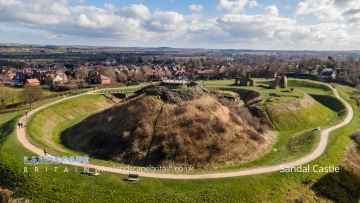
Don't miss Kirkstall Abbey, and Sandal Castle's ruins if visiting the area around Apperley Bridge.
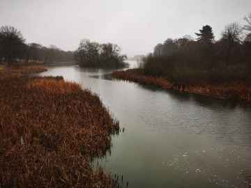
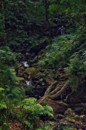
Rivers and Streams to visit near Apperley Bridge include River Dearne at Bretton, Hebden Water, and Hebden Beck.
Places near Apperley Bridge feature a number of interesting castles including Sandal Castle.
Greenwood Lee Clough Waterfall is one of Apperley Bridge's best, nearby waterfalls to visit in Apperley Bridge.
Apperley Bridge is near some unmissable boroughs like Kirklees,
Apperley Bridge History
There are some historic monuments around Apperley Bridge:
- Rock with parallel grooves 95m west of flag post on Craven Hall Hill
- Rock with two large cup marks on slope west of enclosure on Woofa Bank
- Westernmost of two carved rocks under Green Crag west of gas pipeline
- Carved rock in field behind Bracken Hall Farm
- Enclosure, fieldwalls and cairnfield, including seven carved rocks and an upright stone.
- Round barrow and L-shaped earthwork on Baildon Golf Course
- Small cup marked rock at eastern edge of a hollow 125m south east of the enclosure on Woofa Bank
- Medieval farmstead in Ireland Wood, 150m north east of Cookridge Hospital
- Cup and ring marked rock at Lanshaw; 1km WSW of High Cragg Farm
- Two cairns on Hawksworth Moor, one with an internal cist
- Two carved rocks on northern slope of ridge at Lanshaw overlooking Woofa Bank
- Carved rock in strip of trees on north side of track from Stead to Burley in Wharfedale
- Cup marked rock on slope south of Green Crag Enclosure
- Rock with large number of cup marks south of Dobrudden caravan park
- Cup and ring marked rock in Dawson Wood, 370m north east of Heaton Shay
- Enclosures, small cairnfield and carved rocks on Pancake Ridge
- Cup marked rock on low knoll west of and overlooking Cow and Calf Hotel
- Cup-marked rock between road and public toilets at Bracken Hall Green
- Rock with one cup mark north east of the Cricketers' Arms, Baildon Green
- Cup and groove-marked rock on east edge of Glovershaw quarry
- Enclosure with carved rocks and disturbed cairn known as Green Crag Enclosure
- Roadblock, Bracken Hall Green, Baildon Moor
- Cairnfield with rubble banks and carved rocks above Stead Crag
- Boulder with prehistoric rock art at Glovershaw Farm
- Cup marked rock in boulder walling between Southpiece Cottage and Bleach Mill
- Cairnfield including ring cairn and carved rocks on Low Plain, Baildon Moor
- Ring cairn 90m ESE of the Great Skirtful of Stones
- Cup and groove marked rock east of New Close Quarry, 300m south west of Whitbeck Manor
- Northernmost of two cairns east of Glovershaw quarry, including adjacent cup-marked rock
- Grubstones stone circle
- Cairnfield with linear banks and carved rocks stretching from Woofa Bank to Green Crag
- Enclosed settlement known as `Soldier's Trench' including a cup-marked rock
- Prehistoric enclosure, carved rocks and orthostat wall, Buck Wood, 195m west of football ground
- Cairn known as the Great Skirtful of Stones
- Carved rock in spoil of shaft mound south east of Dobrudden caravan park
- Rock with single cup mark between road and Pennythorn Hill
- Cup and groove marked rock 32m south west of wall near Stead Crag
- Rock with single cup mark south of Dobrudden caravan park
- Gritstone pillar with three cup marks in the north pavement of the A65 at Horsforth, 440m south east of the roundabout at Low Fold
- Small cairn and carved rock on ridge at Lanshaw overlooking Woofa Bank
- Cup marked rock with triangular groove 75m east of enclosure on Woofa Bank
- Stone hut circle settlement in Clayton Wood on the south west side of Iveson Drive
- Anti-aircraft gunsite 280m east of Carlton Hall
- Cairnfield, carved rocks and associated curved bank at north west end of Green Crag Slack, east of Gill Head Reservoir
- Rock with five cups near Haystack Rock
- Otley Bridge
- Owlcotes deserted medieval village
- Rock with two cup marks south east of quarry at Cow and Calf Rocks
- Cup-marked bedrock near Old Glen House
- Striated cup marked rock 20m west of enclosure on Woofa Bank
- Two cup marked rocks in path south east of quarry at Cow and Calf Rocks
- Cup and ring marked rock 40m south east of Hillcourt, Rawdon
- Carved rock with multiple rings in path above the Cow and Calf Hotel, 180m west of Highfield House
- Rock with cup marks 33m north east of Green Crag Enclosure
- Two adjacent carved rocks and associated rubble bank at top of ridge at Lanshaw overlooking Woofa Bank
- Cup and groove marked rock in boulder walling between Southpiece Cottage and Bleach Mill
- Cup-marked rock close to road south east of a small car park south east of Bracken Hall Farm.
- Carved rock with rounded triangular profile 48m NNW of enclosure on Woofa Bank
- Ring cairn 475m south east of the Great Skirtful of Stones
- Carved rock near north east corner of Glovershaw quarry
- Large rock with single cup mark 130m south east of and overlooking Green Crag Enclosure
- Cup and ring marked rock at Hoyle Court Drive, Charlestown
- Grooved rock on slope at Lanshaw
- Kirkstall Abbey and precinct including a prehistoric cup and ring marked rock
- Southernmost of two cairns east of Glovershaw quarry
- Cup and ring marked rock known as the Knotties Stone on Otley Chevin, 270m north east of The Royalty public house
- Cairn on Hawksworth Moor; largest one of a group of cairns
- Cup and ring marked rock north of Pennythorn Hill
- Cairn known as the Little Skirtful of Stones
- Cup and groove marked rock north of Birch Close Farm house, High Eldwick
- Cup, ring and groove marked rock 15m from south wall of Gab Wood 300m east of Moseley Farm, Cookridge
- Enclosure on Woofa Bank with 11 carved rocks and one upright stone
- Large flat rock with single cup mark 20m north west of enclosure on Woofa Bank
- Roman period native settlement in Danefield Wood, 490m south west of Stubbings Farm
- Cup-marked rock in stone quarry on Stocks Hill
- Small cairn north east of large cairn on Hawksworth Moor
- Cairn west of Craven Hall Hill
- Two cup marked rocks 220m west of Highfield House
- Rock with single cup near wall at Stead Crag
- Cup marked rock 60m south west of the War Memorial at Crowgill Park
- Cup and groove marked rock in garden of Oakwood Barn, High Eldwick
- Cup and grooved marked rock in tree line between New Close Quarry and Poppling Well Beck, 280m south west of Whitbeck Manor
- Cup marked rock 200m west of Cow and Calf Hotel
- Carved rock in Hawksworth Spring
- Cup marked rock in field south of Stead Hall Farm
- Enclosure 50m north east of Horncliff Slade on Hawksworth Moor
- Cup marked rock and round cairn south east of Dobrudden caravan park
- Round cairn on east flank of Baildon Hill
- Cup and ring marked rock 42m south of Dobrudden caravan park
- Cup and ring marked rock east of Eaves Crag, Baildon Moor
- Carved rock on Pelstone Crag 530m west of Danefield House
- Small cup-marked rock 30m east of Glovershaw quarry
- Round cairn and curving bank on Pennythorn Hill
- Roman period native settlement in Poolscar Wood, 350m south of Stubbings Farm
- Cup marked rock in Calverley Wood, 200m north east of junction of Calverley Cutting and Thornhill Drive
- Cup marked rock 71m south east of Dobrudden caravan park
- Cup and ring marked rock at Lanshaw; easternmost of Lanshaw group
- Cup-marked rock on slight bank north east of Glovershaw quarry
- Small carved rock in path east of Glovershaw quarry
- Cup and ring marked rock at Faweather Farm, High Eldwick
- Carved rock known as Planets Rock 180m north east of the Gill Head Reservoir
- Carved rock at east end of disused rifle range
- Carved bedrock close to road north east of the public toilets on Bracken Hall Green
- Cup marked rock 180m north of the covered reservoir at Baildon
- Cup and ring marked rock in Wharfemeadows Park, 280m west of Newall Hall
- Cup, ring and groove marked rock 2m south of north wall of Gab Wood 330m E of Moseley Farm, Cookridge
- Carved rock 80m east of Green Crag Enclosure