


Sourton
Sourton is a Town in the county of Devon.
There are great places to visit near Sourton including some great cities, historic buildings, villages, canals, rivers and streams, beaches, geological features, sssis, hiking areas, nature reserves, towns, parks, airports, castles and ruins.
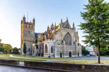
There are a number of cities near to Sourton including Exeter.
Sourton's best nearby historic buildings can be found at Exeter Cathedral, St Mary Steps, and St Stephen's Church - Exeter.
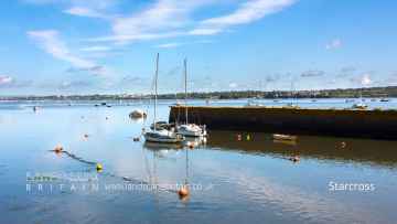
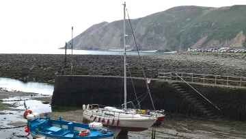
Don't miss Starcross, Lynton and Lynmouth, Littleham, Otterton, Branscombe, Beer, and Hope Cove's villages if visiting the area around Sourton.
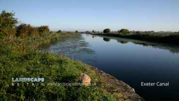
Sourton's best nearby canals can be found at Exeter Canal, and Grand Western Canal at Tiverton.
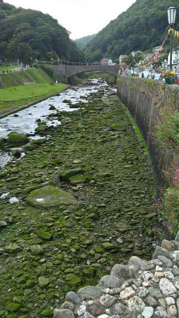
Don't miss East Lyn River's rivers and streams if visiting the area around Sourton.
Sourton's best nearby beaches can be found at Blacklands Beach, Branscombe Beach, and Hope Cove.
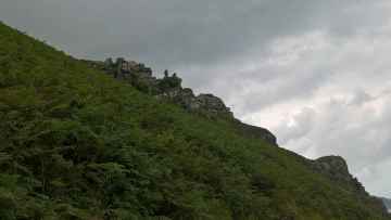
Sourton is near some unmissable geological features like Valley of Rocks,
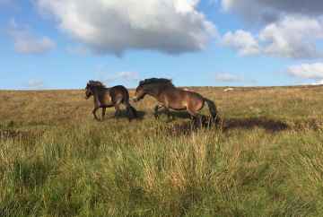
Sourton is near some unmissable sssis like Dartmoor,
Sourton is near some unmissable hiking areas like Dartmoor,
The area close to Sourton boasts some of the best nature reserves including Dartmoor.
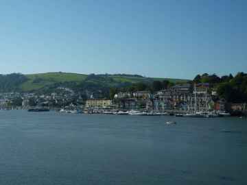
Sourton's best nearby towns can be found at Dartmouth, Tiverton, Crediton, Topsham, Budleigh Salterton, Sidmouth, and Seaton.
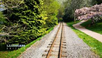
There are a several good parks in the area around Sourton like Bicton Park.
There are a several good airports in the area around Sourton like Exeter Airport.
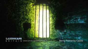
Don't miss Berry Pomeroy Castle's castles if visiting the area around Sourton.
Berry Pomeroy Castle is one of Sourton's best, nearby ruins to visit in Sourton.
Sourton History
There are some historic monuments around Sourton:
- Stone hut circle 640m south-west of Beardown Man forming part of a dispersed settlement on the eastern slope of Conies Down Tor
- Camp SE of Okehampton
- Civil War redoubt 750m south east of East Linnacombe
- Round cairn 250m south east of Standon Farm
- Ring cairn 450m south of Willsworthy Camp
- Round cairn 60m WSW of Branscombe's Loaf forming part of a cemetery on Corn Ridge summit
- Length of boundary wall and seven stone hut circles forming part of a large enclosure north-east of Ger Tor
- Two cairns forming part of a cairnfield on Longstone Hill
- Tinners' building 680m north east of Fur Tor
- Tor cairn on High Willhays summit
- Southernmost cairn forming part of a cairnfield on Longstone Hill
- Guide post at Place Cross
- Round cairn 230m south-west of White Hill summit forming part of White Hill round cairn cemetery
- Stone hut circle settlement 280m south-west of Deadlake Foot
- Round cairn 220m north of Conies Down Tor
- Bowl barrow on Wadland Down
- Cairn forming part of a cairnfield on Longstone Hill
- Northernmost stone hut circle forming part of the unenclosed stone hut circle settlement at Watern Oke
- Wayside cross in the garden hedge of Southcott Cottage, at a crossroads called Southcott Cross
- Round cairn on Standon Hill
- Round cairn 50m north west of Yes Tor summit
- A stone hut circle 430m NE of Ger Tor forming part of a settlement situated within a large enclosure
- Stone hut circle settlement 330m south east of Great Nodden
- Stone hut circle 420m south west of Lints Tor
- Ring cairn 975m south of Sourton Tors
- Ring cairn and rectangular building earthwork 940m west of Widgery Cross
- Stone hut circle 635m south-west of Beardown Man forming part of a dispersed settlement on the eastern slope of Conies Down Tor
- Round cairn 610m north east of Great Nodden
- Bowl barrow 350m south of Broomhill
- Cairn forming part of a cairnfield on Longstone Hill
- Enclosed settlement 420m south of Doetor Farm
- Two stone hut circles 310m south of Deadlake Foot
- Stone circle, cairn alignment, cider millstone and boundary ditch 410m south east of Sourton Tors
- Okehampton Artillery Range: Experimental Parapets and Redoubt
- Round cairn 590m south-west of Beardown Man lying on the eastern slope of Conies Down Tor
- Hut circles and a length of enclosure wall, forming part of a stone hut circle settlement 600m east of Nodden Gate
- Two stone hut circles 450m SSE of Ger Tor
- Stone hut circle settlement and enclosures 970m east of Ger Tor
- A double stone hut circle forming part of the unenclosed stone hut circle settlement at Watern Oke
- Round cairn 140m WSW of Branscombe's Loaf forming part of a cemetery on Corn Ridge summit
- Stone hut circle lying south of a cairnfield on Longstone Hill
- Stone hut circle settlement 580m north east of White Hill summit
- Three stone hut circles situated west of the enclosed stone hut circle settlement 260m north of Deadlake Foot
- Cairn forming part of a cairnfield on Longstone Hill
- The westernmost of four cairns forming part of the cairnfield on the western slope of White Hill
- Stone hut circle 630m north-east of Ger Tor
- Round barrow cemetery and beacon at Heathfield, 650m west of Moorlands
- Seven cairns forming part of a cairnfield on Homerton Hill
- Meldon viaduct
- Ring cairn 120m west of Branscombe's Loaf forming part of a cemetery on Corn Ridge summit
- Two circular cairns, an ovoid cairn and a ring cairn lying within an enclosure forming part of a cairnfield on Homerton Hill
- An enclosed stone hut circle settlement, three round cairns and a length of reave 650m WSW of Ger Tor
- Eighteen cairns, a length of bank and a recumbent stone forming part of a cairnfield on Longstone Hill
- Cairn and cist forming part of a cairnfield on Homerton Hill
- A stone hut circle forming part of an unenclosed settlement, and tinners' building at Watern Oke
- Cairnfield and associated earthworks on the north eastern slope of White Hill
- Ringwork, castle, town banks, site of Saxon town and defences
- Round cairn 700m south-west of Great Nodden
- Stone hut circle 370m south east of Great Nodden forming an outlying part of a stone hut circle settlement
- An enclosure boundary wall, thirteen stone hut circles and a round cairn on Nattor Down and Hamlyn's Newtake
- Two cairns forming part of a cairnfield on Longstone Hill
- Round cairn 750m NNW of East Okement Farm
- Two round cairns 540m ENE of Sourton Tors
- Cairn forming part of a cairnfield on Homerton Hill
- Hillfort and medieval settlement in South Longridge Wood
- Cairn forming part of a cairnfield on Longstone Hill
- Round cairn 380m south-west of White Hill summit, forming part of the White Hill round cairn cemetery
- Three cairns forming the westernmost part of a cairnfield on Longstone Hill
- Two cairns forming the north eastern edge of a cairnfield on the north eastern slope of White Hill
- Enclosure, two stone hut circles and an alignment of upright stones 780m north west of Little Links Tor
- Unenclosed stone hut circle settlement and associated fields north of Standon Down
- Foxhole Mine and other tinworks south east of Arms Tor
- Ring cairn 50m north-east of White Hill summit forming part of the White Hill round cairn cemetery
- Ring cairn 510m south west of Great Nodden
- Eastern of five cairns forming an outlying part of a cairnfield on the north eastern slope of White Hill
- Ring cairn 80m north-east of White Hill summit, forming part of the White Hill round cairn cemetery
- Cairn 690m south west of White Barrow
- Enclosure in Parsonage Wood
- One of five cairns forming an outlying part of a cairnfield on the north eastern slope of White Hill
- Leawood Plantation barrow
- Round cairn 190m east of Doe Tor summit
- Two cairns forming part of a cairnfield on Longstone Hill
- North easternmost cairn forming part of a cairnfield on Homerton Hill
- Two bowl barrows on East Kimber Common 525m north west of Stoney
- Two stone hut circles 675m south-west of Beardown Man forming the southern limit of a dispersed settlement on the eastern slopes of Conies Down Tor
- Enclosed stone hut circle settlement 540m east of Doe Tor
- Stone hut circle 400m south east of Great Nodden forming an outlying part of a stone hut circle settlement
- Two cairns forming part of a cairnfield on Longstone Hill
- Wayside cross at Eastcombe on the road between Durdon Cross and Eastcombe
- Round cairn and stone hut circle 950m south of Sourton Tors
- Village cross in Northlew, 40m south west of the church
- White Barrow round cairn
- Four bowl barrows 340m north west of Mount Pleasant Farm
- Enclosure and unenclosed stone hut circle settlement 510m north of Deadlake Foot
- Icework at Sourton Tors
- Two stone hut circles and a field 340m south west of Lints Tor
- Round cairn and cist on Black Down 1.6km east of Higher Bowden
- Deserted medieval site N of Okehampton camp
- Southern of five cairns forming an outlying part of a cairnfield on the north eastern slope of White Hill
- Stone hut circle 655m south-west of Beardown Man forming part of a dispersed settlement on the eastern slope of Conies Down Tor
- Two cairns forming the western edge of a cairnfield on the northern slope of White Hill
- Round cairn 765m south-west of Great Nodden
- Westernmost cairn forming part of a cairnfield on Homerton Hill
- Okehampton Castle: a motte and bailey castle with associated earthworks north of the West Okement River.
- Enclosure in Brandis Wood, 175m north of Longham
- Stone hut circle and field-plots 100m east of Ger Tor
- Three round cairns 420m south-west of White Hill summit, forming part of White Hill round cairn cemetery
- Round cairn 310m SSW of Great Links Tor
- Sixty stone hut circles forming part of an unenclosed settlement at Watern Oke
- Round cairn 340m north of Hare Tor
- Partially enclosed stone hut circle settlement 290m north west of Lints Tor
- A small stone hut circle forming part of the unenclosed stone hut circle settlement at Watern Oke
- Okehampton Artillery Range: Observation Post 6 and Incline Target Carrier Railway
- Earthworks on Brent Tor
- Cairnfield, irregular aggregate field system, a ring cairn and three round cairns 800m and 920m south of Moorgate Farm
- Round cairn 270m west of Great Nodden
- Three cairns forming part of a cairnfield on Longstone Hill
- A stone hut circle forming part of the unenclosed stone hut circle settlement at Watern Oke
- Platform cairn 30m north west of Fordsland Ledge
- Tor cairn 70m WNW of Branscombe's Loaf forming part of a cemetery on Corn Ridge summit
- Cairn forming part of a cairnfield on Homerton Hill
- Cairn forming part of a cairnfield on Longstone Hill
- Wayside cross at Durdon Cross
- Round cairn and stone cist 310m south of Walla Brook
- Two cairns forming part of a cairnfield on Longstone Hill
- Bowl barrow on Galford Down, 200m south west of Westdown Pool
- Willsworthy Pound adjacent to Willsworthy Bridge
- Eight stone hut circles and a shieling forming part of the unenclosed stone hut circle settlement at Watern Oke
- Ring cairn 460m south-west of White Hill summit, forming part of the White Hill round cairn cemetery
- Stone hut circle 630m south-west of Beardown Man forming part of a dispersed settlement on the eastern slope of Conies Down Tor
- Okehampton Roman fort, fortlet and associated enclosures
- Enclosure 1250m NNW of Standon Down
- Cairn forming part of the cairnfield on the western slope of White Hill
- A cluster of five stone hut circles situated within a large enclosure 470m north-east of Ger Tor
- Two cairns forming part of a cairnfield on Longstone Hill
- Round cairn and shelter 140m north west of Yes Tor summit
- Southern White Hill cairnfield
- Deserted medieval site NW of Okehampton camp
- Cairn forming part of a cairnfield on Longstone Hill
- Four cairns forming part of a cairnfield on Longstone Hill
- A stone hut circle 50m west of Western Red Lake
- Round cairn 540m north of White Barrow
- Ring cairn on Great Nodden summit
- Enclosure and stone hut circle 535m south-west of Beardown Man forming part of the dispersed settlement on the eastern slope of Conies Down Tor
- A double stone hut circle and enclosure 280m south of Deadlake Foot
- Round cairn 470m south east of Sourton Tors
- Ring cairn 660m north west of Little Links Tor
- Bowl barrow on East Kimber Common, 670m west of Stoney
- Lake Down cairnfield 810m ESE and 780m east of Lake Viaduct
- Stone hut circle, cairns and irregular aggregate field system 850m SSE of Sourton Tors
- Ten cairns and a length of bank forming part of a cairnfield on Homerton Hill
- Ring cairn 1060m south west of Great Nodden
- Cairn forming part of a cairnfield on Longstone Hill
- Two round cairns 840m south west of Great Nodden
- Cairnfield on the western slope of White Hill
- Broadbury Castle Roman camp
- Two stone hut circles 1000m north of Standon Down
- Round cairn 700m south of Sourton Tors
- Stone cross adjoining Fitz or Fice's Well
- Tor cairn surrounding Branscombe's Loaf forming part of a cemetery on Corn Ridge summit
- Deserted medieval settlement 750m south of White Hill summit
- Cairn forming part of a cairnfield on Homerton Hill
- Round cairn forming part of a cairnfield on Longstone Hill
- Tor cairn 180m north of High Willhays summit
- Ten stone hut circles forming part of an unenclosed settlement at Watern Oke
- Bidlake Mill and leat
- Two bowl barrows on Broadbury, 140m and 230m south of Oakfield
- Cairn forming part of a cairnfield on Longstone Hill
- Three cairns forming part of a cairnfield on Longstone Hill
- Four cairns forming part of a cairnfield on Longstone Hill
- Ring cairn 160m WNW of Branscombe's Loaf forming part of a cemetery on Corn Ridge summit
- Round cairn 300m south-west of White Hill summit, forming part of the White Hill round cairn cemetery
- Two cairns forming an outlying part of a cairnfield on the northern slope of White Hill
- A cluster of five stone hut circles and associated boundary wall situated within a large enclosure 30m north-east of Ger Tor
- Three cairns forming part of a cairnfield on Longstone Hill
- Two round cairns 715m south-west of Great Nodden
- Two cairns forming part of the cairnfield on the western slope of White Hill
- Round cairn on Black Down 410m south west of Anthony Stile
- Two cairns forming part of a cairnfield on Longstone Hill
- Cairn forming part of a cairnfield on Longstone Hill
- Alluvial tin streamwork in Lydford Woods
- The southernmost of four cairns forming part of the cairnfield on the western slope of White Hill
- Round cairn 550m SSE of Longstone Hill summit
- Stone hut circle 530m south-west of Beardown Man forming part of a dispersed settlement on the eastern slope of Conies Down Tor
- Cairn forming part of a cairnfield on Longstone Hill
- Tinners' building 90m north east of the confluence of the Brim Brook and West Okement River
- An alluvial tin streamwork adjacent to the Brim Brook
- Tinners' building lying adjacent to the Black Ridge Brook and situated 1540m NNE of Fur Tor
- Enclosed stone hut circle settlement 260m north of Deadlake Foot
- Stone hut circle 530m ESE of Nodden Gate forming an outlying part of a stone hut circle settlement
- Round cairn 340m south-west of White Hill summit, forming part of the White Hill round cairn cemetery
- Stone alignment on Conies Down
- Sourton Down Cross, 360m north east of Aliceford Farm
- Beardown Man standing stone
- Five stone hut circles forming part of an unenclosed settlement at Watern Oke
- Stone hut circle 610m ESE of Nodden Gate forming an outlying part of a stone hut circle settlement
- Unenclosed stone hut circle settlement 770m NNW of Little Links Tor
- Wheal Betsy pumping house
- Deserted medieval site 1/4 mile (400m) W of Okehampton camp
- Okehampton Artillery Range: Linear and Curved Target Railways on F Range
- Milestone N of Lower Beardon
- Deserted medieval site 1/2 mile (810m) W of Okehampton camp
- Round cairn 240m north of Ger Tor
- Gallows Hill
- Motte with two baileys and a multivallate hillfort at Burley Wood
- Medieval homesteads S of Meldon quarry
Places to see near Sourton

Lakes near Sourton
Rivers near Sourton
- Broughton Brook (South and West Somerset)
- Tributary of Back Stream (Tone Catchment)
- Hele Bk
- Tone - Wellington to Taunton
- Haywards Water
- Westford Stream
- Sherford Stream
- Tone - Upper
- Back Stream
- Halse WTR
- Allen Brook(Maiden brook)
- Hillfarrance Bk
- West Dart River (Lower)
- West Dart River (Upper)
- East Webburn River
- West Dart River (Blackbrook to Swincombe)
- Wash
- Ashburn
- East Dart River
- Hems - Upper
- West Webburn River
- Swincombe
- Avon (Devon Tidal) and Sth Hams - Blackpool
- Mardle
- Avon (Devon Tidal) and Sth Hams - Slapton
- Cherry Brook
- Hems - Lower
- Dean Burn
- Dart
- Dart (Tidal)
- Am Brook
- Webburn
- Bidwell Brook
- The Gara
- Blackbrook River
- Harbourne River
- Beadon Brook
- Lemon
- South Teign River
- Reedy Brook
- North Teign
- Fingle Brook
- Teign (Upper)
- Ugbrooke Stream
- Wray Brook
- Aller Brook (Teign) - Lower
- Kate Brook
- Scotley Brook
- Aller Brook (Teign) - Upper
- Middle Bovey
- Blackaton Brook
- Liverton Brook
- Aller Brook
- Sowton Brook
- Bramble Brook
- Lower Bovey
- Becka Brook
- Upper Bovey
- Teign (Lower)
- Sheepham Bk
- Ayleston Brook
- Lud Brook
- Lower Erme
- Erme
- Middle Barle
- Dart (Exe)
- Danes Brook
- Lower Batherm
- Upper Barle
- Exe (Haddeo to Barle)
- Burn (Exe)
- Iron Mill Stream
- Upper River Haddeo
- Upper Batherm
- Lowman
- Exe (Barle to Culm)
- North Brook (East Devon)
- Exe (Quarme to Haddeo)
- Calverleigh Stream
- Exe (Source to Quarme)
- Exe (Culm to Creedy)
- Exe (Creedy to Estuary)
- Lower Barle
- Ben Brook
- Ben Brook
- Brockey River
- Quarme
- Lower River Haddeo
- Pulham
- Sherdon Water
- Grindle Brook
- Bolham River
- Weaver
- Aylesbeare Stream
- Polly Brook
- Halberton Stream
- Fulford Water
- Lower Clyst
- Madford River
- Ken Stream
- Middle Culm
- Lower Cranny Brook
- Ford Stream (EXE)
- Spratford Stream
- Upper Clyst
- Sheldon Stream
- Upper Cranny Brook
- Upper Culm
- Lower Culm
- Kenn
- Colebrook
- Holly Water
- Alphin Brook
- Lower Yeo (Creedy)
- Matford Brook
- Ford Brook (EXE)
- Upper Creedy
- Dawlish Water
- Upper Yeo (Creedy)
- Jackmoor Brook
- Shobrooke Lake
- Lower Creedy
- Troney
- Middle Creedy
- Culvery River
- Lim
- Branscombe Stream
- Blackwater River
- Lower Axe
- Kit Brook
- Yarty
- Umborne Brook
- Upper Coly
- Upper Axe
- Offwell Brook
- Lower Coly
- Forton Brook
- Corry Brook
- West Lyn River
- Heddon
- Lower East Lyn River
- Mully Brook
- Rye Stream
- Upper East Lyn River
- Lower River Yeo (Lapford)
- Mole (Taw to Bray)
- Yeo (Molland)
- Venn
- Coney Gut
- Sterridge
- Crooked Oak
- Tributary of River Heddon
- Huntacott Water
- Taw (Source to Bullow Brook)
- Hawkridge Brook
- Newton Tracey Stream
- Taw (River Yeo to Little Dart River)
- Sturcombe River
- Bullow Brook
- Bray (Mole to Hole Water)
- Hollocombe Water
- Upper River Yeo (Barnstaple)
- Upper Caen
- Taw Estuary
- Bradwell Stream
- Upper Little Dart River
- Chelfham Stream
- Hole Water
- Knowl Water
- Badgworthy Water
- Umber
- Farley Water
- Taw (Little Dart River to River Mole)
- Lower River Yeo (Barnstaple)
- Lower Caen
- Mole (Bray to Yeo)
- Lower Little River Dart
- Burcombe Stream
- Taw (River Mole to Estuary)
- Little Silver Stream
- Dalch
- Mole (Yeo to Burcombe Stream)
- Nadrid Water
- Bradiford Water
- Langham Lake
- Bray (Source to Hole Water)
- Mole (Source to Burcombe Stream)
- Taw (Bullow Brook to River Yeo)
- Knighty Brook
- Upper River Yeo (Lapford)
- Dolton Stream
- Lower River Mere
- Kenwith Stream
- Dipple Water
- Horwood Stream
- Little Mere River
- Torridge (Dipple Water to Combe Lake)
- Wagaford Water
- Middle River Lew (Torridge)
- Iddesleigh Stream
- Middle River Okement
- Upper River Yeo (Bideford)
- West Okement
- Upper River Mere
- East Okemont River
- Langtree Lake
- Mussel Brook
- Hole Brook
- Lower River Okement
- Pulworthy Brook
- Waldon
- Torridge (Source to Dipple Water)
- Combe Lake
- Woolleigh Brook
- Whiteleigh Water
- Hookmoor Brook
- Northlew Stream
- Torridge (Lew to Estuary)
- Whitsleigh Down Brook
- Cookbury Stream
- Duntz
- Upper River Lew (Torridge)
- Torridge (Combe Lake to Lew)
- Huntshaw Water
- Lower River Yeo (Bideford)
- Lower River Lew (Torridge)
- Medland Brook
- Welcombe Stream
- Philham Water
- Abbey River
- Tamar (River Lyd to River Inny)
- Tamar (Kelly Brook)
- Lower River Lyd
- Lew (Tamar)
- Quither Brook
- Broadwood Brook
- Thrushel
- Wolf
- Upper River Lyd
- Piall
- Newton Stream
- Upper River Yealm
- Silverbridge Lake
- Lower River Yealm
- Tory Brook
- Meavy
- Lower River Plym
- Upper River Plym
- Walkham
- Burn (Tavy)
- Lumburn
- Upper River Tavy
- Lower River Tavy


