East Lyn River by munki-boy
East Lyn River
East Lyn River is in Exmoor National Park in England.
The East Lyn River is a picturesque waterway located in the county of Devon, England. Flowing through the Exmoor National Park and the town of Lynmouth, this river is known for its stunning natural beauty, diverse wildlife, and its association with the tragic flood of 1952.
Rising on the slopes of Exmoor’s rugged hills, the East Lyn River meanders its way through lush green valleys and ancient woodlands, creating a serene and enchanting landscape. The river’s source lies near the picturesque village of Brendon, where it begins its journey, tumbling over rocky outcrops and forming small cascades as it gains momentum.
As the East Lyn River makes its way downstream, it passes through a deep and narrow gorge, known as the Watersmeet. This dramatic gorge is flanked by towering cliffs covered in dense vegetation, including oak, beech, and birch trees. Walking along the riverbank, visitors are treated to breathtaking views of the river winding its way through the steep-sided valley, while the sound of rushing water fills the air.
One of the highlights of the East Lyn River is the beautiful Watersmeet House, an idyllic National Trust property nestled in the heart of the gorge. Originally a fishing lodge, it now serves as a tearoom where visitors can enjoy a cup of tea or a light snack while taking in the spectacular surroundings.
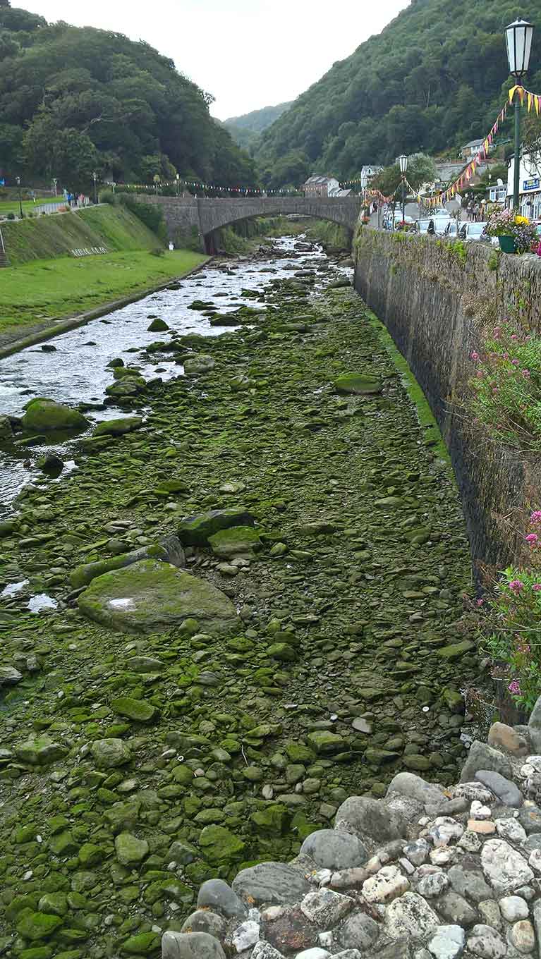
The river continues its course through the charming coastal town of Lynmouth, where it flows into the Bristol Channel. Lynmouth is a popular destination for tourists, offering a range of activities such as boat trips, coastal walks, and exploring the quaint village shops. The East Lyn River adds to the town’s appeal, as it meanders through the center, providing a picturesque backdrop to the charming streets and buildings.
Despite its serene appearance, the East Lyn River holds a tragic history. On August 15, 1952, the river experienced a devastating flood that swept through Lynmouth, causing significant damage and claiming the lives of 34 people. The flood was a result of heavy rainfall combined with the steep slopes and narrow valley of the river, leading to a rapid surge of water that overwhelmed the town. The disaster remains a significant event in the history of Lynmouth and is memorialized through a plaque in the town.
Today, the East Lyn River stands as a symbol of resilience and natural beauty. It continues to attract visitors who come to admire its scenic landscapes, indulge in outdoor activities, and appreciate the tranquility it offers. Whether it’s hiking along the riverbanks, birdwatching, or simply enjoying the calming sounds of flowing water, the East Lyn River provides a captivating experience for nature lovers and adventurers alike.
Created: 29 March 2021 Edited: 29 November 2023
East Lyn River
Lower East Lyn River Details
Lower East Lyn River
Lower East Lyn River is a river in Devon
Lower East Lyn River takes in water from an area around 15.563 km2 in size and is part of the Taw and North Devon Streams catchment area.
Lower East Lyn River is 10.613 km long and is not designated artificial or heavily modified.


