


Moortown - Devon
Moortown - Devon is a Village in the county of Devon.
Moortown - Devon postcode: PL19 9JZ
There are great places to visit near Moortown - Devon including some great cities, historic buildings, villages, canals, rivers and streams, beaches, geological features, sssis, hiking areas, nature reserves, towns, parks, airports, castles and ruins.
The area around Moortown - Devon's best cities can be found at Exeter.
The area around Moortown - Devon features a number of interesting historic buildings including Exeter Cathedral, St Mary Steps, and St Stephen's Church - Exeter.
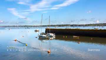
The area around Moortown - Devon features a number of interesting villages including Starcross, Lynton and Lynmouth, Littleham, Otterton, Branscombe, Beer, and Hope Cove.
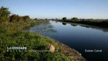
Exeter Canal, and Grand Western Canal at Tiverton are some of Moortown - Devon best canals to visit near Moortown - Devon.
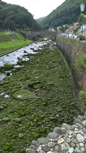
Places near Moortown - Devon feature a number of interesting rivers and streams including East Lyn River.
Blacklands Beach, Branscombe Beach, and Hope Cove are great places to visit near Moortown - Devon if you like beaches.
The area around Moortown - Devon's best geological features can be found at Valley of Rocks.
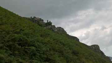
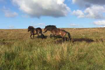
Dartmoor is one of Moortown - Devon's best, nearby sssis to visit in Moortown - Devon.
Dartmoor is one of Moortown - Devon's best, nearby hiking areas to visit in Moortown - Devon.
Don't miss Dartmoor's nature reserves if visiting the area around Moortown - Devon.
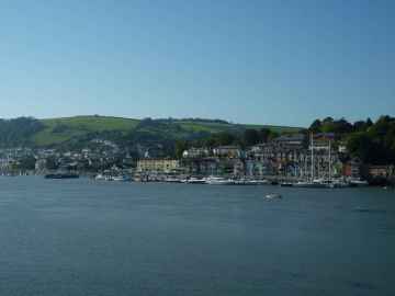
Towns to visit near Moortown - Devon include Dartmouth, Tiverton, Crediton, Topsham, Budleigh Salterton, Sidmouth, and Seaton.
Don't miss Bicton Park's parks if visiting the area around Moortown - Devon.
Exeter Airport is a great place to visit close to Moortown - Devon if you like airports.
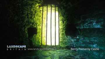
Castles to visit near Moortown - Devon include Berry Pomeroy Castle.
Berry Pomeroy Castle is a great place to visit close to Moortown - Devon if you like ruins.
Moortown - Devon History
There are some historic monuments around Moortown - Devon:
- A small stone hut circle forming part of the unenclosed stone hut circle settlement at Watern Oke
- Four round cairns 1060m south east of Great Trowlesworthy Tor
- Enclosure west of Shell Top
- Length of reave 290m north of Feather Tor, forming part of a coaxial field system on Whitchurch Common
- Two pillow mounds 640m ENE of Trowlesworthy Warren House forming part of Trowlesworthy Warren
- Two enclosures and a length of the Eylesbarrow watershed reave 800m WSW of Eylesbarrow
- Stone hut circle 500m ENE of Merrivale Bridge, forming part of a partially enclosed stone hut circle settlement
- Two cairns forming an outlying part of a cairnfield on the northern slope of White Hill
- Enclosure and stone hut circle 160m south east of Broad Hole
- An unenclosed stone hut circle settlement 760m north east of Trowlesworthy Warren House
- Unenclosed stone hut circle settlement and tinners' buildings west of Dead Lake
- Two stone hut circles 675m south-west of Beardown Man forming the southern limit of a dispersed settlement on the eastern slopes of Conies Down Tor
- Vermin trap immediately south west of Legis Tor forming part of Legistor Warren
- Vermin trap 700m ENE of Trowlesworthy Warren House, forming part of Trowlesworthy Warren
- Cairnfield and enclosure 725m east of Cuckoo Rock
- Cairn south-west of Gutter Tor
- Stone hut circle forming an outlying part of a large stone hut circle settlement east of Raddick Lane
- Agglomerated enclosure with hut circles south-west of Ditsworthy Clam
- Pillow mound 100m south east of Great Trowlesworthy Tor, forming part of Trowlesworthy Warren
- Round barrow NW of Saddlesborough
- Stone hut circle 210m south of the Ordnance Survey triangulation pillar on Cox Tor
- Pound and hut circles N of Down Tor
- Cairn with a cist south-west of Drizzlecombe Stone Alignments
- Keaglesborough Mine and Riddipit farmstead 850m north east of Norsworthy Bridge
- Blackaton Cross: a wayside cross 1.25km north of Lee Moor Village
- One of five cairns forming an outlying part of a cairnfield on the north eastern slope of White Hill
- Enclosures and hut circles N of White Tor
- Stone hut circle settlement, irregular aggregate field system, two long houses and a medieval and post-medieval field system 700m SSW of Black Tor
- Pillow mound 450m west of Hen Tor forming part of Hentor Warren
- Stone hut circle 660m east of Roos Tor
- Buckland Abbey
- Settlement on Wigford Down S of Durance
- Three pillow mounds and a linear gully 200m north of Great Trowlesworthy Tor forming part of Trowlesworthy Warren
- Pillow mound 760m ENE of Trowlesworthy Warren House, forming part of Trowlesworthy Warren
- Vermin trap and length of reave 980m ESE of Trowlesworthy Warren House
- The Remains of Longstone Manor House, Wind Strew and associated features
- Vermin trap 490m south of Trowlesworthy Warren House forming part of Trowlesworthy Warren
- An enclosure containing two stone hut circles forming an outlying part of a large stone hut circle settlement in Raddick Plantation
- Cairn with a cist, one of several on the western edge of Lee Moor
- Two round cairns 120m south-east of Langstone Moor stone circle
- Stone hut circle 500m north of Wedlake Farm
- Partially enclosed stone hut circle settlement and post-medieval warren structures on the western slope of Little and Great Trowlesworthy Tors
- Part of Eylesbarrow Reave
- Camp NE of Berra Tor
- Stone hut circle north of Hentor Brook
- Cairn east of Ringmoor Cottage
- Southernmost stone hut circle forming part of the settlement on Langstone Moor
- Cairn adjacent to the south side of Eylesbarrow Reave
- Three stone hut circles situated west of the enclosed stone hut circle settlement 260m north of Deadlake Foot
- Stone hut circle settlement 900m west of Devil's Bridge
- Warren at Sheeps Tor, 520m north of Chubstone Cottage
- Wayside cross 910m ESE of Crazy Well Pool
- Beardown Man standing stone
- Enclosed settlement 380m south west of Raddick Hill summit
- Round cairn 340m east of White Tor summit
- Three round cairns 310m south of White Tor summit
- An enclosure boundary wall, thirteen stone hut circles and a round cairn on Nattor Down and Hamlyn's Newtake
- Medieval settlement on Peek Hill, 240m and 280m north east of Lowery Tor
- Enclosed stone hut circle settlement 540m east of Doe Tor
- Stone hut circle north-east of Hentor Brook
- Stone hut circle settlement 580m north east of White Hill summit
- Two stone hut circles 570m south-east of Roos Tor
- Stone hut circle 635m south-west of Beardown Man forming part of a dispersed settlement on the eastern slope of Conies Down Tor
- Stone cross SW of church
- Cairnfield and associated earthworks on the north eastern slope of White Hill
- Tor cairn 170m south of Cox Tor summit forming part of a round cairn cemetery
- Two concentric stone circles on Langstone Moor
- Huckworthy Cross: a wayside cross 1.4km SSW of Sampford Spiney village
- A stone hut circle 430m NE of Ger Tor forming part of a settlement situated within a large enclosure
- Cairn with a cist, one of several cairns on Lee Moor
- Prehistoric settlement, field system, cairn and three pillow mounds, 290m north east of Merrivale Bridge
- One of three stone hut circles 500m SSE of Legis Tor
- Three round barrows E of Grenna Ball
- Unenclosed stone hut circle settlement 370m south west of Routrundle
- Cairn south of Eylesbarrow Reave
- Round cairn 300m south-west of White Hill summit, forming part of the White Hill round cairn cemetery
- Stone hut circle 350m north-east of Sharpitor forming part of a stone hut circle settlement
- Three hut circles NW of Cadworthy
- Earthworks on Brent Tor
- Round cairn east of Down Tor, 770m north east of Combshead Tor
- Stone hut circle 155m east of Sharpitor
- Parallel reave and two enclosures, east of Roughtor parallel reave
- Tinners' building lying adjacent to the Black Ridge Brook and situated 1540m NNE of Fur Tor
- Pillow mound 620m ESE of Legis Tor forming part of Willings Walls Warren
- Pixies' Cross: a wayside cross and associated earthwork enclosure on Whitchurch Down
- A stone alignment, kerbed cairn, prehistoric settlement, four pillow mounds, a vermin trap and animal runs 720m south west of Great Trowlesworthy Tor
- Enclosed settlement 400m west of Raddick Hill summit
- Round cairn 685m north-east of Sharpitor summit
- Length of boundary wall and seven stone hut circles forming part of a large enclosure north-east of Ger Tor
- Pillow mound 700m north east of Merrivale Bridge, forming part of Merrivale Warren
- Shaugh Prior village cross: a wayside cross at the road junction 150m east of the parish church
- Stone alignment on Conies Down
- Prehistoric settlement, three round cairns and a post-medieval rabbit warren at Legis Tor
- Three round cairns 370m ENE of Down Tor
- Stone alignment, two round cairns and a length of Walkhampton Common reave lying in a valley between Sharpitor and Leeden Tor
- Round cairn 170m north of the Ordnance Survey triangulation pillar on Cox Tor
- Enclosed stone hut circle settlement 200m east of Leeden Tor
- Stone hut circle forming part of the settlement on Langstone Moor
- Cairnfield and two stone hut circles 490m and 550m south west of Cox Tor
- Part of Eylesbarrow Reave
- Routrundle Pound
- Seven stone hut circles, a length of field boundary and a clearance cairn forming part of the settlement on Langstone Moor
- Hut circles W of Saddlesborough
- Windy Post: a wayside cross on open moorland 1.8km north of Sampford Spiney village
- Stone hut circle settlement and enclosures 970m east of Ger Tor
- Unenclosed stone hut circle settlement on Walkhampton Common, 1000m north east of Leeden Tor
- Cairn south-east of Nattor
- One of a group of three cairns on Ringmoor Down
- Greenwell Girt socket stone 600m SSW of Lovaton hamlet
- Enclosed settlement 280m south-west of the Ordnance Survey triangulation pillar on Cox Tor
- Two pillow mounds and a small area of tin streamwork earthworks 770m north of Blackaton Cross, forming part of Trowlesworthy Warren
- Wayside cross 130m ESE of Crazy Well Pool
- Partially enclosed stone hut circle settlement, two cairns and a route marker 325m north west of Yellowmeade Farm
- A double stone hut circle and enclosure 280m south of Deadlake Foot
- A double stone alignment and three cairns south-west of Black Tor
- Pound and hut circles N of Hawk's Tor
- Two cairns forming the western edge of a cairnfield on the northern slope of White Hill
- A stone hut circle forming part of the unenclosed stone hut circle settlement at Watern Oke
- Cairn 550m south-west of Raddick Hill summit forming part of a cairnfield
- Eight stone hut circles and two enclosures forming part of an unenclosed settlement 580m south of Leeden Tor
- Cairn east of Scout Hut
- Two stone hut circles and a length of walling 240m south west of Yellowmeade Farm
- Round cairn 240m north of Ger Tor
- Unenclosed stone hut circle settlement 200m west of Yellowmeade Farm
- Cairn south-east of Ringmoor Cottage
- Stone hut circle 640m south-west of Beardown Man forming part of a dispersed settlement on the eastern slope of Conies Down Tor
- Stone alignment and cairn 830m east of Down Tor
- Round cairn 190m east of Cross Gate
- Cairn and cist on Barn Hill, 840m north east of Moortown Farm
- Two lengths of reave, two stone hut circles, a round cairn and stone alignment on Walkhampton Common
- Bowl barrow 570m east of The Firs, forming part of a round barrow cemetery at Heathfield
- Stone row NW of Saddlesborough
- Two pillow mounds 660m ENE of Merrivale Bridge, forming part of Merrivale Warren
- Pounds and hut circles N of Saddlesborough
- Twelve cairns, a lynchet and a boundary bank forming part of a cairnfield 440m south-west of Raddick Hill summit
- A stone hut circle forming part of an unenclosed settlement, and tinners' building at Watern Oke
- Eight stone hut circles and a shieling forming part of the unenclosed stone hut circle settlement at Watern Oke
- Enclosure and stone hut circle 535m south-west of Beardown Man forming part of the dispersed settlement on the eastern slope of Conies Down Tor
- Vermin trap 90m west of Great Trowlesworthy Tor, forming part of Trowlesworthy Warren
- Cairn 410m south-west of White Tor summit
- Round cairn 590m south-west of Beardown Man lying on the eastern slope of Conies Down Tor
- Part of Eylesbarrow watershed reave
- Two cairns forming part of the cairnfield on the western slope of White Hill
- Brisworthy stone circle
- Pillow mound 540m east of Trowlesworthy Warren House forming part of Trowlesworthy Warren
- White Tor camp, Cudlipptown Down
- Prehistoric enclosed settlement 950m north east of Ditsworthy Warren House
- Enclosure with hut circles on Eastern Tor
- Enclosure east of Down Tor, 740m north east of Combshead Tor
- Tavistock Abbey
- Hentor Warren boundary stone standing on Lee Moor 860m south west of Hen Tor
- Enclosed stone hut circle settlement on the south slope of White Tor
- Eastern of five cairns forming an outlying part of a cairnfield on the north eastern slope of White Hill
- An enclosure and three stone hut circles 550m ENE of Merrivale Bridge, forming part of a partially enclosed stone hut circle settlement
- Stone hut circle settlement 280m south-west of Deadlake Foot
- Prehistoric enclosures on Dewerstone Hill, 500m south east of Dewerstone Cottage
- Platform cairn 60m north of Raddick Hill summit
- Round cairn 1100m ENE of Wedlake Farm
- Pillow mound 860m SSE of Trowlesworthy Warren House, forming part of Trowlesworthy Warren
- A partially enclosed stone hut circle settlement, round cairn, post medieval farmstead, millstone and stone cutting pits 580m ESE of Merrivale Bridge
- A cluster of five stone hut circles and associated boundary wall situated within a large enclosure 30m north-east of Ger Tor
- Pillow mound 770m ENE of Merrivale Bridge, forming part of Merrivale Warren
- A ring cairn 490m north east of Great Trowlesworthy Tor
- Stone hut circle 360m NNE of Hart Tor forming part of an unenclosed stone hut circle settlement
- Round cairn 340m south-west of White Hill summit, forming part of the White Hill round cairn cemetery
- A stone hut circle 50m west of Western Red Lake
- Stone alignment, five cairns, two stone hut circles and a length of reave 600m north east of Horseyeatt
- Walkhampton Church House cross: a wayside cross on the east side of Church House, 650m north east of Walkhampton village
- Partially enclosed stone hut circle settlement south of Foggintor Quarries, 1140m ENE of Criptor
- Pillow mound 530m north east of Merrivale Bridge, forming part of Merrivale Warren
- Pillow mound 900m SSW of Little Mis Tor, forming part of Merrivale Warren
- Cairn north east of Yellowmead stone circles
- Pillow mound 610m SSW of Ditsworthy Warren House forming part of Willings Walls Warren
- Cairn 590m south-west of Raddick Hill summit forming part of a cairnfield
- Stone hut circle 600m south-east of Roos Tor
- Round cairn 330m north of the Ordance Survey triangulation pillar on Cox Tor
- Three pillow mounds and a military training pit 1000m ENE of Merrivale Bridge
- Round cairn 540m north of White Barrow
- Ring cairn 80m north-east of White Hill summit, forming part of the White Hill round cairn cemetery
- Southern White Hill cairnfield
- A length of the Great Western Reave, a prehistoric settlement, three cairns and two field systems on Walkhampton Common
- Two stone hut circles 160m south of Down Tor
- Cairn 800m ENE of Big Pond
- Enclosed stone hut circle settlement on the south-east slope of Conies Down Tor
- Cairn with a cist north of Whittenknowles Rocks
- Cairn with a cist north of Drizzlecombe stone alignments
- Round cairn 380m NNW of Sharpitor summit
- Cairn south-east of Ringmoor Cottage
- Round cairn and cist 440m east of White Tor summit
- Part of Eylesbarrow Reave
- Crazy Well Farmstead, 420m south of Crazy Well Pool
- Stone hut circle settlement 250m east of Cuckoo Rock
- An enclosure, stone hut circle, rectangular building and `V'-shaped gully 410m east of Trowlesworthy Warren House
- Stone hut circle situated on the north eastern edge of an unenclosed stone hut circle settlement 1180m south of North Hessary Tor
- Vermin trap 730m ENE of Trowlesworthy Warren House, forming part of Trowlesworthy Warren
- Pillow mound 860m NNW of Blackaton Cross, forming part of Trowlesworthy Warren
- Vermin trap 130m west of Great Trowlesworthy Tor, forming part of Trowlesworthy Warren
- Stone hut circle forming part of an unenclosed stone hut circle settlement on the north-east slope of Cox Tor
- Stone hut circle 270m north of Hart Tor forming part of an unenclosed stone hut circle settlement
- Large stone hut circle settlement, an irregular aggregate field system, post-medieval farmstead and associated remains east of Raddick Lane
- Cairn and cist 370m east of Trowlesworthy Warren House
- Two ring cairns 250m north of the Ordnance Survey triangulation pillar on Cox Tor
- Pillow mound 630m east of Legis Tor forming part of Willings Walls Warren
- Two stamping mills 200m and 175m north of Norsworthy Bridge
- Enclosures and hut circles N of Tory Brook Head
- Two cairns forming the north eastern edge of a cairnfield on the north eastern slope of White Hill
- Cairn and cist 150m north of Vixen Tor
- Agglomerated enclosure with hut circles and later farmstead at Whittenknowles Rocks
- Prehistoric settlement 610m south west of Cox Tor
- An unenclosed stone hut circle settlement, an irregular aggregate field system, a length of reave and an enclosure on the south east slope of Leeden Tor
- Two enclosed stone hut circle settlements 300m south of Broad Hole
- Stone hut circle 630m north-east of Ger Tor
- One of a group of three cairns on Ringmoor Down
- Round cairn 560m south east of Little Staple Tor
- Yellowmead stone circles, cairn and stone alignment
- Tin mill, tinwork and post-medieval farmstead at Outcombe, 260m east of eastern boundary of Roughtor Plantation
- Stone hut circle 655m south-west of Beardown Man forming part of a dispersed settlement on the eastern slope of Conies Down Tor
- Pillow mound on Langstone Moor, 870m south east of White Tor
- Cairnfield on the western slope of White Hill
- Riddipit hull 700m WSW of the northern end of Raddick Lane
- Stone hut circle 380m south-west of Devil's Bridge
- Two enclosures and a cairnfield 180m north east of Crazy Well Pool
- Two stone hut circles, a length of boundary bank and a short length of the Devonport Leat 380m WNW of Raddick Hill summit
- Prehistoric coaxial field system and cairns, an historic enclosure and part of RAF Sharpitor, situated on and around Peek Hill
- Enclosure 1250m NNW of Standon Down
- Round cairn east of Whittenknowles Rocks, 960m ENE of Gutter Tor
- Three round cairns 610m south west of Black Tor
- Two stone hut circles, a reave, round cairn and shelter south east of Sharpitor
- Stone hut circle 390m south west of Yellowmeade Farm
- Roughtor parallel reave
- Stone hut circle 930m ENE of Big Pond
- Two round cairns 140m south-west of Raddick Hill summit
- A partially enclosed stone hut circle settlement 330m south west of Hen Tor
- Alluvial tin streamwork in Lydford Woods
- Rectangular building 420m north west of Hen Tor, forming an outlying part of Hentor Farm
- Sixteen stone hut circles forming part of an unenclosed stone hut circle settlement on the north-east slope of Cox Tor
- A prehistoric and historic archaeological landscape within Merrivale Newtake
- Round cairn 100m south of Down Tor
- Cairn with a cist north-east of Drizzlecombe
- Pillow mound 210m east of Great Trowlesworthy Tor, forming part of Trowlesworthy Warren
- Round cairn 230m south-west of White Hill summit forming part of White Hill round cairn cemetery
- Vermin trap 800m south east of Trowlesworthy Warren House forming part of Trowlesworthy Warren
- Trendle earthwork NE of Kelly College
- Stone hut circle 510m NNE of Hart Tor forming part of an unenclosed stone hut circle settlement
- A ring cairn on Longash Common lying 400m south east of Merrivale Bridge
- Round barrow on North Hessary Tor
- Settlement on Wigford Down
- Unenclosed stone hut settlement south-west of Gutter Tor
- Pillow mound 225m north west of Great Trowlesworthy Tor forming part of Trowlesworthy Warren
- Enclosed stone hut circle settlement 700m south of Leeden Tor
- Cross S of Shaden Plantation
- Round barrow N of Cadworthy Wood
- Two stone hut circles and an enclosure 680m ENE of Trowlesworthy Warren House
- Vermin trap 620m south east of Legis Tor forming part of Trowlesworthy Warren
- Milestone N of Lower Beardon
- Stone hut circle 410m south-east of Roos Tor
- Pillow mound 870m ENE of Merrivale Bridge, forming part of Merrivale Warren
- Enclosure and stone hut circle 700m west of Sharpitor
- Pillow mound 220m south west of Legis Tor forming part of Legistor Warren
- Two stone hut circles north of Spanish Lake, Lee Moor
- Pillow mound 790m NNE of Blackaton Cross, forming part of Trowlesworthy Warren
- A 350m length of reave on Hingston Hill, 470m NNW of Combshead Tor
- An enclosed stone hut circle settlement and later tin working earthworks, 540m south east of Down Tor
- Cairn 560m south-west of Raddick Hill summit forming part of a cairnfield
- White Barrow round cairn
- Round cairn 1060m ENE of Wedlake Farm
- Stone hut circle 130m south east of the Ordnance Survey triangulation pillar on Cox Tor
- Stone hut circle settlement, fields and enclosures 270m south-west of White Tor
- Stone hut circle forming part of an unenclosed stone hut circle settlement west of Dead Lake
- Round cairn 670m north-east of Sharpitor summit
- Stone hut circle situated on the south eastern edge of an unenclosed stone hut circle settlement 1180m south of North Hessary Tor
- An enclosed stone hut circle settlement 400m south-west of Devil's Bridge
- Four stone hut circles forming part of an unenclosed settlement 580m south of Leeden Tor
- The southernmost of four cairns forming part of the cairnfield on the western slope of White Hill
- Cholwich Town contour reave, cairn and two enclosures
- Enclosed stone hut circle settlement and kerbed boulder 300m WNW of White Tor summit
- Pillow mound 180m west of Legis Tor forming part of Legistor Warren
- Round cairn and later tin prospecting pits 615m ESE of Down Tor
- Cross Dyke reave
- Cairn 690m south west of White Barrow
- A stone hut circle on Longash Common lying 870m ESE of Merrivale Bridge
- Two stone hut circles 570m south west of Down Tor
- Middleworth farmstead, 450m south east of Norsworthy Bridge
- Bowl barrow at Emmets Post
- Round cairn 740m south east of Great Trowlesworthy Tor
- Medieval farmstead and field system, length of Willings Walls Reave, four round cairns, a ring cairn and pillow mounds at Willings Walls Warren
- Vermin trap 510m WSW of Great Trowlesworthy Tor forming part of Trowlesworthy Warren
- Stone hut circle 630m south-west of Beardown Man forming part of a dispersed settlement on the eastern slope of Conies Down Tor
- Round cairn 280m north-east of Raddick Hill summit
- Deserted medieval settlement 750m south of White Hill summit
- Stone hut circle 160m east of Sharpitor
- Two pillow mounds 415m and 430m north east of Trowlesworthy Warren House forming part of Trowlesworthy Warren
- Two cairns and a boundary bank forming part of a cairnfield 440m south-west of Raddick Hill summit
- Barrow near Shaugh Cross
- Eluvial tin streamworks and prehistoric coaxial field system together with other archaeological remains on Whitchurch Common
- Enclosed stone hut circle settlement 260m north of Deadlake Foot
- Stone hut circle 430m NNE of Hart Tor forming part of an unenclosed stone hut circle settlement
- Cairn and cist 425m north of Hen Tor
- Two hut circles S of Catstor Down
- Tinworks and other archaeological remains in the Meavy valley at Stanlake, Black Tor, Hart Tor and Cramber Tor
- Two round cairns 600m ENE of Great Trowlesworthy Tor
- Stone hut circle 310m north of Hart Tor forming part of an unenclosed stone hut circle settlement
- An enclosure, attached stone hut circle and length of reave 180m north-north-east of Leather Tor
- Vermin trap 350m south west of Great Trowlesworthy Tor forming part of Trowlesworthy Warren
- Two overlapping enclosures on the western edge of the River Walkham
- Enclosure and stone hut circle 770m south of Cox Tor
- Two stone hut circles situated on the southern edge of an unenclosed stone hut circle settlement 1180m south of North Hessary Tor
- Two pillow mounds and a small area of tin streamwork 510m south west of Ditsworthy Warren House forming part of Willings Walls Warren
- Irregular aggregate field system, stone hut circles and post-medieval fields on the north-east slope of Cox Tor
- Pillow mound and animal run 830m north east of Trowlesworthy Warren House, forming part of Trowlesworthy Warren
- Prehistoric irregular aggregate field system, stone hut circles and a medieval field on the south-west slope of White Tor
- Round cairn 340m north of Hare Tor
- Two stone hut circles 100m east of Leeden Tor forming part of a stone hut circle settlement
- Ring cairn 920m south west of Little Staple Tor
- Hut circles W of Wigford Down China Clay Works
- Round cairn 690m north-east of Sharpitor summit
- Round cairn 740m WSW of Crazy Well Pool
- Pillow mound 490m south of Trowlesworthy Warren House, forming part of Trowlesworthy Warren
- Tinners' building 680m north east of Fur Tor
- Enclosed stone hut circle settlement 600m WSW of White Tor
- Coaxial field system and prehistoric settlement 410m west of Cox Tor
- Southern of five cairns forming an outlying part of a cairnfield on the north eastern slope of White Hill
- Stone hut circle 320m north of Hart Tor forming part of an unenclosed stone hut circle settlement
- Stone hut circle 370m north-east of Sharpitor forming part of a stone hut circle settlement
- A stone hut circle on Longash Common lying 980m ESE of Merrivale Bridge
- Cairn west of Legis Lake
- Marchant's Cross: a wayside cross 700m south east of Meavy
- Round barrow cemetery and beacon at Heathfield, 650m west of Moorlands
- Enclosure and stone hut circle 200m south of Broad Hole
- Pillow mound 840m north east of Trowlesworthy Warren House, forming part of Trowlesworthy Warren
- Stone hut circle 130m east of Leeden Tor forming part of a stone hut circle settlement
- One of two cairns west of Penn Beacon
- Round cairn 190m east of Doe Tor summit
- Two stone alignments and a round cairn 390m NW of Sharpitor
- Cairn north-west of Ditsworthy Warren House
- Two stone hut circles forming part of the enclosed stone hut circle settlement on the south-east slope of Conies Down Tor
- Stone hut circle and a short length of boundary wall forming part of an unenclosed stone hut circle settlement on the north-east slope of Cox Tor
- A rectangular building 750m south east of Legis Tor
- Upper Merrivale tin blowing and stamping mills, 750m north of Shillapark
- Stone hut circle 530m south-west of Beardown Man forming part of a dispersed settlement on the eastern slope of Conies Down Tor
- Multi-period remains at Hentor Warren
- Ringwork, castle, town banks, site of Saxon town and defences
- Unenclosed stone hut circle settlement, associated fields and a length of the Great Western Reave 500m south of Wedlake Farm
- Long cairn 350m east of White Tor summit
- Cairn and cist 600m north east of Routrundle
- Two stone hut circles and an enclosure forming part of an unenclosed stone hut circle settlement of the north-east slope of Cox Tor
- Stone hut circle and field-plots 100m east of Ger Tor
- Gawton arsenic mine and flue
- An enclosure containing one stone hut circle 460m west of Cross Gate
- Round cairn 250m south east of Standon Farm
- Four stone hut circles and a cairnfield 400m south-east of Wedlake Farm forming part of the settlement on the north-west slope of Roos Tor
- A stone hut circle 650m east of Merrivale Bridge forming part of a partially enclosed stone hut circle settlement
- Two stone hut circles and a length of associated walling 620m south east of Cuckoo Rock, forming an outlying part of a prehistoric settlement
- Enclosure north-east of Brisworthy Plantation
- Inscribed stones in vicarage garden
- Stone hut circle 570m ENE of Merrivale Bridge, forming part of a partially enclosed stone hut circle settlement
- Vermin trap at southern base of Great Trowlesworthy Tor
- Stanlake Farmstead, 930m south west of Black Tor
- Northernmost stone hut circle forming part of the unenclosed stone hut circle settlement at Watern Oke
- Pillow mound 530m ENE of Trowlesworthy Warren House forming part of Trowlesworthy Warren
- Enclosed settlement 420m south of Doetor Farm
- Prehistoric and historic archaeological landscape at Trowlesworthy Warren
- Five stone hut circles forming part of an unenclosed settlement at Watern Oke
- An enclosure, six stone hut circles, a length of reave and several prospecting pits 170m north-east of Leather Tor
- 'V'-shaped gully 350m east of Trowlesworthy Warren House
- Round cairn and stone cist 310m south of Walla Brook
- Enclosure in Parsonage Wood
- Enclosures and stone hut circles forming part of a stone hut circle settlement on Langstone Moor
- Round cairn 25m south of Langstone Moor stone circle
- Ring cairn 220m SSE of Devil's Bridge
- Stone hut circle 315m north-east of Sharpitor forming part of a stone hut circle settlement
- Round cairn on Lee Moor 950m south east of Great Trowlesworthy Tor
- Hut circles SW of Wedlake
- Unenclosed stone hut circle settlement and associated fields north of Standon Down
- Cist south east of Roughtor Plantation
- Willsworthy Pound adjacent to Willsworthy Bridge
- Stone hut circle 890m south-west of Beardown Man
- Tor cairn 60m south east of Down Tor
- Part of Eylesbarrow watershed reave
- Enclosure and stone hut circle 320m north-east of Sharpitor forming part of a stone hut circle settlement
- Cairn with cist north of Gutter Tor
- Stone setting (retaining kerb of a cairn) north-east of Brisworthy Plantation
- Stone hut circle 380m north-east of Leather Tor
- Enclosure with hut circles south-east of Eastern Tor
- Round cairn 650m WSW of Raddick Hill summit
- Pillow mound 865m ESE of Trowlesworthy Warren House, forming part of Trowlesworthy Warren
- Cairn with a cist east of Willings Walls Reave
- Double stone alignment with a terminal stone setting south of Great Trowlesworthy Tor
- Cairn with cist west of Legis Lake
- Stone hut circle 240m south of Down Tor
- Length of reave and three military emplacements 290m south west and 280m south east of Cox Tor
- Stone hut circle 330m north of Hart Tor forming part of an unenclosed stone hut circle settlement
- Green Lane Cross: a wayside cross at the north west end of Whitchurch Down
- Pillow mound 270m south east of Ditsworthy Warren House forming part of Hentor Warren
- Tinners' cache 570m north east of Norsworthy Bridge
- Pillow mound and `V'-shaped gully 350m north west of Great Trowlesworthy Tor forming part of Trowlesworthy Warren
- Enclosure and stone hut circle 450m north of Shillapark Farm
- Roman's Cross 50m west of the church
- Yennadon Cross: a wayside cross 340m south of Peekhill
- Enclosure with hut circles on Gutter Tor
- Cairnfield 460m south east of Cox Tor
- Wayside cross 75m south east of Cross Gate
- An agglomerate enclosure and seven stone hut circles 460m WSW of Raddick Hill summit
- Wigford Down cross: a wayside cross 230m WNW of Cadover Bridge
- The westernmost of four cairns forming part of the cairnfield on the western slope of White Hill
- Hut circles SE of Brisworthy
- Cist south-west of Gutter Tor
- Pillow mound 40m east of Legis Tor forming part of Legistor Warren
- Fice's Well
- Pillow mound 160m south west of Great Trowlesworthy Tor, forming part of Trowlesworthy Warren
- Enclosure north-west of Gutter Tor
- Ring cairn 460m south-west of White Hill summit, forming part of the White Hill round cairn cemetery
- Easternmost stone hut circle forming part of the settlement on Langstone Moor
- Four round cairns 340m ENE of Sharpitor
- Round cairn 340m ESE of Norsworthy Bridge
- Hillfort and medieval settlement in South Longridge Wood
- Eight pillow mounds and a vermin trap on the northern slope of Little Trowlesworthy Tor forming part of Trowlesworthy Warren
- Hilltop enclosure known as Maristow Camp, 240m east of Middle Park House
- Two stone hut circles 310m south of Deadlake Foot
- Unenclosed stone hut circle settlement on the western edge of Lee Moor
- Part of Eylesbarrow Reave
- Ten stone hut circles forming part of an unenclosed settlement at Watern Oke
- Post-medieval building at Crazy Well Farm, 300m south of Crazy Well Pool
- Pillow mound 180m north west of Great Trowlesworthy Tor forming part of Trowlesworthy Warren
- An enclosed stone hut circle settlement, three round cairns and a length of reave 650m WSW of Ger Tor
- Ring cairn 450m south of Willsworthy Camp
- Stone hut circle 260m north of Hart Tor forming part of an unenclosed stone hut circle settlement
- Sixty stone hut circles forming part of an unenclosed settlement at Watern Oke
- Three stone hut circles 340m west of Hen Tor forming part of a partially enclosed stone hut circle settlement
- Three stone alignments, ten cairns, three stone hut circles and a length of the Great Western Reave on Longash Common
- Enclosed stone hut settlement south-west of Gutter Tor
- A cluster of five stone hut circles situated within a large enclosure 470m north-east of Ger Tor
- Stone hut circle settlement 360m north-east of Leather Tor
- Cairn north-east of Brisworthy Plantation
- Round cairn 220m north of Conies Down Tor
- Blowing mill and vermin trap 350m north east of Merrivale Bridge
- Four round barrows on Wigford Down
- Eleven stone hut circles, a length of boundary wall and a field system forming part of an unenclosed settlement on the north-east slope of Sharpitor
- Two stone hut circles and two clearance cairns forming part of the settlement on Langstone Moor
- Three round cairns 420m south-west of White Hill summit, forming part of White Hill round cairn cemetery
- Ring cairn 50m north-east of White Hill summit forming part of the White Hill round cairn cemetery
- Thirty-six stone hut circles and an irregular aggregate field system forming part of an unenclosed stone hut circle settlement 450m north of Hart Tor
- One of a group of three cairns on Ringmoor Down
- Four stone hut circles and an enclosure 100m north-east of Sharpitor summit
- Cairn forming part of the cairnfield on the western slope of White Hill
- Wheal Betsy pumping house
- Stone alignment and terminal cairn with a retaining kerb on Ringmoor Down
- An enclosed settlement, length of reave, two vermin traps and a pillow mound 770m east of Trowlesworthy Warren House
- Enclosure in Brandis Wood, 175m north of Longham
- Two stone hut circles and an enclosure 140m east of the Ordnance Survey triangulation pillar on Cox Tor
- Enclosure and unenclosed stone hut circle settlement 510m north of Deadlake Foot
- Vermin trap 520m SSW of Trowlesworthy Warren House forming part of Trowlesworthy Warren
- Three hut circles on south part of Wigford Down
- Two stone hut circles 450m SSE of Ger Tor
- Cairn south of Eylesbarrow Reave
- Three stone hut circles forming part of an unenclosed stone hut circle settlement on the north-east slope of Cox Tor
- Enclosure and stone hut circle 80m north of White Tor fort
- Round cairn on Standon Hill
- Three pillow mounds 720m ENE of Merrivale Bridge, forming part of Merrivale Warren
- A stone circle, standing stone, cairn, recumbent stone and stone alignment on Longash Common
- A double stone hut circle forming part of the unenclosed stone hut circle settlement at Watern Oke
- Nine huts, five post-medieval shelters and a field boundary forming part of an unenclosed stone hut circle settlement 1180m south of North Hessary Tor
- Tor cairn forming part of a round cairn cemetery, and a stone hut circle on the summit of Cox Tor
- Stone alignment and round cairn on Langstone Moor
- Pillow mound 920m north east of Merrivale Bridge, forming part of Merrivale Warren
- Hut circle on Wigford Down
- Two stone hut circles 1000m north of Standon Down
- Stone hut circle settlement 600m ENE of Great Trowlesworthy Tor
- Round cairn 380m south-west of White Hill summit, forming part of the White Hill round cairn cemetery
Places to see near Moortown - Devon


Lakes near Moortown - Devon
Rivers near Moortown - Devon
- Broughton Brook (South and West Somerset)
- Tributary of Back Stream (Tone Catchment)
- Hele Bk
- Tone - Wellington to Taunton
- Haywards Water
- Westford Stream
- Sherford Stream
- Tone - Upper
- Back Stream
- Halse WTR
- Allen Brook(Maiden brook)
- Hillfarrance Bk
- West Dart River (Lower)
- West Dart River (Upper)
- East Webburn River
- West Dart River (Blackbrook to Swincombe)
- Wash
- Ashburn
- East Dart River
- Hems - Upper
- West Webburn River
- Swincombe
- Avon (Devon Tidal) and Sth Hams - Blackpool
- Mardle
- Avon (Devon Tidal) and Sth Hams - Slapton
- Cherry Brook
- Hems - Lower
- Dean Burn
- Dart
- Dart (Tidal)
- Am Brook
- Webburn
- Bidwell Brook
- The Gara
- Blackbrook River
- Harbourne River
- Beadon Brook
- Lemon
- South Teign River
- Reedy Brook
- North Teign
- Fingle Brook
- Teign (Upper)
- Ugbrooke Stream
- Wray Brook
- Aller Brook (Teign) - Lower
- Kate Brook
- Scotley Brook
- Aller Brook (Teign) - Upper
- Middle Bovey
- Blackaton Brook
- Liverton Brook
- Aller Brook
- Sowton Brook
- Bramble Brook
- Lower Bovey
- Becka Brook
- Upper Bovey
- Teign (Lower)
- Sheepham Bk
- Ayleston Brook
- Lud Brook
- Lower Erme
- Erme
- Middle Barle
- Dart (Exe)
- Danes Brook
- Lower Batherm
- Upper Barle
- Exe (Haddeo to Barle)
- Burn (Exe)
- Iron Mill Stream
- Upper River Haddeo
- Upper Batherm
- Lowman
- Exe (Barle to Culm)
- North Brook (East Devon)
- Exe (Quarme to Haddeo)
- Calverleigh Stream
- Exe (Source to Quarme)
- Exe (Culm to Creedy)
- Exe (Creedy to Estuary)
- Lower Barle
- Ben Brook
- Ben Brook
- Brockey River
- Quarme
- Lower River Haddeo
- Pulham
- Sherdon Water
- Grindle Brook
- Bolham River
- Weaver
- Aylesbeare Stream
- Polly Brook
- Halberton Stream
- Fulford Water
- Lower Clyst
- Madford River
- Ken Stream
- Middle Culm
- Lower Cranny Brook
- Ford Stream (EXE)
- Spratford Stream
- Upper Clyst
- Sheldon Stream
- Upper Cranny Brook
- Upper Culm
- Lower Culm
- Kenn
- Colebrook
- Holly Water
- Alphin Brook
- Lower Yeo (Creedy)
- Matford Brook
- Ford Brook (EXE)
- Upper Creedy
- Dawlish Water
- Upper Yeo (Creedy)
- Jackmoor Brook
- Shobrooke Lake
- Lower Creedy
- Troney
- Middle Creedy
- Culvery River
- Lim
- Branscombe Stream
- Blackwater River
- Lower Axe
- Kit Brook
- Yarty
- Umborne Brook
- Upper Coly
- Upper Axe
- Offwell Brook
- Lower Coly
- Forton Brook
- Corry Brook
- West Lyn River
- Heddon
- Lower East Lyn River
- Mully Brook
- Rye Stream
- Upper East Lyn River
- Lower River Yeo (Lapford)
- Mole (Taw to Bray)
- Yeo (Molland)
- Venn
- Coney Gut
- Sterridge
- Crooked Oak
- Tributary of River Heddon
- Huntacott Water
- Taw (Source to Bullow Brook)
- Hawkridge Brook
- Newton Tracey Stream
- Taw (River Yeo to Little Dart River)
- Sturcombe River
- Bullow Brook
- Bray (Mole to Hole Water)
- Hollocombe Water
- Upper River Yeo (Barnstaple)
- Upper Caen
- Taw Estuary
- Bradwell Stream
- Upper Little Dart River
- Chelfham Stream
- Hole Water
- Knowl Water
- Badgworthy Water
- Umber
- Farley Water
- Taw (Little Dart River to River Mole)
- Lower River Yeo (Barnstaple)
- Lower Caen
- Mole (Bray to Yeo)
- Lower Little River Dart
- Burcombe Stream
- Taw (River Mole to Estuary)
- Little Silver Stream
- Dalch
- Mole (Yeo to Burcombe Stream)
- Nadrid Water
- Bradiford Water
- Langham Lake
- Bray (Source to Hole Water)
- Mole (Source to Burcombe Stream)
- Taw (Bullow Brook to River Yeo)
- Knighty Brook
- Upper River Yeo (Lapford)
- Dolton Stream
- Lower River Mere
- Kenwith Stream
- Dipple Water
- Horwood Stream
- Little Mere River
- Torridge (Dipple Water to Combe Lake)
- Wagaford Water
- Middle River Lew (Torridge)
- Iddesleigh Stream
- Middle River Okement
- Upper River Yeo (Bideford)
- West Okement
- Upper River Mere
- East Okemont River
- Langtree Lake
- Mussel Brook
- Hole Brook
- Lower River Okement
- Pulworthy Brook
- Waldon
- Torridge (Source to Dipple Water)
- Combe Lake
- Woolleigh Brook
- Whiteleigh Water
- Hookmoor Brook
- Northlew Stream
- Torridge (Lew to Estuary)
- Whitsleigh Down Brook
- Cookbury Stream
- Duntz
- Upper River Lew (Torridge)
- Torridge (Combe Lake to Lew)
- Huntshaw Water
- Lower River Yeo (Bideford)
- Lower River Lew (Torridge)
- Medland Brook
- Welcombe Stream
- Philham Water
- Abbey River
- Tamar (River Lyd to River Inny)
- Tamar (Kelly Brook)
- Lower River Lyd
- Lew (Tamar)
- Quither Brook
- Broadwood Brook
- Thrushel
- Wolf
- Upper River Lyd
- Piall
- Newton Stream
- Upper River Yealm
- Silverbridge Lake
- Lower River Yealm
- Tory Brook
- Meavy
- Lower River Plym
- Upper River Plym
- Walkham
- Burn (Tavy)
- Lumburn
- Upper River Tavy
- Lower River Tavy


