


Gidleigh
Gidleigh is a Village in the county of Devon.
There are great places to visit near Gidleigh including some great cities, historic buildings, villages, canals, rivers and streams, beaches, geological features, sssis, hiking areas, nature reserves, towns, parks, airports, castles and ruins.
The area around Gidleigh's best cities can be found at Exeter.
Historic Buildings to visit near Gidleigh include Exeter Cathedral, St Mary Steps, and St Stephen's Church - Exeter.
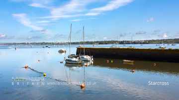
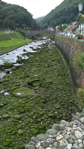
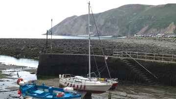
The area around Gidleigh boasts some of the best villages including Starcross, Lynton and Lynmouth, Littleham, Otterton, Branscombe, Beer, and Hope Cove.
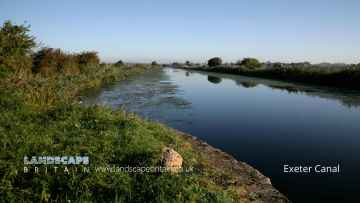
Exeter Canal, and Grand Western Canal at Tiverton are great places to visit near Gidleigh if you like canals.
East Lyn River is a great place to visit close to Gidleigh if you like rivers and streams.
Blacklands Beach, Branscombe Beach, and Hope Cove are great places to visit near Gidleigh if you like beaches.
There are a several good geological features in the area around Gidleigh like Valley of Rocks.
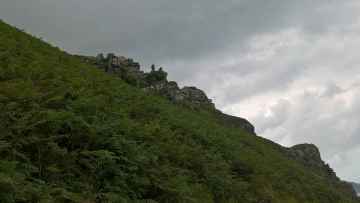
There are a number of sssis near to Gidleigh including Dartmoor.
There are a several good hiking areas in the area around Gidleigh like Dartmoor.
Nature Reserves to visit near Gidleigh include Dartmoor.
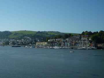
Don't miss Dartmouth, Tiverton, Crediton, Topsham, Budleigh Salterton, Sidmouth, and Seaton's towns if visiting the area around Gidleigh.
Places near Gidleigh feature a number of interesting parks including Bicton Park.
There are a number of airports near to Gidleigh including Exeter Airport.
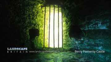
The area close to Gidleigh boasts some of the best castles including Berry Pomeroy Castle.
Don't miss Berry Pomeroy Castle's ruins if visiting the area around Gidleigh.
Gidleigh History
There are some historic monuments around Gidleigh:
- Round cairn on Long Ridge 800m north east of Teignhead Farm
- Partially enclosed stone hut circle settlement on the north eastern slope of Steeperton Tor
- Round cairn 480m south west of Higher White Tor
- Two round cairns 800m north west of Statts Bridge
- Stone hut circle 140m north west of Higher Shilstone
- A round cairn on Watchet Hill
- Pillow mound 670m WNW of Longaford Tor forming an outlying part of a rabbit warren on the western slopes of Longaford and Littaford Tors
- Cist on Whitehorse Hill, 910m south east of Taw Head
- Round cairn 400m south east of Higher White Tor
- Beetor Cross: the site of a wayside cross and a later, 18th century, waymarker 230m south east of Beetor
- Leapra Cross: a wayside cross at the entrance to Moor Gate Farm
- North Bovey village cross: a wayside cross at the south west end of North Bovey village green
- Linscott Cross: a wayside cross on the north side of a minor road 280m north west of Howton Farm
- Cairnfield 370m west of Blackaton Brook Ford
- Stone alignment and cairn 800m SSW of Yardworthy
- Boundary stone 110m north west of St Mary's Church
- Circular enclosure 290m north of Great Parford
- Partially enclosed stone hut circle settlement 900m and 940m north west of Warren House Inn
- Round cairn 620m south east of Challacombe Cross
- Hut circle NE of Thornworthy Lodge
- Deserted medieval settlement at Blackaton, 340m and 400m north east of Lower Blackaton
- Three Headland Warren boundary stones, 350m, 330m and 400m south east of Headland Warren Farm
- Two hut circles N of Lower Blackaton
- An unenclosed stone hut circle settlement 400m north west of Scorhill stone circle
- Agglomerate enclosure and 15 stone hut circles 560m west of Cawsand Beacon
- Stone alignment, hut circle settlement, medieval long house and post-medieval farmstead at Assycombe
- Hut circles E of Pritton
- Three agglomerated enclosures containing stone hut circles, a cairn cemetery, post-medieval fields and tinworks on Chagford Common
- Hameldown Beacon barrow
- Cairn and cist 875m north west of Arch Tor
- Agglomerate enclosure and ten stone hut circles 500m west of Cawsand Beacon
- Two round cairns on the northern slope of Metheral Hill
- Grimspound, a partially enclosed prehistoric settlement with field system and two post-medieval caches between Hookney Tor and Hameldown Tor
- Spinster's Rock
- Cawsand Beacon, a round cairn, a ring cairn, a stone building and five post-medieval shelters on the summit of Cawsand Hill
- Five cairns, two stone alignments and three cists, forming part of a ritual complex on Lakehead Hill
- A cairnfield, unenclosed stone hut circle settlement and boundary stone 380m south west of a ford on the Small Brook
- Two stone hut circles 850m WSW of the confluence of Gallaven Brook and Walla Brook, 1045m north east of the Thirlstone
- Taw River tin blowing mill, 840m south of Tawcroft
- Four round barrows on Soussons Down, 960m north west of Soussons
- Part of a coaxial field system, prehistoric settlements and cairns on Buttern Hill
- Round cairn on Soussons Down, 1.2km north west of Soussons
- Three hut circles at north end of Vogwell Down
- Roundy Park prehistoric enclosure and cairn with cist, 560m north east of Archerton
- Partially enclosed stone hut circle settlement known as Kraps Ring
- Two stone hut circles and field system, 590m south of Buttern, forming part of a coaxial field system on Buttern Hill
- Wayside cross 225m north east of Scarhill Cross
- Round cairn 780m south of the Thirlstone
- Dispersed stone hut circle settlement and associated fields 490m south east of Silk House
- Ring cairn 140m north east of Cawsand Beacon forming part of a cairn cemetery on the summit of Cawsand Hill
- Round cairn 250m south east of Winter Tor
- A platform cairn 240m NNE of Cawsand Beacon forming part of a cairn cemetery on the summit of Cawsand Hill
- Unenclosed stone hut circle settlement 320m south east of Higher Tor
- Stone hut circle and associated walling 780m WNW of Longaford Tor
- Okehampton Artillery Range: Observation Post 7
- Enclosed prehistoric settlement 650m south west of Longaford Tor
- Coaxial field system and prehistoric settlements at Kestor
- Prehistoric enclosed settlement 740m north west of Hartland Tor
- An enclosed prehistoric settlement 230m east of Higher Tor
- Cairn 190m west of Archerton
- Medieval settlement 470m east of Hartyland
- Enclosure on Cator Common, 400m ESE of Riddon Brake
- Stone hut circle 610m west of Cawsand Beacon forming an outlying part of an enclosed stone hut circle settlement
- Broadun prehistoric enclosed settlement, 780m NNW of Archerton
- Headland Warren boundary stone 570m NNE of Headland Warren Farm
- Round cairn on Watern Tor
- Kerbed cairn and cist 635m south west of The Grey Wethers
- Camp SE of Okehampton
- Cairn and cist 400m east of Lydford Tor
- Hut circles on Bonehill Down
- Medieval strip field system, tinworks, part of a prehistoric settlement, a cairn and reave on Challacombe Down
- A partially enclosed stone hut circle settlement 670m south of The Grey Wethers
- Blowing Mill at Outer Down
- Hamel Down Cross
- Tinners' building in Great Stannon Newtake, 810m north west of Stannon Tor
- Four hut circles N of Bush Down
- Two stone hut circles and part of a coaxial field system at Frenchbeer Rock
- Hele Cross: a wayside cross 700m south east of Wormhill
- Two hut circles E of Foxes Holt
- A prehistoric settlement complex, length of reave, tin streamwork and stamping mill on the western slopes of Cosdon Hill
- Unenclosed stone hut circle settlement, two cairns and section of field system 330m north east of Hemstone Rocks
- Shorter Cross: a wayside cross on the north side of a minor road, 350m north west of Middlecott
- Bennett's Cross: a wayside cross on the south side of the B3212, 900m north east of the Warren House Inn
- Warren in Whiddon Park
- Round cairn 530m north east of Gartaven Ford
- Stone hut circle 210m east of Scorhill stone circle
- Stone circle and cairn 330m south of Little Hound Tor
- Kistvaen 325yds (300m) S of Archerton
- Stone alignment 260m south of Higher White Tor
- Chambered cairn 830m south of Buttern
- Medieval strip fields, tinworks, prehistoric settlements, and a cairn on the lower western slopes of Hamel Down
- Two cairns 720m and 800m east of Higher White Tor
- A partly enclosed stone hut circle settlement on Kennon Hill
- Stone hut circle settlement at Higher Tor
- Hut circles W of Higher Shapley
- Coaxial fields forming part of Shapley Common coaxial field system, 720m north of Hookney Tor
- A round cairn 190m north east of Cawsand Beacon forming part of a cairn cemetery on the summit of Cawsand Hill
- Cairn on Hurston Ridge 1km north west of Warren House Inn
- Blowing mill 260m south east of Teignhead Farm
- White Moor Stone
- Stone circle 400m south west of Buttern Hill
- Cairn cemetery and earthwork bank 340m south west of Blackaton Brook Ford
- Hut circles on Hedge Down
- Nine Stones ring cairn on Belstone Common
- Ring cairn 296m south east of Riddon Brake
- Stone hut circle 215m south east of Hartland Tor
- A stone circle, known as Fernworthy Circle, three stone alignments and five cairns 425m and 525m north west of Sandeman Bridge
- Enclosed prehistoric settlement 150m south east of Hookney Tor
- Enclosed stone hut circle settlement and cairn 460m north east of Rough Tor
- A warren, two stone hut circle settlements, cairnfields and cairns at Ivy Tor, ESE of Belstone
- Stone alignment, cairns, enclosed prehistoric settlement and a length of reave on Hurston Ridge
- A ring cairn 700m south east of Runnage Bridge, on the southern side of Soussons Down
- Three pillow mounds adjacent to Longaford Tor forming an outlying part of a rabbit warren on the western slopes of Longaford and Littaford Tors
- An agglomerated enclosed settlement 480m west of Stoneyhurst
- Cairnfield 790m north west of Stoneyhurst
- Tor cairn 50m north east of Hookney Tor
- Coaxial fields and prehistoric settlements 180m north and 350m north west of Hartland Tor
- Quintin's Man round cairn
- Stone hut circle 450m north east of Teignhead Farm
- Three stone hut circles 300m south east of Headland Warren Farm
- Two cairns on the summit of Water Hill 450m north west of Warren House Inn
- Five barrows on Hamel Down
- Prehistoric settlements, fields and enclosures within the Shapley Common coaxial field system, 770m south of Challacombe Cross
- Stone hut circle 580m south west of Statts Bridge
- Enclosure 200yds (180m) WSW of Meacombe
- Prehistoric settlement and field system 240m east of Challacombe Cross
- Partially enclosed stone hut circle settlement 650m south east of Tawcroft
- Hut circle 300yds (270m) SW of Meacombe
- Cairn 500m NNW of Archerton
- Three agglomerated enclosures, a round cairn and part of the Stannon block field system lying within Great Stannon Newtake
- A round cairn on White Ridge lying 570m north of the source of Stannon Brook
- Stone hut circle settlement 290m south east of Manga Rock
- Triple stone alignment and cairn 780m east of Cawsand Beacon
- Round cairn and Headland Warren boundary stone 210m north of Birch Tor
- Cairn and cist 430m north east of Grimspound
- Two prehistoric settlements 1280m SSW of The Grey Wethers
- Partially enclosed stone hut circle settlement 780m south west of Metherall
- Cranbrook Castle
- A stone hut circle settlement and irregular aggregate field system at the northern tip of Long Ridge
- Two partially enclosed stone hut circle settlements and a round cairn on the eastern slope of Oke Tor
- Round cairn and cist on the south west side of Crow Tor
- Cairn and cist on Chittaford Down, 300m north of Archerton
- Four stone hut circles and associated boundary walls south east of Fernworthy Reservoir, 250m north west of Metherall
- Cairn on Hameldown Tor
- Round cairn 80m south west of Little Hound Tor summit
- Round cairn 570m west of Stoneyhurst
- Two Headland Warren boundary stones, 275m and 430m north of Birch Tor
- Two cairns on Cator Common
- Blackaton Ball tin mill
- Two stone circles known as The Grey Wethers, three round cairns, two ring cairns and an oval enclosure in Great Stannon Newtake
- Meacombe burial chamber
- Round cairn on Cosdon Hill, 1010m north of Cosdon Beacon
- Three hut circles E of Bush Down
- Clapper Bridge, Postbridge
- Round cairn on the summit of Little Hound Tor
- Stone hut circle and field system 580m north west of North Creaber, forming part of a coaxial field system on Buttern Hill
- Cairnfield and field 1030m north west of Archerton
- Okehampton Artillery Range: Observation Post 6 and Incline Target Carrier Railway
- Cairnfield, cairn and a length of the Taw Marsh Reave 830m ESE of Moorland House
- An unenclosed stone hut circle settlement 1.1km south east of Gartaven Ford, south west of Rippator
- Stone hut circle settlement, cairnfield and field system 580m north east of Gartaven Ford
- Deserted medieval settlement at Challacombe
- Round cairn 80m SSW of White Moor stone circle
- Round cairn on Hangingstone Hill
- Cairn and cist on the northern side of Fernworthy Reservoir, 660m north west of Metherall
- Stone alignment and cairn 470m east of Stannon Brook source
- Prehistoric stone hut circle settlement 630m south of Hemstone Rocks
- The North Teign coaxial field system (western part) and associated later remains at Shovel Down, Stonetor Hill and Long Ridge
- King's Barrow on King Tor, Hookney Down
- Two round cairns 400m north west of Scorhill Farm
- Platform cairn 370m south east of Challacombe Cross
- Hut circles on Heatree Down
- Prehistoric enclosed settlement known as Broadun Ring, 500m north west of Hartland Tor
- A partially enclosed stone hut circle settlement, two cairns containing cists and a post-medieval building 440m NNW of Powder Mills
- Gidleigh Castle (remains of)
- Okehampton Artillery Range: Observation Post 16 and flanking target butts
- Scorhill stone circle, three cairns and a length of reave
- Cairnfield 760m west of Stoneyhurst
- Coaxial fields, prehistoric settlement, two cairns and a stone alignment in Little Stannon Newtake, 900m south east of Stannon Tor
- Cairn cemetery 880m south west of Wallabrook Bridge
- Stone hut circle 380m north west of North Creaber
- Week Down cross: a wayside cross 530m south west of Yellam
- Hillerton Cross
- A cairn cemetery on Long Ridge
- Two stone hut circle settlements with an irregular aggregate field system east of Rival Tor, 900m south west of Buttern Hill
- Unenclosed stone hut circle settlement on Tom's Hill, 870m north west of Sandeman Bridge
- Chambered cairn 430m south of Buttern
- Stone hut circle settlement and post-medieval shelter 990m north east of Hawthorn Clitter, 1030m east of The Thirlstone
- Coaxial field system, associated and later remains at Throwleigh Common and Kennon Hill
- Camp 325yds (300m) SE of Archerton
- Watching Place Cross: a wayside cross at the junction of the B3212 with the B3344
- Tinworks, field systems, settlements, warren, cairns and a stone alignment at Headland Warren
- Two hut circles NW of Bush Down
- Round cairn and enclosure 930m south of Hound Tor
- Ring cairn 230m south east of Cullever Steps
- Cairn on Chagford Common 320m west of West Vitifer Mine
Places to see near Gidleigh


Lakes near Gidleigh
Rivers near Gidleigh
- Broughton Brook (South and West Somerset)
- Tributary of Back Stream (Tone Catchment)
- Hele Bk
- Tone - Wellington to Taunton
- Haywards Water
- Westford Stream
- Sherford Stream
- Tone - Upper
- Back Stream
- Halse WTR
- Allen Brook(Maiden brook)
- Hillfarrance Bk
- West Dart River (Lower)
- West Dart River (Upper)
- East Webburn River
- West Dart River (Blackbrook to Swincombe)
- Wash
- Ashburn
- East Dart River
- Hems - Upper
- West Webburn River
- Swincombe
- Avon (Devon Tidal) and Sth Hams - Blackpool
- Mardle
- Avon (Devon Tidal) and Sth Hams - Slapton
- Cherry Brook
- Hems - Lower
- Dean Burn
- Dart
- Dart (Tidal)
- Am Brook
- Webburn
- Bidwell Brook
- The Gara
- Blackbrook River
- Harbourne River
- Beadon Brook
- Lemon
- South Teign River
- Reedy Brook
- North Teign
- Fingle Brook
- Teign (Upper)
- Ugbrooke Stream
- Wray Brook
- Aller Brook (Teign) - Lower
- Kate Brook
- Scotley Brook
- Aller Brook (Teign) - Upper
- Middle Bovey
- Blackaton Brook
- Liverton Brook
- Aller Brook
- Sowton Brook
- Bramble Brook
- Lower Bovey
- Becka Brook
- Upper Bovey
- Teign (Lower)
- Sheepham Bk
- Ayleston Brook
- Lud Brook
- Lower Erme
- Erme
- Middle Barle
- Dart (Exe)
- Danes Brook
- Lower Batherm
- Upper Barle
- Exe (Haddeo to Barle)
- Burn (Exe)
- Iron Mill Stream
- Upper River Haddeo
- Upper Batherm
- Lowman
- Exe (Barle to Culm)
- North Brook (East Devon)
- Exe (Quarme to Haddeo)
- Calverleigh Stream
- Exe (Source to Quarme)
- Exe (Culm to Creedy)
- Exe (Creedy to Estuary)
- Lower Barle
- Ben Brook
- Ben Brook
- Brockey River
- Quarme
- Lower River Haddeo
- Pulham
- Sherdon Water
- Grindle Brook
- Bolham River
- Weaver
- Aylesbeare Stream
- Polly Brook
- Halberton Stream
- Fulford Water
- Lower Clyst
- Madford River
- Ken Stream
- Middle Culm
- Lower Cranny Brook
- Ford Stream (EXE)
- Spratford Stream
- Upper Clyst
- Sheldon Stream
- Upper Cranny Brook
- Upper Culm
- Lower Culm
- Kenn
- Colebrook
- Holly Water
- Alphin Brook
- Lower Yeo (Creedy)
- Matford Brook
- Ford Brook (EXE)
- Upper Creedy
- Dawlish Water
- Upper Yeo (Creedy)
- Jackmoor Brook
- Shobrooke Lake
- Lower Creedy
- Troney
- Middle Creedy
- Culvery River
- Lim
- Branscombe Stream
- Blackwater River
- Lower Axe
- Kit Brook
- Yarty
- Umborne Brook
- Upper Coly
- Upper Axe
- Offwell Brook
- Lower Coly
- Forton Brook
- Corry Brook
- West Lyn River
- Heddon
- Lower East Lyn River
- Mully Brook
- Rye Stream
- Upper East Lyn River
- Lower River Yeo (Lapford)
- Mole (Taw to Bray)
- Yeo (Molland)
- Venn
- Coney Gut
- Sterridge
- Crooked Oak
- Tributary of River Heddon
- Huntacott Water
- Taw (Source to Bullow Brook)
- Hawkridge Brook
- Newton Tracey Stream
- Taw (River Yeo to Little Dart River)
- Sturcombe River
- Bullow Brook
- Bray (Mole to Hole Water)
- Hollocombe Water
- Upper River Yeo (Barnstaple)
- Upper Caen
- Taw Estuary
- Bradwell Stream
- Upper Little Dart River
- Chelfham Stream
- Hole Water
- Knowl Water
- Badgworthy Water
- Umber
- Farley Water
- Taw (Little Dart River to River Mole)
- Lower River Yeo (Barnstaple)
- Lower Caen
- Mole (Bray to Yeo)
- Lower Little River Dart
- Burcombe Stream
- Taw (River Mole to Estuary)
- Little Silver Stream
- Dalch
- Mole (Yeo to Burcombe Stream)
- Nadrid Water
- Bradiford Water
- Langham Lake
- Bray (Source to Hole Water)
- Mole (Source to Burcombe Stream)
- Taw (Bullow Brook to River Yeo)
- Knighty Brook
- Upper River Yeo (Lapford)
- Dolton Stream
- Lower River Mere
- Kenwith Stream
- Dipple Water
- Horwood Stream
- Little Mere River
- Torridge (Dipple Water to Combe Lake)
- Wagaford Water
- Middle River Lew (Torridge)
- Iddesleigh Stream
- Middle River Okement
- Upper River Yeo (Bideford)
- West Okement
- Upper River Mere
- East Okemont River
- Langtree Lake
- Mussel Brook
- Hole Brook
- Lower River Okement
- Pulworthy Brook
- Waldon
- Torridge (Source to Dipple Water)
- Combe Lake
- Woolleigh Brook
- Whiteleigh Water
- Hookmoor Brook
- Northlew Stream
- Torridge (Lew to Estuary)
- Whitsleigh Down Brook
- Cookbury Stream
- Duntz
- Upper River Lew (Torridge)
- Torridge (Combe Lake to Lew)
- Huntshaw Water
- Lower River Yeo (Bideford)
- Lower River Lew (Torridge)
- Medland Brook
- Welcombe Stream
- Philham Water
- Abbey River
- Tamar (River Lyd to River Inny)
- Tamar (Kelly Brook)
- Lower River Lyd
- Lew (Tamar)
- Quither Brook
- Broadwood Brook
- Thrushel
- Wolf
- Upper River Lyd
- Piall
- Newton Stream
- Upper River Yealm
- Silverbridge Lake
- Lower River Yealm
- Tory Brook
- Meavy
- Lower River Plym
- Upper River Plym
- Walkham
- Burn (Tavy)
- Lumburn
- Upper River Tavy
- Lower River Tavy


