Retail in Buckland-Tout-Saints
There are great places to visit near Buckland-Tout-Saints including some great cities, historic buildings, villages, canals, rivers and streams, beaches, geological features, sssis, hiking areas, nature reserves, towns, parks, airports, castles and ruins.
There are a several good cities in the area around Buckland-Tout-Saints like Exeter.
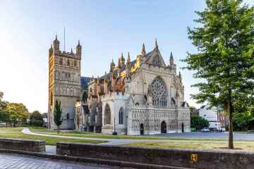
Exeter Cathedral, St Mary Steps, and St Stephen's Church - Exeter are some of Buckland-Tout-Saints best historic buildings to visit near Buckland-Tout-Saints.
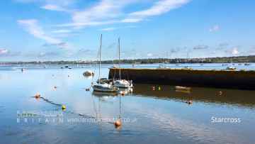
Villages to visit near Buckland-Tout-Saints include Starcross, Lynton and Lynmouth, Littleham, Otterton, Branscombe, Beer, and Hope Cove.
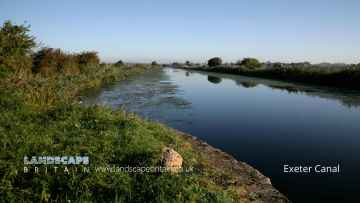
The area around Buckland-Tout-Saints boasts some of the best canals including Exeter Canal, and Grand Western Canal at Tiverton.
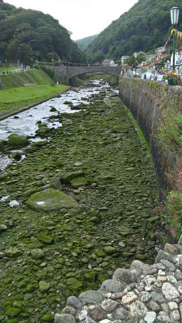
Buckland-Tout-Saints is near some unmissable rivers and streams like East Lyn River,
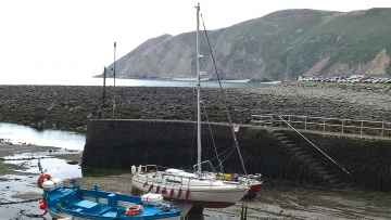
Buckland-Tout-Saints has some unmissable beaches nearby like Blacklands Beach, Branscombe Beach, and Hope Cove.
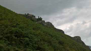
There are a number of geological features near to Buckland-Tout-Saints including Valley of Rocks.
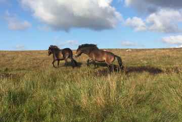
Dartmoor is one of Buckland-Tout-Saints's best, nearby sssis to visit in Buckland-Tout-Saints.
Dartmoor is one of Buckland-Tout-Saints's best, nearby hiking areas to visit in Buckland-Tout-Saints.
Places near Buckland-Tout-Saints feature a number of interesting nature reserves including Dartmoor.
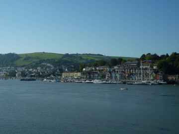
Towns to visit near Buckland-Tout-Saints include Dartmouth, Tiverton, Crediton, Topsham, Budleigh Salterton, Sidmouth, and Seaton.
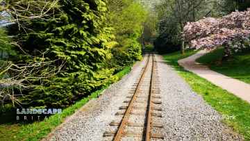
There are a several good parks in the area around Buckland-Tout-Saints like Bicton Park.
Exeter Airport is a great place to visit close to Buckland-Tout-Saints if you like airports.
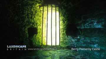
The area around Buckland-Tout-Saints's best castles can be found at Berry Pomeroy Castle.
Berry Pomeroy Castle is a great place to visit close to Buckland-Tout-Saints if you like ruins.
Buckland-Tout-Saints History
There are some historic monuments around Buckland-Tout-Saints:
- Two ring cairns 330m south east of Coldharbour Cross
- Three bowl barrows 310m west of Home Farm, forming part of a round barrow cemetery
- Medieval settlement, site of quadrangular castle and relict garden between Ilton Farm and Ilton Castle Farm
- Churchyard cross, 5m south of the porch of St Leonard's Church
- Bowl barrow 660m south west of Woodland Barton
- Round barrow cemetery known as Ritson Barrows, 420m north east of Stanborough Camp
- Bowl barrow 530m south east of Duncombe Court, forming an outlying part of a barrow cemetery.
- Regular aggregate field system 480m west of West Soar
- Bowl barrow on Churchland Green 350m west of Coldharbour Farm
- Two bowl barrows 440m south east of Duncombe Court, forming part of a round barrow cemetery
- Hilltop enclosure 380m east of Middle Soar
- Hillfort and two bowl barrows at Halwell Camp
- Two bowl barrows 380m and 410m south west of Allaleigh Cross
- Bowl barrow 210m south of West Soar
- Ringwork and bailey castle 400m south of Langford Barton
- Four bowl barrows at Bickleigh Brake 540m south west of Bickleigh, forming part of a linear round barrow cemetery
- Field systems, hut circles and four beacons, 510m south of Middle Soar
- Site of a medieval fortified house at Leigh Barton, including the south and west ranges, a gatehouse, section of curtain wall and fishpond
- Ringwork and motte, 230m north east of Stanborough Camp
- Two hut circles and associated field systems and enclosure at Mousehill Brake
- Bowl barrow 400m south of Home Farm, forming an outlying part of a round barrow cemetery
- Stanborough Camp Iron Age hillfort and bowl barrow
- Animal pound and enclosure 220m and 120m south west of High Marks Barn
- Coaxial field system, hut circles and medieval farm buildings at Starehole Bottom
- Coaxial field systems and associated later remains between Deckler's Cliff and Gammon Head
- Fort Charles
- Iron Age hillfort known as Burleigh Dolts, 280m south east of Burleigh Farm
- Hillfort known as Slapton Castle
- Blackdown Rings prehistoric hillfort and medieval castle
- Post-medieval animal pound 430m south of East Soar Farm
- Medieval farmstead, boundary work and earthwork enclosures 350m south east of Middle Soar
- Animal pound 50m south west of All Saint's Church
- Medieval farmstead and field system at Warren Barn, 500m south and 400m south west of West Soar
- Coaxial field system and semaphore station at Signal House Point