


Bickleigh
Bickleigh is a Town in the county of Devon.
There are great places to visit near Bickleigh including some great cities, historic buildings, villages, canals, rivers and streams, beaches, geological features, sssis, hiking areas, nature reserves, towns, parks, airports, castles and ruins.
Places near Bickleigh feature a number of interesting cities including Exeter.
The area around Bickleigh boasts some of the best historic buildings including Exeter Cathedral, St Mary Steps, and St Stephen's Church - Exeter.
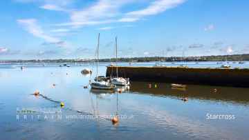
There are a number of villages near Bickleigh including Starcross, Lynton and Lynmouth, Littleham, Otterton, Branscombe, Beer, and Hope Cove.
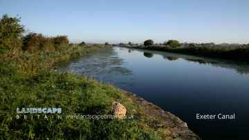
Bickleigh's best nearby canals can be found at Exeter Canal, and Grand Western Canal at Tiverton.
The area around Bickleigh's best rivers and streams can be found at East Lyn River.
The area around Bickleigh features a number of interesting beaches including Blacklands Beach, Branscombe Beach, and Hope Cove.
Places near Bickleigh feature a number of interesting geological features including Valley of Rocks.
There are a several good sssis in the area around Bickleigh like Dartmoor.
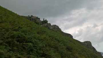
Hiking Areas to visit near Bickleigh include Dartmoor.
The area around Bickleigh's best nature reserves can be found at Dartmoor.
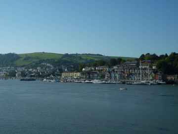
Bickleigh's best nearby towns can be found at Dartmouth, Tiverton, Crediton, Topsham, Budleigh Salterton, Sidmouth, and Seaton.
Places near Bickleigh feature a number of interesting parks including Bicton Park.
The area close to Bickleigh boasts some of the best airports including Exeter Airport.
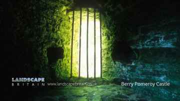
There are a several good castles in the area around Bickleigh like Berry Pomeroy Castle.
Places near Bickleigh feature a number of interesting ruins including Berry Pomeroy Castle.
Bickleigh History
There are some historic monuments around Bickleigh:
- Vermin trap 90m west of Great Trowlesworthy Tor, forming part of Trowlesworthy Warren
- Round barrow 950yds (868m) N of Drakeland Corner
- Riddipit hull 700m WSW of the northern end of Raddick Lane
- A stone alignment, kerbed cairn, prehistoric settlement, four pillow mounds, a vermin trap and animal runs 720m south west of Great Trowlesworthy Tor
- Stone alignment and terminal cairn with a retaining kerb on Ringmoor Down
- Cairn north-east of Brisworthy Plantation
- Cairn with a cist, one of several cairns on Lee Moor
- Stone hut circle settlement, irregular aggregate field system, two long houses and a medieval and post-medieval field system 700m SSW of Black Tor
- Stone hut circle 320m north of Hart Tor forming part of an unenclosed stone hut circle settlement
- Round cairn 380m NNW of Sharpitor summit
- Cairn north east of Yellowmead stone circles
- Stone hut circle 930m ENE of Big Pond
- Two stone hut circles, a reave, round cairn and shelter south east of Sharpitor
- Prehistoric enclosures on Dewerstone Hill, 500m south east of Dewerstone Cottage
- Knowle battery
- Enclosure with hut circles on Eastern Tor
- Settlement on Wigford Down
- Deer park pale, 460m north east of Lyneham House
- Western Kings artillery tower
- Pillow mound 840m north east of Trowlesworthy Warren House, forming part of Trowlesworthy Warren
- Prehistoric coaxial field system and cairns, an historic enclosure and part of RAF Sharpitor, situated on and around Peek Hill
- Cairn south-west of Gutter Tor
- Cross Dyke reave
- An enclosure containing one stone hut circle 460m west of Cross Gate
- Brisworthy stone circle
- Hentor Warren boundary stone standing on Lee Moor 860m south west of Hen Tor
- Round cairn 670m north-east of Sharpitor summit
- Cairn 590m south-west of Raddick Hill summit forming part of a cairnfield
- The Remains of Longstone Manor House, Wind Strew and associated features
- Pillow mound 630m east of Legis Tor forming part of Willings Walls Warren
- Cairn with a cist north of Drizzlecombe stone alignments
- Stone hut circle 160m east of Sharpitor
- A rectangular building 750m south east of Legis Tor
- Two stone hut circles and an enclosure 680m ENE of Trowlesworthy Warren House
- Round cairn 650m WSW of Raddick Hill summit
- Pillow mound 490m south of Trowlesworthy Warren House, forming part of Trowlesworthy Warren
- Twelve cairns, a lynchet and a boundary bank forming part of a cairnfield 440m south-west of Raddick Hill summit
- Warren at Sheeps Tor, 520m north of Chubstone Cottage
- Part of Eylesbarrow Reave
- Pillow mound 790m NNE of Blackaton Cross, forming part of Trowlesworthy Warren
- An enclosed stone hut circle settlement 400m south-west of Devil's Bridge
- Pillow mound 100m south east of Great Trowlesworthy Tor, forming part of Trowlesworthy Warren
- A 350m length of reave on Hingston Hill, 470m NNW of Combshead Tor
- Enclosure and stone hut circle 320m north-east of Sharpitor forming part of a stone hut circle settlement
- Three hut circles NW of Cadworthy
- Walkhampton Church House cross: a wayside cross on the east side of Church House, 650m north east of Walkhampton village
- Round barrow N of Cadworthy Wood
- Stone hut circle settlement 600m ENE of Great Trowlesworthy Tor
- Pounds and hut circles N of Saddlesborough
- Unenclosed stone hut circle settlement 370m south west of Routrundle
- Stone hut circle 330m north of Hart Tor forming part of an unenclosed stone hut circle settlement
- Eight stone hut circles and two enclosures forming part of an unenclosed settlement 580m south of Leeden Tor
- Enclosure west of Shell Top
- Round cairn east of Whittenknowles Rocks, 960m ENE of Gutter Tor
- Two round cairns 600m ENE of Great Trowlesworthy Tor
- A partially enclosed stone hut circle settlement 330m south west of Hen Tor
- Roman's Cross 50m west of the church
- Iron Age hillfort known as Wasteberry Camp, medieval deer park and post-medieval warren, 800m north west of Lyneham House
- Two stone hut circles and a length of associated walling 620m south east of Cuckoo Rock, forming an outlying part of a prehistoric settlement
- Two round cairns 140m south-west of Raddick Hill summit
- Stone hut circle forming an outlying part of a large stone hut circle settlement east of Raddick Lane
- Three stone hut circles 340m west of Hen Tor forming part of a partially enclosed stone hut circle settlement
- Camp NE of Berra Tor
- Cist south-west of Gutter Tor
- Pillow mound 270m south east of Ditsworthy Warren House forming part of Hentor Warren
- Blockhouse at the Garden Battery
- Beatland Corner socket stone: a wayside cross 900m south east of Shaugh Prior church
- Part of Eylesbarrow Reave
- Two pillow mounds and a small area of tin streamwork earthworks 770m north of Blackaton Cross, forming part of Trowlesworthy Warren
- Partially enclosed stone hut circle settlement and post-medieval warren structures on the western slope of Little and Great Trowlesworthy Tors
- Cist south east of Roughtor Plantation
- Stone hut circle north of Hentor Brook
- Pillow mound and `V'-shaped gully 350m north west of Great Trowlesworthy Tor forming part of Trowlesworthy Warren
- Round cairn 340m ESE of Norsworthy Bridge
- Stone hut circle 130m east of Leeden Tor forming part of a stone hut circle settlement
- Yennadon Cross: a wayside cross 340m south of Peekhill
- Pillow mound 760m ENE of Trowlesworthy Warren House, forming part of Trowlesworthy Warren
- Lee Moor Tramway Bridge
- Cairn south-east of Nattor
- Tinners' cache 570m north east of Norsworthy Bridge
- Vermin trap 350m south west of Great Trowlesworthy Tor forming part of Trowlesworthy Warren
- Two stone hut circles 100m east of Leeden Tor forming part of a stone hut circle settlement
- Enclosed settlement 380m south west of Raddick Hill summit
- Shaugh Prior village cross: a wayside cross at the road junction 150m east of the parish church
- Plympton Castle
- Tor cairn 60m south east of Down Tor
- A length of the Great Western Reave, a prehistoric settlement, three cairns and two field systems on Walkhampton Common
- Cairn with cist west of Legis Lake
- Enclosure north-east of Brisworthy Plantation
- Enclosure and stone hut circle 700m west of Sharpitor
- Cross in grounds of Stentaway House, Billacombe
- Medieval farmstead and field system, length of Willings Walls Reave, four round cairns, a ring cairn and pillow mounds at Willings Walls Warren
- Pillow mound 225m north west of Great Trowlesworthy Tor forming part of Trowlesworthy Warren
- Two pillow mounds 415m and 430m north east of Trowlesworthy Warren House forming part of Trowlesworthy Warren
- Two stamping mills 200m and 175m north of Norsworthy Bridge
- Plymouth Castle (remains of)
- Hut circles SE of Brisworthy
- Roughtor parallel reave
- Vermin trap 800m south east of Trowlesworthy Warren House forming part of Trowlesworthy Warren
- Fort Stamford
- Large stone hut circle settlement, an irregular aggregate field system, post-medieval farmstead and associated remains east of Raddick Lane
- Cairn 560m south-west of Raddick Hill summit forming part of a cairnfield
- Stanlake Farmstead, 930m south west of Black Tor
- Stone hut circle settlement 900m west of Devil's Bridge
- Hut circles W of Saddlesborough
- Woodland fort
- Eight pillow mounds and a vermin trap on the northern slope of Little Trowlesworthy Tor forming part of Trowlesworthy Warren
- Blackaton Cross: a wayside cross 1.25km north of Lee Moor Village
- Stone hut circle 315m north-east of Sharpitor forming part of a stone hut circle settlement
- Two cairns and a boundary bank forming part of a cairnfield 440m south-west of Raddick Hill summit
- Cairn and cist 600m north east of Routrundle
- Wayside cross 130m ESE of Crazy Well Pool
- Four round cairns 340m ENE of Sharpitor
- Stone hut circle 155m east of Sharpitor
- Four stone hut circles forming part of an unenclosed settlement 580m south of Leeden Tor
- Animal pound at The Pound, 620m south of Roborough House
- Tinworks and other archaeological remains in the Meavy valley at Stanlake, Black Tor, Hart Tor and Cramber Tor
- Round barrow on Burrow Hill
- Pillow mound 450m west of Hen Tor forming part of Hentor Warren
- Four round cairns 1060m south east of Great Trowlesworthy Tor
- Cairn south of Eylesbarrow Reave
- Pillow mound 865m ESE of Trowlesworthy Warren House, forming part of Trowlesworthy Warren
- The Goreus Stone, immediately west of St Bartholomew's Church
- Cholwich Town Cross: a wayside cross between Quick Bridge and Tolchmoor Gate
- Pillow mound 210m east of Great Trowlesworthy Tor, forming part of Trowlesworthy Warren
- A ring cairn 490m north east of Great Trowlesworthy Tor
- Stone alignment and cairn 830m east of Down Tor
- Pillow mound 180m west of Legis Tor forming part of Legistor Warren
- Cairnfield and enclosure 725m east of Cuckoo Rock
- Stone hut circle 380m north-east of Leather Tor
- Prehistoric barrow cemetery on Crownhill Down, 900m north of Drakelands Farm
- Firestone Bay artillery tower
- An enclosed stone hut circle settlement and later tin working earthworks, 540m south east of Down Tor
- One of three stone hut circles 500m SSE of Legis Tor
- Barrow cemetery on western slope of Crownhill Down
- Rectangular building 420m north west of Hen Tor, forming an outlying part of Hentor Farm
- Agaton fort
- Pound and hut circles N of Down Tor
- Eastern King battery
- Pillow mound 160m south west of Great Trowlesworthy Tor, forming part of Trowlesworthy Warren
- Enclosure with hut circles on Gutter Tor
- Agglomerated enclosure with hut circles south-west of Ditsworthy Clam
- Keaglesborough Mine and Riddipit farmstead 850m north east of Norsworthy Bridge
- Thirty-six stone hut circles and an irregular aggregate field system forming part of an unenclosed stone hut circle settlement 450m north of Hart Tor
- Part of Eylesbarrow Reave
- Four stone hut circles and an enclosure 100m north-east of Sharpitor summit
- Cairn with a cist north of Whittenknowles Rocks
- Double stone alignment with a terminal stone setting south of Great Trowlesworthy Tor
- Nine huts, five post-medieval shelters and a field boundary forming part of an unenclosed stone hut circle settlement 1180m south of North Hessary Tor
- Cairn 550m south-west of Raddick Hill summit forming part of a cairnfield
- Stone hut circle north-east of Hentor Brook
- 'V'-shaped gully 350m east of Trowlesworthy Warren House
- Hut circle on Wigford Down
- Stone hut circle situated on the north eastern edge of an unenclosed stone hut circle settlement 1180m south of North Hessary Tor
- Bowden Battery
- Stone hut circle 370m north-east of Sharpitor forming part of a stone hut circle settlement
- Laira Emplacement, immediately south west of Laira Battery
- Enclosed stone hut circle settlement 200m east of Leeden Tor
- Two enclosures and a length of the Eylesbarrow watershed reave 800m WSW of Eylesbarrow
- An enclosure, stone hut circle, rectangular building and `V'-shaped gully 410m east of Trowlesworthy Warren House
- Unenclosed stone hut circle settlement on the western edge of Lee Moor
- Two cairns with stone rows E of Collard Tor on Wotter Common
- Post-medieval deer park, medieval fishpond, 18th century triumphal arch and a 19th century lead mine, ore works and smelt mill at Boringdon Park
- Round cairn 100m south of Down Tor
- Mount Batten: 17th century artillery tower, Civil War breastwork, and World War II remains
- An unenclosed stone hut circle settlement 760m north east of Trowlesworthy Warren House
- Three hut circles on south part of Wigford Down
- Round cairn 280m north-east of Raddick Hill summit
- An enclosure containing two stone hut circles forming an outlying part of a large stone hut circle settlement in Raddick Plantation
- Cairn with a cist south-west of Drizzlecombe Stone Alignments
- Ring cairn 220m SSE of Devil's Bridge
- Stone row NW of Saddlesborough
- Crazy Well Farmstead, 420m south of Crazy Well Pool
- Pillow mound and animal run 830m north east of Trowlesworthy Warren House, forming part of Trowlesworthy Warren
- Pillow mound 40m east of Legis Tor forming part of Legistor Warren
- Resolution Fort: Civil War town defences at Friary Court
- Multi-period remains at Hentor Warren
- Cairn and cist 425m north of Hen Tor
- Barrow near Shaugh Cross
- The West Ropery (site of), South Yard, Devonport Dockyard
- Unenclosed stone hut settlement south-west of Gutter Tor
- Stone hut circle 350m north-east of Sharpitor forming part of a stone hut circle settlement
- Stone hut circle 510m NNE of Hart Tor forming part of an unenclosed stone hut circle settlement
- Cairn adjacent to the south side of Eylesbarrow Reave
- Mount Pleasant Redoubt
- Round cairn and later tin prospecting pits 615m ESE of Down Tor
- Yellowmead stone circles, cairn and stone alignment
- Settlement on Wigford Down S of Durance
- Prehistoric enclosed settlement 950m north east of Ditsworthy Warren House
- Round cairn 740m south east of Great Trowlesworthy Tor
- Eggbuckland Keep
- Enclosure with hut circles south-east of Eastern Tor
- Tin mill, tinwork and post-medieval farmstead at Outcombe, 260m east of eastern boundary of Roughtor Plantation
- Enclosed stone hut settlement south-west of Gutter Tor
- Prehistoric and historic archaeological landscape at Trowlesworthy Warren
- Cairn with cist north of Gutter Tor
- Marchant's Cross: a wayside cross 700m south east of Meavy
- Pillow mound 620m ESE of Legis Tor forming part of Willings Walls Warren
- Slip No 1 (The Covered Slip), South Yard, Devonport Dockyard
- Ernesettle battery
- Cairn with a cist north-east of Drizzlecombe
- Eleven stone hut circles, a length of boundary wall and a field system forming part of an unenclosed settlement on the north-east slope of Sharpitor
- Cairn west of Legis Lake
- Wayside cross 75m south east of Cross Gate
- An unenclosed stone hut circle settlement, an irregular aggregate field system, a length of reave and an enclosure on the south east slope of Leeden Tor
- Two lengths of reave, two stone hut circles, a round cairn and stone alignment on Walkhampton Common
- Post-medieval building at Crazy Well Farm, 300m south of Crazy Well Pool
- Cairn and cist 370m east of Trowlesworthy Warren House
- Crownhill Fort
- Greenwell Girt socket stone 600m SSW of Lovaton hamlet
- Platform cairn 60m north of Raddick Hill summit
- Stone hut circle 270m north of Hart Tor forming part of an unenclosed stone hut circle settlement
- Stone alignment, two round cairns and a length of Walkhampton Common reave lying in a valley between Sharpitor and Leeden Tor
- Austin Fort and section of military road
- Vermin trap 490m south of Trowlesworthy Warren House forming part of Trowlesworthy Warren
- A double stone alignment and three cairns south-west of Black Tor
- Stone hut circle situated on the south eastern edge of an unenclosed stone hut circle settlement 1180m south of North Hessary Tor
- Two stone hut circles north of Spanish Lake, Lee Moor
- Round cairn on Lee Moor 950m south east of Great Trowlesworthy Tor
- Cairn with a cist east of Willings Walls Reave
- Pillow mound 530m ENE of Trowlesworthy Warren House forming part of Trowlesworthy Warren
- Stone hut circle settlement 250m east of Cuckoo Rock
- Enclosure north-west of Gutter Tor
- Stone alignment, five cairns, two stone hut circles and a length of reave 600m north east of Horseyeatt
- Enclosure east of Down Tor, 740m north east of Combshead Tor
- Cross S of Shaden Plantation
- Deer park and rabbit warren at Newnham Park
- Pillow mound 540m east of Trowlesworthy Warren House forming part of Trowlesworthy Warren
- Round cairn 190m east of Cross Gate
- Stone hut circle 360m NNE of Hart Tor forming part of an unenclosed stone hut circle settlement
- Unenclosed stone hut circle settlement on Walkhampton Common, 1000m north east of Leeden Tor
- Plympton Priory
- Partially enclosed stone hut circle settlement south of Foggintor Quarries, 1140m ENE of Criptor
- Pillow mound 860m NNW of Blackaton Cross, forming part of Trowlesworthy Warren
- Agglomerated enclosure with hut circles and later farmstead at Whittenknowles Rocks
- Two stone alignments and a round cairn 390m NW of Sharpitor
- Hilltop enclosure known as Maristow Camp, 240m east of Middle Park House
- Two stone hut circles, a length of boundary bank and a short length of the Devonport Leat 380m WNW of Raddick Hill summit
- Hut circle 1000yds (915m) E of Coleland Bridge
- Enclosed settlement 400m west of Raddick Hill summit
- Two round barrows on Ridding Down
- Cairn south-east of Ringmoor Cottage
- Stone hut circle 260m north of Hart Tor forming part of an unenclosed stone hut circle settlement
- Pillow mound 180m north west of Great Trowlesworthy Tor forming part of Trowlesworthy Warren
- Parallel reave and two enclosures, east of Roughtor parallel reave
- One of a group of three cairns on Ringmoor Down
- Cairn 800m ENE of Big Pond
- Routrundle Pound
- Huckworthy Cross: a wayside cross 1.4km SSW of Sampford Spiney village
- Vermin trap 700m ENE of Trowlesworthy Warren House, forming part of Trowlesworthy Warren
- Vermin trap immediately south west of Legis Tor forming part of Legistor Warren
- Two stone hut circles 160m south of Down Tor
- Buckland Abbey
- Two enclosures and a cairnfield 180m north east of Crazy Well Pool
- Cholwich Town contour reave, cairn and two enclosures
- Enclosed stone hut circle settlement 700m south of Leeden Tor
- Round cairn 690m north-east of Sharpitor summit
- Hut circles W of Wigford Down China Clay Works
- Cairn north-west of Ditsworthy Warren House
- Two stone hut circles 570m south west of Down Tor
- One of a group of three cairns on Ringmoor Down
- Cairn with a cist, one of several on the western edge of Lee Moor
- Two hut circles S of Catstor Down
- Efford Fort and Efford Emplacement
- Gawton arsenic mine and flue
- Prehistoric settlement, three round cairns and a post-medieval rabbit warren at Legis Tor
- Stone hut circle 380m south-west of Devil's Bridge
- Part of Eylesbarrow watershed reave
- The coastal fortifications of Drake's Island
- Pillow mound 860m SSE of Trowlesworthy Warren House, forming part of Trowlesworthy Warren
- Bowl barrow at Emmets Post
- Medieval settlement on Peek Hill, 240m and 280m north east of Lowery Tor
- Four round barrows on Wigford Down
- Vermin trap 620m south east of Legis Tor forming part of Trowlesworthy Warren
- Bowl barrow immediately south of the cricket ground and pavilion in Mount Edgcumbe Park
- Middleworth farmstead, 450m south east of Norsworthy Bridge
- Cairn south-east of Ringmoor Cottage
- Vermin trap 510m WSW of Great Trowlesworthy Tor forming part of Trowlesworthy Warren
- Pillow mound 220m south west of Legis Tor forming part of Legistor Warren
- Round cairn 685m north-east of Sharpitor summit
- Boringdon Camp hillfort and associated remains
- Vermin trap 130m west of Great Trowlesworthy Tor, forming part of Trowlesworthy Warren
- Enclosures and hut circles N of Tory Brook Head
- Vermin trap 520m SSW of Trowlesworthy Warren House forming part of Trowlesworthy Warren
- Three pillow mounds and a linear gully 200m north of Great Trowlesworthy Tor forming part of Trowlesworthy Warren
- Part of Eylesbarrow Reave
- Pillow mound 610m SSW of Ditsworthy Warren House forming part of Willings Walls Warren
- Worth's Cattedown Bone Cave 150m north of Cattedown Wharves
- Round cairn 740m WSW of Crazy Well Pool
- Two stone hut circles situated on the southern edge of an unenclosed stone hut circle settlement 1180m south of North Hessary Tor
- Three round cairns 370m ENE of Down Tor
- Stonehouse Town Wall
- Round cairn east of Down Tor, 770m north east of Combshead Tor
- Wayside cross 910m ESE of Crazy Well Pool
- Stone hut circle settlement 360m north-east of Leather Tor
- An enclosure, attached stone hut circle and length of reave 180m north-north-east of Leather Tor
- Mount Batten: prehistoric and Romano-British settlement
- Vermin trap at southern base of Great Trowlesworthy Tor
- An enclosed settlement, length of reave, two vermin traps and a pillow mound 770m east of Trowlesworthy Warren House
- Stone hut circle 430m NNE of Hart Tor forming part of an unenclosed stone hut circle settlement
- Stone setting (retaining kerb of a cairn) north-east of Brisworthy Plantation
- Stone hut circle 240m south of Down Tor
- Part of Eylesbarrow watershed reave
- Round barrow NW of Saddlesborough
- Vermin trap and length of reave 980m ESE of Trowlesworthy Warren House
- Pound and hut circles N of Hawk's Tor
- Cairn east of Ringmoor Cottage
- The Royal Citadel mid 17th century bastioned artillery defence, incorporating late 16th century artillery fort and 18th century statue, on the Hoe
- An agglomerate enclosure and seven stone hut circles 460m WSW of Raddick Hill summit
- Two pillow mounds and a small area of tin streamwork 510m south west of Ditsworthy Warren House forming part of Willings Walls Warren
- Wigford Down cross: a wayside cross 230m WNW of Cadover Bridge
- Cairn east of Scout Hut
- Laira Battery
- Stone cross SW of church
- Vermin trap 730m ENE of Trowlesworthy Warren House, forming part of Trowlesworthy Warren
- One of a group of three cairns on Ringmoor Down
- An enclosure, six stone hut circles, a length of reave and several prospecting pits 170m north-east of Leather Tor
- Cairn south of Eylesbarrow Reave
- Three round cairns 610m south west of Black Tor
- Stone hut circle 310m north of Hart Tor forming part of an unenclosed stone hut circle settlement
- Two pillow mounds 640m ENE of Trowlesworthy Warren House forming part of Trowlesworthy Warren
Places to see near Bickleigh


Lakes near Bickleigh
Rivers near Bickleigh
- Broughton Brook (South and West Somerset)
- Tributary of Back Stream (Tone Catchment)
- Hele Bk
- Tone - Wellington to Taunton
- Haywards Water
- Westford Stream
- Sherford Stream
- Tone - Upper
- Back Stream
- Halse WTR
- Allen Brook(Maiden brook)
- Hillfarrance Bk
- West Dart River (Lower)
- West Dart River (Upper)
- East Webburn River
- West Dart River (Blackbrook to Swincombe)
- Wash
- Ashburn
- East Dart River
- Hems - Upper
- West Webburn River
- Swincombe
- Avon (Devon Tidal) and Sth Hams - Blackpool
- Mardle
- Avon (Devon Tidal) and Sth Hams - Slapton
- Cherry Brook
- Hems - Lower
- Dean Burn
- Dart
- Dart (Tidal)
- Am Brook
- Webburn
- Bidwell Brook
- The Gara
- Blackbrook River
- Harbourne River
- Beadon Brook
- Lemon
- South Teign River
- Reedy Brook
- North Teign
- Fingle Brook
- Teign (Upper)
- Ugbrooke Stream
- Wray Brook
- Aller Brook (Teign) - Lower
- Kate Brook
- Scotley Brook
- Aller Brook (Teign) - Upper
- Middle Bovey
- Blackaton Brook
- Liverton Brook
- Aller Brook
- Sowton Brook
- Bramble Brook
- Lower Bovey
- Becka Brook
- Upper Bovey
- Teign (Lower)
- Sheepham Bk
- Ayleston Brook
- Lud Brook
- Lower Erme
- Erme
- Middle Barle
- Dart (Exe)
- Danes Brook
- Lower Batherm
- Upper Barle
- Exe (Haddeo to Barle)
- Burn (Exe)
- Iron Mill Stream
- Upper River Haddeo
- Upper Batherm
- Lowman
- Exe (Barle to Culm)
- North Brook (East Devon)
- Exe (Quarme to Haddeo)
- Calverleigh Stream
- Exe (Source to Quarme)
- Exe (Culm to Creedy)
- Exe (Creedy to Estuary)
- Lower Barle
- Ben Brook
- Ben Brook
- Brockey River
- Quarme
- Lower River Haddeo
- Pulham
- Sherdon Water
- Grindle Brook
- Bolham River
- Weaver
- Aylesbeare Stream
- Polly Brook
- Halberton Stream
- Fulford Water
- Lower Clyst
- Madford River
- Ken Stream
- Middle Culm
- Lower Cranny Brook
- Ford Stream (EXE)
- Spratford Stream
- Upper Clyst
- Sheldon Stream
- Upper Cranny Brook
- Upper Culm
- Lower Culm
- Kenn
- Colebrook
- Holly Water
- Alphin Brook
- Lower Yeo (Creedy)
- Matford Brook
- Ford Brook (EXE)
- Upper Creedy
- Dawlish Water
- Upper Yeo (Creedy)
- Jackmoor Brook
- Shobrooke Lake
- Lower Creedy
- Troney
- Middle Creedy
- Culvery River
- Lim
- Branscombe Stream
- Blackwater River
- Lower Axe
- Kit Brook
- Yarty
- Umborne Brook
- Upper Coly
- Upper Axe
- Offwell Brook
- Lower Coly
- Forton Brook
- Corry Brook
- West Lyn River
- Heddon
- Lower East Lyn River
- Mully Brook
- Rye Stream
- Upper East Lyn River
- Lower River Yeo (Lapford)
- Mole (Taw to Bray)
- Yeo (Molland)
- Venn
- Coney Gut
- Sterridge
- Crooked Oak
- Tributary of River Heddon
- Huntacott Water
- Taw (Source to Bullow Brook)
- Hawkridge Brook
- Newton Tracey Stream
- Taw (River Yeo to Little Dart River)
- Sturcombe River
- Bullow Brook
- Bray (Mole to Hole Water)
- Hollocombe Water
- Upper River Yeo (Barnstaple)
- Upper Caen
- Taw Estuary
- Bradwell Stream
- Upper Little Dart River
- Chelfham Stream
- Hole Water
- Knowl Water
- Badgworthy Water
- Umber
- Farley Water
- Taw (Little Dart River to River Mole)
- Lower River Yeo (Barnstaple)
- Lower Caen
- Mole (Bray to Yeo)
- Lower Little River Dart
- Burcombe Stream
- Taw (River Mole to Estuary)
- Little Silver Stream
- Dalch
- Mole (Yeo to Burcombe Stream)
- Nadrid Water
- Bradiford Water
- Langham Lake
- Bray (Source to Hole Water)
- Mole (Source to Burcombe Stream)
- Taw (Bullow Brook to River Yeo)
- Knighty Brook
- Upper River Yeo (Lapford)
- Dolton Stream
- Lower River Mere
- Kenwith Stream
- Dipple Water
- Horwood Stream
- Little Mere River
- Torridge (Dipple Water to Combe Lake)
- Wagaford Water
- Middle River Lew (Torridge)
- Iddesleigh Stream
- Middle River Okement
- Upper River Yeo (Bideford)
- West Okement
- Upper River Mere
- East Okemont River
- Langtree Lake
- Mussel Brook
- Hole Brook
- Lower River Okement
- Pulworthy Brook
- Waldon
- Torridge (Source to Dipple Water)
- Combe Lake
- Woolleigh Brook
- Whiteleigh Water
- Hookmoor Brook
- Northlew Stream
- Torridge (Lew to Estuary)
- Whitsleigh Down Brook
- Cookbury Stream
- Duntz
- Upper River Lew (Torridge)
- Torridge (Combe Lake to Lew)
- Huntshaw Water
- Lower River Yeo (Bideford)
- Lower River Lew (Torridge)
- Medland Brook
- Welcombe Stream
- Philham Water
- Abbey River
- Tamar (River Lyd to River Inny)
- Tamar (Kelly Brook)
- Lower River Lyd
- Lew (Tamar)
- Quither Brook
- Broadwood Brook
- Thrushel
- Wolf
- Upper River Lyd
- Piall
- Newton Stream
- Upper River Yealm
- Silverbridge Lake
- Lower River Yealm
- Tory Brook
- Meavy
- Lower River Plym
- Upper River Plym
- Walkham
- Burn (Tavy)
- Lumburn
- Upper River Tavy
- Lower River Tavy


