


Joppa Farm
Joppa Farm is a Village in the county of Cornwall.
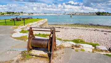
There are great places to visit near Joppa Farm including some great hiking areas, country parks, towns, hills, villages, historic buildings and airports.
Don't miss Tehidy's hiking areas if visiting the area around Joppa Farm.
Joppa Farm's best nearby country parks can be found at Tehidy Country Park, Kit Hill Country Park, and Mount Edgcumbe House and Country Park.
Joppa Farm has some unmissable towns nearby like Callington, Polperro, and St Ives.
Joppa Farm is near some unmissable hills like Kit Hill Country Park,
The area around Joppa Farm features a number of interesting villages including Cremyll, and Botallack.
Joppa Farm is near some unmissable historic buildings like Mount Edgcumbe House and Country Park,
Cornwall Airport Newquay, and Land's End Airport are great places to visit near Joppa Farm if you like airports.
Joppa Farm History
There are some historic monuments around Joppa Farm:
- Part of a field system and cairn field 375m west of Bojuthnoe Farm
- Courtyard house settlement known as Bosullow Trehyllys, 515m north east of Chun Castle
- Fogou at Lower Boscaswell
- Standing stone 410m south east of Boskenna Cross
- Treen Common stone circle
- Kerbed cairn 225m south of Heather Farm
- Stone cross base 450yds (405m) NW of Santry Farm
- Courtyard house settlement 315m NNE of Botrea Farm
- Iron Age defended settlement 460m south east of Caer Bran Farm
- Wayside cross-head in Sancreed churchyard on churchyard wall by west gate
- The Merry Maidens (or Dawns Men) stone circle
- Part of a prehistoric field system and medieval strip fields 250m south west of Higher Bartinney
- Trevescan Cross 340m SSW of Sennen Church
- Barrow 100yds (90m) SE of Halgolluir Farm
- Fogou 70m north of Pendeen Manor Farm
- Three wayside crosses in the churchyard of St Sennara's Church
- Round called Trewern Round
- Early Christian memorial stone and churchyard cross in Sancreed churchyard, 10m south of the church
- Medieval wayside cross 35m SSW of Pendrea Cottage, south west of St Buryan
- Enclosure 220yds (200m) NE of Trevean
- Wayside cross 310m WNW of Little Boswarthen
- Round cairn on Carn Polpry
- Churchyard cross in Sancreed churchyard, immediately south of the church
- Wayside cross base 125m west of the Merry Maidens stone circle
- Stone hut circle 40m west of Carnyorth Farm
- Tin streamworks 245m south east of Higher Numphra
- Hut circles with associated field system 400yds (360m) SW of Little Higher Bosullow
- Medieval playing place known as Plain an Gwary, St Just
- Tin mine calciner at Botallack Mine
- A kerbed cairn with cists, 450m north east of Trevedra Farm
- Long stone W of Boswens Common
- Three bowl barrows 380m south east of Bryndowr
- Boskenna Gate Cross
- Churchyard cross in St Buryan churchyard
- Standing stone 230m west of the Old Manor
- Iron Age defended settlement immediately south east of Boskennal Farm
- Round cairn 230m SSW of Higher Tregiffian
- Stone setting and holed stone known as the Men-an-Tol, 315m south east of Coronation Farm
- Round barrow 600yds (550m) NW of Nine Maidens stone circle
- Prehistoric entrance grave 900m north west of Tregiffian Farm
- Wayside cross in St Just Vicarage garden
- Promontory fort called Bosigran Castle
- Enclosed hut circle settlement, 500m north-west of Jericho Farm
- Two barrows on Woon Gumpus Common 700yds (640m) NNW of Boslow Farm
- Holy well 30m north west of St Levan's Chapel
- Megalithic tomb 220yds (200m) SW of Trevarthen
- Round cairn 160m north east of Bosistow Island
- Medieval chapel called Chapel Jane
- Holed stones on Kenidjack Common
- Courtyard house settlement 335m south of Nanjulian Farm
- Cliff castle known as Maen Castle
- Churchyard cross in St Just's churchyard, 10m west of the church
- Bowl barrow 300m south west of the Merry Maidens Stone Circle
- Standing stone 75m south of Tremayne
- Round 340m south east of Trevean
- Enclosure containing eight round cairns known as Bartine Castle, 460m south east of Higher Bartinney
- Round, courtyard house, stone hut circle settlement and field system 275m north of Castallack Carn
- Tremethick Cross, 760m east of Tremethick Farm
- Standing stone known as the 'Blind Fiddler', 405m south east of Lesbew Farm
- Chun Downs prehistoric landscape complex, incorporating Chun Cromlech, Chun Castle, and barrow 200yds (180m) SW of Chun Farm
- Two standing stones known as 'The Pipers', 130m and 230m south west of Boleigh Farm
- An entrance grave re-used as a kerbed cairn with cist known as 'Chapel Carn Brea'
- Two hut circles 380yds (350m) NE of Trevean
- Hut circle on Carnyorth Common 200yds (180m) W of Carn Kenidjack
- Botrea barrows
- Choone Cross, 220m WNW of Choone Farm
- Portal dolmen known as Mulfra Quoit
- Two stone hut circle settlements and part of an associated field system 370m south west of Boswens
- Holy well called Madron Well
- Round 500yds (460m) NW of Nancothan Cottages, Trewidden
- Cross slab at parish church
- Nun Careg Cross, 400m south-west of Boleigh Farm
- Standing stone 105m south east of Chyenhal Farm
- Promontory fort known as Treryn Dinas
- Group of round barrows on Truthwall Common
- Iron Age defended settlement, 330m south east of Caer Bran Farm
- Kerbed cairn 365m north west of Tredinney
- Wayside cross 200m north west of Pendrea
- Chambered barrow SSE of Treen
- Bowl barrow 180m north of the Merry Maidens Stone Circle
- Porthgwarra Ullies
- Round barrow 550yds (500m) N of Chycarne
- Base slab of a medieval wayside cross, 110m west of the Merry Maidens stone circle
- Bosiliack prehistoric settlement, field systems, entrance grave, cairns and later tinworks
- Deserted medieval settlement with 16th and 18th century structures 85m west of West Lanyon Quoit
- Medieval wayside cross 150m ESE of Lower Alsia
- Ring cairn 305m NNW of Joppa Farm
- Crows-an-wra medieval wayside cross and a turnpike milestone.
- Two entrance graves and two bowl barrows 670m SSE of Treen Farm
- Three round barrows 650yds (595m) N of Nine Maidens stone circle
- Kerbed cairn 100m NNW of Chapel Carn Brea
- Trembath Cross 200m ENE of Buryas Bridge
- Wayside cross in Sancreed churchyard, 20m south east of the church
- Leswidden Stone, 370m south west of Leswidden
- Wayside cross-head in St Sennen's churchyard, 10m south of the church
- Wayside cross in St Sennen's churchyard, 6m north of the church
- St Buryan churchtown cross
- Courtyard house settlement with part of a field system and a possible fogou 550m SSE of Treen
- Iron Age beehive hut 380m SSW of Bosporthennis Farm Cottage
- Two ring cairns 110m north east of Chycarne
- Medieval chapel known as Madron Well Chapel associated with Madron holy well
- Wayside cross 260m south east of Mayon Farm
- Multi-period archaeological landscape 430m north of Tredinney
- Round barrow 1000yds (910m) ESE of Rosemergy SW of Carn Galver
- Wayside cross known as Vellansagia Cross
- Standing stone called Tresvennack Pillar
- Croftoe British village
- Entrance grave 245m north west of Pennance
- Standing stone 150m north west of Trewern Round
- Boslow Cross 550yds (500m) NW of Boslow Farm
- Round barrow on Gear Common 400yds (370m) WSW of Pennance Farm
- Two standing stones known as the Long Stones, 280m south east of Higher Drift Farm
- Wayside cross in St Levan churchyard, 10m north east of the church
- Medieval chapel and hermitage called St Levan's Chapel
- Wayside cross immediately north east of St John the Baptist's Church
- Promontory fort called Kenidjack Castle
- Fogou 70m west of Higher Bodinnar
- Cist 165m east of Tredinneck Farm
- Two large regular stone circles 290m north east of Hailglower Farm
- Courtyard house and stone hut circle settlement 430m south west of Bosporthennis Farm Cottage
- Boskenna Cross
- The Men Scryfa, an early Christian memorial stone
- Courtyard house settlement with enclosure and fogou 235m south east of Porthmeor Farm
- Trevorgans Cross 375m east of Crows-an-wra
- Standing stone 230m south of Primrose Cottage
- Platform cairn 190m SSE of the Nine Maidens Stone Circle
- Hut circle 280yds (250m) SW of Trevarthen
- Round, courtyard house settlement and field system 140m WNW of Goldherring
- Watermill near Bosigran Castle
- Carnyorth Circles, Carnyorth Farm
- Medieval chapel called St Helen's Chapel with a dwelling and enclosure at Cape Cornwall
- Chapel 140m south west of Bosence
- Courtyard house settlement and field system and medieval farmstead 440m south of Bosporthennis Farm Cottage
- Wayside cross at Nanquidno Farm
- Promontory Fort called Trereen Dinas
- Three bowl barrows on Treen Common 430m north east of Higher Bosporthennis
- Two kerbed cairns 240m WSW of Boscregan
- Wayside cross at Tregwainton Carn
- Standing stone 60m north west of the Nine Maidens Stone Circle
- Enclosed stone hut circle settlement at Chygwidden Vean, 250m east of Land Vue
- Iron Age to Roman settlement with incorporated fogou and adjacent post-medieval cottage at Carn Euny
- Chambered long barrow known as Lanyon Quoit
- Two round barrows 300yds (270m) E of Little Higher Bosullow
- Barrow 250yds (230m) W of Higher Botallack
- Portal dolmen known as West Lanyon Quoit, 380m south west of Lanyon Farm
- Entrance grave 290m south west of Brane End Farm
- Higher Levant Mine
- Churchyard cross in St Levan churchyard, 10m south of the church
- Geevor Mine
- Bowl barrow 600m south west of Trewidden Farm
- Two kerbed cairns 285m north east of Higher Botallack
- Round barrow 300yds (270m) W of Nine Maidens
- Kerris Cross
- Large regular stone circle called Boscawen-Un with two outlying standing stones west of Boscawen Noon Farm
- Barrow 800yds (730m) WNW of Boswens Farm
- Wayside cross in Sancreed churchyard, 10m east of the church
- The Ballowall Barrow incorporating entrance grave, cairn, ritual pits and cists 420m WSW of Bollowal Farm
- Large regular stone circle known as the 'Nine Maidens' and a round cairn 690m north-west of Killiow Farm
- Cross 150m south west of Rospletha
- Field system on Truthwall Common
- Kerbed cairn and round cairn 210m north west of the Nine Maidens Stone Circle
- Standing stone 335m west of the Merry Maidens Stone Circle
- Round barrow 200yds (180m) NNW of Long Stone
- Promontory fort at Carn Les Boel
- Field system on Dry Carn
- An early Christian memorial stone at Boskenna
- Standing stone 200yds (180m) W of Chycarne
- Enclosed stone hut circle settlement and part of a field system 400m north of Bodrifty Farm
- Wayside cross 290m SSW of Madron Well
- Part of a prehistoric field system at Tor Noon
- Stone hut circle 390m south east of Little Brea Farm
- Entrance grave 140m east of Kerrow
- Two barrows and circular enclosure on Pordenack Point
- Stone hut circle settlements, courtyard house settlement, enclosures and part of a field system at Boswarva Carn
- Round cairn and medieval settlement 150m south of Solomons Isle
- Wayside cross 170m north of Trevilley
- Boleigh fogou
- Chapel and holy well on Chapel Downs
Places to see near Joppa Farm


Lakes near Joppa Farm
Rivers near Joppa Farm
- West Looe River
- Polperro River
- East Looe River
- Seaton
- Upper River Ruthern
- Amble
- Camel (De Lank to Stannon)
- Stannon Stream
- Lower River Camel
- St Lawrence Stream
- Issey Brook (Camel)
- Upper River Amble
- De Lank River
- Lower River Ruthern
- Demelza Stream (Ruthern)
- Polmorla Stream
- Upper River Camel
- Amble tributary (Camel)
- Allen
- Lanivet Stream
- Porth Stream
- Gannel (Upper)
- Menalhyl
- Gannel (Lower)
- Harlyn Water
- Benny Stream
- Porthcothan Stream
- Trebant Water
- Lerryn River
- Cardinham Water
- Warleggan River
- Fowey (Upper)
- Fowey (Warleggan to St Neot)
- Pont Pill
- St Neot River
- Lower River Fowey
- Crackington Stream
- Marsland Water
- Lower River Strat
- Lower River Neet
- Upper River Neet
- Jacob Stream
- Valency
- Upper River Strat
- Coombe Valley Stream
- Newlyn River
- Trevaylor Stream
- Penberth Stream
- Marazion River
- Lamorna Stream
- Roseworthy Stream
- Portreath Stream
- Red River (Upper)
- Bolingey Stream
- Red River (Lower)
- Hayle
- Angarrack Stream
- Holywell Stream
- Kestle Stream
- Upper River Allen (Fal)
- Kenwyn
- Kennal
- Zelah Brook
- Brighton Stream
- Hicks Mill Stream
- Gwindra Stream
- Tresillian River (Lower)
- Upper River Fal
- Calenick Stream
- Trevella Stream
- Tresillian River (Upper)
- Lower River Allen (Fal)
- Lower River Fal
- Upper Carnon River
- Lower River Carnon
- Bokiddick Stream
- Crinnis River
- St Austell River
- Caerhays Stream
- Par River (Upper)
- Par River (Lower)
- Tywardreath Stream
- Carminowe Creek
- Gunwalloe Stream
- Cury River
- Helford River
- Manaccan River
- Poltesco River
- Lestraines River
- Lower River Cober
- Porthleven Stream
- Upper River Cober
- Gweek River
- Upper River Inny
- Penpont Water
- Cotehele Stream
- Lowley Brook
- Lower River Inny
- Lower River Tamar
- Upper River Lynher
- Tiddy
- Withey Brook
- Lower River Lynher
- Tala Water
- Canworthy Water
- Carey
- Tamar (River Ottery to River Deer)
- Tamar (Small Brook to River Deer)
- Upper River Ottery
- Kensey
- Tamar (Small Brook to Lamberal Water)
- Small Brook (Tamar)
- Claw
- Tamar (River Ottery to River Lyd)
- Lower River Ottery
- Upper River Tamar
- Caudworthy Water
- Deer
- Lamberal Water
- Bolesbridge Water
- Derril Water
- Middle River Ottery


