


Hellandbridge
Hellandbridge is a village in the county of Cornwall.
There are great places to visit near Hellandbridge including some great hiking areas, country parks, towns, hills, villages, historic buildings and airports.
The area close to Hellandbridge boasts some of the best hiking areas including Tehidy.
There are a number of country parks near Hellandbridge including Tehidy Country Park, Kit Hill Country Park, and Mount Edgcumbe House and Country Park.
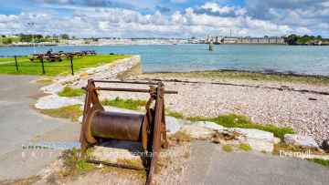
Hellandbridge has some unmissable towns nearby like Callington, Polperro, and St Ives.
Hills to visit near Hellandbridge include Kit Hill Country Park.
Hellandbridge has some unmissable villages nearby like Cremyll, and Botallack.
Hellandbridge is near some unmissable historic buildings like Mount Edgcumbe House and Country Park,
Cornwall Airport Newquay, and Land's End Airport are some of Hellandbridge best airports to visit near Hellandbridge.
Hellandbridge History
There are some historic monuments around Hellandbridge:
- Churchyard cross in Lanivet churchyard, 5m west of the church
- Medieval wayside cross in Blisland churchyard, 10m west of the church
- Kerbed cairn 415m NNW of Candra
- Standing stone 415m south west of Moorgate called 'Long Stone'
- Bowl barrow called Tregawne Barrow
- Ruthern Bridge with adjacent ford
- Berrycombe Cross, on the north side of Berrycombe Road at its junction with Cardell Road
- Medieval tenement boundary with adjacent medieval field north of Dinnever Hill
- Hut circles 330yds (300m) SW of Henneward
- Hut circle group and enclosure NE of Carwen
- Prehistoric cairns and field boundary 450m south of the Louden Stone Circle
- Tawna Downs round barrows
- St Ingunger Cross, 240m south-east of St Ingunger Farm
- Stannon Stone Circle, prehistoric field system, hut circle settlement, cairns, cist, linear boundaries and medieval building north of Dinnever Hill
- Iron Age defended settlement called Penhargard Castle
- Two stone hut circles 130m south east of Highsteps
- Small multivallate hillfort with outworks known as Pencarrow Rounds
- Two bowl barrows 535m ENE of Fairy Cross forming part of a round barrow cemetery
- Medieval wayside cross at Blisland
- Bowl barrow 270m south west of Castle Hill Farm
- Killibury Castle later Prehistoric hillfort
- Wayside cross in the grounds of Pencarrow, 130m SSE of Pencarrow House
- Medieval tenement boundary between Louden Hill and King Arthur's Downs
- Polrode Cross in St Kew churchyard, 3m east of the church
- Roman fortlet 440m south west of Restormel Farm
- Motte and bailey castle called Cardinham Castle
- Bowl barrow 145m north west of Bodmin Lodge forming part of a round barrow cemetery
- Bury Castle
- Stone hut circle settlement and part of a coaxial field system at Watergate
- Trezance Holy Well and chapel enclosure
- Woodley Cross, opposite Fernside Farm
- Wayside cross known as Peverell's Cross
- Large regular stone circle 560m north east of Leaze
- Wayside cross 55m north east of Laninval House
- Bowl barrow 430m south west of Fairy Cross Farm forming part of a round barrow cemetery
- Ornamented cross shaft at Glynn
- Wayside cross in the grounds of the former Rectory at Withiel, 70m south-west of the house
- Three platform cairns 320m south-east of Moorgate
- Prehistoric stone setting 62m north-west of the Stannon Stone Circle
- Trequite Cross, at Trequite village
- Reperry Cross, 550m ENE of Reperry Manor Farm
- The Louden Stone Circle, 950m ENE of Camperdown Farm
- Stone hut circle north of Dinnever Hill, 200m WNW of the Stannon Stone Circle
- Bowl barrow known as Council Barrow
- Trevenning Cross and post-medieval guide post, 700m south west of Trevenning village
- Large regular stone circle called the Trippet Stones
- An early Christian memorial stone at Lancarffe
- Four bowl barrows on Bofarnel Downs forming part of a round barrow cemetery
- St Protus's Cross, 330m east of Blisland church
- Churchyard cross in Lanhydrock churchyard
- Wayside cross in the grounds of Higher Lank Farm 10m south of the farm house
- The Middle Moor Cross, 230m north-east of Camperdown Farm
- Slight univallate hillfort in Dunmere Wood 235m WNW of Crabb's Pool
- Round cairn with central cist capstone and inner kerb 935m north-east of Camperdown Farm
- Small multivallate hillfort called Tregeare Rounds
- Wayside cross 220m north west of Steppes Farm
- Two small stone circles 530m ESE of King Arthur's Hall
- Early Christian memorial stone and wayside cross in Cardinham churchyard, 10m east of the church
- Wayside cross in Egloshayle churchyard, 0.16m west of the church porch
- Prehistoric standing stone, medieval wayside cross and cross base and post-medieval guide post at Longstone
- Treslea Cross, 750m ENE of Cardinham Church
- Churchyard cross in Lanivet churchyard, 30m north of the church
- Wayside cross in Egloshayle churchyard, 0.46m east of the church porch
- The Prior's Cross at Washaway
- Three bowl barrows 590m south west of Bedwindle forming part of a round barrow cemetery
- Round barrow cemetery on Hustyn Downs
- Large multivallate hillfort known as 'Castle Canyke', 375m SSW of Castle Canyke Farmhouse
- Medieval wayside cross in St Mabyn churchyard
- Wayside cross at Bodwannick Manor Farm
- Wayside cross on Druid's Hill, 350m south east of Bodmin Lodge
- Hut circle 440yds (400m) SW of Candra
- Restormel Castle: motte, bailey and shell keep
- Two hut circles 400m WSW of Furhouse
- Round 410m west of Kenningstockmill
- Slight univallate hillfort with outworks containing a medieval chapel and beacon at Helsbury Castle
- Inchs Cross, 200m south-west of Inchs
- Ring cairn 295m north west of Candra
- St Bellarmin's Chapel
- Earlier prehistoric hillfort, stone hut circle settlement and field system at Helman Tor
- Stone hut circle settlement and part of a coaxial field system 940m north east of Newton
- Medieval churchyard cross 20m south of the Church of St Bruerdus, Churchtown
- Lesquite Cross, 160m NNW of Lesquite Farm
- Two wayside crosses in the grounds of Trewardale 34m WSW of the house
- A henge re-used as a medieval playing place, 75m north east of Castle Hill Farm
- Carminow Cross, south east of Bodmin
- Medieval wayside cross in Blisland churchyard, 30m east of the church
- The Three Holes Cross 550m west of Sandylands Farm
- Three wayside crosses in St Julitta's churchyard
- Kerbed cairn on Alex Tor
- Barrow group on Greenbarrow Downs
- Wayside cross 120m north west of Callywith
- Holy well near St James' Chapel
- Chapel Amble Cross in St Kew churchyard, 30m north west of the church
- Cross near Deviock Cottage
- Portal dolmen 400m north east of Lesquite Farm
- Fenton Pits Cross, 210m WSW of Penburthen Farm
- Kerbed cairn 500m east of Casehill
- Helland Bridge
- Iron Age defended settlement 500m north west of Higher Trevinnick
- Wayside cross 330m NNW of Higher Woodley
- Medieval wayside cross at Lockengate
- Job's Cross, medieval wayside cross 500m north east of Trewethern
- Medieval chapel of St Thomas Becket 45m east of the church, Priory Road in Bodmin
- Medieval wayside cross at Castle Hill, 740m north east of Bodmin parish church
- Hut circles near New Hall
- Platform cairn on Dinnever Hill, 510m north of Camperdown Farm
- Medieval churchyard cross in Michaelstow churchyard
- Churchyard cross in the cemetery at St Teath, 60m north west of the church
- Prehistoric hut circle and field system 440m south west of Treswallock Cottage
- Holy well in Michaelstow churchyard
- Four bowl barrows north of Greymare Farm, forming part of a round barrow cemetery
- The Castle Goff Stone and Valley Truckle Cross in St Julitta's churchyard
- Prehistoric to post-medieval funerary, ritual and settlement remains on and around Louden Hill
- Churchyard cross in Cardinham churchyard, 5m south of the church
- Cross head N of Tregony Farm
- Roman fort called 'Nanstallon Roman fort' 135m south west of Tregear
- Multi-span bridge known as Respryn Bridge
- King Arthur's Hall
- Prehistoric embanked platform cairn and linear boundary with superimposed medieval boundary and adjacent clearance cairn on Dinnever Hill
- Lantern cross 60m north east of Lancarffe
Places to see near Hellandbridge


Lakes near Hellandbridge
Rivers near Hellandbridge
- West Looe River
- Polperro River
- East Looe River
- Seaton
- Upper River Ruthern
- Amble
- Camel (De Lank to Stannon)
- Stannon Stream
- Lower River Camel
- St Lawrence Stream
- Issey Brook (Camel)
- Upper River Amble
- De Lank River
- Lower River Ruthern
- Demelza Stream (Ruthern)
- Polmorla Stream
- Upper River Camel
- Amble tributary (Camel)
- Allen
- Lanivet Stream
- Porth Stream
- Gannel (Upper)
- Menalhyl
- Gannel (Lower)
- Harlyn Water
- Benny Stream
- Porthcothan Stream
- Trebant Water
- Lerryn River
- Cardinham Water
- Warleggan River
- Fowey (Upper)
- Fowey (Warleggan to St Neot)
- Pont Pill
- St Neot River
- Lower River Fowey
- Crackington Stream
- Marsland Water
- Lower River Strat
- Lower River Neet
- Upper River Neet
- Jacob Stream
- Valency
- Upper River Strat
- Coombe Valley Stream
- Newlyn River
- Trevaylor Stream
- Penberth Stream
- Marazion River
- Lamorna Stream
- Roseworthy Stream
- Portreath Stream
- Red River (Upper)
- Bolingey Stream
- Red River (Lower)
- Hayle
- Angarrack Stream
- Holywell Stream
- Kestle Stream
- Upper River Allen (Fal)
- Kenwyn
- Kennal
- Zelah Brook
- Brighton Stream
- Hicks Mill Stream
- Gwindra Stream
- Tresillian River (Lower)
- Upper River Fal
- Calenick Stream
- Trevella Stream
- Tresillian River (Upper)
- Lower River Allen (Fal)
- Lower River Fal
- Upper Carnon River
- Lower River Carnon
- Bokiddick Stream
- Crinnis River
- St Austell River
- Caerhays Stream
- Par River (Upper)
- Par River (Lower)
- Tywardreath Stream
- Carminowe Creek
- Gunwalloe Stream
- Cury River
- Helford River
- Manaccan River
- Poltesco River
- Lestraines River
- Lower River Cober
- Porthleven Stream
- Upper River Cober
- Gweek River
- Upper River Inny
- Penpont Water
- Cotehele Stream
- Lowley Brook
- Lower River Inny
- Lower River Tamar
- Upper River Lynher
- Tiddy
- Withey Brook
- Lower River Lynher
- Tala Water
- Canworthy Water
- Carey
- Tamar (River Ottery to River Deer)
- Tamar (Small Brook to River Deer)
- Upper River Ottery
- Kensey
- Tamar (Small Brook to Lamberal Water)
- Small Brook (Tamar)
- Claw
- Tamar (River Ottery to River Lyd)
- Lower River Ottery
- Upper River Tamar
- Caudworthy Water
- Deer
- Lamberal Water
- Bolesbridge Water
- Derril Water
- Middle River Ottery


