Fountains Abbey by munki-boy
Fountains Abbey (ruin)
Grade I listed Fountains Abbey is a ruined yet beautiful and well-preserved Cistercian monastery located in Yorkshire, England. It is a popular tourist destination, due to its stunning architecture and historical significance. The site includes the remains of the monastery itself, as well as features from the 18th century gardens of Fountains Hall.
The Abbey flourished for many centuries, but began to decline in the 16th century. In 1539, Henry VIII dissolved all monasteries in England as part of the Dissolution of the Monasteries. Fountains Abbey was seized by the Crown and sold off to private owners. Over time, it fell into ruin.
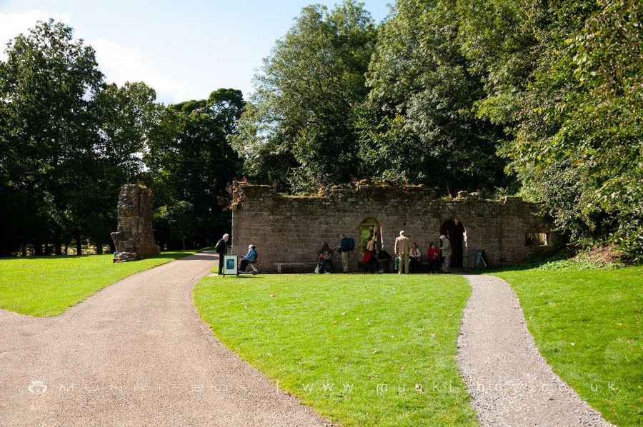
Today, Fountains Abbey managed by the National Trust. It is open to the public year-round, and is a popular spot for both tourists and locals alike. Whether you’re interested in history, architecture, or simply want to enjoy a beautiful day out, Fountains Abbey is definitely worth a visit.
The White Monks
Fountains Abbey was a Cistercian monastery, and Cistercians - or “white monks” owing to their undyed habits - led a harder life than earlier monastic orders, believing in the importance of austerity, prayer, and manual labor. Seeking isolation, they built their homes in remote and wild areas where they implemented large land improvement projects.
Monasteries were an essential component of medieval culture, not only serving as places of worship, learning, and charity, but also acting as centres of enormous wealth and political power owing to the extensive land holdings of some orders.
Fountains Abbey History
The abbey was established in 1132 by a group of monks from the Benedictine Abbey of St Mary in York, the abbey was adopted by the Cistercian order a few months later.
The early years were difficult, but the abbey expanded greatly under Abbot Murdac in the 1140s, when simple timber structures were replaced with a formal enclosure of the cloister. Following the tragic fire of 1146 that destroyed the abbey, a period of rebuilding ensued, during which much of Murdac’s prior work was replaced.
As a result of the developments under abbots Murdac, Pipewell, and Huby, the Abbey grew in size and splendor to become England’s most powerful house.
Fountains Abbey was finally dissolved in 1539 when all fittings were torn out and some stone was taken away for buildings elsewhere.
What to See When You Visit Fountains Abbey
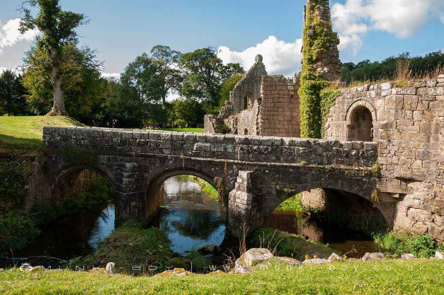
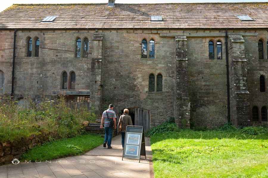
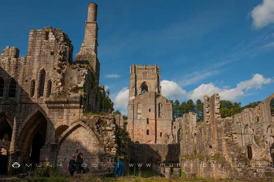
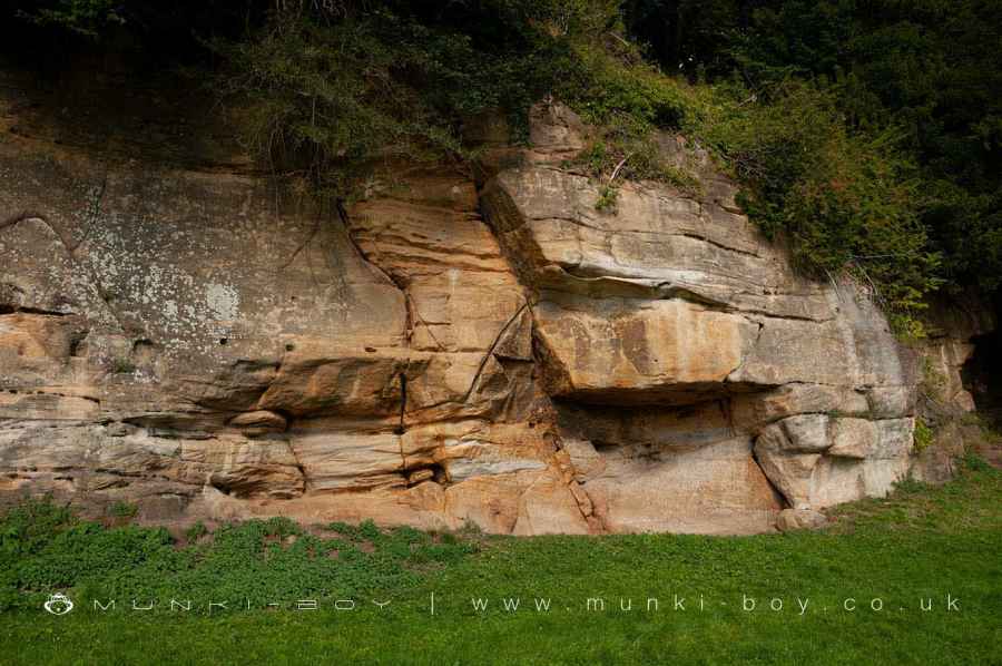
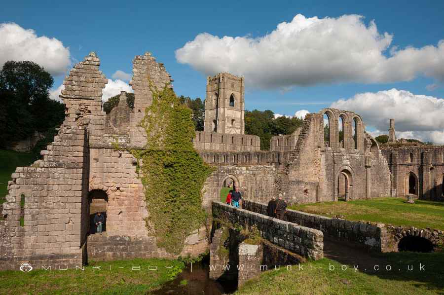
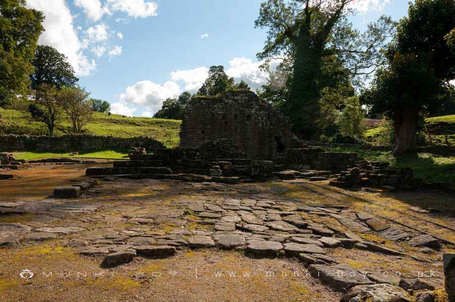
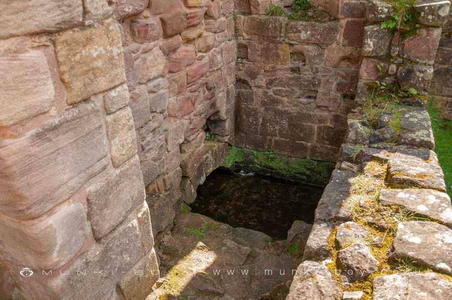
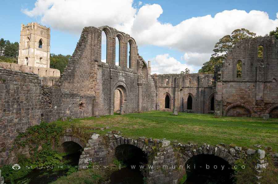
Fountains Abbey is located in a remote, narrow valley of the River Skell, with its north bank having been mined away to form a cliff. The standing remains of the monastery and other features inside the outer enclosure wall are part of a scheduled monument.
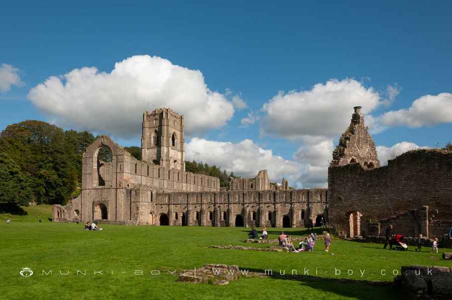
The extensive and exceptionally well preserved standing ruins indicate the typical layout of a Cistercian abbey, which are located to the north of and occasionally straddling the River Skell.
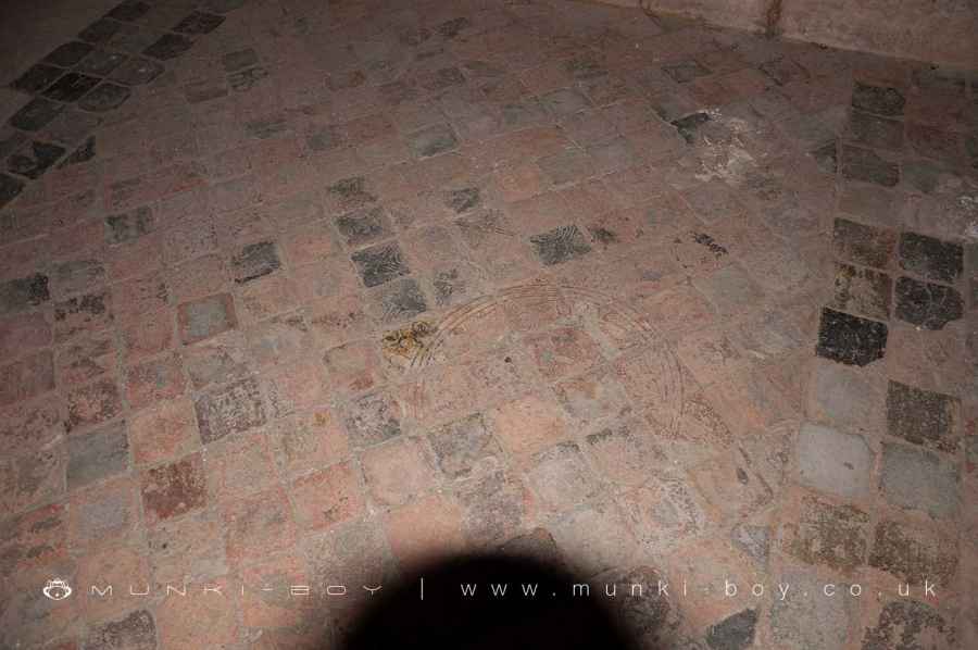
Excavations have revealed the remains of timber structures and of the first stone church erected in the 1130s and 1140s, respectively, within the existing standing ruins, suggesting that similar traces will be preserved elsewhere.
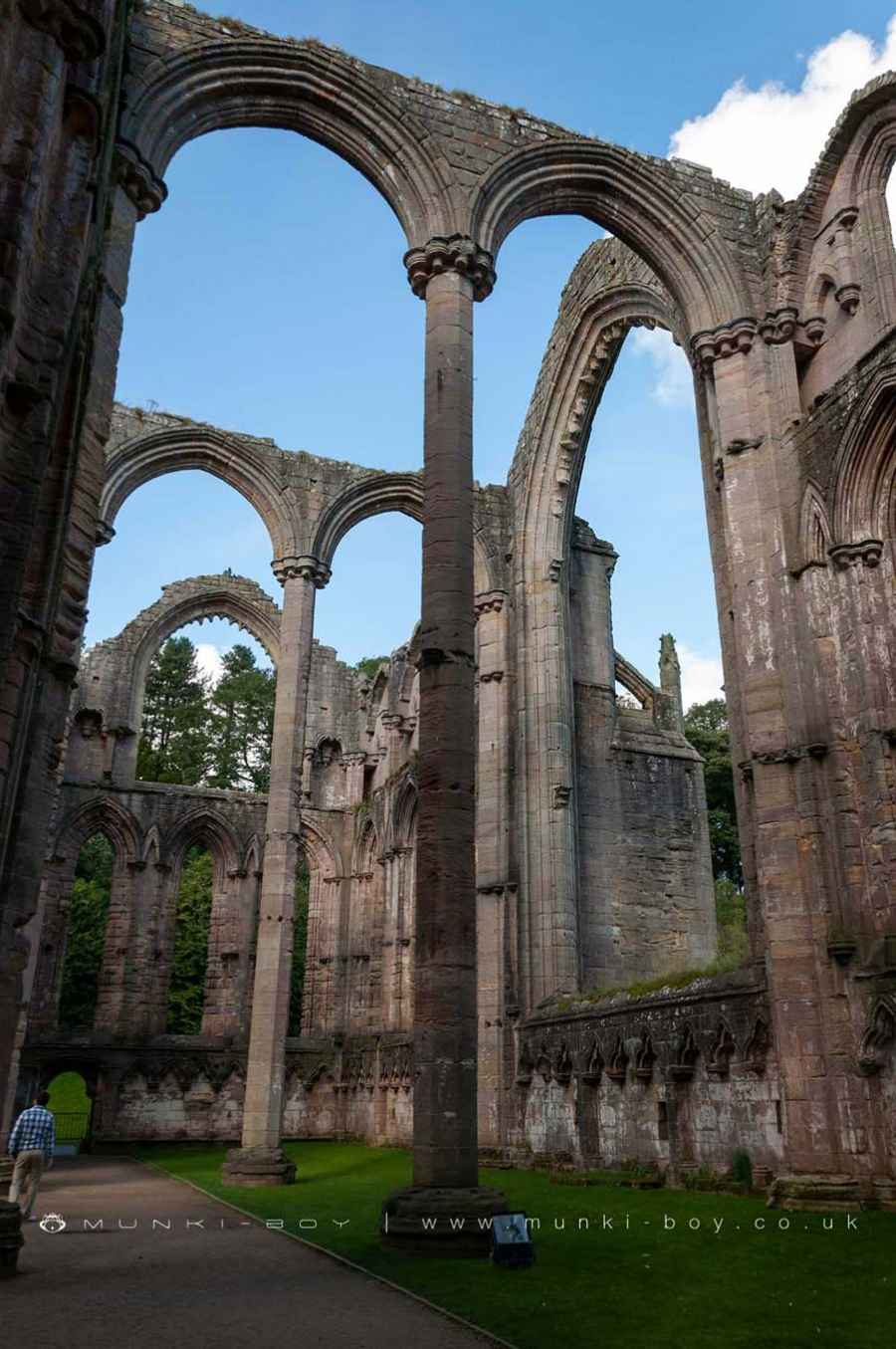
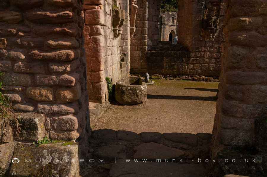
The refectory, or communal dining hall, was located on the western side of the Abbey. The north range of the four-sided cloister included an east to west oriented church that formed the northern range of a four-sided complex known as the cloister, with lay and monastic brethren’s lodgings on the remaining sides.
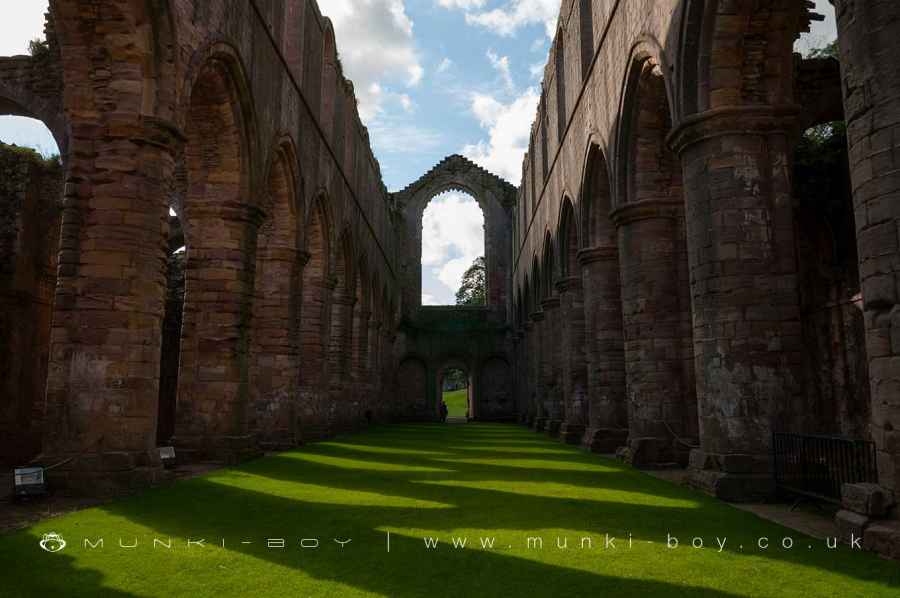
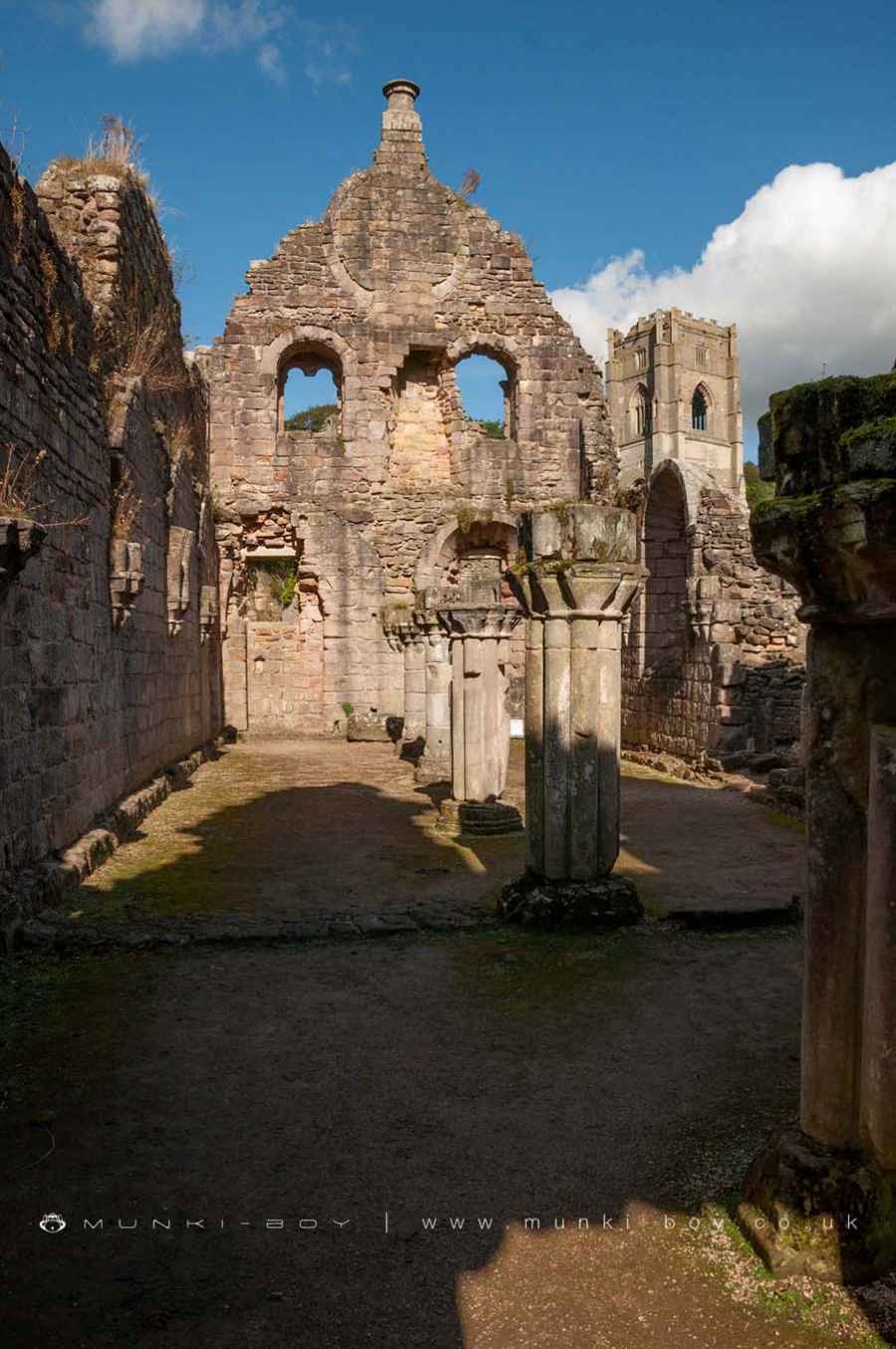
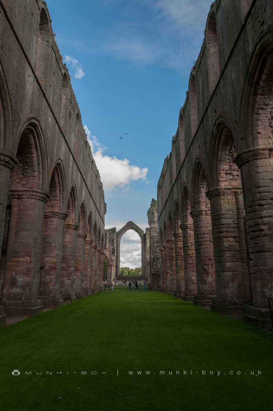
The nave, aisles, and transepts of the existing church date primarily to the 1150s and 1160s, when an earlier church that had been partly damaged in a fire was replaced by the considerably larger structure that we see today.
The simplicity of its architecture and plan is characteristic of Cistercian buildings in Europe during the mid 12th century, and the order’s austerity is demonstrated by the lack of a triforium or gallery in the nave.
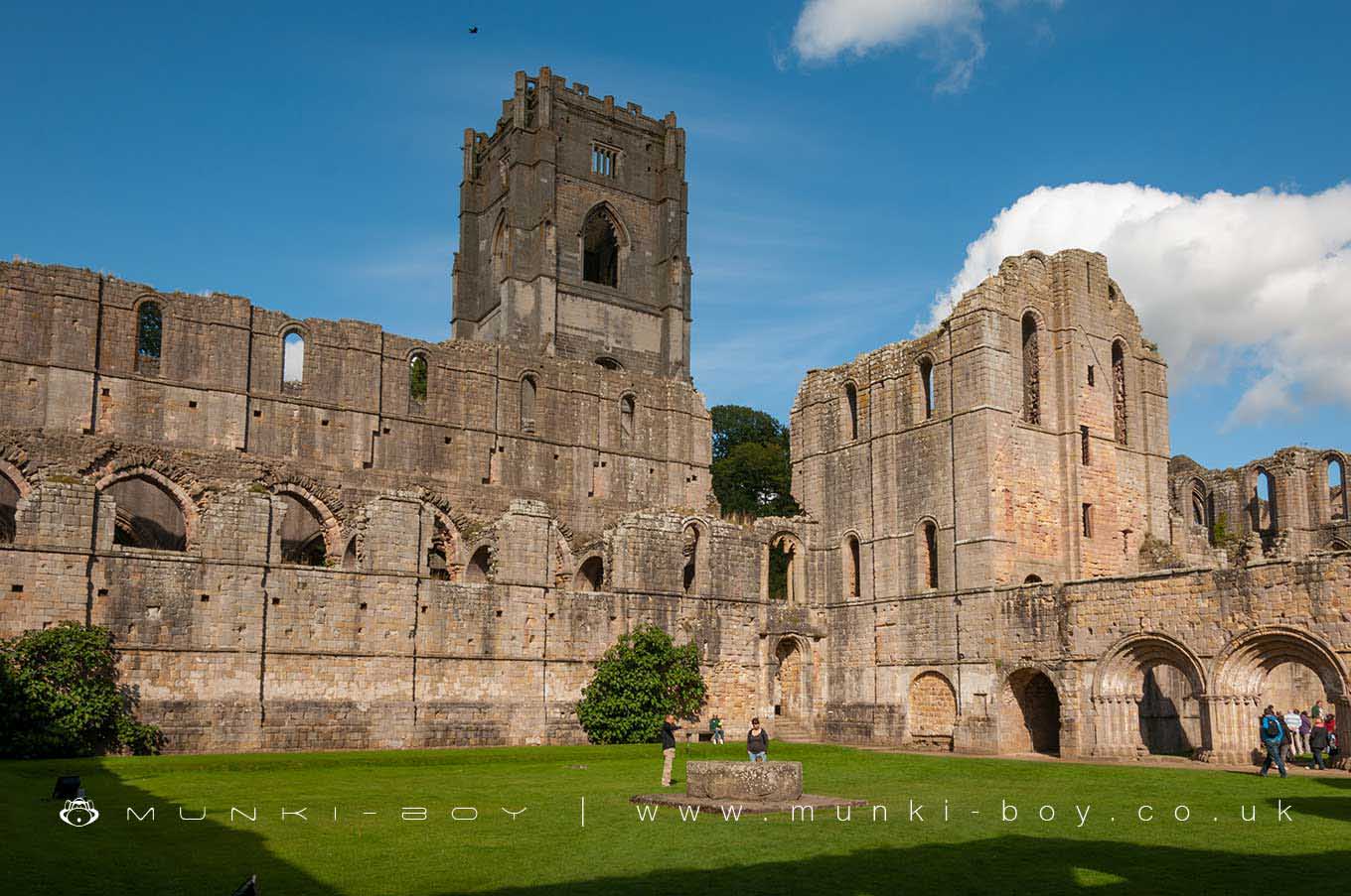
The Crossing and The Choir
Interestingly, the sound of the offices being sung in the choir stalls above the crossing, where the transepts join the nave was amplified by a pair of stone-lined pits called resonance chambers.
The early 13th century aisled presbytery and transepts, which now stand at the church’s eastern end, replaced the previous aisleless and square-ended middle section.
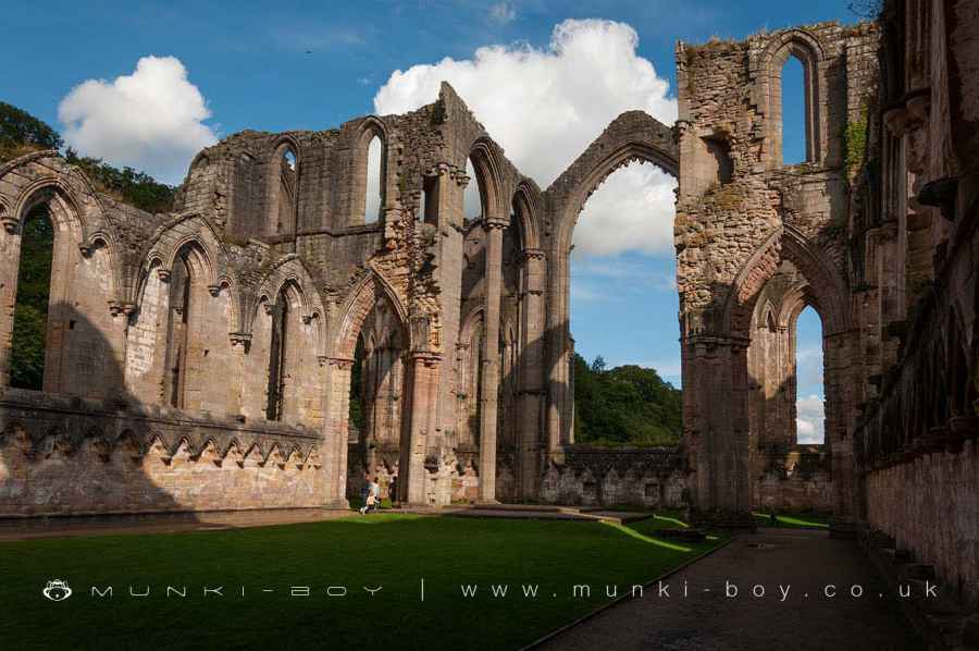
The Chapel of the Nine Altars
The second transept, the Chapel of Nine Altars, is preserved to a significant hight, and most of the architectural features are intact. The chapel derives its name from the location of nine altars, which were dedicated to a range of saints.
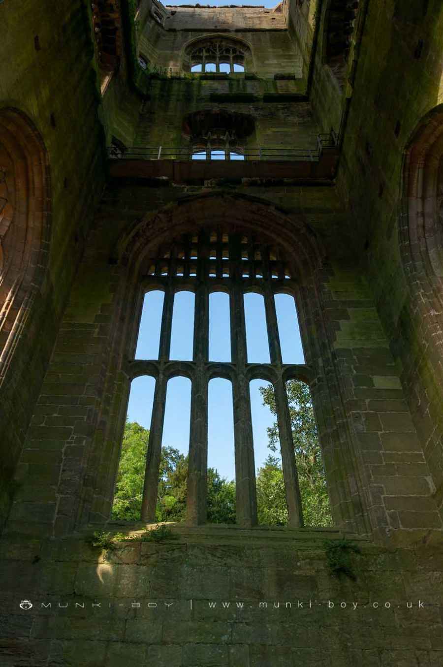
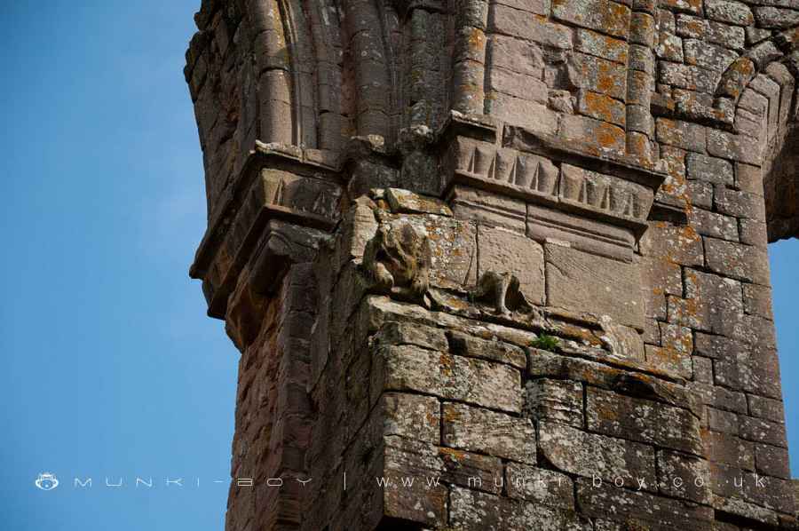
Huby’s Tower
To the north of the transept, Huby’s tower still rises to a height of 48.7m. It was completed in the early 16th century and remains largely intact, save for its floors, roof, bells, and some window tracery.
Fountains Abbey Architecture
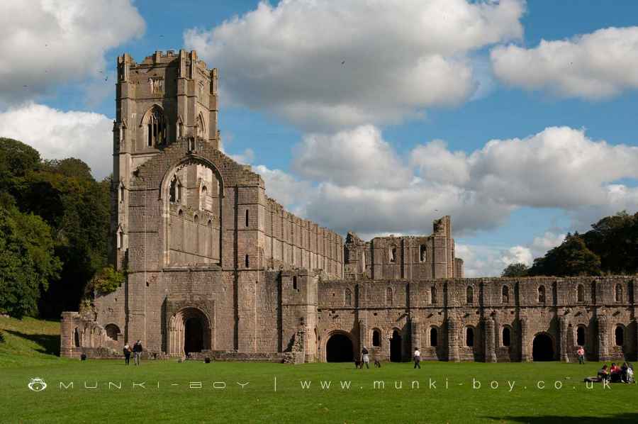
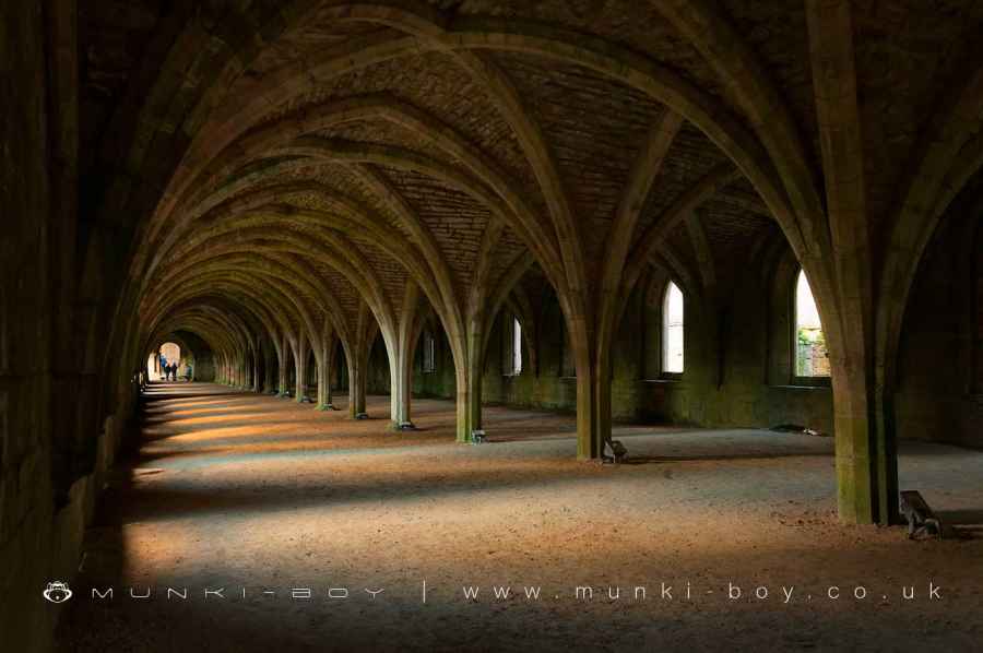
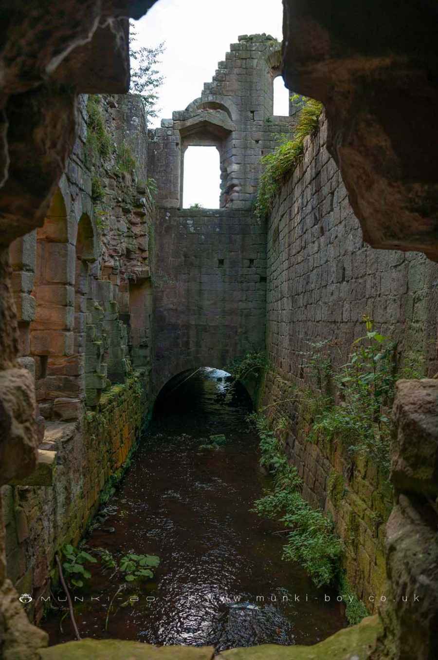
The long, western wing is 91.5 meters in length and has a southern end that extends over the river on the foundations of an earlier bridge.
The first floor, which included the cellarium or storeroom as well as the lay brothers’ refectory, was completely preserved. It is vaulted in 22 double bays from a line of central piers that spring without an intervening capital and, while now a single open area, was originally divided into separate rooms.
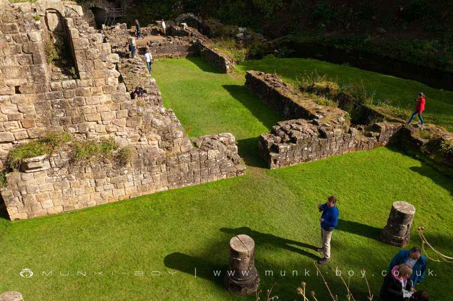
To the south of the church, the cloister and claustral ranges were first constructed in 1154 and subsequently modified and expanded during two phases of restoration, from the 1160s to the 1180s.
The library, the chapter house, the parlor, and a long chamber that extends beyond the cloister are on the ground level of the east range.
The chapter hall and the north wing of the west range were erected in the 1160s, and the south wing of the west range, as well as the cloister arcade, were built in the 1170s. Remains of earlier structures may be seen throughout existing ruins.
Fountains Abbey World Heritage Site
Fountains Abbey is a World Heritage Site, due to its significant historical and architectural importance. The Abbey is one of the best-preserved medieval monasteries in England, and has been praised for its beauty and unique design.
Fountains Abbey was once the most powerful and affluent monastic house in northern England. The major monastic structures have survived well, and they preserve important architectural evidence of the monastery’s changing status.
In particular, the Chapel of the Nine Altars, which is unique in England, has been preserved to its full height as well as the cellarium of the west range’s vaulted ceiling for a length of 91.5 meters.
Fountains Abbey (ruin) is in Nidderdale AONB, a designated Area of Outstanding Natural Beauty.
Created: 14 March 2022 Edited: 29 November 2023

Fountains Abbey and Studley Royal Water Garden Information
Fountains Abbey and Studley Royal Water Garden Address
Ripon HG4 3DY, UK
HG4 3DY
Website: https://www.nationaltrust.org.uk/fountains-abbey-and-studley-royal-water-garden
Get directionsSkell from Source to River Laver Details
Skell from Source to River Laver
Skell from Source to River Laver is a river in North Yorkshire
Skell from Source to River Laver takes in water from an area around 37.633 km2 in size and is part of the Ure Middle and Lower catchment area.
Skell from Source to River Laver is 22.151 km long and has been heavily modified by industry in the past.
Fountains Abbey (ruin) LiDAR Map

Contains public sector information licensed under the Open Government Licence v3.0
Local History around Fountains Abbey (ruin)
There are some historic monuments around including:
Castle Dikes defended Roman villaMedieval monastic fishponds immediately east of Park HouseRipley Park crossSite of medieval chapel and section of Fountains Park park pale, 170m south west of How Hill FarmWallerthwaite medieval villageMarkenfield Hall moated medieval fortified house with associated service buildings and park paleMotte and bailey castle, known as Mowbray Castle, east of Kirkby MalzeardRipon Minster CloseAiley HillRound barrow 250m west of WallerthwaiteSt Anne's ChapelVillage cross with sundial and stocksFountains Cistercian Abbey; monastic precinct, mill, water management works, agricultural and industrial features and 18th century gardensButterton BridgeCross base in All Saints' churchyardMedieval monastic grange and site of medieval settlement at NinevahMedieval deer park pale surrounding Fountains ParkCistercian grange and medieval settlement at High Cayton.


