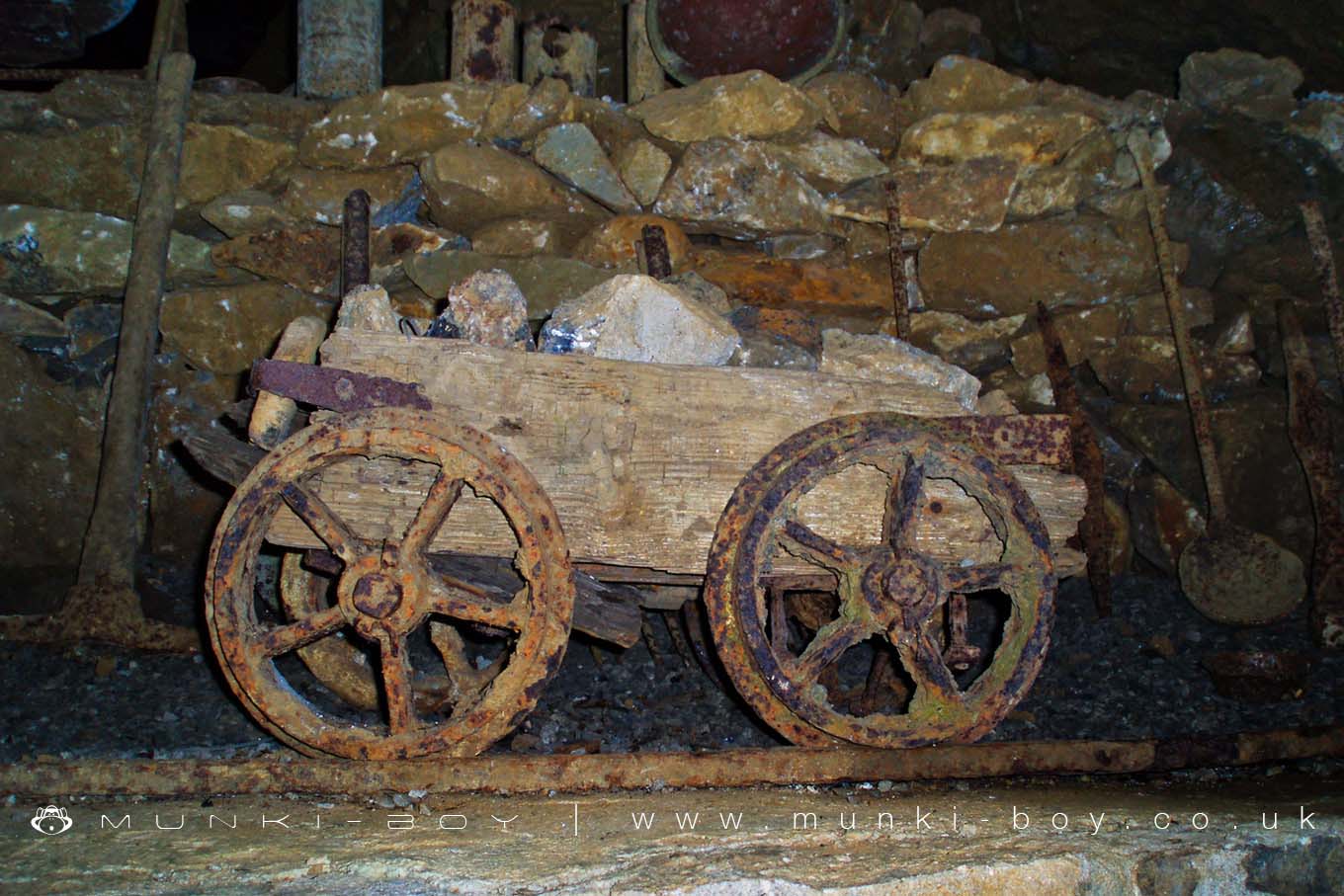
Blue John Cavern Minecart by munki-boy
Blue John Cavern
Blue John Cavern is in The Peak District National Park in England.
Blue John Cavern is a well-known show cave located near Castleton in Derbyshire, within the Peak District National Park. It is famous for its deposits of Blue John, a rare and striking variety of banded fluorite that displays vivid blue and yellow colours. This mineral is unique to this part of Derbyshire, making the cavern one of only a few places in the world where it can be found.
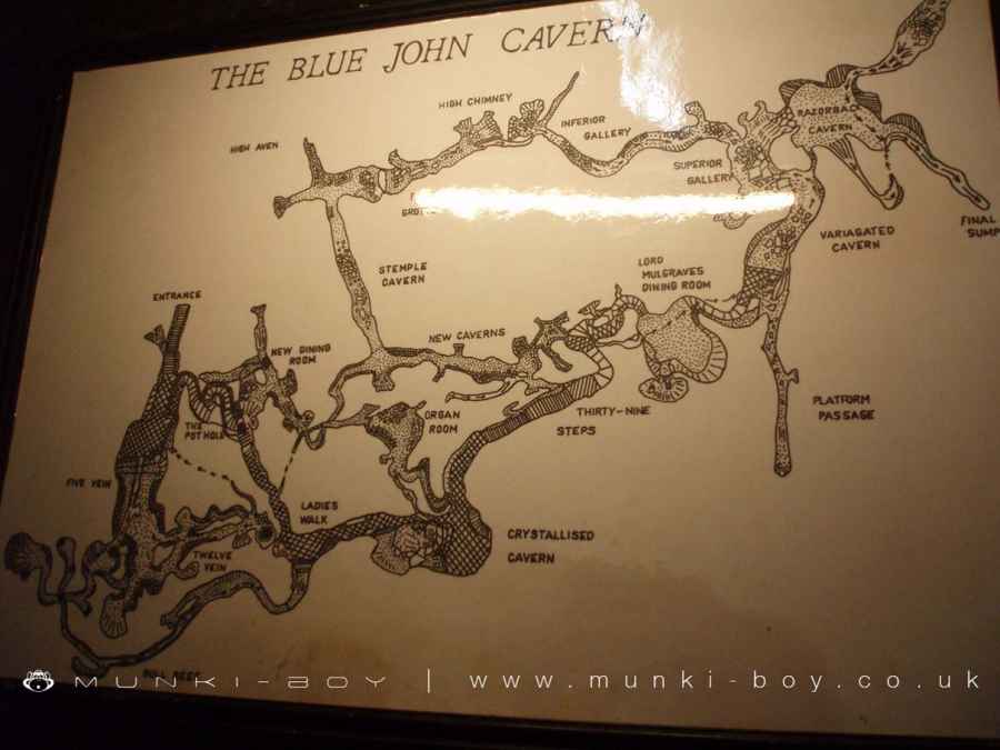
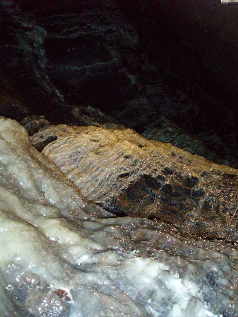
The cavern consists of natural limestone chambers and mining tunnels that have formed over millions of years. Visitors can explore a number of impressive underground spaces, including the Waterfall Cavern and the Grand Crystallised Cavern. These feature a range of geological formations such as stalagmites and exposed veins of Blue John, giving a vivid picture of the area’s geological history.
Guided tours are available and typically last around 50 minutes to an hour. The guides are knowledgeable and often have direct experience of mining in the cavern. Tours are enhanced with electric lighting, making it easier to appreciate the natural features without overwhelming the atmosphere of the cave.
Blue John Cavern is still an active site for small-scale mining, with pieces of the mineral extracted under careful control. The Blue John is then used to make jewellery and decorative items, which can be bought in the cavern’s shop or in shops in Castleton village.
The cave is accessible from the Mam Tor Road and is close to other local landmarks such as Winnats Pass and Peveril Castle. With its combination of rare geology, industrial heritage, and natural underground beauty, Blue John Cavern remains one of the Peak District’s most popular visitor attractions.
Created: 8 November 2018 Edited: 2 May 2025

Blue John Cavern
Blue John Cavern LiDAR Map

Contains public sector information licensed under the Open Government Licence v3.0
Local History around Blue John Cavern
There are some historic monuments around including:
Cop Low oval barrowStanding cross known as Wheston CrossTown defences 270m north and 350m north east of Peveril CastleBowl barrow on Withery LowBowl barrow on Withery LowBatham Gate, Roman roadOdin Mine nucleated lead mine and ore works, 350m WNW of Knowlegates FarmPlatform cairn south of Hill RakeEldon Hill bowl barrowRound cairn on Bridge-end Pasture, 300m north-east of Two Thorne Fields FarmOne of two bowl barrows on Bole HillHow Grove Lead MineCoalpithole RakeThe Tong bowl barrow and long barrowHope MottePalisaded hilltop enclosure 230m SSE of Dirt LowNew Rake lead mines 600m south east of Rowter FarmMedieval hospital 530m south east of Losehill HallStanding cross in the churchyard of St Peter's ChurchTideslow Rake lead rake and lime kilnFaucet Rake lead mines 870m south west and 930m south east of Oxlow HouseCop Rake and Moss Rake lead mines 750m north east of Wheston HouseRound cairn on Bridge-end Pasture, 600m north-east of Two Thorne Fields FarmSnelslow Plantation bowl barrowRound barrow 500m south west of Peveril CastlePeveril Castle eleventh to fourteenth century tower keep castlePin Dale lead side veinsSlitherstone and Linacre lead mines and a limekiln 725m south west of Rowter FarmGautries Hill bowl barrowOxlow Rake lead minesOx Low oval barrowWatt's Grove Rake lead mines 520m north of SweetknollLord's Seat bowl barrowPerry Dale bowl barrow and long barrowHigh Rake MineEngine Sough and associated nucleated lead mine, 500m south of Mam TorPeakshill or Oden soughTides Low bowl barrow, limekiln and standing stoneHill's Venture lead mineAnglian high cross in the churchyard of St Peter's ChurchThe Folly platform cairnHarrod Low long barrowOne of two bowl barrows on Bole HillCrookstone Hill round cairnGautries RakeSlight univallate hillfort and two bowl barrows on Mam TorEldon Hill crushing circle, associated lead mining remains and palisaded enclosure on Eldon HillWayside cross known as Eccles Cross.


