Castleton by munki-boy
Castleton
Castleton is in The Peak District National Park in England.
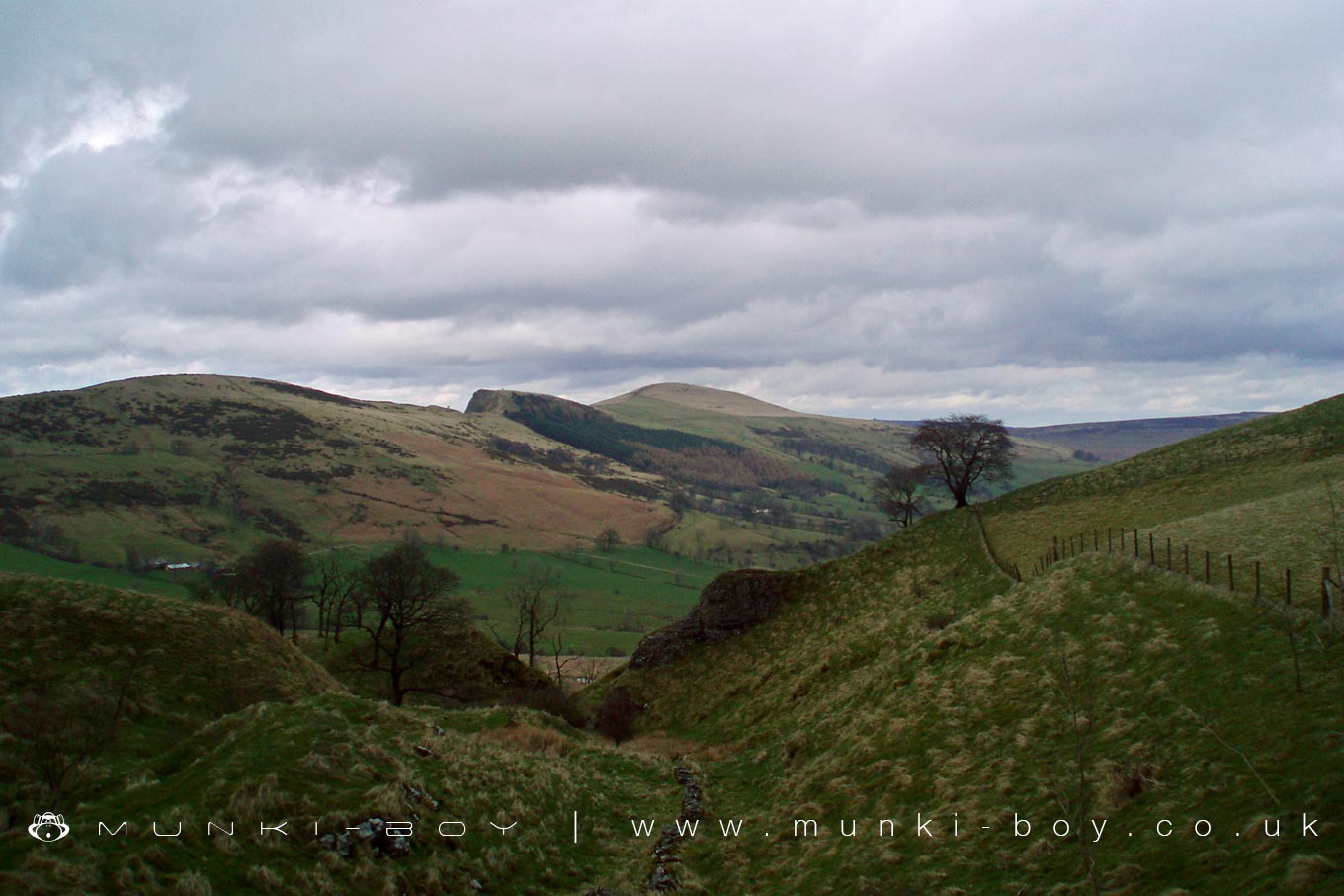
Castleton in Derbyshire is home to the fantastic limestone caves of Blue John Cavern and Speedwell Cavern, overlooked by the mighty Mam Tor.
Created: 8 November 2018 Edited: 29 November 2023
Castleton
Shopping in Castleton
Sandbrook Park Sudden, Castleton
Sandbrook Park retail park
Tesco Manchester Road, Sudden
Tesco supermarket
The Co-operative Food Leonard Street, Trub
The Co-operative Food supermarket
Local History around Castleton
There are some historic monuments around including:
Wind Low bowl barrow and standing crossOdin Mine nucleated lead mine and ore works, 350m WNW of Knowlegates FarmPlatform cairn south of Hill RakeCop Rake and Moss Rake lead mines 750m north east of Wheston HouseTown defences 270m north and 350m north east of Peveril CastleEldon Hill bowl barrowPike Low bowl barrowPalisaded hilltop enclosure 230m SSE of Dirt LowPeveril Castle eleventh to fourteenth century tower keep castleAnglian high cross in the churchyard of St Peter's ChurchTideslow Rake lead rake and lime kilnPeakshill or Oden soughStone circle 330m north west of Crookhill FarmHow Grove Lead MineThe Grey DitchTides Low bowl barrow, limekiln and standing stoneRound cairn on Bridge-end Pasture, 600m north-east of Two Thorne Fields FarmFaucet Rake lead mines 870m south west and 930m south east of Oxlow HouseSlight univallate hillfort and two bowl barrows on Mam TorRound barrow 500m south west of Peveril CastleEngine Sough and associated nucleated lead mine, 500m south of Mam TorHill's Venture lead mineRound cairn 430m west of Crookhill FarmSlitherstone and Linacre lead mines and a limekiln 725m south west of Rowter FarmOne of two bowl barrows on Bole HillBurr Tor prehistoric stock enclosureHope MotteWatt's Grove Rake lead mines 520m north of SweetknollBatham Gate, Roman roadStanding cross known as Wheston CrossEldon Hill crushing circle, associated lead mining remains and palisaded enclosure on Eldon HillWayside cross known as Eccles CrossNew Rake lead mines 600m south east of Rowter FarmLong Low bowl barrowNavio Roman fort and vicusOne of two bowl barrows on Bole HillRound cairn on Bridge-end Pasture, 300m north-east of Two Thorne Fields FarmLord's Seat bowl barrowThe Folly platform cairnOxlow Rake lead minesStanding cross in the churchyard of St Peter's ChurchPerry Dale bowl barrow and long barrowRound cairn and clearance cairn 770m north west of Crookhill FarmOx Low oval barrowMedieval hospital 530m south east of Losehill HallSnelslow Plantation bowl barrowCrookstone Hill round cairnCop Low oval barrowPin Dale lead side veinsHigh Rake MineTup Low bowl barrowThe Tong bowl barrow and long barrow.