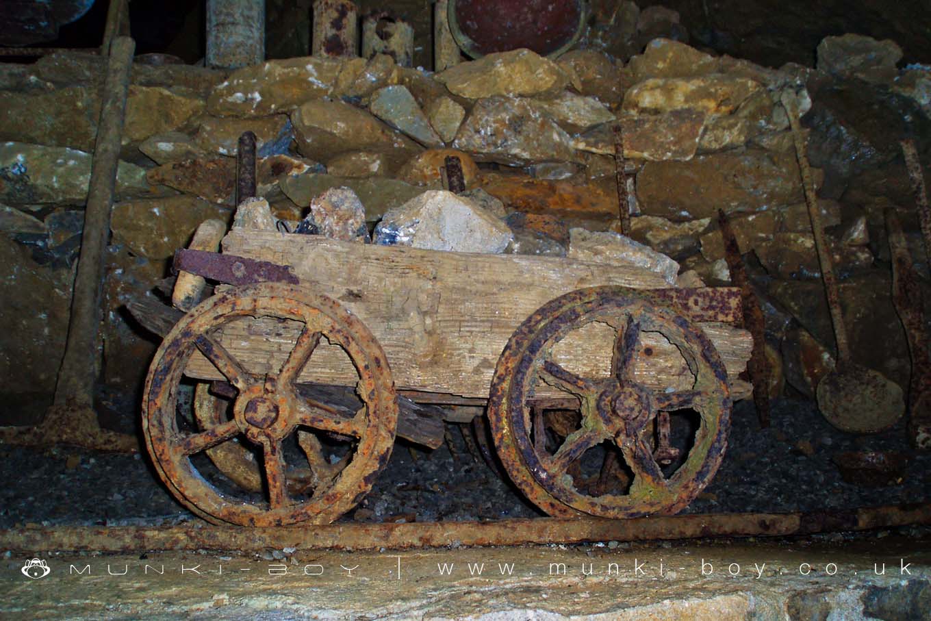
Blue John Cavern Minecart by munki-boy
Blue John Cavern
Blue John Cavern is in The Peak District National Park in England.
The spectacular Blue John Cavern is famous as the place where the mineral Blue John was found and mined, a form of Flourite which can be seen in various places throughout the cavern.
The Blue John Cavern is open to the public for short walking tours but the cave itself, part of a large system of potholes, enlarged by historic mining activity is much larger.
A good number of the old mining equipment is on display along the tour including old mine carts together with remnants of the early days of the “show cave”.
Created: 8 November 2018 Edited: 29 November 2023
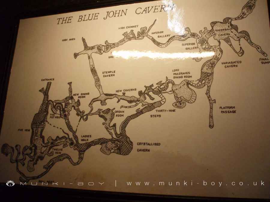
Blue John Cavern
Blue John Cavern LiDAR Map

Contains public sector information licensed under the Open Government Licence v3.0
Local History around Blue John Cavern
There are some historic monuments around including:
One of two bowl barrows on Bole HillEldon Hill bowl barrowEldon Hill crushing circle, associated lead mining remains and palisaded enclosure on Eldon HillBatham Gate, Roman roadRound cairn on Bridge-end Pasture, 600m north-east of Two Thorne Fields FarmHope MotteWatt's Grove Rake lead mines 520m north of SweetknollPalisaded hilltop enclosure 230m SSE of Dirt LowPeakshill or Oden soughHigh Rake MineStanding cross known as Wheston CrossHill's Venture lead mineOxlow Rake lead minesOdin Mine nucleated lead mine and ore works, 350m WNW of Knowlegates FarmPerry Dale bowl barrow and long barrowBowl barrow on Withery LowHow Grove Lead MineRound barrow 500m south west of Peveril CastleSlitherstone and Linacre lead mines and a limekiln 725m south west of Rowter FarmEngine Sough and associated nucleated lead mine, 500m south of Mam TorCop Low oval barrowCoalpithole RakePin Dale lead side veinsOne of two bowl barrows on Bole HillTown defences 270m north and 350m north east of Peveril CastleSnelslow Plantation bowl barrowWayside cross known as Eccles CrossOx Low oval barrowGautries Hill bowl barrowThe Tong bowl barrow and long barrowPlatform cairn south of Hill RakeTides Low bowl barrow, limekiln and standing stoneStanding cross in the churchyard of St Peter's ChurchGautries RakeNew Rake lead mines 600m south east of Rowter FarmCop Rake and Moss Rake lead mines 750m north east of Wheston HouseRound cairn on Bridge-end Pasture, 300m north-east of Two Thorne Fields FarmFaucet Rake lead mines 870m south west and 930m south east of Oxlow HouseMedieval hospital 530m south east of Losehill HallLord's Seat bowl barrowTideslow Rake lead rake and lime kilnAnglian high cross in the churchyard of St Peter's ChurchThe Folly platform cairnBowl barrow on Withery LowHarrod Low long barrowCrookstone Hill round cairnPeveril Castle eleventh to fourteenth century tower keep castleSlight univallate hillfort and two bowl barrows on Mam Tor.


