Sullington
Sullington is a Village in the county of West Sussex.
Sullington postcode: RH20 4AE
There are great places to visit near Sullington including some great towns, country parks, woodlands and airports.
There are a number of towns near Sullington including Chichester, and Crawley.
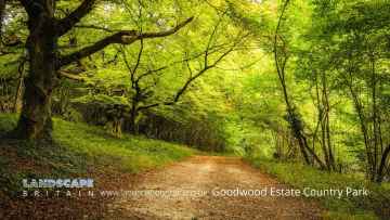
There are a number of country parks near Sullington including Goodwood Country Park, and Buchan Country Park.
Woodlands to visit near Sullington include Goodwood Country Park.
Gatwick Airport, Shoreham Airport, and Chichester/Goodwood Airport are great places to visit near Sullington if you like airports.
Sullington History
There are some historic monuments around Sullington:
- Round barrow cemetery in Rackham Plantation
- Motte and bailey castle in Pulborough Park
- Highdown Hill Camp: A Ram's Hill type enclosure, an Anglo-Saxon cemetery and associated remains
- Cross dyke on Springhead Hill, 780m south of Springhead Farm
- Group of four bowl barrows at the Chantry Post
- Cross dyke on Steyning Round Hill, 700m south west of Pepperscoombe
- Bowl barrow 120m north west of Cissbury
- Rackham Banks: A cross dyke and Itford Hill style settlement on Rackham Hill, 900m SSE of Oldbottom Barn
- Linear group of three bowl barrows immediately east of Kithurst Hill car park: part of a dispersed round barrow cemetery on Kithurst Hill
- Bowl barrow 100m west of the south western edge of Cissbury Ring hillfort
- Prehistoric flint mine and part of a round barrow cemetery at Blackpatch, 400m north east of Myrtle Grove Farm
- Cross dyke on Sullington Hill, 500m south east of The Chantry
- Cross dyke 760m WNW of Pepperscoombe
- Flint mine and a bowl barrow on Church Hill, 400m south west of Findon Place
- Bowl barrow on Springhead Hill, 750m SSW of Springhead Farm
- Knepp Castle
- Ringwork 400m NNW of Batworthpark House
- Group of three saucer barrows and a pair of hlaews south east of Chanctonbury Ring hillfort
- Bowl barrow 240m east of Trinity Methodist Church, forming part of a round barrow cemetery on Sullington Warren
- Stopham Bridge
- Bowl barrow 200m SE of Trinity Methodist Church, forming part of a round barrow cemetery on Sullington Warren
- The Burgh: a bowl barrow 940m east of Canada
- Romano-British villa at Borough Farm
- Roman building 200yds (180m) NW of Spring Copse
- Bowl barrow on Chanctonbury Hill, 560m north east of Frieslands
- Bowl barrow 440m south east of Chanctonbury Ring hillfort
- Medieval moated site off Moat Lane
- Cross dyke on Steep Down, 600m north east of Titch Hill Farm
- Cross dyke 420m west of Chanctonbury Ring hillfort
- Moated site and associated earthworks north west of West Wolves Farm, Ashington.
- Prehistoric linear boundary on Wepham Down
- Bowl barrow 200m west of Chanctonbury Ring hillfort
- Hardham Priory
- Cross dyke on Steep Down, 700m north east of Beggars Bush
- Saucer barrow 330m north east of The Mill House
- Burpham camp
- Bowl barrow 230m NE of Trinity Methodist Church, forming part of a round barrow cemetery on Sullington Warren
- Itford Hill style settlement and an Anglo-Saxon barrow field at New Barn Down, 850m north west of Myrtle Grove Farm
- Cross dyke in Court Plantation, 600m south west of Wiston Barn
- Settlement site in Chantry Bottom
- Lynchets N of Downs Farm
- Cissbury Ring hillfort, prehistoric flint mine and associated remains
- Deserted medieval settlement at Lower Barpham Farm
- Pair of hlaews 150m south east of Chanctonbury Ring hillfort
- Group of six bowl barrows 790m south west of Grey Friars Farm: part of a dispersed round barrow cemetery on Kithurst Hill
- Section of Roman road north of Rock
- Pallingham Manor
- Pair of platform barrows on the western side of Kithurst Hill car park: part of a dispersed round barrow cemetery on Kithurst Hill
- Itford Hill style settlement on Cock Hill
- An unenclosed Iron Age urnfield and associated remains on Rackham Hill, 900m SSE of Rackham Farm
- Platform barrow 360m north east of The Mill House
- Bowl barrow 380m south east of Chanctonbury Ring hillfort
- Roman mansio and settlement, 535m north-east of Penn House
- Pair of bowl barrows on Amberley Mount, 760m north east of Downs Farm
- Greatham Bridge
- Bowl barrow 120m SE of Trinity Methodist Church, forming part of a round barrow cemetery on Sullington Warren
- Bowl barrow at Kithurst Hill car park: part of a dispersed round barrow cemetery on Kithurst Hill
- Prehistoric flint mine and a Martin Down style enclosure on Harrow hill, 850m south east of Lee Farm
- Bowl barrow 950m south west of Grey Friars Farm: part of a dispersed round barrow cemetery on Kithurst Hill
- Deserted medieval settlement at Upper Barpham Farm
- Muntham Court Romano-British site
- Old Swan Bridge, Pulborough
- Roman barrow at Broomershill, 200m south east of Brocks Rew Farm
- Lickfold Roman Bath House, Wiggonholt
- Romano-British villa and traces of Iron Age occupation 500m WSW of New Barn
- Chanctonbury Ring hillfort and Romano-Celtic temples
- Cross dyke on Chantry Hill, 470m south of Grey Friars Farm
- Cross dyke on Barpham Hill, 600m north west of Lower Barpham
- Barrows and ditches on Steyning Round Hill
- Bowl barrow on Wiggonholt Common, 290m south of Upperton's Barn
- Flint mine and part of a cross dyke 300m south east of Tolmare Farm
- Regular aggregate field system with prehistoric and Romano-British farmsteads and a Bronze Age bowl barrow on Park Brow
- Bowl barrow 260m east of Trinity Methodist Church, forming part of a round barrow cemetery on Sullington Warren
- Group of three bowl barrows 350m SE of Trinity Methodist Church, forming part of a round barrow cemetery on Sullington Warren
- Pair of bowl barrows 280m SE of Trinity Methodist Church, forming part of a round barrow cemetery on Sullington Warren
- Cross dyke and platform barrow 460m south east of Chanctonbury Ring hillfort