
Chichester
Chichester
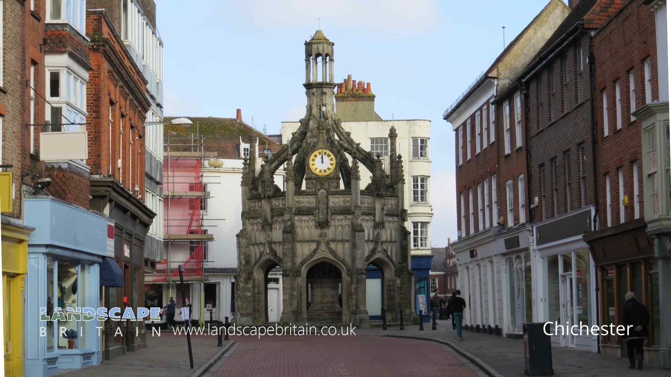
Chichester in West Sussex is one of the most historic towns in England.
The city’s origins date back to the Roman and Anglo-Saxon times, when it was a major market town. Today, Chichester is still a thriving market town, with a cathedral, museums, and plenty of shops and restaurants to enjoy. If you’re looking for a charming English town to explore, Chichester should definitely be on your list!
Created: 7 August 2022 Edited: 29 November 2023
Chichester
Local History around Chichester
There are some historic monuments around including:
Devil's Ditch, section extending 960yds (870m) S of Lavant HouseDevil's Ditch, section extending 200yds (180m) E of Waterbeach Hotel, Goodwood ParkOval barrow, the south-eastern of two on Stoughton DownChichester CastleDevil's Ditch, section extending 380yds (350m) NW from The Cottage, Goodwood ParkAn Itford Hill style settlement in Kingley ValeThe Trundle hillfort, causewayed enclosure and associated remains at St Roche's HillLinear boundary on Stoke Down, 800m north of West Stoke HouseBowl barrow on Charlton Down, 250m south of Goodwood racecourseGreyfriars Chapel, Priory ParkDevil's Ditch, section extending 330yds (300m) W of Waterbeach Hotel, Goodwood Park, Box GroveCross dyke on south eastern spur of Bow Hill, 900m south west of the Tansley StoneMedieval settlement in Eastdean Park, 670m north east of Counter's GateDevil's Ditch, section extending 200yds (180m) E from Chapel LaneChichester Dyke, earthwork extending 110yds (100m) in Raughmere CopseDevil's Ditch, section extending 1730yds (1580m) from Stane Street to NW end of Redvin's CopseRoman amphitheatreCross dyke on St Roche's Hill, 480m north west of The Trundle hillfortChichester Dyke, Broyle earthwork, section extending 430yds (393m) through East Broyle Copse, to railway, and earthwork extending 400yds (365m) from Brandy Hole Lane, New FishbourneA 362m length of Devil's Ditch running WNW from Chapel LaneBexley Bushes earthworksOval barrow, the north-western of two on Stoughton DownLinear boundary 310m north west of the Tansley Stone on Bow HillMarket crossDevil's Ditch, section extending 900yds (820m), Lye Wood, West StokeA Romano-Celtic temple, Iron Age shrine and associated remains 250m north west of Ratham MillDevil's Ditch, section extending 1200yds (1100m) through Little Tomlins CopseCross dyke on northern spur of Bow Hill, 500m north east of the Tansley StoneA 210m length of Devil's Ditch running east from Chichester Main Road to Pook LaneChichester Dyke, earthwork extending N 360yds (330m) from Otter Memorial CollegeDevil's Ditch, section extending 1100yds (1000m), Valdoe WoodFishbourne Roman siteCross dyke on St Roche's Hill, 410m and 425m north east of The Trundle hillfortBowl barrow in Stonehill Clump, Goodwood Country ParkChichester Dyke, earthwork extending 300yds (270m) W of Densworth HouseChichester Dyke, Broyle earthwork, section extending 360yds (330m) S of West Broyle HouseFlint mine on Stoke Down, immediately north of Stoke ClumpSt Martin's Lane, Little London car park, Roman siteA multiple enclosure fort known as Goosehill Camp and a prehistoric linear boundary on Bow HillChichester Dyke, earthwork extending 250yds (230m) in Densworth CopseBowl barrow on Charlton Down, 350m south of Goodwood racecourseChichester Dyke, earthwork extending N 480yds (440m) from The Drive, Summersdale, near ChichesterCross dyke on north eastern spur of Bow Hill, 150m south east of the Tansley StoneCross dyke on Heathbarn Down, 520m south east of Lodge Hill FarmHilltop enclosure and linear boundary on Bow HillChichester Dyke: section 200yds (180m) long in Mouthey's Plantation, section 245yds (220m) long in Oakwood and section 100yds (90m) long SW of Oakwood HouseChichester Dyke, section of Broyle earthwork, extending 150yds (140m) through Plain WoodChichester City Walls, The Tower, Orchard StreetChichester Dyke, Broyle earthwork, section extending 360yds (330m) SW of Broyle HouseA saucer barrow and a bowl barrow on Bow Hill, 270m south east of the Tansley StoneDevil's Ditch, section extending 530yds (480m) W from Lavant LodgeIron Age farmstead and Roman villa, 360m SSW of Brickkiln FarmTwo bell barrows, two pond barrows and a cross dyke on Bow Hill: part of The Devil's Humps round barrow cemeteryFlint mines on Bow HillChichester Dyke, earthwork E of Chichester Barracks extending 600yds (550m)Two bowl barrows on Bow Hill forming part of The Devil's Humps round barrow cemeteryChichester Dyke, Broyle earthwork, section at Brandy Hole, extending E 230yds (210m) from railway, New FishbourneChichester Dyke, sections in Little Cotfield PlantationBowl barrow on Bow Hill, 290m south east of the Tansley Stone.Wildlife in and Around Chichester
Mammals found in Chichester
There have been 42 species of mammals recorded in the chichester area.
| 45 Khz Pipistrelle (Pipistrellus pipistrellus) |
| American Mink (Neovison vison) |
| Bank Vole (Myodes glareolus) |
| Bechstein's Bat (Myotis bechsteinii) |
| Brown Long-Eared Bat (Plecotus auritus) |
| 55 Khz Pipistrelle (Pipistrellus pygmaeus) |
| Badger (Meles meles) |
| Barbastelle (Barbastella barbastellus) |
| Brown Hare (Lepus europaeus) |
| Brown Rat (Rattus norvegicus) |
Tap here for more mammals found in and around Chichester
Fish found in Chichester
There have been 28 species of fish recorded in the chichester area.
| Barbel (Barbus barbus) |
| Bleak (Alburnus alburnus) |
| Brook Lamprey (Lampetra planeri) |
| Brown/Sea Trout (Salmo trutta) |
| Carp (Cyprinus carpio) |
| Belica (Leucaspius delineatus) |
| Bream (Abramis brama) |
| Brown Trout (Salmo trutta subsp. fario) |
| Bullhead (Cottus gobio) |
| Chub (Squalius cephalus) |


