Wootton Bridge
Wootton Bridge
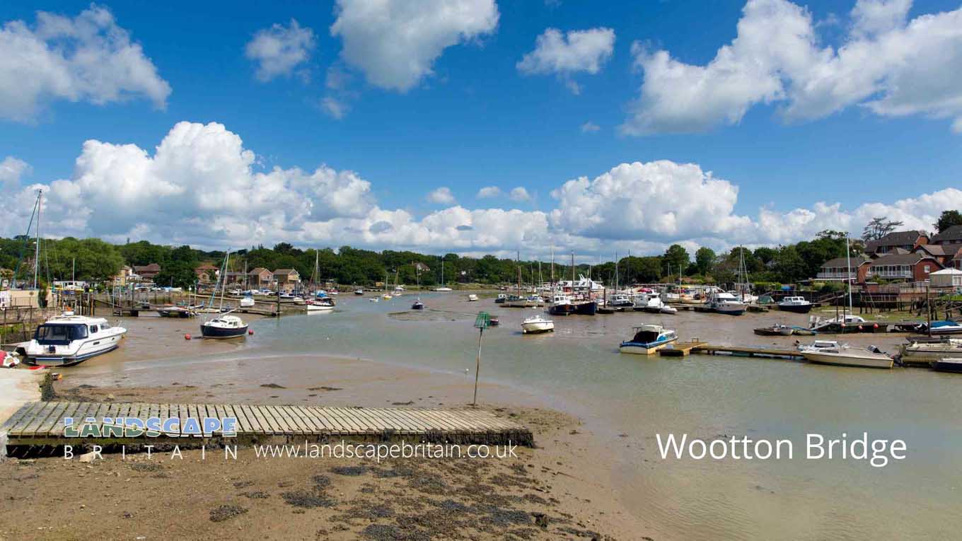
The village of Wootton Bridge is located on the Isle of Wight in southern England.
The village was formerly an important crossing point of the River Medina, and a bridge has been present here since at least the 12th century. The current bridge, which dates from 1859, is a Grade II listed structure.
The parish of Wootton Bridge also contains the settlement of Wootton, which is located to the north of the village.
Created: 23 May 2022 Edited: 29 November 2023
Wootton Bridge
Local History around Wootton Bridge
There are some historic monuments around including:
Bowl barrow 280m WNW of sea mark, forming part of a Bronze Age round barrow cemetery on Ashey DownNewport Roman VillaThree bowl barrows 220m WSW of sea mark, forming part of a Bronze Age round barrow cemetery on Ashey DownBowl barrow 370m east of Eaglehead Copse, forming part of a Bronze Age barrow cemeteryA group of 11 round barrows forming part of a Bronze Age cemetery, and part of a field system east of Eaglehead CopseBowl barrow 390m east of Eaglehead Copse, forming part of a Bronze Age barrow cemeteryNine barrows and part of a later enclosure 350m north east of sea mark: the barrows forming part of a round barrow cemetery on Ashey DownBowl barrow 340m east of Eaglehead Copse, forming part of a Bronze Age barrow cemeteryTwo fishponds associated with Quarr Abbey at Puckers Copse, NewnhamBowl barrow on Arreton DownBowl barrow 220m east of Eaglehead Copse, forming part of a Bronze Age barrow cemeteryTwo bowl barrows forming part of a Bronze Age barrow cemetery, and part of a field system east of Eaglehead CopseThree pillow mounds 540m north east of sea mark on Ashey DownMedieval settlement 100m south east and 350m north east of East Ashey Manor FarmBowl barrow 275m north west of sea mark, forming part of a Bronze Age round barrow cemetery on Ashey DownBowl barrow and part of a later enclosure 490m north east of sea mark, the barrow forming part of a Bronze Age round barrow cemetery on Ashey DownBowl barrow known as Michael Morey's Hump, and a Highway Commission barrier on Gallows HillMonastic grange at Haseley ManorDownend Romano-British villaThree pillow mounds 810m NNE of Kern FarmBowl barrow 110m north west of sea mark, forming part of a Bronze Age round barrow cemetery on Ashey DownTwo pillow mounds 400m ENE of sea mark on Ashey DownAshey Down Sea MarkCarisbrooke Castle: a shell keep castle on the site of a Saxon burhQuarr AbbeyBowl barrow 290m north east of sea mark, forming part of a Bronze Age round barrow cemetery on Ashey DownTwo bowl barrows 180m WNW of Puck House, FishbourneTwo bowl barrows 130m south west of sea mark, forming part of a Bronze age round barrow cemtery on Ashey Down.


