Rivington Moor Colliery (ruin) by munki-boy
Rivington Moor Colliery (ruin)
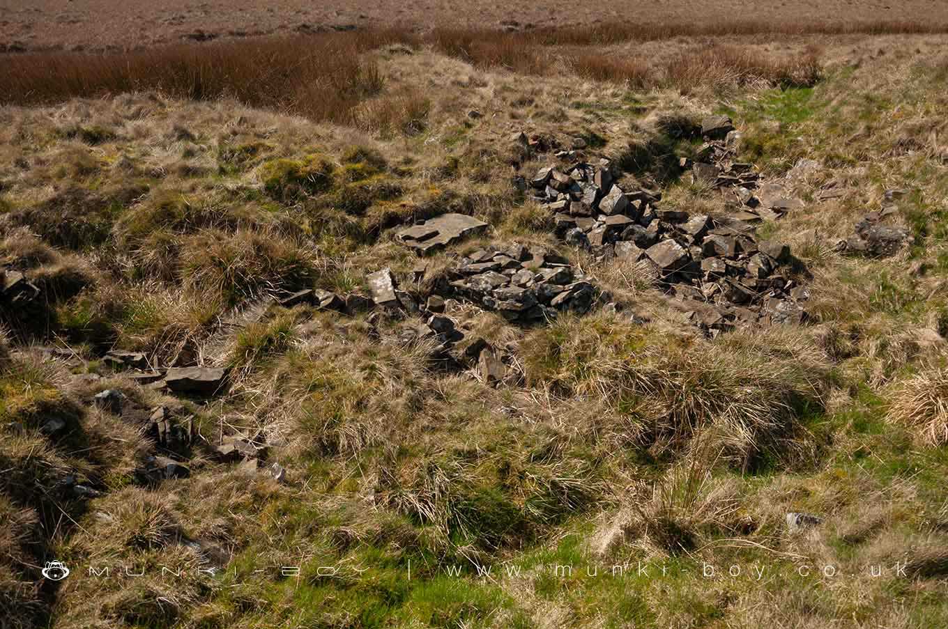
The remains of 19th Century Rivington Moor Colliery towards the summit of Winter Hill.
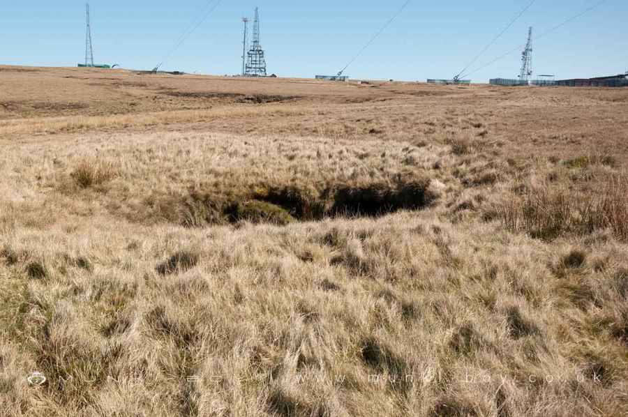
On the ground the footprint of the stone colliery buildings can still be seen A few of the old shafts are visible as deep pits, they have been infilled but don’t have NCB caps. Later adits were used to bring out the fireclay associated with the coal seam - see Rivington Moor Brickworks nearby.
The mines here were quite extensive with a number of galleries along where the section of road now leads past the summit trig point. Some of the old tunnels began to collapse I think in the 1990s and the top area was further infilled by machines. Concrete caps can be seen with narrow slots for bats that were fount to be using the mines. A section of land is fenced off still as the ground must be considered unstable. The mines would probably have run into the junction of the Rossendale Formation on the other side of the summit although a drift entrance was present near ‘The Stumps’, on top of the hill, already served by the Belmont track across from the old Winter Hill Tunnel.
Created: 29 May 2021 Edited: 29 November 2023
West Pennine Moors SSSI Details
Type: SSSI
Rivington Moor Colliery (ruin)
Rivington Moor Colliery (ruin) LiDAR Map

Contains public sector information licensed under the Open Government Licence v3.0
Local History around Rivington Moor Colliery (ruin)
There are some historic monuments around including:
Round cairn on Noon HillRound cairn 280m west of Old Harpers FarmRound cairn on Winter HillSteam tramway reversing triangleGidlow Hall moated site, Aspull, 560m NNE of Pennington HallRound Loaf bowl barrow on Anglezarke MoorPike Stones chambered long cairnHeadless Cross, Grimeford.


