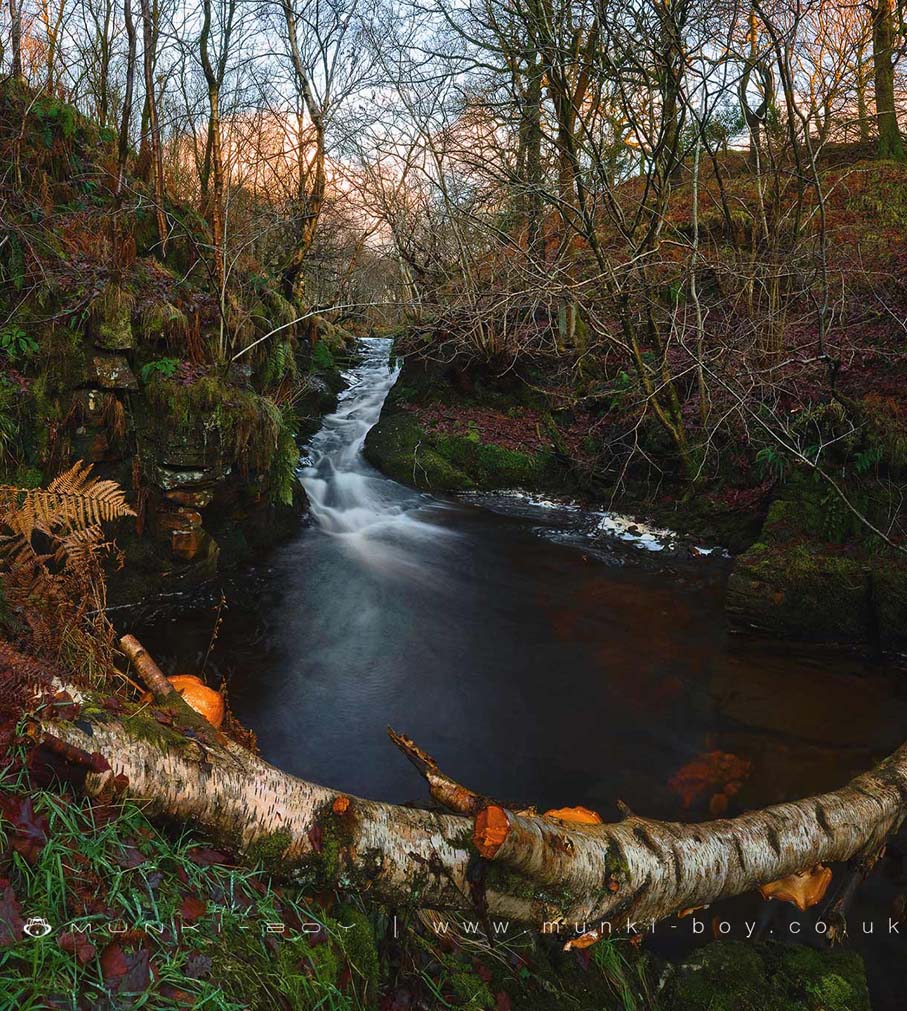
River Yarrow Water Chute by munki-boy
River Yarrow Water Chute
Not a waterfall by any definition other than the visual appeal, the water chute on the River Yarrow is in a beautiful setting hidden in a rocky little clough, with mossy rocks, ferns and fallen leaves.
This section of the River Yarrow is up behind The Meeting of the Waters in a steep-sided, rocky clough and although easy to access as the fencing is broken (the proper footpath leads to a stile - currently destroyed and barbed wired), there is a nice little wooded area between the two rivers and the Yarrow is found down big drop over a stone wall followed by rock. Heading upstream to the water chute is sometimes difficult, and often too muddy.
There’s an adit for the old lead mines nearby, overgrown and collapsed to a small hole, probably used as a drain into the stream. If we could move horizontally into the rock bank here we’d find the old lead mines, whose shafts we can see on the hill above.
Created: 15 December 2019 Edited: 29 November 2023
River Yarrow Water Chute
Yarrow US Big Lodge Water Details
Yarrow US Big Lodge Water
Yarrow US Big Lodge Water is a river in Lancashire
Yarrow US Big Lodge Water takes in water from an area around 37.424 km2 in size and is part of the Yarrow and Lostock catchment area.
Yarrow US Big Lodge Water is 21.267 km long and has been heavily modified by industry in the past.
River Yarrow Water Chute LiDAR Map

Contains public sector information licensed under the Open Government Licence v3.0
Local History around River Yarrow Water Chute
There are some historic monuments around including:
Pike Stones chambered long cairnBretters Farm moated site and two fishpondsRound cairn 280m west of Old Harpers FarmRound Loaf bowl barrow on Anglezarke MoorRound cairn on Winter HillThe Moat House moated site 600m WNW of St David's ChurchHeadless Cross, GrimefordMoated site at Arley Hall, Haigh near WiganRound cairn on Noon Hill.