Nob End SSSI by munki-boy
Nob End SSSI
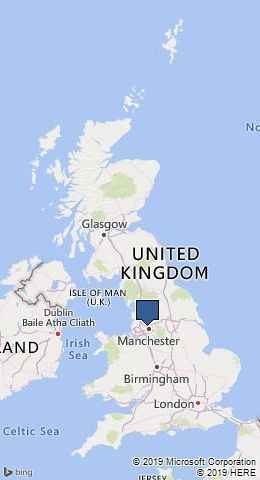
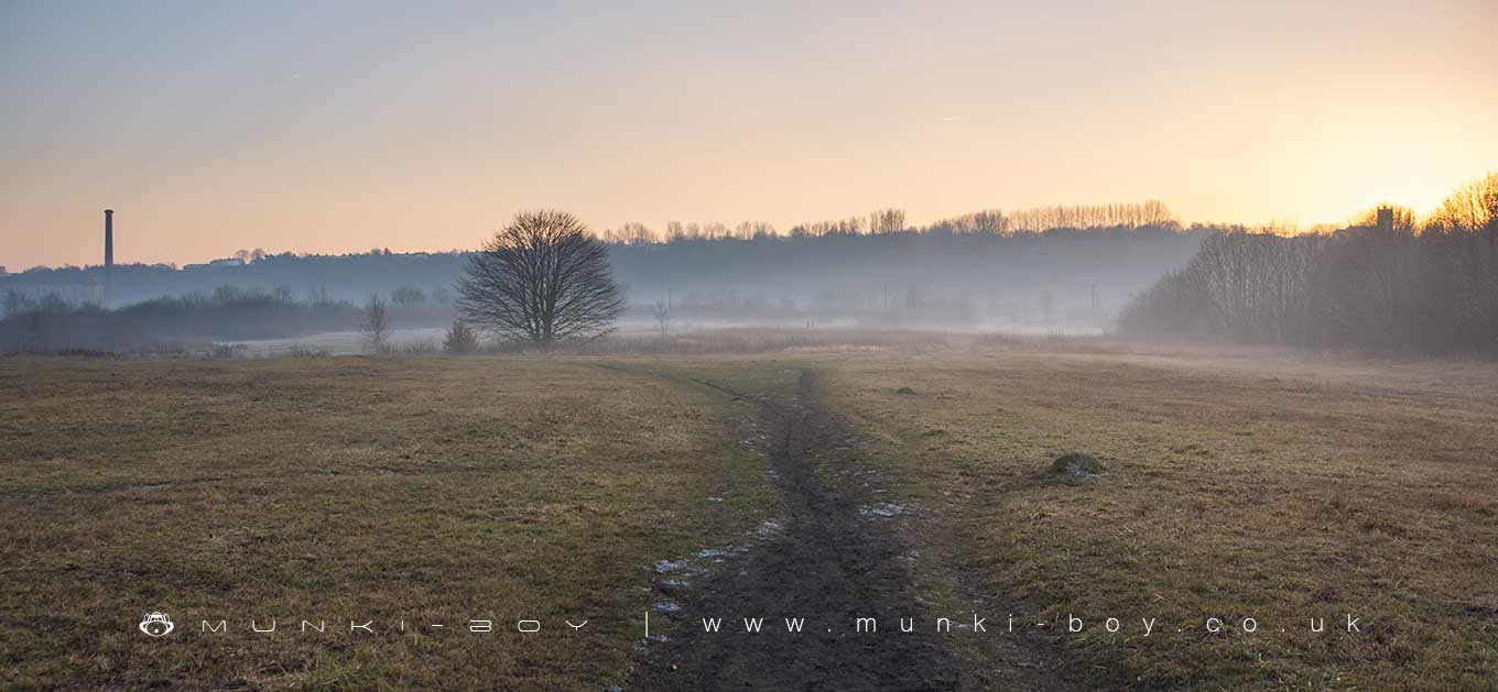
The Nob End SSSI occupies an area of post-industrial wasteland in the triangle of land that is the confluence the rivers of Croal and Irwell in Bolton and is a serious spot for flora despite its humorous name.
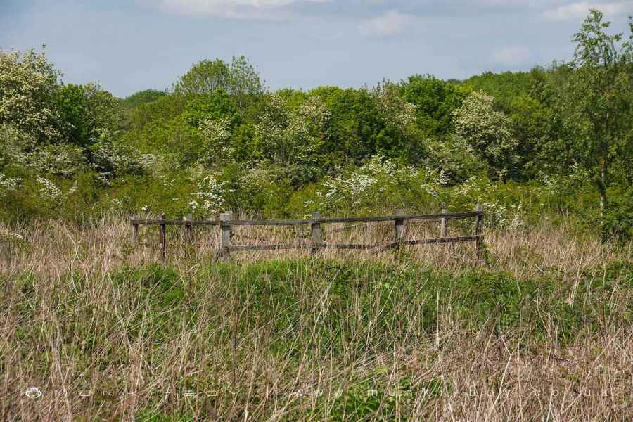
Nob End SSSI has a formidable range of interesting and rare plants, insects, birds, mammals and wildlife with perhaps the main attraction being the orchids when in season, although deer are not uncommon. The riverside banks of the Croal and Irwell aren’t easy to visit around this area and there is poisonous Giant Hogweed around too, but there is a stretch of canal to walk nearby and footpaths along either side of the Croal to the northwest of the area.
With regard to the names round here, the area to the northeast would have been the hamlet of Nob, with its titter inducing Nob Inn, and of course the peninsular Nob End. Don’t laugh too hard, you might scare the wildlife - it’s obvious that back when the places where named they didn’t have the same slang terms as us.
The site at Nob End is also a designated Local Nature Reserve, the Nob End LNR which covers an overlapping area with the SSSI, The western edge of the Nob End area is also part of the Moses Gate Country Park. A decent little walk follows down from the park along the Croal and returning along the other bank through the Nob End SSSI which is popular with dog walkers.
The industrial history of the Nob End SSSI Area
The land now designated for the Nob End SSSI has been heavily used during the industrial revolution and the ground is heavily modified such that it’s only possible to guess at the former land surface or its usage.
From historic records we find the area occupied by a coal mine with up to three shafts operating through the early 19th Century on the top end of the site, while the southern tip at the confluence of the Croal and Irwell occupied by the old Prestolee Cotton Mill that would have taken advantage of the nearby water sources. There were also several large mill ponds beside the old mill around the area of the modern bridge and southwards together with several canals moving water from the main canal down to the ponds with a by-wash or overflow leading to the northwest corner of the site where it was taken underground to a stone arched tunnel at the river bed at the foot of the old Darley Bridge, all that remains of which today being a broken stone weir. The mouth of the old tunnel is still visible today, although it is blocked within a couple of metres.
One of the old mine shafts can be easily located today as it is surrounded by a square wooden fence and is found in the middle of the area where a rough patch of vegetation occurs.
According to the SSSI designation a large portion of the area has been buried under “alkali waste produced as a by-product of the Leblanc process for the making of sodium carbonate”, which is to say a soap making process for washing cloth. The old Prestolee Mill site must be buried under this layer together with a large amount of rubble and cinder, this is said to be as deep as 10 metres in places. This process seems to have been carried out by the Prestolee Works that occupied a large area at the East of the site, which in-turn was derelict apart from a couple of remaining buildings by the turn of the 20th Century.
No buildings remain on the site today but the shapes of some of the old canal sections can be seen in the ground and the outlines of several of the old Prestolee Works buidlings.
Created: 15 May 2019 Edited: 29 November 2023
Nob End SSSI Details
Type: SSSI
Area: 9.3952 ha
Nob End SSSI Designation
Nob End is situated on the outskirts of the village of Little Lever, approximately 4.5 km from Bolton town centre. It lies at the confluence of the Rivers Croal and Irwell and the site consists of a flattopped, steep-sided tip of alkali waste produced as a by-product of the Leblanc process for the making of sodium carbonate. The plateau of the tip is approximately 10 m above the level of the rivers.
It was built up between the years 1850 and 1870 and it would, initially, have been extremely toxic to all plant life (due to the high concentrations of calcium sulphide, calcium oxysulphide and calcium polysulphides present). Subsequent weathering of the surface, however, has converted these toxic salts to calcium carbonate, thus permitting the establishment of a calcicolous vegetation.
The most significant and extensive vegetation type found on the site closely resembles that occurring on eroding, base-rich clay cliffs typical of parts of the Durham, North Yorkshire and Humberside coastlines, and represented more locally on the Wirral coast of the Dee Estuary in Merseyside. It is the best example in Greater Manchester and Merseyside of the nationally rare species rich variant of the tall fescue–coltsfoot plant community and is of especial interest because of its development on an unusual and scientifically interesting substrate.
It is characterised by an open-structured sward in which grasses play a minor role and herbs typical of limestone grasslands predominate. As natural limestone grassland does not occur in Greater Manchester, many of the species found here are rare in the county. Examples include carline thistle Carlina vulgaris, blue fleabane Erigeron acer, purging flax Linum catharticum, rough hawkbit Leontodon hispidus, common centaury Centaurium erythraea and common broomrape Orobanche minor.
Orchids, too, are well represented and several species occur here in large numbers. Most notable amongst these are fragrant orchid Gymnadenia conopsea, northern marsh orchid Dactylorhiza purpurella and early marsh-orchid D. incarnata. Southern marsh-orchid D. praetermissa and common spotted-orchid D. fuchsii also occur and hybrid swarms between the Dactylorhiza species form large populations with considerable variability between individuals. Green-winged orchid Orchis morio has also been recorded here. In some areas a more neutral grassland has developed with a denser sward in which coarse grasses such as Yorkshire fog Holcus lanatus, cocksfoot Dactylis glomerata and false oat-grass Arrhenatherum elatius are abundant. Herbs, however, are not infrequent and common knapweed Centaurea nigra, tufted vetch Vicia cracca and meadow vetchling Lathyrus pratensis make a significant contribution to the sward. Adder’s-tongue fern Ophioglossum vulgatum, devil’s-bit scabious Succisa pratensis and eyebright Euphrasia officinalis also occur here.
A few small patches of acidic grassland are found where boiler-ash has been spread over the surface of the Leblanc waste. Mat-grass Nardus stricta, wavy hair-grass Deschampsia flexuosa and even heather Calluna vulgaris occur in these areas.
Towards the north of the site the water-table lies close to the surface and areas of marshy grassland and willow carr have developed here. Small areas of sycamore woodland and patches of hawthorn scrub add to the habitat diversity of the site, and this is reflected in a high entomological interest. Particularly notable are the large populations of burnet moths and common blue butterflies Polyommatus icarus.
Natural England
Nob End LNR Details
Nob End LNR is a nature reserve managed by Bolton Metropolitan Borough Council - Greenspace.
Nob End LNR is a great place to visit for The main habitats are calcareous grassland and woodland/scrub..
Nob End SSSI
Nob End SSSI Woodland
Nob End (sssi) is a woodland area in Greater Manchester, managed by Bolton Metropolitan Borough Council.Local History around Nob End SSSI
There are some historic monuments around including:
Affetside Cross at Affetside 75m north west of the Pack Horse InnWardley Hall moated site, WorsleyAstley Green Colliery: engine house and headgearCanal tunnel entrances and wharfLime kiln and associated culvert 50m north of Worsley Methodist ChurchRadcliffe Tower and site of hall 100m south west of the parish church in RadcliffeRingley Old Bridge.