Mickleden Beck Prehistoric Cairnfield And Field System by munki-boy
Mickleden Beck Prehistoric Cairnfield And Field System
Mickleden Beck Prehistoric Cairnfield And Field System is in The Lake District National Park in England.
Mickleden Beck prehistoric cairnfield and field system, funerary cairn and a medieval dispersed settlement centred 840m south west of Pike of Stickle.
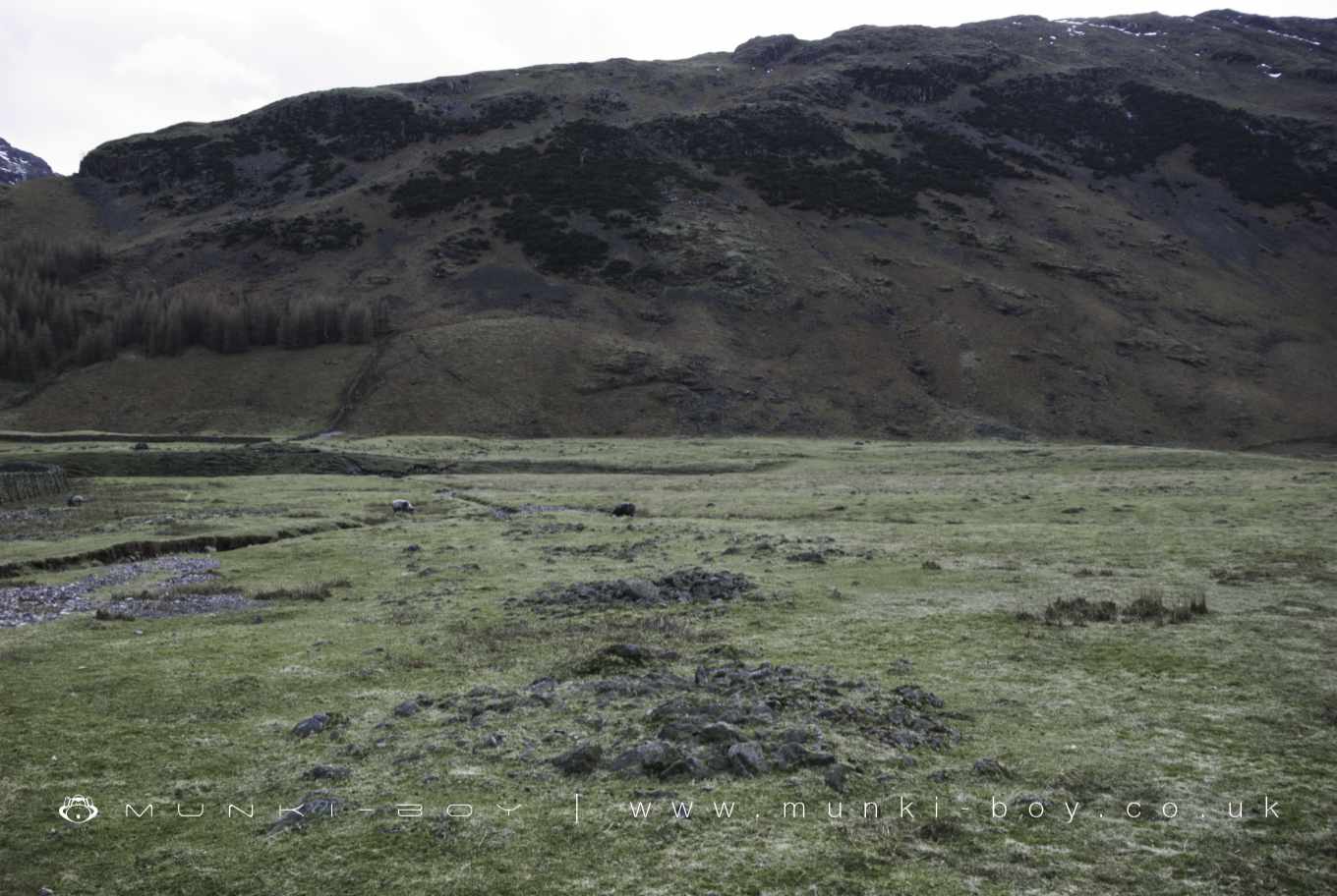
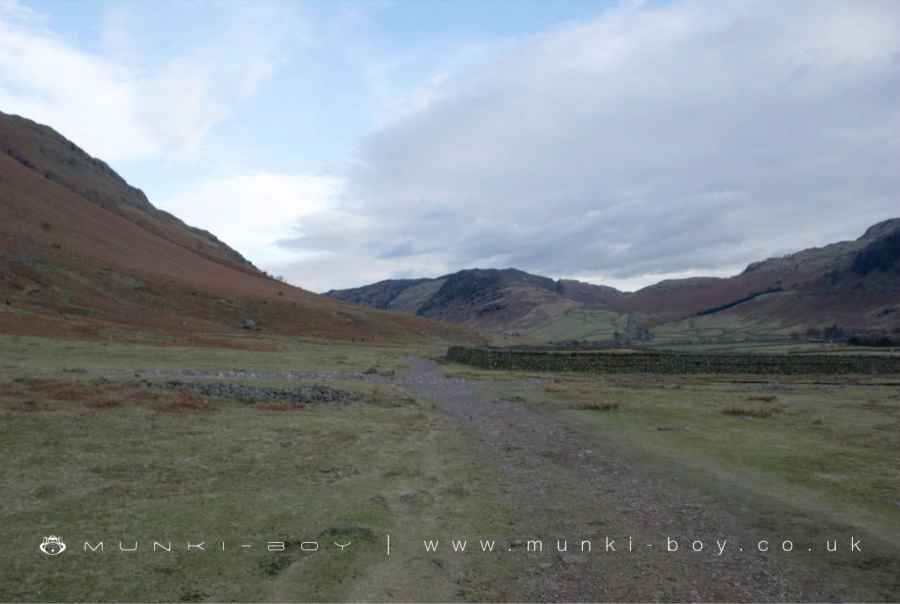
The monument, which falls into six separate areas of protection, includes the earthworks and buried remains of Mickleden Beck prehistoric cairnfield, an associated field system, a funerary cairn and a medieval dispersed settlement. It is located on unenclosed land along the valley floor either side of Mickleden Beck and is centred 840m south west of Pike of Stickle. The monument represents evidence for the prehistoric and medieval exploitation of this landscape.
The prehistoric cairnfield consists of four groups of round and oval-shaped clearance cairns, two on the north bank of Mickleden Beck, two on the south bank. The group centred at NY27180645 consists of over 30 cairns up to 0.7m high; the round cairns measure between 1.9m to 5.4m in diameter while the oval-shaped cairns measure between 1.8m to 19m long by 1.8m to 6.9m wide. Within this group of cairns there is part of an associated field system comprising discontinuous and generally irregular stone banks and elongated cairns following the alignment of the valley. A cross-valley stone bank has a greater width and stone volume than the valley-aligned bank. The cairn group centred at NY27060624 consists of over 20 cairns up to 0.6m high; the round cairns measure between 3m to 5.4m in diameter while the oval-shaped cairns measure between 2.3m to 11m long by 1.8m to 6.6m wide. There are two alignments of elongated cairns suggesting that these may have been constructed along the lines of former boundaries. At the eastern end of this group of cairns there is a short length of stone bank. The cairn group centred at NY26800676 consists of over 30 cairns up to 0.6m high; the round cairns measure between 2m to 8m in diameter while the oval-shaped cairns measure between 1.9m to 14m long by 1.8m to 6m wide. Within this group of cairns there are further traces of the associated field system, the most significant element being a cross-valley wall and a series of stone banks meandering along the valley. As with the previously described cross-valley wall this one is also much more substantially built than the valley-aligned banks. Pollen samples taken from beneath both of the cross-valley walls suggest a pre-medieval date. The stone banks include cairns within their overall alignments and their form is more consistent with stone clearance which may have been deposited against former boundary markers. They appear to define two irregular and discontinuous lines along the valley. The cairn group centred at NY26320689 consists of seven cairns up to 0.7m high; the round cairns measure between 2.7m to 3.5m in diamater while the oval-shaped cairns measure between 3.3m to 5m long by 2.5m to 4m wide. There is a small semi-circular stone bank just to the north of the cairns. To the south east of this cairn group there is a field consisting of a gently-sloping area of cleared pasture bounded by streams on three sides and a continuous decayed stone wall on the remaining side. This wall effectively acts as the fourth side of an enclosing quadrilateral as it links two parallel streams. There are two entrances through the wall, one at the north end the other near the centre. This enclosed land is largely clear of surface stone, is well-drained, and is relatively good quality pasture land. Within the field there is a single oval-shaped cairn which is interpreted as a funerary cairn. It consists of a small circle of approximately 20 stones which define an external kerb surrounding a slightly raised scatter of smaller stones. It measures 4m by 3m and is 0.25m high with a slight surface depression possibly indicative of disturbance. The form of this cairn corresponds with the Kerb Cairn monument type, and excavated Scottish examples are typically dated to the later Bronze Age. At NY26200733 there are the remains of a rectangular stock enclosure bounded by a series of stone banks and cairns. There is a small circular stone-free shelter built into the enclosure’s south west wall.
The medieval dispersed settlement consists of the remains of four structures located at either side of the valley track at the eastern end of the monument. South of the track, at NY27160633, there is a single-roomed building measuring 14m long by 7m wide with turf-covered walls up to 0.4m high and an entrance on its western side. Adjacent is a less well-defined structure consisting of a `boat’-shaped bank of stones enclosing a stone-free area. North of the track, at NY27310647, there is a two-roomed stone-walled structure measuring 13m long by 7m wide with an entrance into the larger western room on its south side. About 60m to the south east is a less well-preserved structure measuring 9m long by 8m wide with entrances at both east and west ends. Immediately adjacent to its south east side is a pile of stones which may be a small cairn or, alternatively, the collapsed gable end of the structure.
A modern drystone wall and the surface of the valley track are excluded from the scheduling, although the ground beneath these features is included.
The Cumbrian uplands comprise large areas of remote mountainous terrain, much of which is largely open fellside. As a result of archaeological surveys between 1980 and 1990 within the Lake District National Park, these fells have become one of the best recorded upland areas in England. On the open fells there is sufficient well preserved and understood evidence over extensive areas for human exploitation of these uplands from the Neolithic to the post- medieval period. On the enclosed land and within forestry the archaeological remains are fragmentary, but they survive sufficiently well to show that human activity extended beyond the confines of the open fells. Bronze Age activity accounts for the most extensive use of the area, and evidence for it includes some of the largest and best preserved field systems and cairn fields in England, as well as settlement sites, numerous burial monuments, stone circles and other ceremonial remains. Taken together, their remains can provide a detailed insight into life in the later prehistoric period. Of additional importance is the well-preserved and often visible relationship between the remains of earlier and later periods, since this provides an understanding of changes in land use through time. Because of their rarity in a national context, excellent state of preservation and inter-connections, most prehistoric monuments on the Lake District fells will be identified as nationally important.
Medieval rural settlements in England were marked by great regional diversity in form, size, and type, and the protection of their archaeological remains needs to take these differences into account. To do this, England has been divided into three broad Provinces on the basis of each area’s distinctive mixture of nucleated and dispersed settlements. These can be further divided into sub-Provinces and local regions, possessing characteristics which have gradually evolved during the past 1500 years or more.
This monument lies in the Cumbria-Solway sub-Province of the Northern and Western Province, an area characterised by dispersed hamlets and farmsteads, but with some larger nucleated settlements in well-defined agriculturally favoured areas, established after the Norman Conquest. Traces of seasonal settlements, or shielings, dominate the high, wet and windy uplands, where surrounding communities grazed their livestock during the summer months. The Lake District local region is characterised by a series of mountain blocks separated by deep valleys, providing great variation in local terrain. Settlement is sparse, but villages and hamlets occasionally appear in the valleys. Higher up, beyond the head-dyke, are traces of medieval and earlier settlements in farmlands since abandoned.
In some areas of medieval England settlement was dispersed across the landscape rather than nucleated into villages. Such dispersed settlement in an area, usually a township or parish, is defined by the lack of a single (or principal) nucleated settlement focus such as a village and the presence instead of small settlement units (small hamlets or farmsteads) spread across the area. These small settlements normally have a degree of interconnection with their close neighbours, for example, in relation to shared common land or road systems. Dispersed settlements varied enormously from region to region, but where they survive as earthworks their distinguishing features include roads and other minor tracks, platforms on which stood houses and other buildings such as barns, enclosed crofts and small enclosed paddocks. In areas where stone was used for building, the outline of building foundations may still be clearly visible. Areas of dispersed medieval settlement are found in both the South East Province and Northern and Western Province of England where they occupy both upland and lowland areas.
Mickledon Beck prehistoric cairnfield, associated field system, and funerary cairn 840m south west of Pike of Stickle survives reasonably well and forms an outlying part of a large area of well-preserved prehistoric landscape extending along the fellsides of south west Cumbria which represents evidence of long term management and exploitation of this area in prehistoric times. Additionally the medieval dispersed settlement also survives reasonably well and will add greatly to our knowledge and understanding of settlement patterns and economy during this period. Overall the monument is a rare example of a landscape within which evidence of human exploitation is visible through a range of well-preserved monuments dating to the prehistoric and medieval periods.
Created: 16 May 2020 Edited: 29 November 2023
Mickleden Beck Prehistoric Cairnfield And Field System
Mickleden Beck Prehistoric Cairnfield And Field System LiDAR Map

Contains public sector information licensed under the Open Government Licence v3.0
Local History around Mickleden Beck Prehistoric Cairnfield And Field System
There are some historic monuments around including:
Borrowdale graphite mines and associated grinding mill, 660m north west of SeathwaiteMickleden Beck prehistoric cairnfield and field system, funerary cairn and a medieval dispersed settlement centred 840m south west of Pike of StickleThe Langdale Boulders, two prehistoric rock art sites in Great Langdale 250m south of Harry PlaceCastle Howe hillfort, Little LangdaleGreenburn copper mines and associated ore processing worksConiston copper minesRoman road in Wrynose BottomMoot mound at Fell Foot Farm, Little LangdaleLong Intakes medieval dispersed settlement and associated kiln 370m south of Fell FootRifle Range target and Marker's Hut, 150m north west of Blea MossRoman road up Wrynose PassSeven Intakes medieval dispersed settlement 210m south west of Fell FootYewdale lime kiln 380m south west of Low Yewdale.


