Loch Kennard by Daniel Giza
Loch Kennard
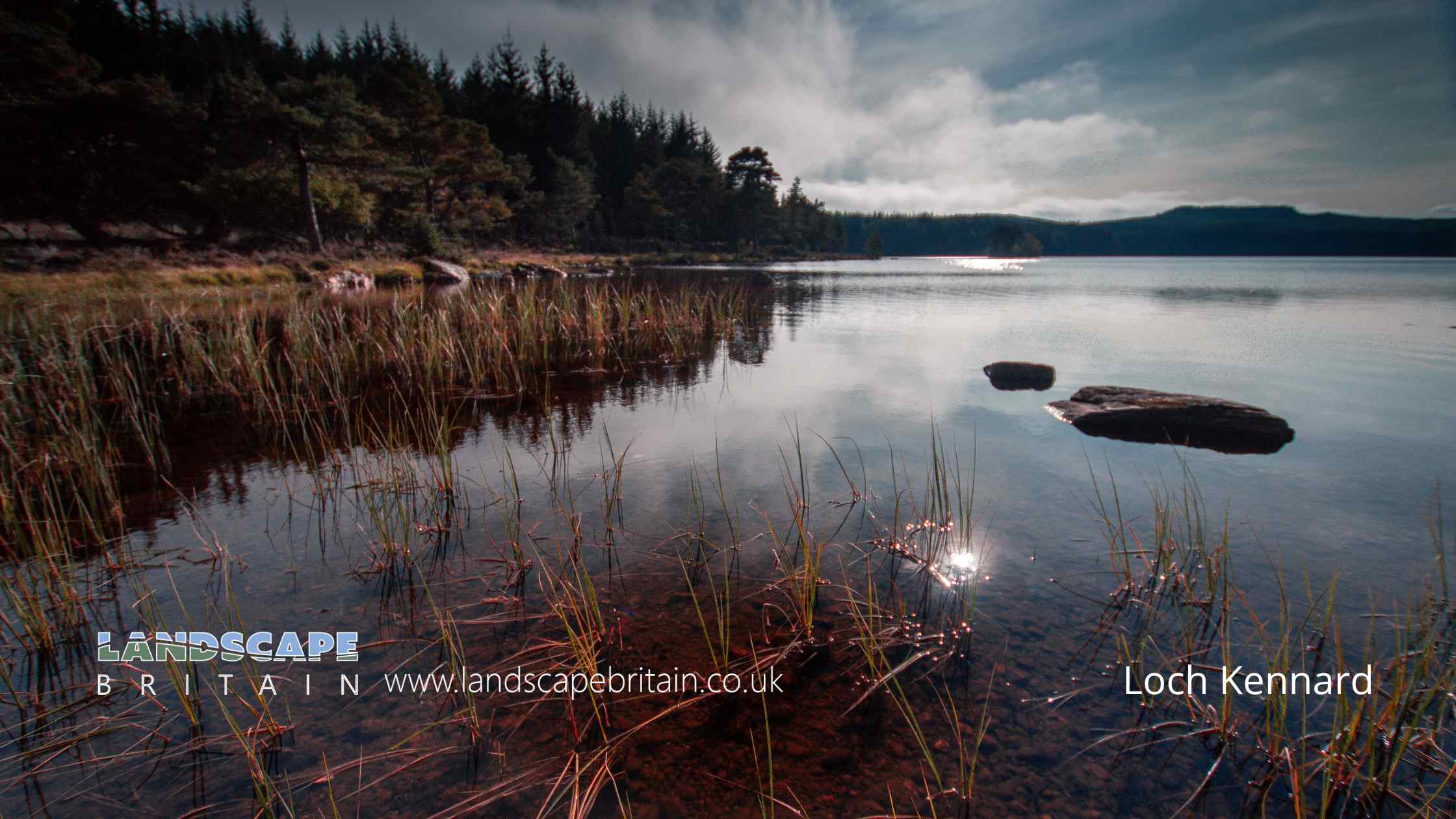
Loch Kennard is a lesser-known spot, and it might offer a more secluded experience, away from the popular tourist destinations.
These hidden gems often appeal to travellers seeking solitude and an unspoiled natural environment.
Created: 21 October 2023 Edited: 5 January 2024
Loch Kennard
Local History around Loch Kennard
There are some historic monuments around including:
Lundin, stone circle and cup-marked stone 370m NNW of Prehistoric ritual and funerary: stone circle or ring SM1563The Dun,fort 400m ESE of Tyndun Prehistoric domestic and defensive: fort (includes hill and promontory fort) SM4587Haugh of Grandtully, standing stone and barrows 490m WNW of Prehistoric ritual and funerary: standing stone SM1576Findynate,homestead 450m SW of Secular: enclosure SM4850Balnaguard,settlements & field systems 1900m S of Prehistoric domestic and defensive: field or field system; Secular: settlement, including deserted, depopulated and townships SM5320Tom of Cluny,chambered cairns 450m SSW of Prehistoric ritual and funerary: chambered cairn SM6251Castle Dow,fort Prehistoric domestic and defensive: fort (includes hill and promontory fort) SM4432Edradynate Castle, earthwork 120m E of Milton of Cluny Secular: homestead moat SM9512Tomtayewen, dun Prehistoric domestic and defensive: dun SM2621Tulloch of Pitnacree, enclosure 150m NW of Prehistoric domestic and defensive: enclosure (domestic or defensive) SM9528Lundin, dun 500m NNE of Prehistoric domestic and defensive: dun SM2665St Louis,settlement,field system and cairn 600m NW of Prehistoric domestic and defensive: settlement; Prehistoric ritual and funerary: bell cairn SM5322Middleton of Derculich, chambered cairn 70m SE of Prehistoric ritual and funerary: chambered cairn SM266618th century military road and bridges, 1750m northwest of Scotston, Glen Cochill. Industrial: bridge, viaduct, aqueduct SM13735Meall Uaine, round houses 940m, 1020m and 1040m NE of Loch Scoly Prehistoric domestic and defensive: hut circle, roundhouse SM5859Cairn 30m NW of Sunny Bank, Balnaguard Prehistoric ritual and funerary: cairn (type uncertain) SM2232Balnaguard Farm, standing stone 220m N of Prehistoric ritual and funerary: standing stone SM1504Haugh of Grandtully, fort 200m SSE of Prehistoric domestic and defensive: field or field system SM9533Creag Eilid,settlements,field system and cairn 1000m ESE of Prehistoric domestic and defensive: field or field system; Prehistoric ritual and funerary: cairn (type uncertain); Secular: house SM5321Cup and ring marked stone, dun and farmstead 70m SW of Brae of Cultullich Prehistoric domestic and defensive: dun; Prehistoric ritual and funerary: cupmarks or cup-and-ring marks and similar rock art; Secular: farmstead SM2669Balenduin, cairn 80m SE of Prehistoric ritual and funerary: barrow SM4318Lundin Farm, standing stones 380m NW of Prehistoric ritual and funerary: standing stone SM1565Castle Dow,hut circles 1150m SSW of Prehistoric domestic and defensive: hut circle, roundhouse SM5910Pitnacree,burial mound 350m NW of West Mains Prehistoric ritual and funerary: barrow SM6147Lundin, standing stone 500m NW of Prehistoric ritual and funerary: standing stone SM1564Scotston,settlement & field system 700m NNW of Prehistoric domestic and defensive: fort (includes hill and promontory fort); Secular: road SM4860Dunvorist,dun 180m S of Prehistoric domestic and defensive: dun SM2664.


