Lilbourne Castle by munki-boy
Lilbourne Castle
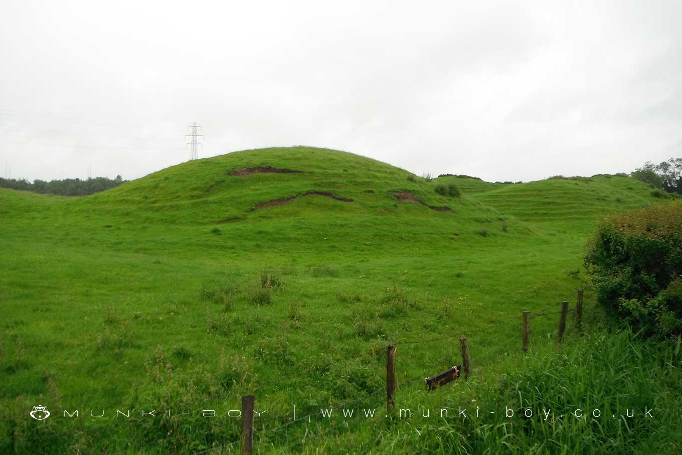
Lilbourne motte and bailey castle is located just south of the River Avon beside a crossing point of the river and presents a well preserved example of a motte castle with two peripheral baileys and an associated fishpond. Possibly dating to the 11th and 12th centuries, the earthworks of the motte and bailey castle cover an area measuring approximately 140 metres by 100 metres.
The motte is a round conical mound about 10 metres high, which is surrounded by a ditch 2 metres deep on the north, south and east sides. To the southeast of the motte lies a substantial peripheral bailey, about 35 metres square. The bailey has banks up to 3 metres high around its inner edge on all but the north side, and is surrounded by a ditch up to 5 metres wide.
A further bank, about 1 metre high, lies on the outer edge of the south side of the bailey. To the north east of the motte mound is sited the remains of a second smaller peripheral bailey area, oval in shape. This bailey is surrounded by a ditch and has a slight inner bank on the south east side. Lying outside the motte and bailey to the north east is a small rectangular fishpond which was associated with the castle and was connected by a water channel to the ditches of the bailey.
In Janet and Colin Bord’s 1972 book, Mysterious Britain, a local tradition is described that the earthworks are prehistoric in origin and that the site was flooded with water from the River Avon in some form of ritual. A romantic notion, but the earthworks here are certainly a motte and bailey castle, post the Norman conquest. It is of course possible the river flooded the surrounding fields yearly in the past.
Created: 4 July 2021 Edited: 29 November 2023
Lilbourne Castle
Lilbourne Castle LiDAR Map

Contains public sector information licensed under the Open Government Licence v3.0
Local History around Lilbourne Castle
There are some historic monuments around including:
Moated site and fishponds south-west of Highfields FarmLilbourne motte and bailey castle and fishpondRound mound at HillmortonPrehistoric settlement site 1/2 mile (800m) SW of villageHillmorton Village CrossMotte castle and associated earthwork SSW of All Saints ChurchStormsworth deserted medieval village and fishpondWatling Street Roman RoadBarby motte castleBowl barrow at MistertonTripontium Roman stationSt Andrew's Church (remains of)Motte and bailey castle south of Lilbourne GorseMedieval village of StanfordBowl barrow 470m south west of Coton House.


