Langshaw Ford Weir by munki-boy
Langshaw Ford Weir
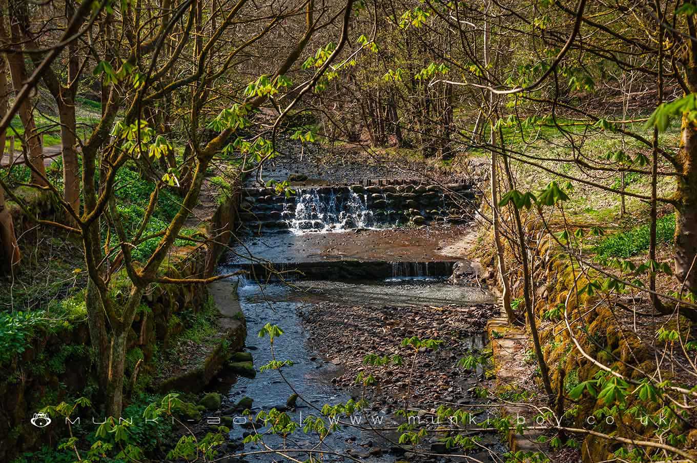
A picturesque weir of uncertain age, on a section of the Dean Brook modified for industry in the 18th or 19th Century. The weir itself may be more modern, as may some of the embanking work. The presence of concrete sections is perhaps contemporary with the concreting-over of the stream bed in the village downstream Circa 1950s. Variable flow of water, after heavy-rain it can be quite forceful. The weir is constructed of large, stone blocks as are the embankments which is unique in the Bolton area, though similar to the ornamental waterfalls at Sunnyhurst.
A favourite picnic and paddling spot for locals despite the presence of crumbling concrete flooring on the river bed and the remains if rusted iron foils on top of the weir. These signs of former industry are ageing into their surroundings and could be described as post-rustic - a term I have just invented.
The river here has been straightened sometime earlier than the mid-18th Century - almost certainly relating to the former, water-powered mill downstream. The original course was a small curve on what is now the flat area above the east bank near the weir, curving slightly to around where the bridge is today. Here was the Langshaw Ford on a possibly ancient but at least very old packhorse route. This explains the ‘uncomfortable’ bend in the Longshaw Ford Road as it meets Barrow Bridge Road. For the track originial carried on diagonally, crossing the old course of the stream as described - that is without the further bend in the current road. When the course of the river was straightened, the old ford was replaced with a wooden footbridge.
The packhorse route carried on up the hillside where a public footpath leads today onto the area around the Old Links golf course. A not un-popular walking route, but somehow perpendicular to the routes we prefer today.
The local name Langshaw Ford has changed over time, although the ford has gone we now have Longshaw Ford Road and Longshaw Ford Farm.
Of further interest, just upstream from the weir the bank on the west side of the stream is reinforced with concrete cylinders that are said to be anti-tank defences left-over from WWII.
A popular spot for locals in easy-reach of the car park at Barrow Bridge, and a bit of extra interest for hikers passing up or down the valley via Twitchills or the old path by the river.
Created: 22 April 2021 Edited: 29 November 2023
Langshaw Ford Weir
Astley Brook (Irwell) Details
Astley Brook (Irwell)
Astley Brook (Irwell) is a river in Greater Manchester
Astley Brook (Irwell) takes in water from an area around 14.381 km2 in size and is part of the Croal Irwell catchment area.
Astley Brook (Irwell) is 7.829 km long and has been heavily modified by industry in the past.
Langshaw Ford Weir LiDAR Map

Contains public sector information licensed under the Open Government Licence v3.0
Local History around Langshaw Ford Weir
There are some historic monuments around including:
Stone circle, ring cairn and two round cairns on Cheetham CloseRound cairn on Winter HillRound cairn on Noon HillRound cairn 280m west of Old Harpers Farm.


