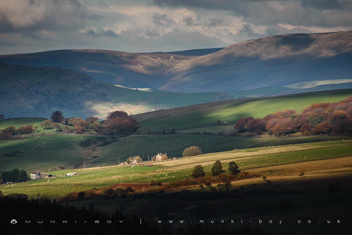
Kinder Scout from a Walk Over Shining Tor by munki-boy
Kinder Scout
Kinder Scout is in The Peak District National Park in England.
Kinder Scout is the highest point in the Peak District and the East Midlands, standing at 636 metres (2,087 feet) above sea level. Located in the Dark Peak area of Derbyshire, it is a large and rugged moorland plateau known for its gritstone edges, deep peat bogs, and dramatic scenery. The summit offers wide views over the surrounding countryside and is a popular destination for walkers and hillwalkers throughout the year.
Access to Kinder Scout is typically gained from villages such as Edale or Hayfield. One of the most well-known routes is via Jacob’s Ladder, a steep stone path that leads up to the southern edge of the plateau. Another highlight is Kinder Downfall, the tallest waterfall in the Peak District at about 30 metres high. On windy days, the water from the fall can blow back upwards, creating a striking effect. The long-distance Pennine Way also crosses the plateau, marking Kinder Scout as a key point for those walking the national trail.
Kinder Scout is also notable for its place in the history of countryside access in the UK. In 1932, a group of ramblers staged the Mass Trespass of Kinder Scout to protest against restricted access to open land. The protest played a major role in shaping the movement for public access to the countryside and eventually helped lead to the creation of national parks and the Countryside and Rights of Way Act 2000, which gave the public greater access to certain types of land.
Today, Kinder Scout is protected as a National Nature Reserve, both for its natural beauty and ecological importance. The upland habitat supports a variety of wildlife, including mountain hares, curlews, and rare plants that thrive in the acidic, boggy soils. It remains one of the most iconic and wild places in the Peak District.
Created: 30 October 2019 Edited: 2 May 2025
Kinder Scout Details
Kinder Scout is a 636.3 metre high mountain in Derbyshire.
Kinder Scout
Kinder Scout LiDAR Map

Contains public sector information licensed under the Open Government Licence v3.0
Local History around Kinder Scout
There are some historic monuments around including:
Anglo Scandinavian high cross in the churchyard of St Thomas Becket ChurchEldon Hill bowl barrowStanding cross in the churchyard of St Thomas Becket ChurchFaucet Rake lead mines 870m south west and 930m south east of Oxlow HouseLord's Seat bowl barrowMarket crossEngine Sough and associated nucleated lead mine, 500m south of Mam TorWatt's Grove Rake lead mines 520m north of SweetknollGautries Hill bowl barrowHarrod Low long barrowPeakshill or Oden soughKinderlow bowl barrowEldon Hill crushing circle, associated lead mining remains and palisaded enclosure on Eldon HillWayside and boundary cross known as Edale CrossPerry Dale bowl barrow and long barrowCoalpithole RakeGautries RakeOx Low oval barrowSlight univallate hillfort and two bowl barrows on Mam TorGreen Low ringcairn.