Hope
Hope
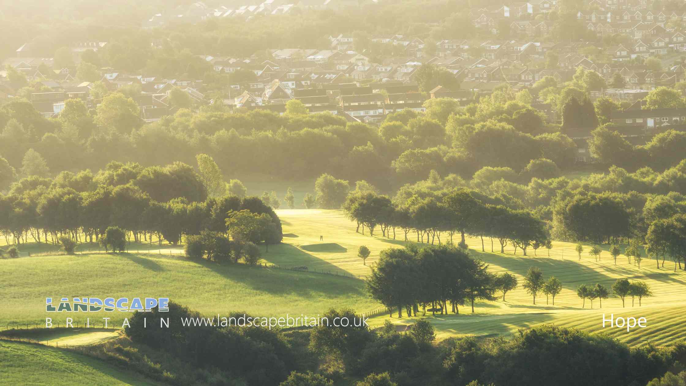
Hope is in The Peak District National Park in England.
The village of Hope and the Hope Valley in Derbyshire is a picturesque area is located in the heart of the Peak District National Park, a beautiful and popular destination for outdoor enthusiasts and nature lovers.
Getting to Hope
By Car: Hope and the Hope Valley are easily accessible by car. If you are coming from the north, take the A6 from Manchester or the M1 from Sheffield. If you are coming from the south, take the A515 from Derby.
By Train: Hope train station is located on the Hope Valley Line, which runs from Sheffield to Manchester. The journey takes approximately 30-45 minutes from either city.
By Bus: There are regular bus services from Sheffield, Buxton, and other nearby towns and villages.
Things to See and Do around the Hope Valley
Hope Valley Walks
Hope Valley is a great place to explore on foot. There are many walks to choose from, ranging from easy strolls to challenging hikes. Popular walks include Mam Tor, Stanage Edge, and Kinder Scout.
Castleton
The nearby village of Castleton is a charming and historic village with a rich history. It is home to several interesting attractions, including Peveril Castle, Blue John Cavern, and the Castleton Village Museum.
Hope Valley Railway Line
The Hope Valley Railway Line is one of the most scenic train journeys in the UK. It runs from Manchester to Sheffield, passing through the Hope Valley and offering stunning views of the surrounding countryside.
Edale
The village of Edale is a popular starting point for walks in the Peak District, including the Pennine Way. It is also home to several pubs, cafes, and shops.
Chatsworth House Chatsworth House is a magnificent stately home and estate located near Bakewell, just a short drive from Hope. It is home to beautiful gardens, a farmyard, a playground, and a restaurant.
Where to Eat
The Old Hall Hotel
The Old Hall Hotel is a historic coaching inn located in the center of Hope. It offers traditional pub food, real ale, and a warm and welcoming atmosphere.
The Samuel Fox Country Inn
The Samuel Fox Country Inn is located in nearby Bradwell and offers a more upscale dining experience. It serves modern British cuisine using locally sourced ingredients.
The Cheshire Cheese Inn
The Cheshire Cheese Inn is a traditional pub located in nearby Castleton. It serves classic pub food, including pies, burgers, and fish and chips.
Where to Stay
The Old Hall Hotel
The Old Hall Hotel offers comfortable and affordable accommodation in the heart of Hope.
The Yorkshire Bridge Inn
The Yorkshire Bridge Inn is a traditional pub with rooms located in nearby Bamford. It offers comfortable accommodation and great food.
Losehill House Hotel and Spa
Losehill House Hotel and Spa is a luxurious hotel located in the heart of the Peak District. It offers beautiful views, a spa, and fine dining.
Hope and the Hope Valley are a beautiful and charming destination that is perfect for anyone who loves the outdoors. With its stunning walks, historic attractions, and great food and accommodation options, it is the perfect place for a weekend getaway or a longer stay.
Created: 31 March 2023 Edited: 29 November 2023
Hope
Shopping in Hope
Local History around Hope
There are some historic monuments around including:
Slitherstone and Linacre lead mines and a limekiln 725m south west of Rowter FarmRound barrow 500m south west of Peveril CastleMedieval hospital 530m south east of Losehill HallRomano-British farmstead and post-medieval charcoal burning site 570m north east of Ladybower InnStanding cross known as Wheston CrossLong Low bowl barrowWatt's Grove Rake lead mines 520m north of SweetknollCrookstone Hill round cairnHigh Rake MineOx Low oval barrowThe Folly platform cairnRound cairn on Bridge-end Pasture, 600m north-east of Two Thorne Fields FarmSlight univallate hillfort and two bowl barrows on Mam TorTup Low bowl barrowOdin Mine nucleated lead mine and ore works, 350m WNW of Knowlegates FarmBatham Gate, Roman roadRing cairn on Bamford Moor, 900m north east of Lydgate FarmNew Rake lead mines 600m south east of Rowter FarmHope MotteSnelslow Plantation bowl barrowRound cairn on Bridge-end Pasture, 300m north-east of Two Thorne Fields FarmPeveril Castle eleventh to fourteenth century tower keep castleCop Rake and Moss Rake lead mines 750m north east of Wheston HousePlatform cairn south of Hill RakeRound cairn 780m south west of Offerton HouseTides Low bowl barrow, limekiln and standing stoneTideslow Rake lead rake and lime kilnCop Low oval barrowHill's Venture lead mineBurr Tor prehistoric stock enclosureRound cairn 430m west of Crookhill FarmCairnfield 870m north east of Lane End FarmEngine Sough and associated nucleated lead mine, 500m south of Mam TorCairn on Bamford Edge, 500m north east of MooredgeRound cairn and clearance cairn 770m north west of Crookhill FarmSmall stone circle on Smelting Hill, 560m north east of Lane End FarmPalisaded hilltop enclosure 230m SSE of Dirt LowLittle Pasture MineStanding cross in the churchyard of St Peter's ChurchRomano-British farmstead 475m east of Ladybower InnPike Low bowl barrowStone circle 330m north west of Crookhill FarmWayside cross known as Eccles CrossEldon Hill crushing circle, associated lead mining remains and palisaded enclosure on Eldon HillRound cairn 680m south west of Offerton HouseCairn 800m WSW Of Offerton HousePeakshill or Oden soughOxlow Rake lead minesThe Grey DitchTown defences 270m north and 350m north east of Peveril CastleNavio Roman fort and vicusBronze Age field system, 400m south east of Ladybower InnFaucet Rake lead mines 870m south west and 930m south east of Oxlow HouseAnglian high cross in the churchyard of St Peter's ChurchTwo round cairns 750m south west of Offerton HouseHow Grove Lead MineCairnfield 710m and 840m south east of Ladybower InnPin Dale lead side veins.


