
Great Barford
Great Barford
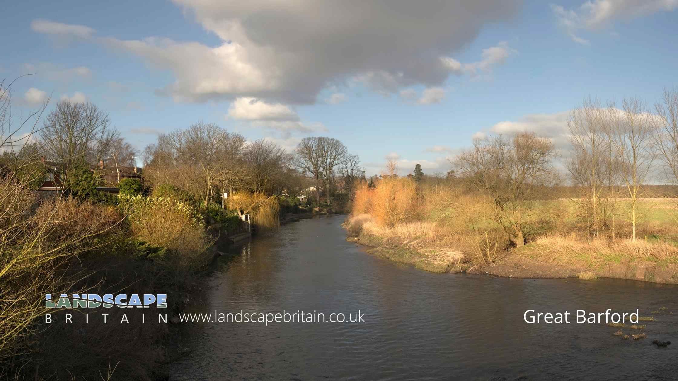
The Bedfordshire village of Great Barford is located on the River Great Ouse, just east of the county town of Bedford.
The village is home to a number of historic buildings, including the Grade I listed Church of St Mary the Virgin, which dates back to the 13th century. There is also evidence of a 12th-century Norman motte and bailey castle, known as Castle Hill, which was built by Hugh de Beau.
Created: 31 October 2022 Edited: 29 November 2023
Great Barford
River Great Ouse Details
River Great Ouse
River Great Ouse is a river in Bedfordshire
River Great Ouse is 230 Km long and has been heavily modified by industry in the past.
Local History around Great Barford
There are some historic monuments around including:
Gannocks Castle moated siteBowl barrow 550m south-east of Dairy FarmTwo barrows 500m NE of Octagon Farm: part of a Neolithic and Bronze Age mortuary complexBowl barrow, known as the `Round Hill', 440m WNW of College FarmPalaceyard Wood medieval moated enclosure and associated enclosures, woodland bank and cultivation earthworksBirchfield Farm moated site and associated fishponds and leatsSite discovered by aerial photography S of villageMortuary enclosure 1200m north-west of Octagon Farm: part of a Neolithic and Bronze Age mortuary complexWillington stablesMoated site, near Hill House, Old WardenTurnpike Farm moated enclosure and associated cultivation earthworks.Chawston Manor moated site and associated fishpondBlunham BridgeBarford BridgeMedieval fishery and warren in Home Wood'The Docks' moated site and dock, WillingtonA barrow 1000m NW of Octagon Farm: part of a Neolithic and Bronze Age mortuary complexHengi-form monument 480m south of Dairy FarmThe Hillings, Castle Hills: a ringwork castle associated with a Saxon vill, shifted medieval village and a windmill moundNeolithic and Bronze Age mortuary complex 600m NW of Octagon FarmWillington dovecotMortuary enclosure 900m NNW of Octagon Farm: part of a Neolithic and Bronze Age mortuary complexManor Farm moated enclosure, fishponds and fowling earthworksManor Farm Iron Age univallate hillfort and medieval moated enclosure.Henge, henge type monument and bowl barrow 500m south-east of Dairy FarmManor Farm moated siteTempsford BridgeMoated enclosure and associated building platforms, The Lane, Wyboston.Settlement site N of Chapel End FarmTwo bowl barrows 330m south of Dairy FarmA barrow 400m north of Octagon Farm: part of a Neolithic and Bronze Age mortuary complexHowbury ringwork and medieval trackwayBarrow and mortuary enclosure 1100m WNW of Octagon Farm: part of a Neolithic and Bronze Age mortuary complexThree barrows and a rectilinear enclosure 1000m NNW of Octagon Farm: part of a Neotlithic and Bronze Age mortuary complex.


