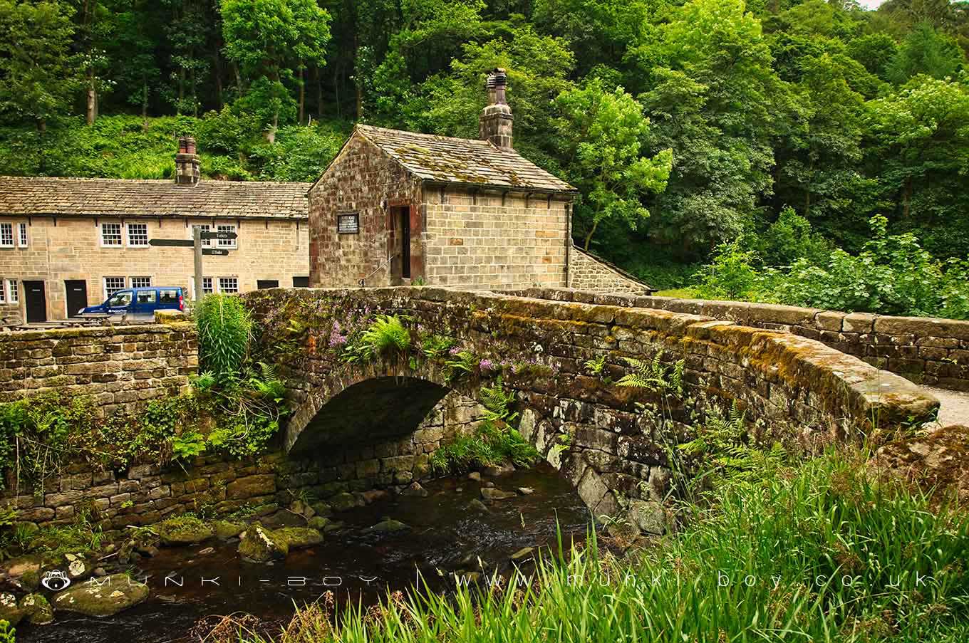
Gibson's Bridge by munki-boy
Gibson's Bridge
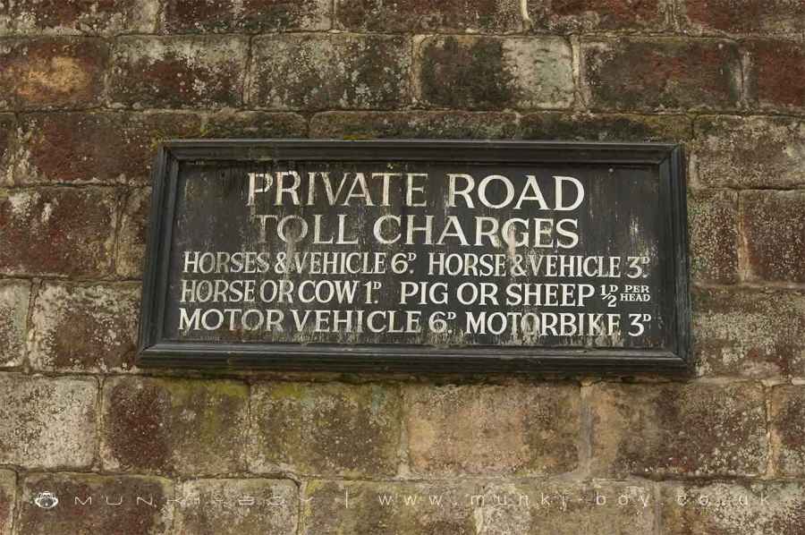
Former Toll-bridge over the Hebden Water. Early C19. Roughly dressed voussoirs and intrados to single segmental arch. Roughly dressed well coursed stone parapet with large stone copings. The north-east end of the bridge is attached to No. 6 Gibson’s Mill Cottages which carries the board recording the toll charges.
Small single-cell cottage adjacent to toll bridge, likely to have been the toll-keeper’s house. Early C19. Quoins, watershot masonry, stone slate roof. Of similar character to Nos. 4 and 5 Gibson’s Mill Cottages which it faces across the former mill yard to Gibson Mill. 3-light flat faced mullioned window with plain stone surrounds and projecting sill to left of doorway with sill-tie, 4-light window over to 1st floor. Gable stack to left hand return wall which has outshut attached with 2 doorways. Rear backs on to river and has 2-light window to ground floor. Right hand return wall has doorway with tie-stone jambs to 1st floor approached up a flight of 5 stone steps. This is adjacent to the parapet of the toll bridge. A wooden plaque is fixed to the wall recording the various tolls.
Created: 30 January 2021 Edited: 29 November 2023
Gibson's Bridge
Hebden Water from Widdop Beck to R Calder Details
Hebden Water from Widdop Beck to R Calder
Hebden Water from Widdop Beck to R Calder is a river in West Yorkshire
Hebden Water from Widdop Beck to R Calder takes in water from an area around 15.953 km2 in size and is part of the Calder Upper catchment area.
Hebden Water from Widdop Beck to R Calder is 7.485 km long and has been heavily modified by industry in the past.
Local History around Gibson's Bridge
There are some historic monuments around including:
Wayside cross known as Reaps CrossWayside cross known as Abel CrossEnclosed Bronze Age urnfield 200m north west of Hanging Field FarmOld Church of St Thomas Becket, 210m north east of Daisy Field FarmWayside cross known as Tinker CrossCairn known as Millers Grave on Midgley MoorEnclosed Bronze Age urnfield 440m north west of Rough Bottom on Midgeley MoorThe old bridge over the Hebden Water at Hebden Bridge.


