Falls of Moness by Ian
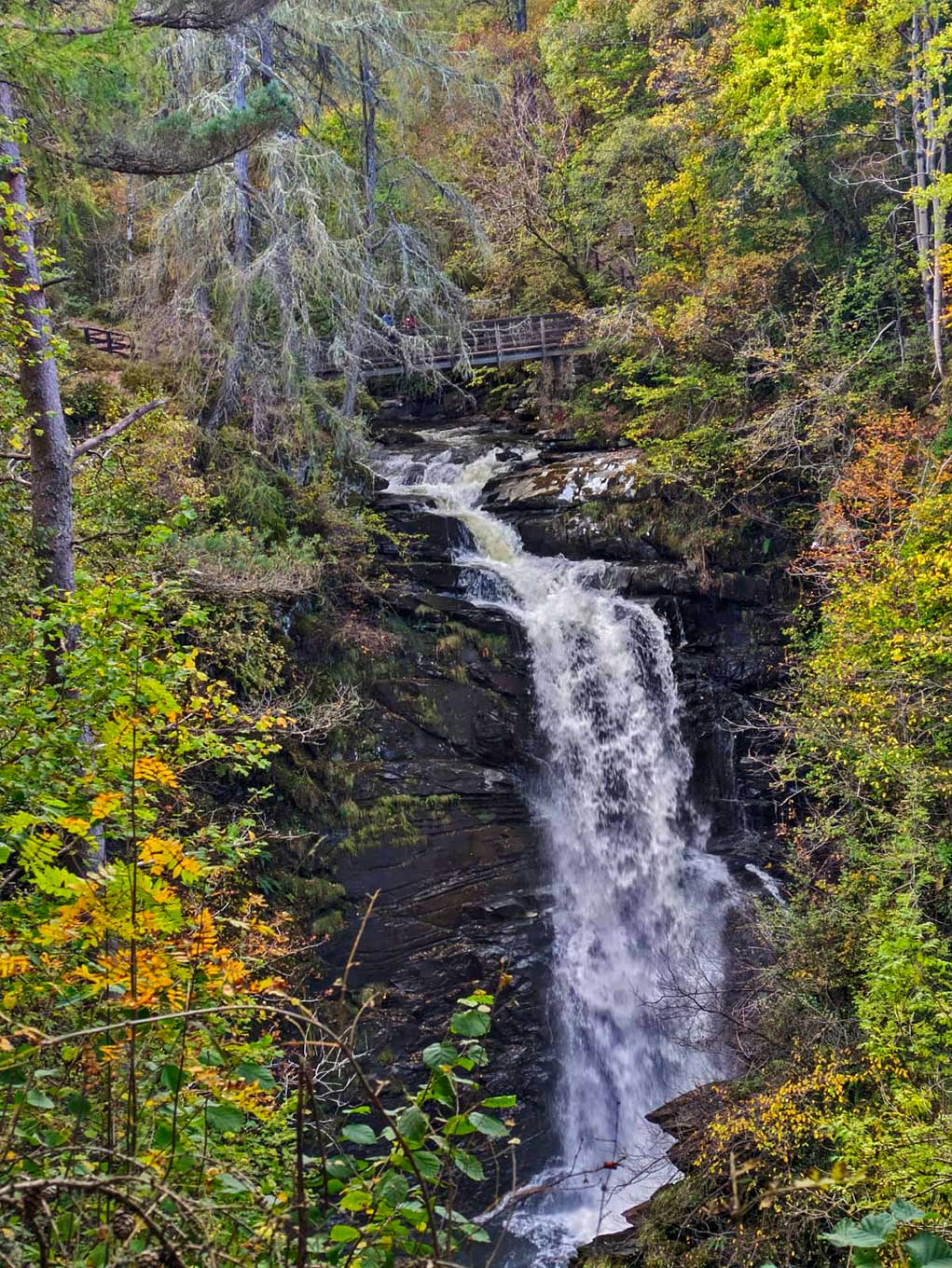
Falls of Moness
The Falls of Moness are a captivating cascade located close to the town of Aberfeldy in Perth and Kinross, Scotland. Nestled within the verdant embrace of the Birks of Aberfeldy, a woodland area that inspired Scotland’s national bard, Robert Burns, to pen a poem in 1787, the falls are one of the most scenic spots in the region, drawing visitors from far and wide. The name “Birks” comes from the Scots word for birch trees, and the area is a celebration of natural beauty, tranquility, and the poetic heritage that Burns left behind.
A walk to the Falls of Moness is a journey through a canopy of mixed woodland, along the Moness Burn (stream), which offers an ever-changing soundscape from the gentle whispers of flowing water to the powerful roars of the falls themselves. The main waterfall, often a torrent of white froth following heavy rains, presents a majestic sight as it tumbles down a steep ravine. The surrounding terrain, rich with a variety of flora, changes with the seasons, offering a spectrum of colors, from the fresh greens of spring to the rich, earthy tones of autumn, providing a paradise for nature lovers and photographers alike.
The path that leads to the Falls of Moness, known as the “Birks of Aberfeldy” walk, is a well-maintained circular route that offers several vantage points from which to admire the cascades and the lush valley below. Various bridges cross the stream, adding a picturesque charm to the trek. The walk, though steep in parts, is considered accessible for most, and the rewards of the stunning views are well worth the effort. Interpretative plaques along the way provide insight into the local wildlife, vegetation, and the area’s connection to Robert Burns, making a trip to the Falls of Moness not just an outdoor adventure but a cultural and educational experience as well.
Created: 21 October 2023 Edited: 5 January 2024
Falls of Moness
Falls of Moness LiDAR Map

Contains public sector information licensed under the Open Government Licence v3.0
Local History around Falls of Moness
There are some historic monuments around including:
Dull,cross,Aberfeldy Crosses and carved stones: cross (free-standing) SM1622The Dun,fort 400m ESE of Tyndun Prehistoric domestic and defensive: fort (includes hill and promontory fort) SM4587Margmore, cup and ring marked rock 580m SSW of Prehistoric ritual and funerary: cupmarks or cup-and-ring marks and similar rock art SM7767Lundin, stone circle and cup-marked stone 370m NNW of Prehistoric ritual and funerary: stone circle or ring SM1563Croftmoraig,stone circle Prehistoric ritual and funerary: stone circle or ring SM5024Home Farm, unenclosed settlement 200m ENE of Prehistoric domestic and defensive: settlement SM7750Urlar,ring cairn 700m SE of and cup marked boulder 750m E of Prehistoric ritual and funerary: cupmarks or cup-and-ring marks and similar rock art SM4588Tom of Cluny,chambered cairns 450m SSW of Prehistoric ritual and funerary: chambered cairn SM6251Glassie, cup-marked rock 720m W of Prehistoric ritual and funerary: cupmarks or cup-and-ring marks and similar rock art SM9682Home Farm, settlement and souterrains 300m E of Prehistoric domestic and defensive: palisaded settlement SM7747Lundin Farm, standing stones 380m NW of Prehistoric ritual and funerary: standing stone SM1565Home Farm, ring-ditch 420m S of Prehistoric domestic and defensive: house SM7751Glassie, standing stone 960m NW of Prehistoric ritual and funerary: long cairn SM9685Croftmoraig, burial mound 300m NNW of Prehistoric ritual and funerary: barrow; Secular: mound (unallocated to other category) SM9003Lundin, dun 500m NNE of Prehistoric domestic and defensive: dun SM2665Camserney Burn, shielings 900m S of Sliabh Fada Secular: shieling SM7524Lundin, standing stone 500m NW of Prehistoric ritual and funerary: standing stone SM1564Margmore, cup-marked rock 740m SSW of Prehistoric domestic and defensive: dun SM7768Home Farm, unenclosed settlement 200m NNE of Prehistoric domestic and defensive: settlement SM7757Dull,stone circle 270m S of Appin House,formerly the Manse Prehistoric ritual and funerary: stone circle or ring SM1539Carse Farm,stone circle 350m WNW of Prehistoric ritual and funerary: stone circle or ring SM1511Cup and ring marked stone, dun and farmstead 70m SW of Brae of Cultullich Prehistoric domestic and defensive: dun; Prehistoric ritual and funerary: cupmarks or cup-and-ring marks and similar rock art; Secular: farmstead SM2669Glassie, cup-and-ring-marked stone and cup-marked stones NW of Prehistoric ritual and funerary: cupmarks or cup-and-ring marks and similar rock art SM9511Urlar,settlement 550m E of Secular: settlement, including deserted, depopulated and townships SM4589Edradynate Castle, earthwork 120m E of Milton of Cluny Secular: homestead moat SM9512Balhomais stone circle and barrow, 20m NNW of junction at B846 and Balhomais Farm entrance Prehistoric ritual and funerary: barrow SM1499.


