Fairies Chapel by munki-boy
Fairies Chapel
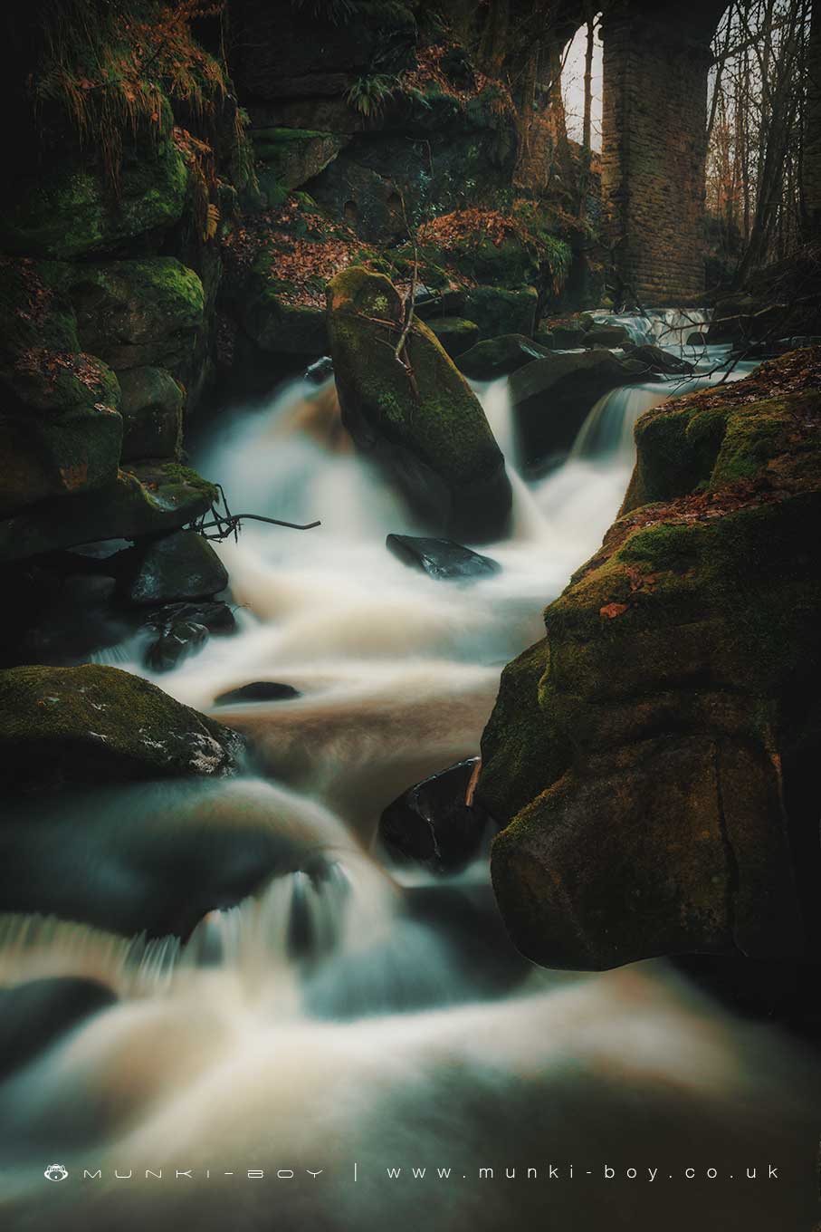
Fairies Chapel is now a small area towards the north viaduct at Healey Dell where the River Spodden passes through a narrow ravine forming small waterfalls over the exposed bedrock.
The area has a local legend attached of a ‘fairies chapel’ reveled after a landslide. I understand this to be a description of a cavity in the exposed rock that could be likened to a miniature church with perhaps “columns” of calcium or iron. It is uncommon to find natural cavities in the sandstone rock but there are a lot of geological faults which could conceivably cause a gap in the rock. The river here is also heavily modified so quarrying or even blasting could have been used here in the past.
Natural rock caves or old quarries with either column-like structures or pedestal/plinth or alter-like rocks are often ascribed as chapels or cathedrals in local legends or urban myths, often associated with the devil.
Created: 7 April 2019 Edited: 29 November 2023
Fairies Chapel
Fairies Chapel LiDAR Map

Contains public sector information licensed under the Open Government Licence v3.0
Local History around Fairies Chapel
There are some historic monuments around including:
March Barn Bridge, Rochdale Canal.